Category:Remote views of Rangitoto Island
Jump to navigation
Jump to search
Media in category "Remote views of Rangitoto Island"
The following 83 files are in this category, out of 83 total.
-
 Achilles Point In Auckland City.jpg 1,600 × 1,200; 473 KB
-
 Aerial view of Milford, Auckland, ca 1920s-1940s.jpg 5,194 × 3,934; 7.24 MB
-
 Auckland 20170513 170213.jpg 5,312 × 2,988; 3.48 MB
-
 Auckland aussicht2.JPG 800 × 600; 528 KB
-
 Auckland CBD and Rangitoto Island From Sky Tower.jpg 4,032 × 3,024; 3.4 MB
-
 Auckland CBD Around 1920-1940.jpg 600 × 440; 71 KB
-
 Auckland cbd view.jpg 1,200 × 800; 515 KB
-
 Auckland City From the Sky Tower.png 750 × 500; 681 KB
-
 Auckland from mount eden.jpg 925 × 608; 96 KB
-
 Auckland from the SSW Taken in July 1849 - cropped.jpg 367 × 256; 32 KB
-
 Auckland from the SSW Taken in July 1849.jpg 800 × 637; 61 KB
-
 Auckland Harbor, Auckland New Zealand (50871011678).jpg 3,696 × 2,448; 2.71 MB
-
 Auckland, from St. Matthews Tower LCCN2017657812.jpg 7,280 × 5,340; 6.83 MB
-
 Auckland, with a View of Albert Barracks (1859).jpg 800 × 558; 86 KB
-
 Blazing Sunlight Over The Hauraki Gulf From Grafton.jpg 1,600 × 1,200; 208 KB
-
 Buckland Beach (2016).jpg 2,448 × 3,264; 1.45 MB
-
 Charles Blomfield, Mechanics Bay Painting.jpg 440 × 300; 44 KB
-
 Davenport Auckland.jpg 2,112 × 2,816; 1.61 MB
-
 DSC02268 - Flickr - 111 Emergency.jpg 1,600 × 1,065; 1.31 MB
-
 East Auckland 20210212 154713-cropped.jpg 2,742 × 3,654; 1.02 MB
-
 East Auckland 20210212 154728-fixed.jpg 3,656 × 2,884; 1.85 MB
-
 East Auckland and Rangitoto 10 March 2005.jpg 2,142 × 1,080; 2.48 MB
-
 Emerald Hours in New Zealand (1906) · Lowth · 037.jpg 3,006 × 2,217; 1.05 MB
-
 Fossil forest.jpg 2,560 × 1,920; 598 KB
-
 Hello Rangitoto! (15354965331).jpg 3,456 × 5,184; 4.39 MB
-
 Hobson Bay In Auckland City.jpg 1,600 × 1,200; 298 KB
-
 Lake Pupuke 20230823 102215 (cropped).jpg 1,307 × 980; 388 KB
-
 Lake Pupuke 20230823 102215.jpg 4,032 × 3,024; 3.29 MB
-
 Looking across to Rangitoto Island (12427208674).jpg 5,984 × 3,002; 5.76 MB
-
 Looking out over the Hauraki Gulf to Rangitoto Island from Okahu Bay (11003307596).jpg 6,000 × 4,000; 7.2 MB
-
 Looking south over Long Bay.jpg 2,551 × 1,673; 2 MB
-
 Mount Wellington, Auckland, New Zealand (3).JPG 4,000 × 3,000; 3.41 MB
-
 Mt Victoria, Auckland, New Zealand (Unsplash).jpg 7,360 × 4,912; 1.35 MB
-
 MtEdenCrater.1.jpg 2,304 × 1,728; 1.21 MB
-
 North Head AKL view of Rangitoto.jpg 1,024 × 768; 138 KB
-
 North Shore view 20240101 125826.jpg 4,000 × 3,000; 2.74 MB
-
 O'Brien Ak Grafton Br.jpg 1,454 × 931; 620 KB
-
 One Tree Hill Auckland. (8955128184).jpg 3,000 × 1,698; 4.42 MB
-
 One Tree Hill, Auckland, March 2015.jpg 1,611 × 916; 1.01 MB
-
 Pōhutukawa at Mission Bay (6706399383).jpg 4,000 × 3,000; 3.78 MB
-
 Rangi NorthShore.1.jpg 2,304 × 1,728; 817 KB
-
 Rangitoto and Auckland 31-03-2012 14-03-10 - cropped to Tamaki River.png 1,371 × 903; 2.34 MB
-
 Rangitoto and Auckland 31-03-2012 14-03-10.jpg 3,454 × 2,701; 6.38 MB
-
 Rangitoto and Browns Island from Howick Beach.jpg 3,888 × 2,187; 4.36 MB
-
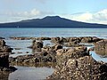
 Rangitoto from Achilles Point.jpg 2,077 × 1,281; 271 KB
-
 Rangitoto from Bucklands Beach.jpg 3,888 × 2,187; 5.13 MB
-
 Rangitoto from ferry.jpg 4,896 × 3,264; 2.39 MB
-
 Rangitoto from Mission Bay.jpg 640 × 480; 59 KB
-
 Rangitoto from One Tree Hill.jpg 5,569 × 3,149; 7.66 MB
-
 Rangitoto from Shakespear Regional Park.jpg 5,616 × 3,744; 9.44 MB
-
 Rangitoto from Takapuna Beach fossils.jpg 1,024 × 768; 257 KB
-
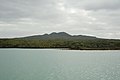
 Rangitoto Island And Motutapu Island.jpg 2,000 × 1,200; 1.09 MB
-

-
 Rangitoto Island banner.jpg 2,820 × 403; 249 KB
-
 Rangitoto Island from Cornwall Park.JPG 1,728 × 2,592; 1.2 MB
-
 Rangitoto Island from ferry.jpg 4,896 × 3,264; 3.68 MB
-
 Rangitoto Island from Mission Bay - Flickr - 111 Emergency.jpg 1,600 × 643; 706 KB
-
 Rangitoto Island from Mt Victoria, Devonport - Flickr - 111 Emergency.jpg 1,600 × 1,065; 1.1 MB
-
 Rangitoto island from north head.jpg 500 × 88; 9 KB
-
 Rangitoto Island North Head.jpg 1,598 × 1,066; 288 KB
-
 Rangitoto-Tiritiri.JPG 3,264 × 2,448; 2.67 MB
-
 Rangitoto.1.jpg 2,303 × 476; 182 KB
-
 Rangitoto.2.jpg 2,303 × 783; 402 KB
-
 Rangitoto.jpg 1,024 × 768; 101 KB
-
 Rangitoto02.jpg 800 × 588; 86 KB
-
 Rangitotofrommountvictoria.jpg 2,576 × 1,161; 1.45 MB
-
 Rangitotofromnorthhead.jpg 622 × 467; 139 KB
-
 RangitotoIsland1.jpg 1,024 × 768; 323 KB
-
 Rangitotopanorama.jpg 827 × 316; 65 KB
-
 RangitotoWhangaparaoa.JPG 1,508 × 977; 1.3 MB
-
 Remuera 20211015 112629.jpg 4,000 × 2,252; 2.97 MB
-
 Saint Leonards Beach 20170326 175418.jpg 5,312 × 2,988; 4.69 MB
-
 Sheep and lambs at Shakespear Regional Park.jpg 2,048 × 1,536; 890 KB
-
 Sunset on Waiheke Island.jpg 6,000 × 4,000; 7.96 MB
-
 Takapuna - Rangitoto from beach at sunset.jpg 1,004 × 744; 204 KB
-
 Tamaki Drive and Devonport.jpg 5,191 × 2,920; 7.77 MB
-
 ThornesBay.4.jpg 2,302 × 1,302; 744 KB
-
 Tiritiri matangi view auckland.jpg 2,560 × 1,920; 1.04 MB
-
 Tiritiri Matangi wharf and Tiri Kat ferry.jpg 2,549 × 2,087; 2.15 MB
-
 Vauxhall, North Shore City Suburbs.jpg 1,600 × 1,200; 1.35 MB
-
 Vehicle Track, Rangitoto Island, Auckland 1010, New Zealand - panoramio.jpg 4,208 × 3,120; 2.38 MB
-
 Volcano Under the Pohutukawa (15358219635).jpg 5,184 × 3,456; 6.21 MB
-
 WhangaparaoaRangitoto.JPG 1,466 × 968; 1.2 MB


.jpg)

.jpg)

.jpg)


_%C2%B7_Lowth_%C2%B7_037.jpg)

.jpg)

.jpg)

.jpg)
.jpg)

.JPG)
.jpg)


.jpg)

.jpg)


.jpg)
