Category:Reedham, Norfolk
Jump to navigation
Jump to search
Main Wikipedia article: Reedham, Norfolk.
village and civil parish in Norfolk, United Kingdom  | |||||
| Upload media | |||||
| Instance of | |||||
|---|---|---|---|---|---|
| Location | Broadland, Norfolk, East of England, England | ||||
| Area |
| ||||
 | |||||
Subcategories
This category has the following 16 subcategories, out of 16 total.
B
- Berney Arms public house (6 F)
C
- Cadge's Mill, Reedham (5 F)
E
F
- Reedham Ferry Mill (north) (3 F)
- Ferry Inn, Reedham (6 F)
H
- Hardley Cross, Norfolk (9 F)
J
N
- North Mill, Reedham (3 F)
P
- Polkey's Mill, Reedham (10 F)
R
- Reedham Chain Ferry, Norfolk (19 F)
- Reedham Junction, Norfolk (5 F)
- Reedham Swing Bridge (29 F)
Y
- River Yare at Reedham (9 F)
Media in category "Reedham, Norfolk"
The following 200 files are in this category, out of 700 total.
(previous page) (next page)-
 385th Bomb Group USAAF memorial - geograph.org.uk - 5189449.jpg 700 × 394; 444 KB
-
 385th Bomb Group USAAF memorial - geograph.org.uk - 5189451.jpg 700 × 525; 585 KB
-
 385th Bomb Group USAAF memorial - geograph.org.uk - 5189453.jpg 700 × 525; 632 KB
-

-
 A marshy pasture in Reedham - geograph.org.uk - 5962379.jpg 800 × 600; 157 KB
-
 A mobile pumping station - geograph.org.uk - 3458649.jpg 640 × 480; 143 KB
-
 A mobile pumping station - geograph.org.uk - 3458652.jpg 640 × 480; 194 KB
-
 A purple patch near Reedham - geograph.org.uk - 6289026.jpg 4,000 × 3,000; 2.88 MB
-
 A rainy day at the Berney Arms Windmill - geograph.org.uk - 3752407.jpg 1,024 × 768; 102 KB
-
 A swan family - geograph.org.uk - 1445635.jpg 640 × 580; 138 KB
-
 Abandoned roller on Reedham marshes - geograph.org.uk - 4292516.jpg 640 × 480; 72 KB
-
 Above the Swing Bridge - geograph.org.uk - 809059.jpg 640 × 426; 55 KB
-
 Access road to Hall Farm, Reedham - geograph.org.uk - 3458441.jpg 640 × 480; 244 KB
-
 American War Memorial, Reedham - geograph.org.uk - 6287120.jpg 4,000 × 3,000; 2.89 MB
-
 An archetypical English pastoral scene - geograph.org.uk - 2565819.jpg 640 × 480; 176 KB
-
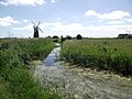
 Approaching Cadge's Mill on the Wherryman's Way - geograph.org.uk - 6292731.jpg 4,000 × 3,000; 2.87 MB
-

-

-

-
 Approaching Reedham Station - geograph.org.uk - 1442767.jpg 640 × 480; 98 KB
-

-

-
 Baby Ducks - geograph.org.uk - 1928504.jpg 800 × 532; 152 KB
-
 Barley crop by Oxpit Farm, Limpenhoe - geograph.org.uk - 3458387.jpg 640 × 480; 202 KB
-
 Berney Arms - geograph.org.uk - 1982115.jpg 856 × 1,280; 167 KB
-
 Berney Arms - geograph.org.uk - 1982162.jpg 1,280 × 856; 206 KB
-
 Berney Arms Branch - geograph.org.uk - 1928336.jpg 800 × 531; 110 KB
-
 Berney Arms Crossing - geograph.org.uk - 1974981.jpg 1,280 × 857; 196 KB
-
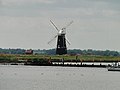
 Berney Arms Drainage Mill - geograph.org.uk - 3971096.jpg 1,200 × 1,600; 378 KB
-
 Berney Arms Drainage Mill - geograph.org.uk - 3971097.jpg 1,600 × 1,200; 362 KB
-
 Berney Arms Drainage Mill - geograph.org.uk - 4540706.jpg 2,000 × 1,500; 587 KB
-
 Berney Arms Drainage Mill - geograph.org.uk - 4789373.jpg 2,520 × 3,776; 3.21 MB
-
 Berney Arms Mill - geograph.org.uk - 1986449.jpg 856 × 1,280; 174 KB
-
 Berney Arms Mill - geograph.org.uk - 2565794.jpg 640 × 480; 152 KB
-
 Berney Arms Railway Station - geograph.org.uk - 5411213.jpg 640 × 480; 104 KB
-
 Berney Arms railway station, Norfolk - geograph.org.uk - 5047618.jpg 1,107 × 830; 257 KB
-
 Berney Arms Station - geograph.org.uk - 1974860.jpg 1,280 × 856; 215 KB
-
 Berney Arms Station - geograph.org.uk - 1975311.jpg 1,280 × 856; 241 KB
-
 Berney Arms station - geograph.org.uk - 2880410.jpg 1,600 × 1,082; 368 KB
-
 Berney Arms station - geograph.org.uk - 2880430.jpg 1,600 × 1,095; 344 KB
-
 Berney Arms Station - geograph.org.uk - 3286123.jpg 1,024 × 768; 197 KB
-
 Berney Arms station - geograph.org.uk - 4540696.jpg 2,000 × 1,500; 666 KB
-
 Berney Arms Station - geograph.org.uk - 4789359.jpg 3,776 × 2,520; 4.01 MB
-

-
 Berney Arms Station in 1979 - geograph.org.uk - 3944964.jpg 800 × 677; 130 KB
-

-
 Berney Arms Windmill - geograph.org.uk - 1951495.jpg 800 × 531; 71 KB
-
 Berney Arms Windmill - geograph.org.uk - 1980876.jpg 640 × 480; 31 KB
-
 Berney Arms windmill - geograph.org.uk - 5047660.jpg 1,200 × 1,600; 252 KB
-
 Berney Arms Windmill - geograph.org.uk - 5411355.jpg 480 × 640; 65 KB
-
 Berney Arms Windmill - geograph.org.uk - 6292684.jpg 4,000 × 3,000; 2.68 MB
-
 Berney Arms Windmill - geograph.org.uk - 6292686.jpg 3,000 × 4,000; 2.29 MB
-

-
 Berney Arms Windmill ^ River Yare - geograph.org.uk - 3286119.jpg 1,024 × 768; 137 KB
-
 Beside the river Yare at Reedham - geograph.org.uk - 6278422.jpg 4,000 × 3,000; 2.29 MB
-
 Beside the Yare on the Wherryman's Way - geograph.org.uk - 2660632.jpg 640 × 480; 217 KB
-
 Big bales on Reedham marshes - geograph.org.uk - 6292854.jpg 4,000 × 3,000; 2.34 MB
-
-

-

-
 Boat and Train - New Cut - geograph.org.uk - 600056.jpg 640 × 480; 45 KB
-
 Boat moored by the river Yare - geograph.org.uk - 6292771.jpg 4,000 × 3,000; 2.77 MB
-
 Boat sheds in Reedham - geograph.org.uk - 4269589.jpg 640 × 480; 208 KB
-
 Boat travelling up the River Waveney - geograph.org.uk - 1803512.jpg 640 × 480; 119 KB
-
 Boat-wright statue - geograph.org.uk - 3102243.jpg 2,277 × 2,277; 1.75 MB
-
 Boats at Reedham Marina - geograph.org.uk - 6292865.jpg 4,000 × 3,000; 2.33 MB
-
 Boats moored at Reedham - geograph.org.uk - 4269590.jpg 640 × 480; 211 KB
-
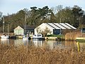
 Boatyard at Reedham - geograph.org.uk - 190320.jpg 640 × 480; 70 KB
-
 Boatyard, Reedham - geograph.org.uk - 808895.jpg 640 × 426; 62 KB
-
 Boatyard, Reedham - geograph.org.uk - 809073.jpg 640 × 426; 115 KB
-
 Boatyard, Reedham - geograph.org.uk - 809077.jpg 640 × 433; 63 KB
-
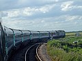
 Branch line diesel- rounding the curve at Reedham (31173579060).jpg 5,145 × 3,430; 7.94 MB
-
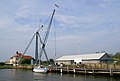
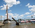
 Bridge in mid swing - geograph.org.uk - 3042571.jpg 3,648 × 2,255; 1.88 MB
-
 Bridges of arches and spans - geograph.org.uk - 4438544.jpg 640 × 480; 97 KB
-
 Broiler Farm on Reedham Road - geograph.org.uk - 6287094.jpg 4,000 × 3,000; 2.69 MB
-
 Cadge's Mill - geograph.org.uk - 3972252.jpg 640 × 427; 60 KB
-
 Cadge's Mill and sluice - geograph.org.uk - 4852004.jpg 2,896 × 1,944; 2.59 MB
-

-

-
 Cadge's Mill with Polkey's Mill behind - geograph.org.uk - 6292727.jpg 4,000 × 3,000; 2.21 MB
-
 Cadge's Mill, Reedham Marshes - fanlight - geograph.org.uk - 2301546.jpg 640 × 480; 168 KB
-
 Cadge's Mill, Reedham Marshes - geograph.org.uk - 2301528.jpg 640 × 560; 91 KB
-
 Cadge's Mill, Reedham Marshes - geograph.org.uk - 2301532.jpg 640 × 474; 87 KB
-
 Cadge's Mill, Reedham Marshes - geograph.org.uk - 2301537.jpg 480 × 640; 95 KB
-
 Cadge's Mill, Reedham Marshes - geograph.org.uk - 2301548.jpg 480 × 640; 96 KB
-
 Cadge's Mill, Reedham Marshes - the door - geograph.org.uk - 2301543.jpg 480 × 640; 140 KB
-
 Cadges Mill - geograph.org.uk - 1927977.jpg 800 × 531; 68 KB
-
 Cadges Mill - geograph.org.uk - 1928483.jpg 531 × 800; 92 KB
-
 Camping field at Reedham Ferry Inn - geograph.org.uk - 6278424.jpg 4,000 × 3,000; 2.88 MB
-
 Car park, Reedham - geograph.org.uk - 2825689.jpg 1,600 × 1,200; 887 KB
-

-
 Carved Owl from a tree trunk - geograph.org.uk - 6287118.jpg 4,000 × 3,000; 2.44 MB
-
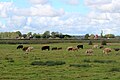
 Cattle and sheep grazing on Reedham Marshes - geograph.org.uk - 6292777.jpg 4,000 × 3,000; 2.71 MB
-
 Cattle beside the Yare - geograph.org.uk - 4627121.jpg 640 × 480; 189 KB
-
 Cattle crush beside Limpenhoe Road - geograph.org.uk - 4292505.jpg 640 × 480; 189 KB
-

-
 Cattle grazing in the Reedham Marshes - geograph.org.uk - 5210930.jpg 640 × 360; 293 KB
-
 Cattle in pasture - geograph.org.uk - 4292550.jpg 640 × 480; 140 KB
-
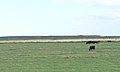
 Cattle on Reedham Marshes - geograph.org.uk - 3640108.jpg 1,024 × 614; 102 KB
-
 Cattle pens by Hall Farm, Reedham - geograph.org.uk - 3458420.jpg 640 × 480; 173 KB
-
-
 Charges, Reedham Ferry - geograph.org.uk - 2939586.jpg 1,034 × 1,600; 275 KB
-
 Chedgrave Marsh - geograph.org.uk - 808929.jpg 640 × 425; 61 KB
-
 Chimney Flue - geograph.org.uk - 1928210.jpg 531 × 800; 136 KB
-
-
 Coal Storage Room - geograph.org.uk - 1928465.jpg 800 × 531; 85 KB
-
 Confluence of Rivers Chet and Yare - geograph.org.uk - 1445698.jpg 640 × 480; 110 KB
-
 Convenience store, Reedham - geograph.org.uk - 2825709.jpg 1,600 × 1,200; 593 KB
-
 Converted Methodist chapel, The Hills - geograph.org.uk - 5210897.jpg 640 × 480; 341 KB
-
 Converted Methodist chapel, The Hills - geograph.org.uk - 5210900.jpg 640 × 480; 341 KB
-
 Cottage by Hall Farm, Reedham - geograph.org.uk - 3458431.jpg 640 × 480; 204 KB
-
 Cottages at Riverside - geograph.org.uk - 5210366.jpg 640 × 480; 360 KB
-
 Cottages at Riverside - geograph.org.uk - 5210369.jpg 640 × 480; 409 KB
-
 Cottages at Riverside - geograph.org.uk - 5210371.jpg 640 × 480; 336 KB
-
 Cottages on Riverside - geograph.org.uk - 5210396.jpg 640 × 501; 327 KB
-
 Cottages, Reedham - geograph.org.uk - 812480.jpg 640 × 426; 110 KB
-
 Cows by River Yare - geograph.org.uk - 5540547.jpg 4,939 × 3,293; 4.43 MB
-
 Crossroads in Reedham, Norfolk - geograph.org.uk - 2939582.jpg 1,600 × 1,001; 262 KB
-
 Cruising on the Yare - geograph.org.uk - 2660603.jpg 640 × 480; 183 KB
-
 Cupcakes on Reedham Quay - geograph.org.uk - 5210374.jpg 640 × 480; 323 KB
-
 Dandelions on field margin, Reedham - geograph.org.uk - 3458395.jpg 640 × 449; 198 KB
-
 Derelict building - geograph.org.uk - 4438539.jpg 1,024 × 768; 594 KB
-
 Derelict building - window detail - geograph.org.uk - 4438542.jpg 729 × 547; 298 KB
-
 Derelict House - geograph.org.uk - 1928323.jpg 800 × 531; 182 KB
-

-

-

-
 Diesel pump, Sanderson Marine - geograph.org.uk - 3102120.jpg 2,736 × 3,648; 2.55 MB
-
 Disused wind pumps by Seven Mile House - geograph.org.uk - 2660620.jpg 640 × 480; 189 KB
-

-
 Drain junction, south of Sprowston Wood - geograph.org.uk - 3635943.jpg 1,024 × 768; 115 KB
-
 Drain on former Limpenhoe marsh - geograph.org.uk - 3635941.jpg 1,024 × 768; 152 KB
-
 Drain on Reedham Marshes - geograph.org.uk - 3640075.jpg 1,024 × 615; 89 KB
-
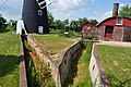
 Drainage Channel at Polkeys Mill - geograph.org.uk - 1928133.jpg 531 × 800; 157 KB
-
 Drainage ditch beside the railway line - geograph.org.uk - 5962410.jpg 800 × 598; 139 KB
-

-
 Drainage pump - geograph.org.uk - 809110.jpg 640 × 426; 76 KB
-
 Drained farmland, south of Church Road - geograph.org.uk - 3635964.jpg 1,024 × 768; 133 KB
-
 Drained field with wrapped hay bales - geograph.org.uk - 3640142.jpg 1,024 × 615; 71 KB
-
 Drained marsh, south of John's Carr - geograph.org.uk - 3635933.jpg 1,024 × 768; 133 KB
-
 Drained marsh, west of Astree Farm - geograph.org.uk - 3640011.jpg 1,024 × 615; 76 KB
-
 Duck couple, Reedham - geograph.org.uk - 2939601.jpg 1,600 × 1,000; 372 KB
-
 Dutch Mill Specialists at North Mill, Reedham - geograph.org.uk - 1928485.jpg 1,024 × 768; 155 KB
-
 East Anglian Real Property Company shed - geograph.org.uk - 4894003.jpg 640 × 480; 274 KB
-
 Electricity poles in marsh pastures - geograph.org.uk - 5962391.jpg 800 × 594; 95 KB
-

-
 Excavated Drainage Channels - geograph.org.uk - 1928013.jpg 800 × 531; 156 KB
-
 Farm track into marsh pastures - geograph.org.uk - 5962381.jpg 800 × 600; 258 KB
-
 Farmland around a wiggly drain, Reedham - geograph.org.uk - 3640134.jpg 1,024 × 615; 76 KB
-
 Farmland north of Reedham - geograph.org.uk - 3635960.jpg 1,024 × 768; 142 KB
-
 Field beside Limpenhoe Road - geograph.org.uk - 5962283.jpg 800 × 600; 105 KB
-

-
 Fields beside Freethorpe Road - geograph.org.uk - 3458393.jpg 640 × 421; 146 KB
-
 Fields by The Spout, Reedham - geograph.org.uk - 3458406.jpg 640 × 480; 216 KB
-
 Fields east of Freethorpe Road, Reedham - geograph.org.uk - 3458404.jpg 640 × 480; 173 KB
-
 Fields north of Hall Farm, Reedham - geograph.org.uk - 3458434.jpg 640 × 433; 185 KB
-
 Fields north of Limpenhoe Road - geograph.org.uk - 5962289.jpg 800 × 600; 109 KB
-
 Fields south of Hall Road, Reedham - geograph.org.uk - 3458402.jpg 640 × 480; 196 KB
-
 Flint Cottage - geograph.org.uk - 3102161.jpg 3,648 × 2,736; 2.53 MB
-
 Flint cottage on Riverside - geograph.org.uk - 5210397.jpg 640 × 480; 351 KB
-
 Flood defence works, Berney Marshes - geograph.org.uk - 5596912.jpg 4,160 × 3,120; 4.88 MB
-
 Flood defence works, Berney Marshes - geograph.org.uk - 5596917.jpg 4,160 × 3,120; 5.5 MB
-

-

-

-
 Flood wall, Reedham - geograph.org.uk - 2825672.jpg 1,600 × 1,200; 627 KB
-
 Flood wall, Reedham - geograph.org.uk - 2825680.jpg 1,600 × 1,200; 732 KB
-
 Floodbank, River Yare - geograph.org.uk - 3340309.jpg 1,024 × 768; 255 KB
-
 Flooded marsh pastures east of Reedham - geograph.org.uk - 2301017.jpg 640 × 434; 114 KB
-
 Footbridge in the reeds - geograph.org.uk - 2301069.jpg 640 × 480; 162 KB
-

-
 Footpath along the River Waveney - geograph.org.uk - 1803704.jpg 640 × 480; 84 KB
-
 Footpath along the Yare - geograph.org.uk - 2823096.jpg 1,600 × 1,200; 781 KB
-
 Footpath to Reedham - geograph.org.uk - 2823356.jpg 1,600 × 1,200; 685 KB
-

-
 Former Methodist Chapel, Reedham - geograph.org.uk - 6287114.jpg 4,000 × 3,000; 2.35 MB
-
 Former millwright's house at Polkey's Mill - geograph.org.uk - 6292770.jpg 4,000 × 3,000; 2.66 MB
-
 Freethorpe Road - geograph.org.uk - 4292538.jpg 640 × 480; 99 KB
-
 Freethorpe Road and adjacent fields - geograph.org.uk - 4292535.jpg 640 × 480; 105 KB
-
 Freethorpe-Hall Road junction - geograph.org.uk - 3458410.jpg 640 × 480; 194 KB
-

-
 Frosty railway line - geograph.org.uk - 5210338.jpg 640 × 480; 317 KB
-

-

-

-
 Gate on the Wherryman's Way, Reedham - geograph.org.uk - 3458568.jpg 640 × 480; 211 KB
-
 Gate on the Wherryman's Way, Reedham - geograph.org.uk - 3458606.jpg 640 × 432; 151 KB
-

-
 Google Street View camera car - geograph.org.uk - 2556950.jpg 3,072 × 2,304; 2.49 MB
-
 Grazing near Reedham Station - geograph.org.uk - 4792090.jpg 640 × 407; 46 KB
-
 Greater Water-parsnip, Reedham Marshes - geograph.org.uk - 4852012.jpg 2,896 × 1,944; 2.54 MB
-
 Haddiscoe New Cut - geograph.org.uk - 812859.jpg 640 × 426; 52 KB
-
 Haddiscoe New Cut looking towards Reedham - geograph.org.uk - 658403.jpg 640 × 427; 108 KB
-
 Hall Cottages by Hall Farm, Reedham - geograph.org.uk - 3458439.jpg 640 × 468; 184 KB
-
 Halvergate Road past Hall Farm, Reedham - geograph.org.uk - 3458444.jpg 640 × 437; 181 KB
-
 Happy Family - geograph.org.uk - 1928512.jpg 800 × 438; 129 KB
-
 Hardley Cross - geograph.org.uk - 690496.jpg 640 × 427; 173 KB
-
 Heading towards Reedham on the Wherryman's Way - geograph.org.uk - 6292778.jpg 4,000 × 3,000; 3.02 MB
-

-
 Heron in Reedham Marshes - geograph.org.uk - 6292780.jpg 4,000 × 3,000; 2.3 MB


.jpg)


