Category:Redmile
Jump to navigation
Jump to search
English: Redmile is a village and civil parish in the Melton district of Leicestershire, England, about 15 miles north of Melton Mowbray and ten miles west of Grantham, in the Vale of Belvoir.
Português: Redmile é um vilarejo localizado no distrito de Melton, em Leicestershire, Inglaterra, a dez milhas ao oeste de Grantham, no Vale de Belvoir.
village and civil parish in Melton, Leicestershire, United Kingdom  | |||||
| Upload media | |||||
| Instance of | |||||
|---|---|---|---|---|---|
| Location | Melton, Leicestershire, East Midlands, England | ||||
 | |||||
Subcategories
This category has the following 5 subcategories, out of 5 total.
Media in category "Redmile"
The following 200 files are in this category, out of 439 total.
(previous page) (next page)-
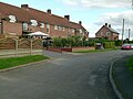
 'Chimneys', Post Office Lane, Redmile - geograph.org.uk - 5170116.jpg 1,280 × 960; 454 KB
-
 A circular walk from Redmile, (10) - geograph.org.uk - 792493.jpg 640 × 427; 113 KB
-
 A circular walk from Redmile, (19) - geograph.org.uk - 792551.jpg 640 × 427; 120 KB
-
 A circular walk from Redmile, (27) - geograph.org.uk - 793344.jpg 639 × 640; 195 KB
-
 A circular walk from Redmile, (28) - geograph.org.uk - 793351.jpg 640 × 480; 173 KB
-
 A circular walk from Redmile, (46) - geograph.org.uk - 794936.jpg 640 × 427; 93 KB
-
 A circular walk from Redmile, (47) - geograph.org.uk - 794940.jpg 640 × 600; 135 KB
-
 A circular walk from Redmile, (5) - geograph.org.uk - 791170.jpg 640 × 427; 87 KB
-
 A circular walk from Redmile, (7) - geograph.org.uk - 791183.jpg 640 × 427; 94 KB
-
 A circular walk from Redmile, (8) - geograph.org.uk - 791198.jpg 640 × 418; 76 KB
-
 A mile marker along the Grantham Canal - geograph.org.uk - 1039639.jpg 625 × 640; 121 KB
-
 Abandoned railway - geograph.org.uk - 6106896.jpg 1,024 × 768; 421 KB
-
 Abandoned railway - geograph.org.uk - 6106963.jpg 1,024 × 768; 267 KB
-
 Allotments perhaps^ - geograph.org.uk - 5018292.jpg 640 × 445; 96 KB
-
 Ash by the bridleway - geograph.org.uk - 4212148.jpg 1,920 × 1,733; 624 KB
-
 Baby tree - geograph.org.uk - 5179110.jpg 640 × 554; 142 KB
-
 Bales by the byway to Redmile - geograph.org.uk - 5570043.jpg 640 × 427; 72 KB
-
 Barkestone Lane - geograph.org.uk - 3574702.jpg 640 × 480; 115 KB
-
 Barkestone Lane - geograph.org.uk - 6108704.jpg 1,024 × 768; 261 KB
-
 Barkestone le Vale, St Peter ^ St Paul - geograph.org.uk - 6362412.jpg 3,000 × 4,000; 3.83 MB
-
 Barkestone Old Bridge - geograph.org.uk - 3553970.jpg 640 × 427; 136 KB
-
 Barkestone triangulation pillar - geograph.org.uk - 5018264.jpg 640 × 428; 84 KB
-
 Barkestone triangulation pillar - geograph.org.uk - 5018265.jpg 640 × 464; 84 KB
-
 Barkestone triangulation pillar - geograph.org.uk - 5018266.jpg 640 × 465; 80 KB
-
 Barkestone Wood, Belvoir Estate - geograph.org.uk - 64011.jpg 480 × 640; 190 KB
-
 Barkestone Wood, Leicestershire - geograph.org.uk - 64008.jpg 640 × 480; 144 KB
-
 Beacon Hill Memorial - geograph.org.uk - 1947208.jpg 2,375 × 2,464; 2.61 MB
-
 Belvoir Angel - geograph.org.uk - 4804336.jpg 1,024 × 683; 283 KB
-
 Belvoir Angel headstone, Plungar churchyard - geograph.org.uk - 5169483.jpg 1,280 × 960; 505 KB
-
 Belvoir Angel headstone, Plungar churchyard - geograph.org.uk - 5169562.jpg 1,280 × 960; 426 KB
-
 Belvoir Angel headstone. Redmile churchyard - geograph.org.uk - 5170072.jpg 1,280 × 960; 443 KB
-
 Belvoir Angel headstone. Redmile churchyard - geograph.org.uk - 5170075.jpg 1,280 × 960; 459 KB
-
 Belvoir Angel headstone. Redmile churchyard - geograph.org.uk - 5170082.jpg 1,280 × 960; 482 KB
-
 Belvoir Angel headstone. Redmile churchyard - geograph.org.uk - 5170085.jpg 1,280 × 960; 453 KB
-
 Belvoir Angel headstone. Redmile churchyard - geograph.org.uk - 5170089.jpg 1,280 × 960; 527 KB
-
 Belvoir Angel headstones. Redmile churchyard - geograph.org.uk - 5170066.jpg 1,280 × 960; 503 KB
-
 Belvoir Castle viewed from Long Lane - geograph.org.uk - 5587197.jpg 800 × 678; 137 KB
-
-
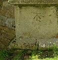
 Bench mark, Fishpond Lane, Barkestone-le-Vale - geograph.org.uk - 5169624.jpg 1,108 × 1,280; 448 KB
-
 Bench mark, Granby Lane railway bridge, Plungar - geograph.org.uk - 5169598.jpg 1,280 × 927; 460 KB
-
 Bench mark, St Helen's Church, Plungar - geograph.org.uk - 5169494.jpg 1,026 × 1,280; 668 KB
-
-
 Bench mark, St Peter's Church, Redmile - geograph.org.uk - 5170091.jpg 960 × 1,280; 441 KB
-
 Blackthorn in flower - geograph.org.uk - 6106910.jpg 1,024 × 768; 220 KB
-

-

-
 Byway to Barkestone - geograph.org.uk - 4212364.jpg 1,920 × 1,440; 980 KB
-
 Byway to Barkestone le Vale - geograph.org.uk - 6105071.jpg 1,024 × 768; 252 KB
-
 Byway to Bottesford - geograph.org.uk - 5170113.jpg 1,280 × 960; 442 KB
-
 Byway to Easthorpe - geograph.org.uk - 6105657.jpg 1,024 × 768; 229 KB
-
 Canal towpath - geograph.org.uk - 941676.jpg 640 × 427; 88 KB
-
 Canal towpath - geograph.org.uk - 941685.jpg 640 × 427; 84 KB
-
 Carved bench end, St Helen's church, Plungar - geograph.org.uk - 5095191.jpg 3,825 × 2,935; 6.31 MB
-
 Cherrytrees, Plungar - geograph.org.uk - 5169586.jpg 1,280 × 960; 568 KB
-
 Church Corner, Redmile - geograph.org.uk - 5170098.jpg 960 × 1,280; 394 KB
-
 Church Farm, Plungar - geograph.org.uk - 2794255.jpg 1,024 × 768; 141 KB
-
 Church Lane, Plungar - geograph.org.uk - 3574679.jpg 640 × 480; 80 KB
-
 Church of St Helen, Plungar - geograph.org.uk - 5169471.jpg 1,280 × 962; 427 KB
-
 Church of St Helen, Plungar - geograph.org.uk - 5169477.jpg 1,280 × 921; 484 KB
-
 Church of St Helen, Plungar - geograph.org.uk - 5169492.jpg 1,280 × 960; 582 KB
-
 Church of St Helen, Plungar - geograph.org.uk - 5169500.jpg 1,280 × 1,280; 370 KB
-
 Church of St Helen, Plungar - geograph.org.uk - 5169502.jpg 1,280 × 1,280; 387 KB
-
 Church of St Helen, Plungar - geograph.org.uk - 5169505.jpg 1,280 × 1,025; 332 KB
-
 Church of St Helen, Plungar - geograph.org.uk - 5169511.jpg 1,280 × 960; 274 KB
-
 Church of St Helen, Plungar - geograph.org.uk - 5169512.jpg 1,280 × 960; 293 KB
-
 Church of St Helen, Plungar - geograph.org.uk - 5169543.jpg 1,280 × 960; 296 KB
-
 Church of St Helen, Plungar - geograph.org.uk - 5169548.jpg 1,280 × 960; 354 KB
-
 Church of St Helen, Plungar - geograph.org.uk - 5169551.jpg 1,280 × 993; 299 KB
-
 Church of St Helen, Plungar - geograph.org.uk - 5169558.jpg 955 × 1,280; 275 KB
-
 Church of St Helen, Plungar - geograph.org.uk - 5169568.jpg 1,280 × 960; 341 KB
-
 Church of St Helen, Plungar - geograph.org.uk - 5169573.jpg 960 × 1,280; 553 KB
-
 Church of St Helen, Plungar - geograph.org.uk - 5169583.jpg 1,280 × 999; 411 KB
-

-

-
 Church of St. Peter, Redmile - geograph.org.uk - 6108099.jpg 768 × 1,024; 201 KB
-
 Cottage on Church Corner, Redmile - geograph.org.uk - 3574709.jpg 640 × 480; 97 KB
-

-
 Country road - geograph.org.uk - 3574698.jpg 640 × 480; 75 KB
-
 County boundary near Plungar - geograph.org.uk - 4211915.jpg 1,920 × 1,408; 796 KB
-

-
 Crop field off Long Lane - geograph.org.uk - 3575008.jpg 640 × 480; 92 KB
-
 Crop field, Vale House - geograph.org.uk - 3574682.jpg 640 × 480; 55 KB
-
 Crossroads ahead - geograph.org.uk - 4586665.jpg 4,608 × 3,456; 3.22 MB
-
 Culvert on Grantham Canal - geograph.org.uk - 675890.jpg 640 × 480; 59 KB
-

-
 Datestone, Peacock Inn, Redmile - geograph.org.uk - 5170095.jpg 1,280 × 960; 314 KB
-
 Decorated capital - geograph.org.uk - 941594.jpg 640 × 427; 35 KB
-
 Derelict building east of Wood Lane - geograph.org.uk - 5179120.jpg 640 × 463; 97 KB
-
 Derelict hut in Plungar Wood - geograph.org.uk - 2024898.jpg 2,601 × 1,696; 1.86 MB
-

-

-
 Drift Hill, Redmile - geograph.org.uk - 6108066.jpg 1,024 × 768; 206 KB
-
 Drive to Woodside Farm from Long Lane - geograph.org.uk - 5570012.jpg 800 × 533; 114 KB
-
 Easthorpe Lane - geograph.org.uk - 2974189.jpg 640 × 427; 118 KB
-
 Easthorpe Lane - geograph.org.uk - 6108052.jpg 1,024 × 768; 265 KB
-
 Easthorpe Lane - geograph.org.uk - 6108059.jpg 1,024 × 768; 263 KB
-
 Easthorpe Lane, Redmile - geograph.org.uk - 5170109.jpg 1,280 × 960; 337 KB
-
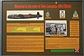 ED549 Memorial information board - geograph.org.uk - 3553950.jpg 640 × 429; 98 KB
-
 Entrance to a field - geograph.org.uk - 5018267.jpg 640 × 474; 66 KB
-

-

-

-
 Farm building, Fishpond Lane, Barkestone-le-Vale - geograph.org.uk - 5169631.jpg 1,280 × 960; 286 KB
-
 Farm track beside dismantled railway - geograph.org.uk - 3574667.jpg 640 × 480; 100 KB
-

-
 Farmland near Plungar - geograph.org.uk - 4206877.jpg 1,920 × 1,443; 594 KB
-
 Farmland off Redmile Lane - geograph.org.uk - 3574693.jpg 640 × 480; 76 KB
-
 Farmland, Peacock Farm - geograph.org.uk - 3574699.jpg 640 × 480; 74 KB
-
 Field east of Wood Lane - geograph.org.uk - 5179073.jpg 640 × 465; 89 KB
-
 Field near Plungar - geograph.org.uk - 4212038.jpg 1,920 × 1,354; 321 KB
-
 Field near Plungar - geograph.org.uk - 4212091.jpg 1,920 × 1,271; 627 KB
-

-

-

-
-
 Field track to Plungar - geograph.org.uk - 5018255.jpg 640 × 437; 51 KB
-
 Fields and hedges north of Long Lane - geograph.org.uk - 5018261.jpg 640 × 466; 64 KB
-
 Fields west of Wood Lane - geograph.org.uk - 5179074.jpg 640 × 445; 68 KB
-

-
 Following the field edge - geograph.org.uk - 6105042.jpg 1,024 × 768; 222 KB
-
 Font, St Helen's church, Plungar - geograph.org.uk - 5095225.jpg 3,090 × 4,315; 7.21 MB
-

-
 Footpath at Barkestone le Vale - geograph.org.uk - 6105668.jpg 1,024 × 768; 418 KB
-

-
 Footpath by The Grimmer - geograph.org.uk - 6105932.jpg 1,024 × 768; 237 KB
-
 Footpath by The Grimmer - geograph.org.uk - 6106008.jpg 1,024 × 768; 253 KB
-
 Footpath junction - geograph.org.uk - 5179112.jpg 640 × 477; 156 KB
-
 Footpath sign - geograph.org.uk - 5018285.jpg 640 × 495; 43 KB
-
 Footpath sign - geograph.org.uk - 5179090.jpg 640 × 546; 78 KB
-
 Footpath through Plungar Woods - geograph.org.uk - 5179111.jpg 640 × 495; 174 KB
-
 Footpath through the woods - geograph.org.uk - 5179065.jpg 640 × 484; 140 KB
-
 Footpath to Barkestone-le-Vale - geograph.org.uk - 5018277.jpg 640 × 498; 118 KB
-

-
 Footpath to Bottesford - geograph.org.uk - 6105891.jpg 1,024 × 768; 255 KB
-
 Footpath to Bottesford - geograph.org.uk - 973623.jpg 527 × 640; 111 KB
-
 Footpath to Redmile - geograph.org.uk - 2972485.jpg 640 × 427; 124 KB
-
 Footpath to Redmile - geograph.org.uk - 2974183.jpg 640 × 427; 141 KB
-

-
 Footpath to the church, Redmile - geograph.org.uk - 6108085.jpg 1,024 × 768; 243 KB
-
 Footpath towards Long Lane - geograph.org.uk - 5179092.jpg 640 × 456; 98 KB
-
 Footpath towards woods on Terrace Hills - geograph.org.uk - 5179093.jpg 640 × 486; 121 KB
-
 Former chapel, Barkestone le Vale - geograph.org.uk - 6105711.jpg 1,024 × 768; 225 KB
-
 Former railway bridge, Granby Lane, Plungar - geograph.org.uk - 5169594.jpg 1,280 × 960; 383 KB
-
 Former railway bridge, Harby Lane, Plungar - geograph.org.uk - 5169214.jpg 1,280 × 960; 532 KB
-
 From Long Lane to Barkestone Wood - geograph.org.uk - 5569974.jpg 640 × 427; 75 KB
-
 Gap in the hedge - geograph.org.uk - 5018269.jpg 640 × 503; 114 KB
-
 Gargoyle, St Helen's church, Plungar - geograph.org.uk - 5095194.jpg 4,595 × 2,949; 6.87 MB
-
 Gated bridge from field to Long Lane - geograph.org.uk - 5018287.jpg 640 × 506; 107 KB
-

-
 Gated track off Redmile Lane - geograph.org.uk - 3574691.jpg 640 × 480; 95 KB
-
 Gateway to the woods - geograph.org.uk - 5179113.jpg 640 × 482; 170 KB
-
 Giant stride swing, Easthorpe Lane, Redmile - geograph.org.uk - 5170111.jpg 960 × 1,280; 585 KB
-
 Granby Lane - geograph.org.uk - 4212162.jpg 1,920 × 1,296; 496 KB
-
 Granby Lane and the centre of Plungar - geograph.org.uk - 2794252.jpg 1,024 × 768; 167 KB
-
 Grantham Canal (disused) - geograph.org.uk - 675889.jpg 640 × 480; 61 KB
-
 Grantham Canal - geograph.org.uk - 3552679.jpg 640 × 427; 125 KB
-
 Grantham Canal - geograph.org.uk - 941380.jpg 640 × 427; 63 KB
-
 Grantham Canal - geograph.org.uk - 941669.jpg 640 × 427; 86 KB
-
 Grantham Canal - geograph.org.uk - 941673.jpg 640 × 427; 91 KB
-
 Grantham Canal - geograph.org.uk - 944231.jpg 640 × 427; 100 KB
-
 Grantham Canal at Plungar Bridge - geograph.org.uk - 5169590.jpg 1,280 × 894; 476 KB
-
 Grantham Canal E of Longore Bridge - geograph.org.uk - 137308.jpg 480 × 640; 156 KB
-
 Grantham Canal from Middlestile Bridge - geograph.org.uk - 153229.jpg 640 × 427; 154 KB
-

-
 Grantham Canal towpath - geograph.org.uk - 3553301.jpg 640 × 427; 132 KB
-
 Grantham Canal towpath - geograph.org.uk - 944167.jpg 640 × 427; 112 KB
-
 Harby Lane - geograph.org.uk - 3574669.jpg 640 × 480; 60 KB
-
 Harby Lane - geograph.org.uk - 3574675.jpg 640 × 480; 62 KB
-
 Highgate Lane looking towards Plungar Wood - geograph.org.uk - 2791911.jpg 1,024 × 768; 161 KB
-
 Home Farmhouse, Plungar - geograph.org.uk - 5169219.jpg 1,280 × 960; 545 KB
-

-
 Inside Plungar Wood - geograph.org.uk - 2024957.jpg 2,856 × 2,111; 2.42 MB
-
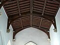
 Interior, St Helen's church, Plungar - geograph.org.uk - 5095188.jpg 4,783 × 3,128; 6.86 MB
-

-
 Jasmine Cottage, Church Corner, Redmile - geograph.org.uk - 5170101.jpg 1,280 × 960; 522 KB
-
 Jericho Bridge (bridge 51) - geograph.org.uk - 6107001.jpg 1,024 × 768; 235 KB
-
 Jericho Bridge - geograph.org.uk - 3554181.jpg 640 × 427; 152 KB
-
 Jericho Lane - geograph.org.uk - 6106835.jpg 1,024 × 768; 251 KB
-
 Jericho Lane - geograph.org.uk - 6106939.jpg 1,024 × 768; 199 KB
-
 Jericho Lane - geograph.org.uk - 6107002.jpg 1,024 × 768; 257 KB
-
 Junction of Castle View Road and Belvoir Road - geograph.org.uk - 3921257.jpg 1,600 × 1,067; 521 KB
-

-
 Junction on Long Lane - geograph.org.uk - 2025004.jpg 2,455 × 1,443; 1.28 MB
-
 Lane to Belvoir Farm - geograph.org.uk - 5074064.jpg 4,320 × 3,240; 5.72 MB
-
 Large muck heap next to Long Lane - geograph.org.uk - 5018256.jpg 640 × 474; 92 KB
-
 Light mist in the Vale - geograph.org.uk - 5194266.jpg 1,280 × 795; 220 KB
-
 Long Lane - geograph.org.uk - 3575009.jpg 640 × 480; 82 KB
-
 Long Lane - geograph.org.uk - 3921228.jpg 4,272 × 2,848; 5.61 MB
-
 Long Lane in the Vale of Belvoir - geograph.org.uk - 5587228.jpg 800 × 522; 91 KB
-
 Long Lane towards Bottesford - geograph.org.uk - 5018257.jpg 640 × 472; 62 KB
-
 Long Lane towards Bottesford - geograph.org.uk - 5018262.jpg 640 × 487; 76 KB
-
 Long Lane towards Bottesford - geograph.org.uk - 5018278.jpg 640 × 380; 54 KB
-
 Long Lane towards Bottesford - geograph.org.uk - 5018289.jpg 640 × 426; 106 KB
-
 Long Lane towards Bottesford - geograph.org.uk - 5179062.jpg 640 × 470; 67 KB
-
 Long Lane towards Harby - geograph.org.uk - 5018258.jpg 640 × 446; 57 KB
-
 Long Lane towards Harby - geograph.org.uk - 5018263.jpg 640 × 482; 65 KB
-
 Long Lane towards Harby - geograph.org.uk - 5018279.jpg 640 × 457; 68 KB
-
 Long Lane towards Harby - geograph.org.uk - 5018281.jpg 640 × 442; 72 KB
-
 Longore Bridge, Grantham Canal - geograph.org.uk - 137306.jpg 640 × 480; 154 KB
-
 Looking north across the Vale of Belvoir - geograph.org.uk - 2031174.jpg 2,369 × 1,769; 1.31 MB

_-_geograph.org.uk_-_792493.jpg)
_-_geograph.org.uk_-_792551.jpg)
_-_geograph.org.uk_-_793344.jpg)
_-_geograph.org.uk_-_793351.jpg)
_-_geograph.org.uk_-_794936.jpg)
_-_geograph.org.uk_-_794940.jpg)
_-_geograph.org.uk_-_791170.jpg)
_-_geograph.org.uk_-_791183.jpg)
_-_geograph.org.uk_-_791198.jpg)


_Castle_tramway_-_geograph.org.uk_-_322185.jpg)


_-_geograph.org.uk_-_675889.jpg)


_-_geograph.org.uk_-_6107001.jpg)


