Category:Rayne, Essex
Jump to navigation
Jump to search
English: It lies on the Roman road called Stane Street, about two miles (3 km) to the west of Braintree, which is the nearest town.
Nederlands: Rayne is een plaats in het bestuurlijke gebied Braintree, in het Engelse graafschap Essex. De plaats telt 3.000 inwoners.
village and civil parish in Essex, UK   | |||||
| Upload media | |||||
| Instance of | |||||
|---|---|---|---|---|---|
| Location | Braintree, Essex, East of England, England | ||||
 | |||||
Subcategories
This category has the following 5 subcategories, out of 5 total.
4
- 47 The Street, Rayne (2 F)
A
- All Saints Church, Rayne (19 F)
R
- Rayne railway station (6 F)
- Rayne War Memorial (2 F)
S
- The Swan, Rayne (3 F)
Media in category "Rayne, Essex"
The following 78 files are in this category, out of 78 total.
-
 A wiggle on The Street - geograph.org.uk - 3479820.jpg 640 × 480; 144 KB
-
 A120 and Flitch Way bridleway bridge - geograph.org.uk - 4103781.jpg 2,047 × 1,466; 232 KB
-
 A120 footbridge north of Fenton's Farm - geograph.org.uk - 3544539.jpg 3,537 × 2,623; 1.05 MB
-
 A120 overbridge carries School Road - geograph.org.uk - 3544551.jpg 3,540 × 2,406; 1.22 MB
-
 A120, eastbound - geograph.org.uk - 4964159.jpg 640 × 294; 28 KB
-
 A120, eastbound - geograph.org.uk - 4964160.jpg 640 × 263; 22 KB
-
 Aircraft at Rayne Hall Farm Airfield - geograph.org.uk - 5297215.jpg 640 × 428; 85 KB
-
-
 Barns at Pound Farm - geograph.org.uk - 5297521.jpg 640 × 428; 123 KB
-
 Base of the old wooden Signal Box - geograph.org.uk - 1214805.jpg 640 × 480; 170 KB
-
 Blue, green and yellow - geograph.org.uk - 3479870.jpg 640 × 480; 138 KB
-
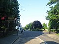
 Braintree Road at the junction of Dunmow Road - geograph.org.uk - 3497560.jpg 2,048 × 1,536; 1.49 MB
-

-

-
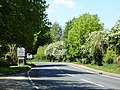
 Crossroads on The Street, Rayne - geograph.org.uk - 3497530.jpg 2,048 × 1,536; 1.43 MB
-
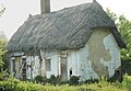 Disused Thatched Cottage - geograph.org.uk - 2375411.jpg 800 × 555; 154 KB
-
 Electricity Sub Station in Martens Meadow - geograph.org.uk - 1424996.jpg 3,072 × 2,304; 1.37 MB
-
 Field of oil seed rape - geograph.org.uk - 3480109.jpg 640 × 480; 134 KB
-
 Field of rape or a field of pylons - geograph.org.uk - 397863.jpg 640 × 480; 82 KB
-
 Flitch Way Bridge Over A120 - geograph.org.uk - 6198068.jpg 678 × 1,024; 203 KB
-
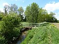
 Footbridge over Pods Brook - geograph.org.uk - 5296853.jpg 640 × 480; 209 KB
-
 Footbridge over Pods Brook - geograph.org.uk - 5297059.jpg 640 × 480; 183 KB
-
 Footbridge over Pods Brook - geograph.org.uk - 5297066.jpg 640 × 480; 165 KB
-
 Footbridge, A120 - geograph.org.uk - 4964162.jpg 640 × 321; 27 KB
-

-
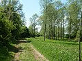
 Footpath from Rayne to Panfield - geograph.org.uk - 5296838.jpg 640 × 480; 158 KB
-
 Footpath through a field of rape - geograph.org.uk - 5296816.jpg 640 × 480; 168 KB
-
 Footpath towards Duckend Green - geograph.org.uk - 5297551.jpg 640 × 480; 170 KB
-
 Footpaths near Pods Brook - geograph.org.uk - 5297503.jpg 640 × 480; 197 KB
-

-
 From yellow field to green field - geograph.org.uk - 5296841.jpg 640 × 480; 167 KB
-
 Gated track - geograph.org.uk - 3484800.jpg 640 × 480; 116 KB
-
 Gated track off Rayne - Shalford Road - geograph.org.uk - 5297572.jpg 640 × 480; 141 KB
-
 Gnarly old Oak Tree - geograph.org.uk - 1272230.jpg 640 × 427; 132 KB
-
 Hazlemere Bridge - geograph.org.uk - 3247368.jpg 640 × 428; 181 KB
-
 Honeycomb Storage - geograph.org.uk - 6198074.jpg 1,024 × 678; 194 KB
-
 Long Lane - geograph.org.uk - 3480414.jpg 640 × 480; 198 KB
-

-
 Old barn near Rayne Hall - geograph.org.uk - 993210.jpg 480 × 640; 109 KB
-
 Old pump off Shelford Road, Rayne - geograph.org.uk - 993211.jpg 480 × 640; 124 KB
-
 Old railway van in paddock - geograph.org.uk - 5297529.jpg 640 × 480; 222 KB
-
 Part of The Street, in Rayne - geograph.org.uk - 1728413.jpg 3,648 × 2,736; 1.05 MB
-
 Path from Duckend Green to Capel Road - geograph.org.uk - 5297560.jpg 640 × 480; 218 KB
-
 Path from Duckend Green to Capel Road - geograph.org.uk - 5297563.jpg 640 × 480; 168 KB
-
 Pods Brook - geograph.org.uk - 5296864.jpg 640 × 480; 214 KB
-
 Pods Brook - geograph.org.uk - 5297035.jpg 480 × 640; 186 KB
-
 Pods Brook - geograph.org.uk - 5297048.jpg 640 × 480; 218 KB
-
 Pods Brook - geograph.org.uk - 5297091.jpg 480 × 640; 216 KB
-
 Pods Lane, Rayne - geograph.org.uk - 866049.jpg 432 × 640; 70 KB
-
 Pond ^ Menacing Sky - geograph.org.uk - 6181402.jpg 1,024 × 678; 153 KB
-
 Pump house by Pods Brook - geograph.org.uk - 5297188.jpg 640 × 480; 137 KB
-

-

-

-
 Rayne - Iron Foundry Chimney - geograph.org.uk - 865857.jpg 254 × 640; 28 KB
-
 Rayne - The Old Schoolroom - geograph.org.uk - 865845.jpg 640 × 421; 51 KB
-

-
 Rayne entrance sign - geograph.org.uk - 2280027.jpg 640 × 480; 48 KB
-
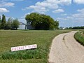
 Rayne Hall Farm Airfield - geograph.org.uk - 3479954.jpg 640 × 480; 81 KB
-
 Rayne Primary School - geograph.org.uk - 3480101.jpg 640 × 480; 107 KB
-
 Rayne Village Shield - geograph.org.uk - 865757.jpg 429 × 640; 71 KB
-
 Rayne Village Shield 800 1194.jpg 800 × 1,194; 179 KB
-
 River Ter bridge - geograph.org.uk - 3247464.jpg 640 × 428; 182 KB
-
 Road from Rayne to Shalford - geograph.org.uk - 5297567.jpg 640 × 480; 133 KB
-
 Road works on The Street, Rayne - geograph.org.uk - 3497538.jpg 2,048 × 1,536; 1.47 MB
-
 School Road Bridge, A120 - geograph.org.uk - 4964165.jpg 640 × 372; 28 KB
-

-
 Shalford Road at junction with Pods Lane - geograph.org.uk - 5297535.jpg 640 × 480; 191 KB
-
 Shalford Road enters Duckend Green - geograph.org.uk - 5297542.jpg 640 × 480; 182 KB
-
 Sign 'Flitch Way Country Park' - geograph.org.uk - 1214802.jpg 640 × 572; 119 KB
-
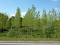 Small plantation, Blake End - geograph.org.uk - 3480178.jpg 640 × 480; 144 KB
-

-
 The Booking Hall Cafe at Rayne Station - geograph.org.uk - 6198053.jpg 1,024 × 678; 232 KB
-
 The Flitch Way in Rayne - geograph.org.uk - 6198035.jpg 1,024 × 678; 230 KB
-
-
 Two Nissen huts, Pound Farm - geograph.org.uk - 3480068.jpg 640 × 480; 135 KB
-
 Village Lock-up - geograph.org.uk - 5673464.jpg 2,944 × 2,229; 729 KB
-
 Woodland by The Street, Rayne - geograph.org.uk - 6089116.jpg 1,838 × 1,142; 1.76 MB


