Category:Rathfriland
Jump to navigation
Jump to search
Български: Ра̀тфриланд (на английски Rathfriland, на ирландски Ráth Fraoileann) е малък град в югоизточната част на Северна Ирландия. Разположен е в район Банбридж на графство Даун на около 40 km южно от столицата Белфаст. Имал е жп гара до 1955 г. Населението му е 2 079 жители според данни от преброяването през 2001 г.
English: Rathfriland is a village in County Down, Northern Ireland. It is a hilltop Plantation of Ulster settlement between the Mourne Mountains, Slieve Croob and Banbridge. It had a population of 2,079 people in the 2001 Census. It is within the Banbridge District Council area.
Nederlands: Rathfriland ( Iers: Ráth Fraoileann) is een plaats in het Noord-Ierse district Banbridge. Rathfriland telt 2061 inwoners. Van de bevolking is 63,6% protestant en 33,5% katholiek.
village in United Kingdom  | |||||
| Upload media | |||||
| Instance of | |||||
|---|---|---|---|---|---|
| Location | County Down, Northern Ireland | ||||
 | |||||
Media in category "Rathfriland"
The following 200 files are in this category, out of 328 total.
(previous page) (next page)-
 "The Hill of Iveagh" -- Annaclone Historical Society Sign.jpg 296 × 244; 40 KB
-
 A boat alongside the Castlewellan Road - geograph.org.uk - 2682057.jpg 1,024 × 768; 151 KB
-
 A Ha Ha Taxi at Rathfriland Bus Station - geograph.org.uk - 2868136.jpg 1,024 × 768; 201 KB
-
 A map of the four townlands of Rathfriland - geograph.org.uk - 5936626.jpg 4,000 × 3,000; 2.26 MB
-

-

-

-

-
 A25 Castlewellan Road, Rathfriland - geograph.org.uk - 4110958.jpg 1,703 × 1,131; 432 KB
-
 An "r" junction - geograph.org.uk - 2669075.jpg 1,024 × 768; 172 KB
-
 Approaching Rathfriland - geograph.org.uk - 1559728.jpg 640 × 480; 79 KB
-

-
 Back Road, Rathfriland - geograph.org.uk - 2669138.jpg 768 × 1,024; 176 KB
-
 Banbridge Road at Lissize Drumgath - geograph.org.uk - 1559724.jpg 640 × 480; 83 KB
-
 Banbridge Road, Rathfriland - geograph.org.uk - 2669124.jpg 1,024 × 768; 151 KB
-

-
 Bearnagh View, Rathfriland - geograph.org.uk - 1972505.jpg 1,024 × 727; 98 KB
-

-
 Bend at the lower end of Castle Hill - geograph.org.uk - 3564521.jpg 1,024 × 768; 282 KB
-
 Big Bites, Downpatrick Street, Rathfriland - geograph.org.uk - 4130477.jpg 1,024 × 748; 160 KB
-
 Bronte Homeland Interpretive Centre - geograph.org.uk - 1370960.jpg 640 × 480; 71 KB
-
 Bronte Homeland Interpretive Centre - geograph.org.uk - 1370972.jpg 640 × 480; 117 KB
-
 Bronte Homeland Interpretive Centre - geograph.org.uk - 1370981.jpg 640 × 480; 71 KB
-
 Buildings in Dowwnpatrick Street, Rathfriland - geograph.org.uk - 5212208.jpg 3,906 × 1,694; 874 KB
-
 Bungalow at the Drumarkin Road junction on the A25 - geograph.org.uk - 5939789.jpg 3,986 × 2,531; 5.69 MB
-
 Bungalows at Bearnagh View, Rathfriland - geograph.org.uk - 1972486.jpg 1,024 × 538; 72 KB
-
 Bungalows on the Carn Valley Estate - geograph.org.uk - 1977620.jpg 1,024 × 767; 126 KB
-

-
 Bus, Rathfriland - geograph.org.uk - 1439504.jpg 640 × 386; 79 KB
-
 Businesses at the northern end of Church Square, Rathfriland - geograph.org.uk - 5212389.jpg 2,927 × 3,327; 1.48 MB
-
 Castlewellan Road just east of Rathfriland - geograph.org.uk - 3553017.jpg 1,024 × 769; 154 KB
-
 Church Square from Dromore Street - geograph.org.uk - 2899900.jpg 1,024 × 679; 128 KB
-
 Church Square Rathfriland - geograph.org.uk - 1370474.jpg 640 × 480; 78 KB
-
 Church Square Rathfriland - geograph.org.uk - 1370488.jpg 640 × 480; 81 KB
-
 Church Square Rathfriland - geograph.org.uk - 1370500.jpg 640 × 480; 98 KB
-
 Church Square, Rathfriland - geograph.org.uk - 2865664.jpg 1,024 × 768; 169 KB
-
 Church Square, Rathfriland - geograph.org.uk - 3816722.jpg 1,024 × 768; 142 KB
-
 Church Square, Rathfriland - geograph.org.uk - 5212214.jpg 3,201 × 2,129; 1.04 MB
-
 Church Square, Rathfriland - geograph.org.uk - 5339960.jpg 2,551 × 3,126; 1.11 MB
-

-

-
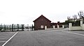
 Council car park at Rathfriland - geograph.org.uk - 3861072.jpg 1,024 × 768; 180 KB
-
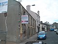
 Derelict buildings in Back Road - geograph.org.uk - 2669141.jpg 1,024 × 768; 207 KB
-
 Derelict buildings in Downpatrick Street - geograph.org.uk - 2670052.jpg 1,024 × 768; 147 KB
-

-

-
 Descending Downpatrick Street, Rathfriland - geograph.org.uk - 4153104.jpg 1,024 × 631; 121 KB
-

-
 Downpatrick Street Car Park, Rathfriland - geograph.org.uk - 5342745.jpg 3,772 × 2,666; 4.22 MB
-

-

-
 Downpatrick Street, Rathfriland (41726374514).jpg 2,268 × 1,624; 953 KB
-
 Downpatrick Street, Rathfriland - geograph.org.uk - 1370491.jpg 640 × 480; 83 KB
-
 Downpatrick Street, Rathfriland - geograph.org.uk - 1439533.jpg 640 × 429; 79 KB
-
 Downpatrick Street, Rathfriland - geograph.org.uk - 1476670.jpg 640 × 440; 38 KB
-
 Downpatrick Street, Rathfriland - geograph.org.uk - 1972495.jpg 1,024 × 755; 137 KB
-
 Downpatrick Street, Rathfriland - geograph.org.uk - 1977591.jpg 768 × 1,024; 134 KB
-
 Downpatrick Street, Rathfriland - geograph.org.uk - 2668479.jpg 1,024 × 768; 133 KB
-
 Downpatrick Street, Rathfriland - geograph.org.uk - 2669094.jpg 1,024 × 618; 129 KB
-
 Downpatrick Street, Rathfriland - geograph.org.uk - 2894233.jpg 1,024 × 750; 124 KB
-
 Downpatrick Street, Rathfriland - geograph.org.uk - 2899987.jpg 1,024 × 759; 151 KB
-
 Downpatrick Street, Rathfriland - geograph.org.uk - 3552880.jpg 1,024 × 765; 120 KB
-
 Downpatrick Street, Rathfriland - geograph.org.uk - 4130464.jpg 1,024 × 768; 151 KB
-
 Downpatrick Street, Rathfriland - geograph.org.uk - 4326690.jpg 1,600 × 1,215; 266 KB
-
 Dromore Road at its junction with Banbridge Road - geograph.org.uk - 2865687.jpg 1,024 × 678; 119 KB
-
 Drumarkin Road, Rathfriland - geograph.org.uk - 1559740.jpg 640 × 480; 110 KB
-
 Drumballyrone graveyard - geograph.org.uk - 1370967.jpg 640 × 480; 110 KB
-
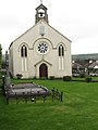
 Drumballyroney Church - geograph.org.uk - 1370917.jpg 640 × 480; 93 KB
-
 Drumballyroney Church - geograph.org.uk - 1370933.jpg 640 × 480; 146 KB
-
 Drumlin swarms north of Rathfriland - geograph.org.uk - 2669157.jpg 1,024 × 768; 179 KB
-
 Elim Church, Rathfriland - geograph.org.uk - 5316828.jpg 3,992 × 2,510; 1.85 MB
-
 Elim Pentecostal Church, Newry Road - geograph.org.uk - 2669466.jpg 1,024 × 743; 152 KB
-
 Empty stores in Rathfriland's CBD - geograph.org.uk - 2669799.jpg 1,024 × 768; 179 KB
-
 Entering Newry Street, Rathfriland - geograph.org.uk - 5342788.jpg 4,000 × 3,000; 2.31 MB
-

-
 Entering Rathfriland on the Ballyroney Road - geograph.org.uk - 2894453.jpg 1,024 × 768; 114 KB
-
 Entering Rathfriland Road on the Hilltown Road - geograph.org.uk - 5763255.jpg 3,790 × 2,096; 4.13 MB
-

-
 Farm buildings on the outskirts of Rathfriland - geograph.org.uk - 1977565.jpg 828 × 1,024; 112 KB
-

-
 Farmland in the Townland of Kiltarriff - geograph.org.uk - 2668375.jpg 1,024 × 767; 105 KB
-
 Farmland north of the Ballyroney Road - geograph.org.uk - 2865958.jpg 1,024 × 768; 198 KB
-
 Farmland on the western side of Castle Hill - geograph.org.uk - 3553677.jpg 1,024 × 587; 74 KB
-

-

-
 Flush Bracket, Rathfriland - geograph.org.uk - 2127342.jpg 640 × 594; 172 KB
-
 For Sale - Rathfriland's Market Hall - geograph.org.uk - 2669754.jpg 1,024 × 768; 153 KB
-
 Fred McCauley's Butchery in Main Street, Rathfriland - geograph.org.uk - 5342769.jpg 3,015 × 2,840; 3.76 MB
-

-

-

-

-
 House in Newry Street, Rathfriland - geograph.org.uk - 5316763.jpg 3,598 × 2,525; 1.32 MB
-
 House on Newry Street, Rathfriland (28576501298).jpg 1,637 × 2,228; 901 KB
-

-
 Houses in Bearnagh View, Rathfriland - geograph.org.uk - 3995352.jpg 1,024 × 731; 108 KB
-
 Houses in Downpatrick Street, Rathfriland - geograph.org.uk - 1719201.jpg 1,024 × 768; 107 KB
-
 Houses on Bearnagh View, Rathfriland - geograph.org.uk - 6346227.jpg 2,669 × 1,998; 3.14 MB
-
 Houses on Castle Hill, Rathfriland - geograph.org.uk - 2669863.jpg 1,024 × 768; 155 KB
-
 Houses on the Carn Valley Estate - geograph.org.uk - 2913245.jpg 1,024 × 768; 125 KB
-
 Houses on the eastern fringe of Rathfriland - geograph.org.uk - 1972500.jpg 1,024 × 561; 89 KB
-
 Houses on the eastern fringe of Rathfriland - geograph.org.uk - 4452827.jpg 1,600 × 1,197; 229 KB
-
 Housing estate off School Road, Rathfriland - geograph.org.uk - 2669314.jpg 1,024 × 768; 156 KB
-
 Industrial premises off John Street - geograph.org.uk - 2899950.jpg 768 × 1,024; 181 KB
-
 Island Bog Road - geograph.org.uk - 1370511.jpg 640 × 480; 93 KB
-
 Island Bog Road, Rathfriland - geograph.org.uk - 1559706.jpg 640 × 480; 105 KB
-

-
 John Street, Rathfriland - geograph.org.uk - 2668472.jpg 1,024 × 768; 142 KB
-
 Katie Banks Coffee House, Church Square, Rathfriland - geograph.org.uk - 5212345.jpg 3,339 × 2,790; 1.65 MB
-
 Lambs grazing where Orangemen parade - geograph.org.uk - 3450659.jpg 1,024 × 768; 126 KB
-
 Lower Green, Kiltariff Park, Rathfriland - geograph.org.uk - 5342298.jpg 3,638 × 2,728; 1.29 MB
-

-

-
 Main Street, Rathfriland - geograph.org.uk - 1370496.jpg 640 × 480; 79 KB
-

-
 Mandarin Palace, Rathfriland - geograph.org.uk - 3848443.jpg 1,024 × 768; 151 KB
-

-

-
 Mural in Church Square, Rathfriland - geograph.org.uk - 2877051.jpg 1,024 × 651; 128 KB
-
 MV Bar in Main Street, Rathfriland - geograph.org.uk - 5212399.jpg 4,000 × 3,000; 2.19 MB
-

-
 Neto Extra, Rathfriland - geograph.org.uk - 5342292.jpg 3,820 × 2,444; 1 MB
-

-

-
 Newry Street, Rathfriland - geograph.org.uk - 2669747.jpg 1,024 × 768; 172 KB
-
 Nisa-extra supermarket in Newry Street, Rathfriland (geograph 2669340).jpg 1,024 × 768; 100 KB
-
 Old warehouses in the Back Road - geograph.org.uk - 2669130.jpg 768 × 1,024; 191 KB
-
 Orange Arch at Rathfriland - geograph.org.uk - 6218947.jpg 1,117 × 1,034; 643 KB
-
 Orange Order District Park - geograph.org.uk - 5317931.jpg 3,024 × 2,809; 1.49 MB
-

-
 Pastureland east of the B7 (Drumlough Road) - geograph.org.uk - 2668356.jpg 1,024 × 768; 147 KB
-
 Prefabricated houses facing on to John Street - geograph.org.uk - 2668451.jpg 1,024 × 633; 118 KB
-
 Prefabricated housing in Glentariff Park - geograph.org.uk - 2668445.jpg 1,024 × 768; 148 KB
-
 Rathfriland - a town on a hill - geograph.org.uk - 3564546.jpg 1,024 × 736; 145 KB
-
 Rathfriland Branch Library, John Street - geograph.org.uk - 2899929.jpg 1,024 × 768; 140 KB
-
 Rathfriland bus depot - geograph.org.uk - 1439375.jpg 640 × 354; 47 KB
-
 Rathfriland fire station - geograph.org.uk - 1438827.jpg 640 × 405; 57 KB
-
 Rathfriland High School - geograph.org.uk - 2669374.jpg 1,024 × 768; 181 KB
-
 Rathfriland Mart - geograph.org.uk - 1559702.jpg 640 × 480; 67 KB
-
 Rathfriland Reformed Presbyterian Church - geograph.org.uk - 2850096.jpg 1,024 × 746; 100 KB
-
 Rathfriland village. - geograph.org.uk - 1420523.jpg 640 × 480; 198 KB
-
 Rathfriland's Bank of Ireland from John Street - geograph.org.uk - 2668425.jpg 1,024 × 768; 147 KB
-
 Rathfriland's Church Square from Newry Street - geograph.org.uk - 2669116.jpg 1,024 × 768; 177 KB
-

-
 Rathfriland's fallen of World War I - geograph.org.uk - 2851400.jpg 488 × 640; 66 KB
-
 Rathfriland's new Fire and Rescue Station - geograph.org.uk - 2848635.jpg 1,024 × 752; 124 KB
-

-
 Rathfriland's Third Presbyterian Church - geograph.org.uk - 2669362.jpg 1,024 × 768; 140 KB
-

-
 Rathfriland's Ulsterbus Depot - geograph.org.uk - 2670046.jpg 1,024 × 766; 121 KB
-
 Rathfriland's War Memorial - geograph.org.uk - 2851643.jpg 768 × 1,024; 133 KB
-
 Rathfriland's War Memorial - geograph.org.uk - 5212105.jpg 2,157 × 2,876; 1.09 MB
-
 Rathfriland's Water Tower - geograph.org.uk - 2669879.jpg 768 × 1,024; 158 KB
-
 Re-roofing St John's CoI Church, Rathfriland - geograph.org.uk - 2851182.jpg 1,024 × 701; 88 KB
-
 Repair Garage in Caddell's Lane, Rathfriland - geograph.org.uk - 3848433.jpg 1,024 × 768; 174 KB
-
-
 Rosconnor Place, Rathfriland - geograph.org.uk - 1476678.jpg 640 × 357; 46 KB
-
 Rosconnor Place, Rathfriland - geograph.org.uk - 5342585.jpg 4,000 × 3,000; 1.94 MB
-

-
 Rosconnor Terrace, Rathfriland - geograph.org.uk - 5342593.jpg 4,000 × 3,000; 2.06 MB
-
 Rossconor Place, Rathfriland - geograph.org.uk - 1972513.jpg 1,024 × 628; 112 KB
-
 Rossconor Place, Rathfriland - geograph.org.uk - 3552915.jpg 1,024 × 768; 186 KB
-
 Rossconor Terrace, Rathfriland - geograph.org.uk - 3552871.jpg 1,024 × 768; 220 KB
-

-
 Rural settlement along Ballyroney Road - geograph.org.uk - 2894449.jpg 1,024 × 648; 79 KB
-
 Saturday Market at Rathfriland - geograph.org.uk - 2865937.jpg 1,024 × 697; 136 KB
-

-
 Shops at the eastern end of Main Street - geograph.org.uk - 2868029.jpg 1,024 × 768; 172 KB
-
 Shops in Downpatrick Street, Rathfriland - geograph.org.uk - 5339966.jpg 3,017 × 2,585; 1.58 MB
-
 Sleepy Valley Estate, Rathfriland on the Hill - geograph.org.uk - 2668182.jpg 1,024 × 768; 185 KB
-
 South Down Action for Healing Wounds - geograph.org.uk - 2868047.jpg 1,024 × 747; 150 KB
-
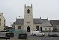
 St John's (CoI) Parish Church, Rathfriland - geograph.org.uk - 2669760.jpg 1,024 × 768; 124 KB
-
 St John's CoI (Anglican) Church, Rathfriland - geograph.org.uk - 5212261.jpg 3,149 × 2,999; 1.7 MB
-
 St Mary's Catholic Chapel, Newry Road - geograph.org.uk - 2669419.jpg 768 × 1,024; 140 KB
-
 St Mary's Catholic Chapel, Newry Street - geograph.org.uk - 2669479.jpg 1,024 × 768; 125 KB
-
 St Mary's Catholic Chapel, Rathfriland - geograph.org.uk - 5340209.jpg 3,671 × 2,753; 1.06 MB
-
-

-
 St Mary's Primary School, Rathfriland - geograph.org.uk - 2682016.jpg 1,024 × 613; 99 KB
-

-

-
-
 Stores at the eastern end of Newry Street - geograph.org.uk - 2669826.jpg 1,024 × 768; 190 KB
-
 Straight ahead towards Rathfriland - geograph.org.uk - 2877030.jpg 1,024 × 724; 107 KB
-

-

-

-
 SuperValu Supermarket, John Street, Rathfriland - geograph.org.uk - 2668469.jpg 1,024 × 768; 173 KB
-

-

-
 The A25 (Castlewellan Road) near Hammy's Bridge - geograph.org.uk - 5763696.jpg 1,130 × 1,328; 781 KB
-

-
 The A25 at its junction with the B7 - geograph.org.uk - 2669443.jpg 1,024 × 768; 184 KB
-
 The A25 at the eastern outskirts of Rathfriland - geograph.org.uk - 5763700.jpg 3,895 × 2,063; 3.66 MB
-
 The ascent to the summit of Castle Hill - geograph.org.uk - 2849945.jpg 1,024 × 768; 150 KB
-

-
 The B7 Mayobridge Road at Iveagh Bungalows - geograph.org.uk - 2669471.jpg 1,024 × 768; 149 KB
-
 The Back Road climbs over another drumlin - geograph.org.uk - 2669269.jpg 768 × 1,024; 250 KB
-

-
 The Ballyroney Road - geograph.org.uk - 1370502.jpg 640 × 434; 83 KB


_-_geograph.org.uk_-_2877038.jpg)


.jpg)


_on_the_eastern_outskirts_of_Rathfriland_-_geograph.org.uk_-_4290294.jpg)


.jpg)


.jpg)


_-_geograph.org.uk_-_2668356.jpg)


_Parish_Church,_Rathfriland_-_geograph.org.uk_-_2669760.jpg)
_Church,_Rathfriland_-_geograph.org.uk_-_5212261.jpg)


_near_Hammy%27s_Bridge_-_geograph.org.uk_-_5763696.jpg)
_approaching_the_hilltown_of_Rathfriland_-_geograph.org.uk_-_2668406.jpg)


