Category:Rathaus Gevelsberg
Jump to navigation
Jump to search
| Object location | | View all coordinates using: OpenStreetMap |
|---|
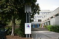
town hall of Gevelsberg, North Rhine-Westphalia, Germany  | |||||
| Upload media | |||||
| Instance of | |||||
|---|---|---|---|---|---|
| Location | Gevelsberg, Ennepe-Ruhr-Kreis, Arnsberg Government Region, North Rhine-Westphalia, Germany | ||||
 | |||||
Media in category "Rathaus Gevelsberg"
The following 9 files are in this category, out of 9 total.
-
 Gevelsberg - Großer Markt - Rathaus 01 ies.jpg 3,888 × 2,592; 1.4 MB
-
 Gevelsberg - Großer Markt - Rathaus 02 ies.jpg 3,888 × 2,592; 2.13 MB
-
 Gevelsberg - Großer Markt - Rathaus 03 ies.jpg 3,888 × 2,592; 1.5 MB
-
 Gevelsberg - Rathausplatz - Rathaus 01 ies.jpg 3,888 × 2,592; 1.68 MB
-
 Gevelsberg - Rathausplatz - Rathaus 02 ies.jpg 3,888 × 2,592; 1.94 MB
-
 Gevelsberg - Rathausplatz - Rathaus 03 ies.jpg 3,888 × 2,592; 2.06 MB
-
 Gevelsberg - Rathausplatz - Rathaus 04 ies.jpg 3,888 × 2,592; 1.25 MB
-
 Gevelsberg - Rathausplatz - Rathaus 05 ies.jpg 3,888 × 2,592; 1.89 MB
-
 Gevelsberg - Rathausplatz - Rathaus 06 ies.jpg 3,888 × 2,592; 1.98 MB


