Category:Rapid transit maps
Jump to navigation
Jump to search
English: Maps of rapid transit lines and networks.
map or schematic diagram of fixed routes of bus, passenger rail and ferry networks | |||||
| Upload media | |||||
| Subclass of | |||||
|---|---|---|---|---|---|
| Depicts | public transport network | ||||
| |||||
See also:
- Category:Public transport maps for all kind of public transport maps
- Category:Metro maps for metro maps
- Category:Tram maps for tramway maps
- Category:Trolleybus maps for trolleybus maps
- Category:Bus maps for bus maps
- Category:Rail transport maps for railway maps
Subcategories
This category has the following 113 subcategories, out of 113 total.
!
- Public transport country maps (59 F)
*
A
B
C
- Public transport maps of Caracas (28 F)
D
- Public transport maps of Denver (14 F)
E
F
G
H
- Maps of Harbin Metro (11 F)
J
K
L
M
- Manchester Metrolink maps (61 F)
- MIO maps (2 F)
N
O
P
R
S
T
X
Z
Media in category "Rapid transit maps"
The following 78 files are in this category, out of 78 total.
-
 World Tramway Map.png 7,676 × 3,905; 2.52 MB
-
 Cagliari mappa SFM.svg 771 × 617; 3.63 MB
-
 Carrerae terrae.png 2,387 × 1,313; 294 KB
-
 Central Park depot map.svg 612 × 517; 96 KB
-
 Ciudades con metro LatAm.svg 793 × 963; 699 KB
-
 Ciudades con suburbano LatAm.svg 512 × 621; 353 KB
-
 Commuterline Merak MapJP.png 3,000 × 1,000; 348 KB
-
 Commuterline Tanjung Priok MapJP.png 3,000 × 1,000; 382 KB
-
 Express Occidentalis.png 1,080 × 2,145; 116 KB
-
 Karte Metro-, Tram- und Obussysteme.svg 1,736 × 2,326; 4.65 MB
-
 Karte ÖPNV-Netze Deutschland.svg 1,736 × 2,326; 4.64 MB
-
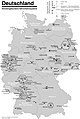
 OePNVSystemeDeutschland.png 1,172 × 1,700; 322 KB
-
 Global metro.png 2,729 × 1,482; 362 KB
-
 HangzhouMetroUnderConstruction.svg 3,985 × 2,247; 429 KB
-
 JabodebekLRTJP.png 2,560 × 2,560; 618 KB
-
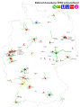
 Karte der ÖPNV-Systeme in den Staaten der ehemaligen Sowjetunion.png 1,571 × 3,027; 1.44 MB
-
 Karte der ÖPNV-Systeme in den USA.png 2,204 × 1,353; 440 KB
-
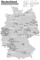 Karte der ÖPNV-Systeme in Deutschland 2008.png 1,535 × 2,257; 456 KB
-
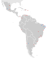
 Karte der ÖPNV-Systeme in Lateinamerika.png 1,371 × 1,575; 356 KB
-
 Karte der ÖPNV-Systeme in Nordafrika.png 2,493 × 1,287; 239 KB
-
 Karte der ÖPNV-Systeme in Spanien und Portugal.png 3,303 × 2,617; 927 KB
-
 Karte ÖPNV-Systeme in der Türkei.png 3,656 × 1,750; 300 KB
-
 Karte ÖPNV-Systeme in Italien.png 2,260 × 1,551; 355 KB
-
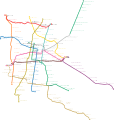
 Kyiv Rapid Transit Map.svg 629 × 595; 593 KB
-
 LRT Bekasi MapJP.png 3,000 × 1,000; 518 KB
-
 LRT Cibubur MapJP.png 3,000 × 1,000; 512 KB
-
 Map of Cercania systems in Spain.png 1,645 × 1,369; 469 KB
-
 Mapa del Metro de la Ciudad de México.svg 3,091 × 3,247; 2.95 MB
-
 Mapa STC Metro Movilidad Integrada.svg 2,015 × 2,848; 9.36 MB
-
 Mappa Circumsalernitana inaugurazione servizio (1997).gif 1,024 × 721; 56 KB
-
 Mappa Circumsalernitana.png 1,024 × 721; 135 KB
-
 Mappa SFM Bologna.svg 1,044 × 901; 938 KB
-
 Maqueta Metro VLN.jpg 1,600 × 1,200; 379 KB
-
 MEGA Ahmedabad Metro Network Map August 2015.png 987 × 814; 72 KB
-
 MEGA Ahmedabad Metro Phase I Network Map.jpg 1,326 × 996; 142 KB
-
 Messina mappa Metroferrovia.svg 627 × 838; 2.55 MB
-
 Metro camisuandia nuevo.jpg 5,000 × 5,000; 2.64 MB
-
 Metro hispanorum.png 1,590 × 1,052; 134 KB
-
 Metro in the World.png 940 × 415; 111 KB
-
 Metro in the World.svg 940 × 415; 1.51 MB
-
 Metro Loco.svg 1,052 × 1,488; 1.45 MB
-
 Metro Museum in Shanghai.jpeg 4,032 × 3,024; 1.71 MB
-
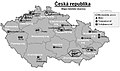 Metro, tram a trolejbusy v ČR.jpg 876 × 518; 148 KB
-
 Metromundi.png 2,384 × 1,312; 728 KB
-
 Miami Metro Map 2017.png 5,500 × 4,600; 835 KB
-
 MRTJ north South MapJP.png 3,000 × 1,000; 618 KB
-
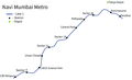 Navi Mumbai Metro Map.png 1,112 × 676; 36 KB
-
 Noapara depot map.svg 301 × 553; 55 KB
-
 NYC Subway Lines, not Services.png 3,000 × 3,800; 1,021 KB
-
 OePNVSystemeDeutschlandJanuar2003.jpg 1,260 × 1,877; 205 KB
-
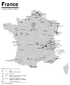 OePNVSystemeFrankreich-fr.png 1,204 × 1,445; 236 KB
-
 OePNVSystemeFrankreich.png 1,204 × 1,445; 165 KB
-
 OePNVSystemeJapanJanuar2003.png 1,503 × 2,223; 413 KB
-
 OePNVSystemePolenMai2007.png 1,500 × 1,836; 245 KB
-
 Palembang LRT MapJP.png 3,000 × 1,000; 430 KB
-
 Parma - mappa progetto metropolitana leggera 2005.svg 994 × 1,328; 6.59 MB
-
 Public transport system map of the USA.png 2,204 × 1,353; 440 KB
-
 Public transport systems of Italy.png 1,298 × 1,551; 251 KB
-
 Rail networks USA map.svg 959 × 593; 124 KB
-
 RFi-1612-DIC-2016-Higgs.jpg 3,154 × 3,508; 5.15 MB
-
 Salerno mappa servizio ferroviario metropolitano.svg 948 × 760; 2.44 MB
-
 Tees Valley Metro Route Map jpg.jpg 2,481 × 1,309; 282 KB
-
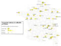 Transports urbains de France.png 1,072 × 811; 190 KB
-
 Tube map icon.svg 650 × 400; 18 KB
-
 Western European express.png 1,584 × 1,676; 95 KB
-
 World metro system cities.png 1,983 × 1,014; 279 KB
-
 World metro system city list.png 1,920 × 982; 287 KB
-
 World Metro systems November 2021.svg 940 × 415; 1.53 MB
-
 World Metro systems.png 940 × 415; 116 KB
-
 World Metro systems.svg 940 × 415; 1.53 MB
-
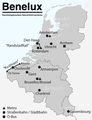 ÖPNV-System in den Benelux-Staaten.png 961 × 1,253; 146 KB
-
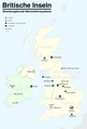 ÖPNV-Systeme auf den Britischen Inseln.png 1,845 × 2,715; 512 KB
-
 ÖPNV-Systeme in China.png 3,176 × 2,560; 1.25 MB
-
 ÖPNV-Systeme in Korea.png 1,638 × 2,644; 633 KB
-
 ÖPNV-Systeme in Südosteuropa.png 1,721 × 1,917; 444 KB
-
 ÖPNV-Systeme Tschechische Republik.png 1,660 × 1,046; 207 KB
-
 ÖPNV-Südkorea de.svg 509 × 800; 182 KB
-
 Саратов 90 автобус.svg 484 × 540; 310 KB


.gif)


