Category:Ramen 2, Hoorn
Jump to navigation
Jump to search
| Object location | | View all coordinates using: OpenStreetMap |
|---|
 | |||||
| Upload media | |||||
| Instance of | |||||
|---|---|---|---|---|---|
| Location | Hoorn, North Holland, Netherlands | ||||
| Street address |
| ||||
| Located on street | |||||
| Heritage designation |
| ||||
 | |||||
|
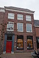
This is a category about rijksmonument number 22547
|
| Address |
|
Media in category "Ramen 2, Hoorn"
The following 3 files are in this category, out of 3 total.
-
 Ramen 2 te Hoorn.jpg 960 × 1,280; 196 KB
-
 Ramen 2, Hoorn.JPG 2,592 × 3,888; 3.84 MB
-
 Voorgevel - Hoorn - 20116610 - RCE.jpg 1,196 × 1,200; 392 KB

