Category:Railings in Lincolnshire
Jump to navigation
Jump to search
Ceremonial counties of England: Bedfordshire · Berkshire · Buckinghamshire · Cambridgeshire · Cheshire · Cornwall · Cumbria · Derbyshire · Devon · Dorset · Durham · East Riding of Yorkshire · East Sussex · Essex · Gloucestershire · Greater London · Greater Manchester · Hampshire · Herefordshire · Hertfordshire · Isle of Wight · Kent · Lancashire · Leicestershire · Lincolnshire · Merseyside · Norfolk · North Yorkshire · Northamptonshire · Northumberland · Nottinghamshire · Oxfordshire · Shropshire · Somerset · South Yorkshire · Staffordshire · Suffolk · Surrey · Tyne and Wear · Warwickshire · West Midlands · West Sussex · West Yorkshire · Wiltshire · Worcestershire
City-counties: Bristol · City of London
Former historic counties:
Other former counties:
City-counties: Bristol · City of London
Former historic counties:
Other former counties:
Media in category "Railings in Lincolnshire"
The following 54 files are in this category, out of 54 total.
-
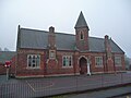
 Aby Church of England Primary School.jpg 800 × 533; 135 KB
-
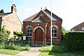
 Baptist Chapel, Dyke - geograph.org.uk - 1162116.jpg 640 × 480; 59 KB
-
 The Old Police Station, High Street - geograph.org.uk - 202297.jpg 640 × 480; 120 KB
-
 Black Sluice Boston.jpg 640 × 480; 71 KB
-
 The Georgians - geograph.org.uk - 335469.jpg 640 × 427; 70 KB
-

-
 Bridge over the Welland, Spalding, Lincs - geograph.org.uk - 132836.jpg 640 × 480; 288 KB
-
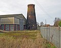 Bell's Mill, Mill Lane, Brigg - geograph.org.uk - 1123421.jpg 640 × 511; 362 KB
-
 Broad Street - geograph.org.uk - 616752.jpg 640 × 427; 84 KB
-

-
 Castle Walls - geograph.org.uk - 132146.jpg 640 × 427; 131 KB
-
 St.Nicholas' church, East Kirkby, Lincs. - geograph.org.uk - 163880.jpg 640 × 427; 106 KB
-
 St.Andrew's church - geograph.org.uk - 1158418.jpg 426 × 640; 90 KB
-
 Mount Pleasant - geograph.org.uk - 327420.jpg 640 × 427; 83 KB
-
 Grantham - canal obliterated - geograph.org.uk - 137287.jpg 640 × 480; 148 KB
-
 Greestone House - geograph.org.uk - 153882.jpg 640 × 427; 116 KB
-
 Grimsby Synagogue - geograph.org.uk - 141647.jpg 480 × 640; 97 KB
-
 Grimsby Synagogue - geograph.org.uk - 264444.jpg 640 × 480; 113 KB
-
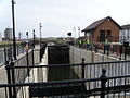
 Hagnaby Lock - geograph.org.uk - 163872.jpg 640 × 427; 132 KB
-
 Harlam Hill Lock - geograph.org.uk - 138880.jpg 640 × 480; 134 KB
-
 Wesleyan Methodist Chapel - geograph.org.uk - 458739.jpg 640 × 427; 78 KB
-
 St.Peter and St.Paul's church - geograph.org.uk - 1162565.jpg 640 × 426; 92 KB
-
 Lincoln Castle, Lincoln - geograph.org.uk - 849637.jpg 480 × 640; 94 KB
-
 Tomb of Katherine Swynford - geograph.org.uk - 641463.jpg 640 × 427; 84 KB
-
 St Katherine's, Lincoln, England - DSCF1398.JPG 3,000 × 4,000; 2.76 MB
-
 St Mary le Wigford - High Street - geograph.org.uk - 1484511.jpg 448 × 640; 283 KB
-
 St.Peter at Gowts water faucet - geograph.org.uk - 307100.jpg 427 × 640; 87 KB
-
 Unitarian Chapel, High Street, Lincoln, England - DSCF1342.JPG 4,000 × 3,000; 2.99 MB
-
 Mablethorpe seafront - geograph.org.uk - 771454.jpg 640 × 427; 53 KB
-
 Marston Thorold's Charity Church Of England School.jpg 640 × 480; 158 KB
-
 Maud Foster Mill - geograph.org.uk - 419122.jpg 640 × 480; 59 KB
-
 Morton Village Hall - geograph.org.uk - 672149.jpg 640 × 427; 78 KB
-
 Navigation Wharf - geograph.org.uk - 390472.jpg 640 × 480; 114 KB
-
 Race at the High Locks - geograph.org.uk - 693504.jpg 427 × 640; 103 KB
-
 Rain Swept Beach - Skegness - geograph.org.uk - 779989.jpg 640 × 480; 44 KB
-
 Royal Dock - entrance from the Humber - geograph.org.uk - 408228.jpg 640 × 480; 74 KB
-

-
 Sea wall walk - geograph.org.uk - 1737619.jpg 640 × 426; 90 KB
-
 Sea wall walk - geograph.org.uk - 1737622.jpg 640 × 426; 69 KB
-
 Skegness Beach - geograph.org.uk - 1063104.jpg 640 × 480; 167 KB
-
 Stamford War Memorial - geograph.org.uk - 616745.jpg 640 × 427; 96 KB
-
 Former brewery, Water Street, St. Martins, Stamford (geograph 2136995).jpg 1,600 × 1,200; 392 KB
-
 Stamp End Lock - geograph.org.uk - 131093.jpg 640 × 427; 93 KB
-
 Steep Hill, Lincoln - geograph.org.uk - 689235.jpg 480 × 640; 97 KB
-
 Steep Hill, Lincoln - geograph.org.uk - 689236.jpg 640 × 480; 94 KB
-
 017 Stoke Rochford Ss Andrew & Mary, exterior - vestry from the south-west.jpg 4,608 × 3,456; 6.68 MB
-
 The Templar's Bath, Bottesford.jpg 1,024 × 768; 205 KB
-

-
 Toft Tunnel, Lincolnshire (geograph 3136755).jpg 640 × 427; 129 KB
-
 Torksey Lock - geograph.org.uk - 553921.jpg 640 × 480; 80 KB
-
 Two beaches - geograph.org.uk - 1386564.jpg 640 × 439; 283 KB
-
 War Memorial at Withern - geograph.org.uk - 455800.jpg 640 × 398; 107 KB
-
 St James's Church, Woolsthorpe by Belvoir - geograph.org.uk - 28159.jpg 640 × 480; 162 KB
-
 Church Tower, Wootton - geograph.org.uk - 431112.jpg 480 × 640; 158 KB


.jpg)


,_Thurlby_-_geograph.org.uk_-_1575204.jpg)
.jpg)


