Category:Rail transport maps of Western Australia
Jump to navigation
Jump to search
Media in category "Rail transport maps of Western Australia"
The following 24 files are in this category, out of 24 total.
-
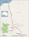
 Baldivis Tramway marked on OpenStreetMap.jpg 447 × 829; 92 KB
-
 Clackline to Piawaning railway map 1917.jpg 2,441 × 2,796; 3.03 MB
-
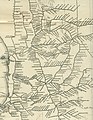
 Eastern Railway 1897 detail.JPG 1,963 × 1,196; 976 KB
-
 Eisenbahnunfall von Turners Siding.png 762 × 983; 927 KB
-
 Fortescue Railway.png 1,608 × 2,081; 429 KB
-
 Iron ore Pilbara 2.svg 1,385 × 1,033; 1.34 MB
-
 Iron ore Pilbara.jpg 2,048 × 1,500; 268 KB
-
 Map of One Rail Australia facilities and serviced lines.png 3,327 × 2,144; 869 KB
-
 Mount Newman Railway.png 1,608 × 2,081; 454 KB
-
 Perth rail map.png 680 × 631; 78 KB
-
 Perth Railway map.svg 2,694 × 570; 74 KB
-
 Roy Hill Railway.png 1,608 × 2,081; 415 KB
-
 Transperth railway map.svg 516 × 810; 653 KB
-
 TransperthRailwayMap.svg 650 × 1,050; 142 KB
-
 WA part railway network map 1935.jpg 2,865 × 3,693; 2.39 MB
-
 WAGR 1935 network Bowelling.JPG 2,368 × 1,290; 2.14 MB
-
 Western Australia Pilbara railway operators.png 1,081 × 892; 75 KB
-
 Western Australia Pilbara railway track gauges.png 1,119 × 936; 76 KB
-
 Western Australia rail network.gif 705 × 1,168; 523 KB
-
 Western Australia railway operators.png 2,482 × 3,443; 317 KB
-
 Western Australia railway track gauges.png 2,498 × 3,533; 321 KB
-
 Western Australia South West railway operators.png 1,052 × 822; 72 KB
-
 Western Australia South West railway track gauges.png 1,092 × 831; 74 KB
-
 Zigzag1.svg 744 × 1,052; 43 KB


