Category:Radar images of Earth
Jump to navigation
Jump to search
Subcategories
This category has the following 13 subcategories, out of 13 total.
- Radar images of California (2 F)
C
N
S
- SAOCOM images (25 F)
- Sentinel-6 images (7 F)
- SIR-C/X-SAR (65 F)
T
- TerraSAR-X (36 F)
U
V
Media in category "Radar images of Earth"
The following 63 files are in this category, out of 63 total.
-
 "Quill" satellite radar image of flooded Eel River outflow current.JPG 1,000 × 719; 123 KB
-
 2007 Tabasco flood seen by TerraSAR-X.jpg 1,998 × 1,124; 4.85 MB
-
 Alfred Ernest Ice Shelf.jpg 640 × 663; 348 KB
-
 Angkor Satellit mit Karte.jpg 1,024 × 609; 148 KB
-
 Angkor satellite with map.jpg 1,024 × 609; 234 KB
-
 Aorounga crater.png 500 × 398; 191 KB
-
 B15t 350.jpg 1,179 × 906; 337 KB
-
 Bass Pro Shop Memphis Pyramid Satellite Image.png 815 × 760; 702 KB
-
 BeardmoreGlacier NASA Radar.jpg 528 × 500; 159 KB
-
 Burningman aug31.jpg 3,044 × 2,836; 9.2 MB
-
 Canada mosaic lcc 1000m 2.jpg 5,700 × 4,800; 4.38 MB
-
 Canada mosaic lcc 1000m.tif 5,700 × 4,800; 26.13 MB
-
 Chicxulub radar topography.jpg 715 × 799; 119 KB
-
 Chicxulub.jpg 3,010 × 3,416; 2.43 MB
-
 CZE PragueCenter.jpg 3,800 × 2,686; 6.01 MB
-
 Death Valley SAR.jpg 287 × 598; 57 KB
-
 Ecuador (14214099788).jpg 4,155 × 1,948; 2.53 MB
-
 F-35 SAR.jpg 399 × 399; 94 KB
-

-
 Floyd flood map.jpg 350 × 269; 35 KB
-
 FRicestreams.jpg 2,808 × 1,985; 2.42 MB
-
 Galeras volcano.jpg 3,930 × 2,880; 3.27 MB
-
 Gwc-from-space.jpg 500 × 1,501; 338 KB
-
 Haiti fault satellite image.jpg 6,662 × 5,139; 6.04 MB
-
 Haughton impact crater radar image.jpg 696 × 600; 104 KB
-
 Hong Kong from Space.jpg 1,792 × 2,496; 979 KB
-
 Inuvik-ROT CROP-stdcalcomposite MRES-FULL.jpg 3,223 × 2,917; 4.93 MB
-
 Iturralde Crater PIA03359 cropped.jpg 1,196 × 1,131; 543 KB
-
 Izmit interferogram.jpg 569 × 585; 83 KB
-
 Kufra-space-radar.jpg 464 × 719; 94 KB
-
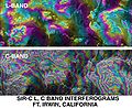 L C band topo interferograms.jpg 638 × 522; 90 KB
-
 Los Angeles JPLLandsat.jpg 4,475 × 1,896; 1.82 MB
-
 Lost Hills Subsidence interferogram.jpg 504 × 662; 88 KB
-
 Napo River in Ecuador and Peru.jpg 2,806 × 1,314; 8.16 MB
-
 NASA Kilauea InSAR.jpg 1,511 × 863; 401 KB
-

-
 Pakistan Khairabad digital elevation model by TanDEM-X (DLR).jpg 2,268 × 2,526; 2.28 MB
-
 Palm Springs JPLLandsat.jpg 1,152 × 870; 172 KB
-
 Palpa geoglyph.jpg 2,161 × 961; 2.55 MB
-
 PIA01844 modest rotated.jpg 418 × 797; 121 KB
-
 Radar Views Earth, Venus, Mars (4089157853).jpg 2,516 × 2,016; 4.51 MB
-
 Roter Kamm, PIA00503 md.jpg 2,896 × 2,032; 3.87 MB
-
 SafsafOasis SAR comparison.jpg 540 × 588; 154 KB
-
 San Diego-Tijuana JPLLandsat.jpg 1,150 × 724; 174 KB
-
 SAR Kilauea topo interferogram.jpg 577 × 577; 152 KB
-
 SAR Kilauea.jpg 1,000 × 1,000; 333 KB
-
 Sarwaterp.jpg 548 × 748; 374 KB
-
 Sc-muar.gif 342 × 480; 188 KB
-
 SIR-B Sudbury Impact Crater.jpg 432 × 249; 87 KB
-
-
 Space radar image of Washington, D.C. DVIDS744627.jpg 1,536 × 1,376; 951 KB
-
 Staufen interferogram detailed by TerraSAR-X.jpg 400 × 400; 171 KB
-
 Swaths imaged Dec 1964 by U. S. "Quill" satellite radar.jpg 1,050 × 634; 187 KB
-
 Tandem-X ScanSAR Greenland.jpg 2,222 × 1,073; 1.56 MB
-
 TEIDE.JPG 3,600 × 2,180; 1.89 MB
-
 TerraSAR-X image of Gabon, 60 kilometres south east of the capital Libreville.jpg 1,107 × 669; 1.53 MB
-
-
 TNF-NASAmap-Labels.png 720 × 436; 431 KB
-
 Tonga rdr 2019280 lrg.jpg 13,226 × 8,578; 23.37 MB
-
 Unzen volcano.jpg 512 × 649; 77 KB
-
 Yucatan chix crater-ar.jpg 715 × 799; 183 KB
-
 Yucatan chix crater.jpg 715 × 799; 305 KB
-
 Радарограмма дна р. Амур.jpg 1,262 × 682; 701 KB


.jpg)


.jpg)


.jpg)


