Category:Raadhuis Apeldoorn
Jump to navigation
Jump to search
| Object location | | View all coordinates using: OpenStreetMap |
|---|
Raadhuisplein 8
|
This is a category about a municipal monument in Apeldoorn with number wikinr 503 |
Raadhuisplein 8a
|
This is a category about a municipal monument in Apeldoorn with number wikinr 504 |
Raadhuisplein 8d
|
This is a category about a municipal monument in Apeldoorn with number wikinr 505 |
| Address |
|
Media in category "Raadhuis Apeldoorn"
The following 7 files are in this category, out of 7 total.
-
 Apeldoorn centrum panorama.jpg 3,100 × 505; 367 KB
-
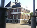
 Apeldoorn Raadhuis.JPG 2,409 × 1,741; 1.43 MB
-
 Apeldoorn Raadhuisplein 8167.jpg 4,288 × 2,848; 6.15 MB
-
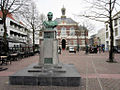
 Apeldoorn Willem I.JPG 1,944 × 2,592; 1.36 MB
-
 Apeldoorn-raadhuisplein-06190031.jpg 1,600 × 1,200; 382 KB
-
 Apeldoorn-raadhuisplein-06190032.jpg 1,600 × 1,200; 379 KB
-
 Raadhuisplein (6488534933).jpg 1,024 × 768; 108 KB


.jpg)