Category:RTCN Krynice
Jump to navigation
Jump to search
| Object location | | View all coordinates using: OpenStreetMap |
|---|
tower .jpg) | |||||
| Upload media | |||||
| Instance of | |||||
|---|---|---|---|---|---|
| Location | Krynice, Podlaskie Voivodeship, Gmina Dobrzyniewo Duże, Białystok County, Podlaskie Voivodeship, Poland | ||||
| Owned by |
| ||||
| Inception |
| ||||
| Height |
| ||||
| Elevation above sea level |
| ||||
 | |||||
Media in category "RTCN Krynice"
The following 20 files are in this category, out of 20 total.
-
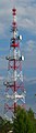
 Krynice (gm. Dobrzyniewo D.) - RTCN Krynice - Maszty.jpg 2,592 × 1,944; 1.01 MB
-
 Krynice (maszt).jpg 1,144 × 856; 579 KB
-
 Podlaskie - Dobrzyniewo Duze - Krynice - RTCN Krynice - Lattice tower.jpg 710 × 2,572; 899 KB
-
 Podlaskie - Dobrzyniewo Duze - Krynice - RTCN Krynice - Main mast.jpg 754 × 7,836; 4.16 MB
-
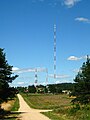
 Podlaskie - Dobrzyniewo Duze - Krynice - RTCN Krynice - Masts.jpg 1,544 × 2,675; 2.89 MB
-
 Podlaskie - Dobrzyniewo Duze - Krynice - RTCN Krynice - Old mast - rear.jpg 662 × 3,607; 1.29 MB
-
 Podlaskie - Dobrzyniewo Duze - Krynice - RTCN Krynice - Old mast.jpg 724 × 3,354; 1.06 MB
-
 Podlaskie - Dobrzyniewo Duze - Krynice.jpg 2,207 × 2,943; 887 KB
-
 Podlaskie - Dobrzyniewo Duze - Obrubniki - RTCN Krynice.jpg 2,304 × 3,072; 1.06 MB
-
 Podlaskie - Dobrzyniewo Duże - Krynice - RTCN Krynice 20110925 01.JPG 2,673 × 3,565; 1.39 MB
-
 RTCN Krynice - Maszt glowny - A236 i A216.jpg 1,200 × 1,600; 479 KB
-
 RTCN Krynice - Maszt glowny - Kotwiczenia.jpg 2,592 × 1,944; 1.29 MB
-
 RTCN Krynice - Maszt glowny - Podstawa.jpg 1,600 × 1,200; 866 KB
-
 RTCN Krynice - Maszt glowny - Szczyt - A313 i A282.jpg 1,200 × 1,600; 446 KB
-
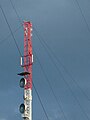
 RTCN Krynice - Maszt oryginalny - Anteny.jpg 1,200 × 1,600; 462 KB
-
 RTCN Krynice - Maszt oryginalny - Kotwiczenia.jpg 2,592 × 1,944; 1.21 MB
-
 RTCN Krynice - Maszt oryginalny - Podstawa.jpg 1,200 × 1,600; 611 KB
-
 RTCN Krynice - Maszt oryginalny.jpg 1,200 × 1,600; 442 KB
-
 RTCN Krynice - Wieza kratownicowa i oryginalny maszt.jpg 1,944 × 2,592; 1.21 MB
-
 RTCN Krynice - Wieza kratownicowa.jpg 1,944 × 2,592; 1.16 MB
_-_RTCN_Krynice_-_Maszty.jpg)


