Category:RAF Valley
Jump to navigation
Jump to search
| Object location | | View all coordinates using: OpenStreetMap |
|---|
Royal Air Force training station on the Isle of Anglesey, Wales  | |||||
| Upload media | |||||
| Pronunciation audio | |||||
|---|---|---|---|---|---|
| Instance of |
| ||||
| Location | Isle of Anglesey, Wales | ||||
| Owned by | |||||
| Occupant | |||||
| Operator | |||||
| ICAO airport code |
| ||||
| official website | |||||
 | |||||
Subcategories
This category has the following 4 subcategories, out of 4 total.
A
- Anglesey Airport (10 F)
Media in category "RAF Valley"
The following 84 files are in this category, out of 84 total.
-
 A hangar behind the dunes - geograph.org.uk - 770336.jpg 640 × 480; 41 KB
-

-
 Buildings at RAF Valley - geograph.org.uk - 116702.jpg 640 × 480; 80 KB
-
 Changes at RAF Valley - geograph.org.uk - 4995798.jpg 640 × 393; 99 KB
-

-

-
 EGOV - Royal Air Force Valley (42000740890).jpg 4,961 × 3,389; 13.7 MB
-
 Grounds maintenance at RAF Valley - geograph.org.uk - 768452.jpg 640 × 276; 47 KB
-
 Hawks on the apron at RAF Valley - geograph.org.uk - 904344.jpg 640 × 480; 36 KB
-
 Landing lights on the RAF Valley perimeter - geograph.org.uk - 2678300.jpg 3,264 × 2,448; 3.75 MB
-
 Landing lights on the RAF Valley perimeter - geograph.org.uk - 2678313.jpg 3,264 × 2,448; 3.21 MB
-
 Married Quarters, RAF Valley - geograph.org.uk - 768439.jpg 640 × 480; 47 KB
-
 MOD housing estate, RAF Valley - geograph.org.uk - 768052.jpg 640 × 266; 31 KB
-

-

-
 Prime Minister Rishi Sunak visits RAF Valley (52764390087).jpg 8,001 × 5,337; 6.16 MB
-
 Prime Minister Rishi Sunak visits RAF Valley (52764930221).jpg 8,192 × 5,464; 6.56 MB
-
 Prime Minister Rishi Sunak visits RAF Valley (52765183709).jpg 7,839 × 5,229; 6.7 MB
-
 Prime Minister Rishi Sunak visits RAF Valley (52765336460).jpg 8,192 × 5,464; 7.55 MB
-
 Prime Minister Rishi Sunak visits RAF Valley (52765336850).jpg 8,033 × 5,358; 5.57 MB
-
 Prime Minister Rishi Sunak visits RAF Valley (52765413633).jpg 7,846 × 5,233; 5.05 MB
-
 Prime Minister Rishi Sunak visits RAF Valley (52765416513).jpg 7,339 × 4,895; 6.51 MB
-
 RAF Valley - Anglesey August 2009 (3859499153).jpg 2,048 × 1,365; 424 KB
-
 RAF Valley - Anglesey August 2009 (3860285162).jpg 2,048 × 1,365; 455 KB
-
 RAF Valley - geograph.org.uk - 1364746.jpg 640 × 480; 25 KB
-
 RAF Valley - geograph.org.uk - 1458766.jpg 640 × 400; 28 KB
-
 RAF Valley - geograph.org.uk - 4973826.jpg 5,033 × 3,290; 3.06 MB
-
 RAF Valley - geograph.org.uk - 50990.jpg 640 × 480; 43 KB
-
 RAF Valley - geograph.org.uk - 760924.jpg 640 × 272; 48 KB
-
 RAF Valley - Medical Centre - geograph.org.uk - 768460.jpg 640 × 304; 43 KB
-

-

-
 RAF Valley 31 8 11 (6099910279).jpg 3,738 × 2,450; 2.36 MB
-
 RAF Valley 31 8 11 (6100618117).jpg 3,240 × 4,320; 4.39 MB
-
 RAF Valley 31 8 11 (6100655049).jpg 4,320 × 3,240; 4.3 MB
-
 RAF Valley 31 8 11 (6101201370).jpg 3,559 × 2,657; 3.03 MB
-
 RAF Valley in Anglesey, North Wales. MOD 45151435.jpg 3,000 × 2,470; 3.54 MB
-
 RAF Valley resurfacing work - geograph.org.uk - 4960913.jpg 640 × 450; 49 KB
-
 RAF Valley runway resurfacing work - geograph.org.uk - 4960920.jpg 640 × 427; 37 KB
-

-
 RAF Valley, Hawk Aircraft Line-up - geograph.org.uk - 849545.jpg 640 × 480; 50 KB
-
 Ready for take-off - geograph.org.uk - 772157.jpg 640 × 480; 48 KB
-
 Royal Air Force 1939-1945- Fighter Command CH4632.jpg 800 × 605; 57 KB
-
 Sand dunes south of Valley Airfield - geograph.org.uk - 763832.jpg 640 × 387; 68 KB
-
 Sepecat Jaguar GR3A, UK - Air Force AN0645723.jpg 1,000 × 650; 202 KB
-
 Sepecat Jaguar T4, UK - Air Force AN0645725.jpg 1,000 × 650; 246 KB
-
 Shower clouds over RAF Valley - geograph.org.uk - 878894.jpg 640 × 480; 32 KB
-
 Smoke on ........GO^ - geograph.org.uk - 51091.jpg 640 × 480; 38 KB
-

-
 Taking Off - geograph.org.uk - 769532.jpg 640 × 356; 36 KB
-
 Taking off from Runway 32 - geograph.org.uk - 772138.jpg 640 × 380; 31 KB
-
 The airfield road - geograph.org.uk - 768916.jpg 640 × 480; 50 KB
-
 The approach to Runway 32 - geograph.org.uk - 772132.jpg 640 × 480; 68 KB
-

-
 The Carnau mast - geograph.org.uk - 769407.jpg 640 × 466; 65 KB
-

-

-

-

-
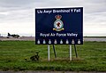
 The main entrance to RAF Valley - geograph.org.uk - 768744.jpg 640 × 404; 47 KB
-

-
 The Officers' Mess, RAF Valley - geograph.org.uk - 816437.jpg 640 × 480; 47 KB
-

-
 The star turn - geograph.org.uk - 768966.jpg 640 × 480; 13 KB
-
 The turning for RAF Valley - geograph.org.uk - 769083.jpg 640 × 480; 54 KB
-
 The Ynys Feirig complex at low tide - geograph.org.uk - 787161.jpg 640 × 183; 23 KB
-
 Traeth Cymyran at low tide - geograph.org.uk - 764842.jpg 640 × 480; 74 KB
-
 Two hangars and two Hawks - geograph.org.uk - 770327.jpg 640 × 346; 36 KB
-
 Valley (Anglesey) banner RAF T-1 Hawks.jpg 2,947 × 421; 429 KB
-
 View across RAF Valley - geograph.org.uk - 2629432.jpg 2,720 × 2,322; 2.34 MB
-

-
 View eastwards along the cliff tops - geograph.org.uk - 859421.jpg 640 × 480; 90 KB
-

-
 View southwards across RAF Valley - geograph.org.uk - 1003847.jpg 640 × 480; 50 KB
-
 Wg-cdr-kevin-marsh-19-squadron-disbandment.jpg 3,872 × 2,592; 2.96 MB
-
 What to see at RAF Valley - geograph.org.uk - 766361.jpg 560 × 640; 117 KB
-
 WV396 - The Gate Guard at RAF Valley - geograph.org.uk - 772174.jpg 640 × 229; 25 KB
-

-

-
 Approaching RAF Valley - geograph.org.uk - 763987.jpg 640 × 343; 57 KB
-
 Entering the RAF Valley base area - geograph.org.uk - 768038.jpg 640 × 332; 55 KB
-
 Hangars at Site 2, RAF Valley - geograph.org.uk - 769793.jpg 640 × 480; 55 KB
-
 Rhosneigr - geograph.org.uk - 82709.jpg 640 × 480; 144 KB
-
 White houses by RAF Valley - geograph.org.uk - 358568.jpg 640 × 480; 69 KB


.jpg)


.jpg)
.jpg)
.jpg)
.jpg)
.jpg)
.jpg)
.jpg)
.jpg)
.jpg)


.jpg)
.jpg)
.jpg)
.jpg)


_with_the_Airfield_at_RAF_Valley_-_geograph.org.uk_-_768633.jpg)


_banner_RAF_T-1_Hawks.jpg)