Category:RAF Manston
Jump to navigation
Jump to search
| Object location | | View all coordinates using: OpenStreetMap |
|---|
RAF station in the north-east of Kent  | |||||
| Upload media | |||||
| Instance of |
| ||||
|---|---|---|---|---|---|
| Location | England | ||||
| Operator | |||||
| Inception |
| ||||
| Dissolved, abolished or demolished date |
| ||||
| Elevation above sea level |
| ||||
| IATA airport code |
| ||||
| ICAO airport code |
| ||||
 | |||||
Subcategories
This category has the following 5 subcategories, out of 5 total.
Media in category "RAF Manston"
The following 31 files are in this category, out of 31 total.
-
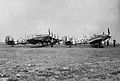 174 Squadron RAF Hurricanes Manston WWII IWM CH 5627.jpg 800 × 542; 61 KB
-
 609 Squadron RAF Typhoon Manston IWM CH 9822.jpg 800 × 548; 50 KB
-
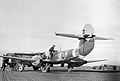
 Aircraft of the Royal Air Force 1939-1945- Hawker Typhoon. CH9822.jpg 2,480 × 1,690; 998 KB
-
 Aircraft of the Royal Air Force, 1939-1945- Gloster Meteor. CL2926.jpg 2,539 × 1,741; 1.03 MB
-
 Avro York, RAF Manston - 1953 - geograph.org.uk - 2856881.jpg 640 × 395; 34 KB
-
 Catering van, RAF Manston 1953 - geograph.org.uk - 2781366.jpg 1,024 × 692; 118 KB
-
 F-84e-512fbs-manston.jpg 600 × 292; 33 KB
-

-
-
 Luftwaffe Photograph Of RAF Manston 1939.jpg 600 × 419; 116 KB
-

-
 Old 747 (537552692).jpg 3,872 × 2,592; 2.2 MB
-
 Project Blue Book report - 1952-09-6383614-Manston AFB, Kent, England.pdf 3,095 × 2,039, 2 pages; 168 KB
-
 RAF Firefighter During a Training Exercise MOD 45152012.jpg 3,032 × 4,800; 1.98 MB
-
 RAF Manston - geograph.org.uk - 2118143.jpg 3,214 × 1,386; 746 KB
-
 RAF Manston 01.jpg 4,455 × 3,691; 3.74 MB
-
 RAF Manston 02.jpg 4,262 × 3,437; 2.92 MB
-
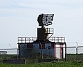
 RAF Manston radar - geograph.org.uk - 2118135.jpg 1,707 × 1,440; 344 KB
-
 Royal Air Force 1939-1945- Fighter Command CH3901.jpg 800 × 608; 63 KB
-
 Royal Air Force 1939-1945- Fighter Command CH9824.jpg 2,280 × 1,772; 1,004 KB
-
 Royal Air Force Fighter Command, 1939-1945. CE108.jpg 800 × 563; 57 KB
-
 Royal Air Force Fighter Command, 1939-1945. CH18112.jpg 1,748 × 2,044; 814 KB
-
 Royal Air Force Fighter Command, 1939-1945. CH2538.jpg 800 × 610; 68 KB
-
 Royal Air Force Fighter Command, 1939-1945. CL2921.jpg 800 × 546; 52 KB
-
 Royal Air Force Fighter Command, 1939-1945. CL2931.jpg 800 × 615; 33 KB
-
 Searchlight at RAF Manston.jpg 2,225 × 3,192; 3.44 MB
-

-
 Statue-bust (537563484).jpg 2,592 × 3,872; 2.33 MB
-
 Upkeep in Lancaster.jpg 1,920 × 1,485; 730 KB
-
 Whirlwind Manston (537574998).jpg 3,872 × 2,592; 2.35 MB
-


.jpg)


_and_other_pilots_of_No._616_Squadron_RAF_with_a_Gloster_Meteor_at_Manston,_Kent,_January_1945._CL3773.jpg)
.jpg)

.jpg)
