Category:Rówień Krupowa
Jump to navigation
Jump to search
| Object location | | View all coordinates using: OpenStreetMap |
|---|
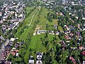
park in Zakopane, Poland .jpg) | |||||
| Upload media | |||||
| Instance of | |||||
|---|---|---|---|---|---|
| Location | Zakopane, Tatra County, Lesser Poland Voivodeship, Poland | ||||
| Street address |
| ||||
| Heritage designation |
| ||||
 | |||||
Media in category "Rówień Krupowa"
The following 13 files are in this category, out of 13 total.
-
 2020 Zakopane, Rówień Krupowa Dolna, 1.jpg 4,872 × 3,658; 11.93 MB
-
 2023 Rówień Krupowa, napis „Zakopane”, 1.jpg 5,445 × 4,084; 16.04 MB
-
 Giewont z Rowni Krupowej, 1.1.1996.jpg 1,433 × 971; 307 KB
-
 Rówień Krupowa (tereny parkowe).jpg 4,608 × 3,072; 3.39 MB
-
 Rówień Krupowa 1 (tereny parkowe).jpg 4,608 × 3,072; 3.46 MB
-
 Rówień Krupowa 2 (tereny parkowe).jpg 4,608 × 3,072; 3.54 MB
-
 Rówień Krupowa nr 3 (tereny parkowe).jpg 4,608 × 3,072; 3.54 MB
-
 W parku w Zakopanem.JPG 3,600 × 2,400; 4.08 MB
-
 Zakopane - park na równi krupowej....jpg 1,332 × 1,000; 1.18 MB
-
 Zakopane - park na równi krupowej...jpg 1,332 × 1,000; 1.13 MB
-
 Zakopane - park na równi krupowej..jpg 1,332 × 1,000; 789 KB
-
 Zakopane - park na równi krupowej.jpg 1,332 × 1,000; 739 KB
-
 Zakopane Rowien Krupowa dron (1).jpg 4,000 × 3,000; 4.18 MB


.jpg)
.jpg)
.jpg)


.jpg)