Category:Pyle
Jump to navigation
Jump to search
village in Bridgend, Wales, United Kingdom   | |||||
| Upload media | |||||
| Instance of | |||||
|---|---|---|---|---|---|
| Location | Bridgend County Borough, Wales | ||||
| Population |
| ||||
| Area |
| ||||
 | |||||
English: Pyle is a village in Bridgend county borough, Wales. Pyle railway station is on the London - South Wales main line and also the Cardiff - Swansea line.
Subcategories
This category has the following 2 subcategories, out of 2 total.
P
- Pyle railway station (6 F)
S
- St James's Church, Pyle (10 F)
Media in category "Pyle"
The following 187 files are in this category, out of 187 total.
-

-

-
 A view NW from Pyle railway station - geograph.org.uk - 3251437.jpg 640 × 512; 105 KB
-

-

-

-

-
 Avacab, Pyle - geograph.org.uk - 3244657.jpg 640 × 433; 63 KB
-

-

-
 Beach Road, Pyle - geograph.org.uk - 3243439.jpg 640 × 369; 56 KB
-
 Bend in Victoria Road, Kenfig Hill - geograph.org.uk - 3262867.jpg 640 × 450; 63 KB
-
 Bengal Lounge, Kenfig Hill - geograph.org.uk - 3255048.jpg 640 × 413; 50 KB
-
 Booze and butchery in Kenfig Hill - geograph.org.uk - 3260315.jpg 551 × 640; 67 KB
-
 Bridge over the Afon Cynffig , Pyle - geograph.org.uk - 2667706.jpg 640 × 480; 146 KB
-
 Bridgend UK community map (Pyle).svg 1,273 × 1,266; 392 KB
-
 Brynglas Terrace houses, Pyle - geograph.org.uk - 3251471.jpg 640 × 410; 63 KB
-
 Brynglas Terrace, Pyle - geograph.org.uk - 3244643.jpg 640 × 527; 59 KB
-
 Bus shelter on A48 in Pyle - geograph.org.uk - 5824384.jpg 1,600 × 1,200; 766 KB
-
 Car soon to be recycled, Pyle - geograph.org.uk - 3251493.jpg 640 × 565; 83 KB
-
 Central Garage, Pyle - geograph.org.uk - 3244356.jpg 640 × 420; 59 KB
-
 Children's Nursery - geograph.org.uk - 4985875.jpg 3,264 × 2,448; 1.98 MB
-

-

-

-

-

-
 Cribbwr Square, Kenfig Hill - geograph.org.uk - 3254198.jpg 640 × 420; 54 KB
-
 Croft Goch Road railway bridge - geograph.org.uk - 2049395.jpg 640 × 480; 96 KB
-
-
 Crown Road, Kenfig Hill - geograph.org.uk - 3262902.jpg 640 × 502; 59 KB
-
 Cycle Path nr Kenfig Hill - geograph.org.uk - 2697036.jpg 1,920 × 2,560; 1.89 MB
-
 DataKom, Kenfig Hill - geograph.org.uk - 3260370.jpg 635 × 640; 88 KB
-

-
 Disused weir on the Afon Cynffig, Pyle - geograph.org.uk - 2670498.jpg 640 × 384; 145 KB
-
 Double Glazing on Village Farm Industrial Estate - geograph.org.uk - 4985869.jpg 3,264 × 2,448; 2.3 MB
-
 DV 77 No.5 Near Pyle Inn.png 1,418 × 908; 3.69 MB
-

-
 Electrical ^ Plumbing Supplies, Pyle - geograph.org.uk - 3254843.jpg 640 × 450; 90 KB
-
-
 Emerson Pharmacy, Kenfig Hill - geograph.org.uk - 3256552.jpg 640 × 453; 61 KB
-
 Entrance to Pil Primary School, Pyle - geograph.org.uk - 3254188.jpg 640 × 437; 64 KB
-
 Esso filling station and Costa coffee shop, Pyle - geograph.org.uk - 5824379.jpg 1,600 × 1,201; 604 KB
-
 Evans Street, Kenfig Hill - geograph.org.uk - 3266539.jpg 564 × 640; 62 KB
-
 Ffald Road houses, Pyle - geograph.org.uk - 3254185.jpg 640 × 440; 75 KB
-
 Ffordd Ddu houses, Pyle - geograph.org.uk - 3244165.jpg 640 × 482; 76 KB
-

-

-

-
 Footpath to Pyle railway station - geograph.org.uk - 3251343.jpg 640 × 573; 106 KB
-
 Former Carolanne shop, Kenfig Hill - geograph.org.uk - 3260306.jpg 640 × 471; 52 KB
-

-

-

-
 Golden Castle, Kenfig Hill - geograph.org.uk - 3256548.jpg 640 × 468; 67 KB
-
 Gorgeous Grooming, Kenfig Hill - geograph.org.uk - 3260360.jpg 640 × 604; 119 KB
-
 Haulfryn houses, Kenfig Hill - geograph.org.uk - 3262930.jpg 640 × 446; 63 KB
-
 Hawker Hunter - geograph.org.uk - 2697028.jpg 2,560 × 1,920; 1.96 MB
-

-
 Houses in the east of Kenfig Hill - geograph.org.uk - 3267441.jpg 640 × 450; 64 KB
-
 In a Spin in Kenfig Hill - geograph.org.uk - 3260217.jpg 580 × 640; 102 KB
-

-
 Iron ore empties at Pyle - geograph.org.uk - 823662.jpg 640 × 420; 86 KB
-
 J ^ A Antiques, Kenfig Hill - geograph.org.uk - 3266950.jpg 640 × 544; 76 KB
-
 Kenfig Hill - geograph.org.uk - 4985823.jpg 3,264 × 2,448; 2.58 MB
-
 Kenfig Hill Clinic - geograph.org.uk - 3260294.jpg 640 × 470; 69 KB
-
-
 Kenfig Hill Labour Club ^ Institute - geograph.org.uk - 3266568.jpg 640 × 453; 59 KB
-
 Kenfig Hill post office and store - geograph.org.uk - 3262764.jpg 597 × 640; 72 KB
-
 Kenfig Hill War Memorial - geograph.org.uk - 3262756.jpg 640 × 626; 73 KB
-

-
 Little Station Road, Kenfig Hill - geograph.org.uk - 3266395.jpg 640 × 399; 56 KB
-
 Lloyds TSB Kenfig Hill - geograph.org.uk - 3260331.jpg 640 × 602; 67 KB
-
 Llys Ton, Kenfig Hill - geograph.org.uk - 3260302.jpg 640 × 480; 59 KB
-

-

-
 Main entrance to Pyle Life Centre - geograph.org.uk - 3254199.jpg 640 × 416; 42 KB
-
 Marlas Close, Pyle - geograph.org.uk - 3244323.jpg 640 × 518; 101 KB
-
 Marlas Road footbridge, Pyle - geograph.org.uk - 3243430.jpg 584 × 640; 104 KB
-
 Marlas Road railway bridge, Pyle - geograph.org.uk - 3243412.jpg 640 × 452; 76 KB
-
 Masons Close, Kenfig Hill - geograph.org.uk - 3266381.jpg 640 × 377; 54 KB
-
 Milepost - Neath 12 - geograph.org.uk - 4464130.jpg 480 × 640; 120 KB
-
 Milepost on A48 near Pyle - geograph.org.uk - 241285.jpg 504 × 640; 196 KB
-
 Milepost, Pyle. - geograph.org.uk - 1471052.jpg 480 × 640; 97 KB
-
 Milestone alongside Pyle Road, Pyle - geograph.org.uk - 3244194.jpg 640 × 517; 115 KB
-

-
 Moriah Business Centre, Kenfig Hill - geograph.org.uk - 3266960.jpg 640 × 400; 54 KB
-

-
-
 Nature Reserve - geograph.org.uk - 4985877.jpg 3,264 × 2,448; 4.29 MB
-
 North Avenue, Kenfig Hill - geograph.org.uk - 3254196.jpg 640 × 382; 53 KB
-
 Northern boundary of Pyle - geograph.org.uk - 3244188.jpg 640 × 547; 125 KB
-

-
 NW corner of Pyle Garden Centre - geograph.org.uk - 3244625.jpg 640 × 465; 97 KB
-

-
-
 One Vision, Kenfig Hill - geograph.org.uk - 3260209.jpg 500 × 640; 77 KB
-
 Ordnance Survey Cut Mark - geograph.org.uk - 4464145.jpg 640 × 480; 102 KB
-
 Ordnance Survey Cut Mark - geograph.org.uk - 4464151.jpg 480 × 640; 114 KB
-
 Ordnance Survey Cut Mark - geograph.org.uk - 5597462.jpg 640 × 430; 93 KB
-

-

-
 Pandy Crescent, Pyle - geograph.org.uk - 3251270.jpg 640 × 349; 42 KB
-

-
 Pil Primary School, Pyle - geograph.org.uk - 3254190.jpg 640 × 442; 96 KB
-
 Pisgah Street bungalows, Kenfig Hill - geograph.org.uk - 3254935.jpg 640 × 427; 58 KB
-
 Pisgah Street News, Kenfig Hill - geograph.org.uk - 3256247.jpg 638 × 640; 100 KB
-
 Plastic Spitfire in Pyle - geograph.org.uk - 3786497.jpg 1,600 × 1,200; 739 KB
-
 Police station and bus shelter, Pyle Road (A48) - geograph.org.uk - 5823279.jpg 1,600 × 914; 507 KB
-
 Pyle , Pyle Road - geograph.org.uk - 5499906.jpg 6,000 × 4,000; 7.23 MB
-
 Pyle , Shops - geograph.org.uk - 5499905.jpg 6,000 × 4,000; 6.87 MB
-
 Pyle - geograph.org.uk - 183719.jpg 640 × 480; 185 KB
-
 Pyle 2002.JPG 1,736 × 1,160; 1.1 MB
-
 Pyle Bridge - geograph.org.uk - 5242894.jpg 2,448 × 3,264; 2.65 MB
-
 Pyle Calvinisitic Methodist Chapel.jpg 2,592 × 1,936; 2.1 MB
-
 Pyle Fish Bar - geograph.org.uk - 3254920.jpg 640 × 508; 70 KB
-
 Pyle police station - geograph.org.uk - 3244305.jpg 640 × 516; 80 KB
-
 Pyle post office - geograph.org.uk - 3244321.jpg 640 × 628; 102 KB
-
 Pyle railway station - geograph.org.uk - 3251359.jpg 640 × 555; 114 KB
-
 Pyle Road railway bridge, Pyle - geograph.org.uk - 3244179.jpg 640 × 524; 118 KB
-
 Pyle Road shops, Pyle - geograph.org.uk - 3244327.jpg 640 × 385; 72 KB
-
 Pyle Road Texaco, Pyle - geograph.org.uk - 3244198.jpg 640 × 484; 65 KB
-
 Pyle Road, Pyle - geograph.org.uk - 3244153.jpg 640 × 440; 63 KB
-
 Pyle Swimming Pool - geograph.org.uk - 3254197.jpg 640 × 342; 47 KB
-
 Pyle telephone exchange - geograph.org.uk - 3251517.jpg 640 × 503; 76 KB
-
 Pyle, St. James' - geograph.org.uk - 5043425.jpg 1,024 × 768; 185 KB
-
 Pyle, Ye Olde Wine House - geograph.org.uk - 5043430.jpg 1,024 × 760; 138 KB
-
 Railway at Pyle - geograph.org.uk - 5242869.jpg 2,448 × 3,264; 2.76 MB
-

-

-

-

-

-
 Riverside trees, Pyle - geograph.org.uk - 3196980.jpg 640 × 446; 147 KB
-

-
 Row of bungalows, Pyle Inn Way, Pyle - geograph.org.uk - 3254192.jpg 640 × 439; 65 KB
-

-
 School Road, Kenfig Hill - geograph.org.uk - 3266984.jpg 640 × 428; 58 KB
-

-

-

-

-

-
 St.Theodore's Church, Kenfig Hill - geograph.org.uk - 4985791.jpg 3,264 × 2,448; 2.33 MB
-
 St.Theodore's Church, Kenfig Hill - geograph.org.uk - 4985801.jpg 3,264 × 2,448; 2.42 MB
-
 Sweetie-licious, Kenfig Hill - geograph.org.uk - 3260379.jpg 640 × 480; 80 KB
-
 Swn Yr Afon - geograph.org.uk - 2794361.jpg 640 × 480; 51 KB
-
 The Afon Cynffig by Pyle and Marlas - geograph.org.uk - 3201160.jpg 427 × 640; 173 KB
-

-
 The Afon Cynffig in woodland near Pyle - geograph.org.uk - 2670675.jpg 640 × 480; 157 KB
-
 The Afon Cynffig near Pyle - geograph.org.uk - 3202662.jpg 480 × 640; 164 KB
-
 The Afon Cynffig, Pyle (2) - geograph.org.uk - 3180633.jpg 640 × 480; 154 KB
-
 The Afon Cynffig, Pyle - geograph.org.uk - 3171404.jpg 458 × 640; 169 KB
-
 The Barn Yard, Pyle - geograph.org.uk - 3244310.jpg 640 × 406; 52 KB
-
 The Crown Inn, Pyle - geograph.org.uk - 5242862.jpg 3,011 × 2,260; 1.72 MB
-
-
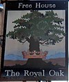 The Royal Oak pub sign, Kenfig Hill - geograph.org.uk - 3266463.jpg 535 × 640; 56 KB
-

-

-
 Tower House and Tower Cottage, Pyle - geograph.org.uk - 3244362.jpg 640 × 523; 89 KB
-

-

-
 Two motor businesses, Pyle Road (A48) - geograph.org.uk - 5823273.jpg 1,600 × 998; 551 KB
-
 Two rugby pitches, Kenfig Hill - geograph.org.uk - 3256551.jpg 640 × 331; 51 KB
-

-
 Victoria Terrace, Pyle - geograph.org.uk - 3244636.jpg 640 × 482; 79 KB
-

-

-
 View of River Cynffig - geograph.org.uk - 5242910.jpg 2,448 × 3,264; 3.21 MB
-
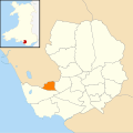 Wales Bridgend Community Pyle map.svg 512 × 509; 326 KB
-
 Walnut Tree pub to let, Kenfig Hill - geograph.org.uk - 3254976.jpg 640 × 417; 66 KB
-
 Waun Bant Road railway bridge - geograph.org.uk - 2045754.jpg 640 × 480; 88 KB
-

-
 Waunbant Road houses, Kenfig Hill - geograph.org.uk - 3260298.jpg 640 × 593; 79 KB
-
 Waunbant Road looking east - geograph.org.uk - 2045766.jpg 640 × 480; 81 KB
-
 Welcome to Pyle RFC - geograph.org.uk - 3251246.jpg 640 × 309; 46 KB
-
 Western boundary of Pyle - geograph.org.uk - 3243434.jpg 640 × 503; 84 KB
-

-

-
 Window Factory - geograph.org.uk - 212547.jpg 640 × 480; 62 KB
-
 Wooded valley, Pyle - geograph.org.uk - 2665459.jpg 640 × 444; 136 KB
-
 Y Brynddu, Kenfig Hill - geograph.org.uk - 4985844.jpg 3,264 × 2,448; 1.96 MB
-
 Ye Olde Wine House, Pyle - geograph.org.uk - 3244162.jpg 640 × 532; 65 KB
-
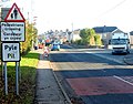
 A48 north of Pyle Cross - geograph.org.uk - 1471063.jpg 640 × 480; 65 KB
-
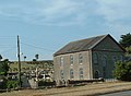 Chapel and cemetery - geograph.org.uk - 212542.jpg 640 × 471; 58 KB
-
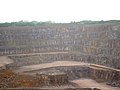 Cornelly Quarry - geograph.org.uk - 183714.jpg 640 × 480; 162 KB
-


.svg)


_-_geograph.org.uk_-_3183882.jpg)


_-_geograph.org.uk_-_4554921.jpg)
_-_geograph.org.uk_-_4554946.jpg)


_-_geograph.org.uk_-_5823279.jpg)


_-_geograph.org.uk_-_2733273.jpg)


_-_geograph.org.uk_-_3180633.jpg)


_-_geograph.org.uk_-_5823273.jpg)


