Category:Pulverfabrik Rottweil
Jump to navigation
Jump to search
| Object location | | View all coordinates using: OpenStreetMap |
|---|
| Upload media | |||||
| Instance of | |||||
|---|---|---|---|---|---|
| Industry |
| ||||
| Location |
| ||||
| Headquarters location | |||||
| Heritage designation | |||||
| Inception |
| ||||
| Dissolved, abolished or demolished date |
| ||||
 | |||||
Subcategories
This category has only the following subcategory.
K
Media in category "Pulverfabrik Rottweil"
The following 96 files are in this category, out of 96 total.
-
 Alte Spulerei Kunstseidenfabrik Pulverfabrik Rottweil 2014.jpg 4,928 × 3,264; 7.18 MB
-
 Arbeiterkantine Pulverfabrik Rottweil 2014.jpg 4,928 × 3,264; 7.17 MB
-

-
 Badhaus Pulverfabrik Rottweil 2014 1.jpg 4,928 × 3,264; 7.24 MB
-
 Badhaus Pulverfabrik Rottweil 2014.jpg 4,928 × 3,264; 6.41 MB
-
 Beamtenkasino Pulverfabrik Rottweil 2014 1.jpg 3,811 × 2,639; 3.78 MB
-
 Beamtenkasino Pulverfabrik Rottweil 2014.jpg 4,928 × 3,264; 6.89 MB
-
 Chemisches Laboratorium Pulverfabrik Rottweil 2014 2.jpg 4,928 × 3,264; 6.17 MB
-
 Chemisches Laboratorium, Pulverfabrik Rottweil 2014.jpg 4,928 × 3,264; 6.96 MB
-
 Denkmal Max Duttenhofer Rottweil 2014 1.jpg 3,262 × 4,350; 4.82 MB
-
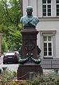 Denkmal Max Duttenhofer Rottweil 2014 2.jpg 2,785 × 4,022; 3.72 MB
-
 Direktion Pulverfabrik Rottweil 2014 1.jpg 4,928 × 3,264; 7.27 MB
-
 Direktion Pulverfabrik Rottweil 2014 2.jpg 4,928 × 3,264; 7.17 MB
-
 Feuerwehrwache Pulverfabrik Rottweil 2014 1.jpg 4,928 × 3,264; 6.49 MB
-
 Feuerwehrwache Pulverfabrik Rottweil 2014 2.jpg 4,928 × 3,264; 6.57 MB
-
 Filter- und Pumpenhaus, Pulverfabrik Rottweil 2014 3.jpg 4,928 × 3,264; 6.9 MB
-
 Filter- und Pumpenhaus, Pulverfabrik Rottweil 2014.jpg 4,928 × 3,264; 6.97 MB
-
 Holländerbau Pulverfabrik Rottweil 2014 1.jpg 4,928 × 3,264; 6.4 MB
-
 Holländerbau Pulverfabrik Rottweil 2014 2.jpg 4,278 × 2,963; 4.11 MB
-
 Hydrant in Rottweil.JPG 4,928 × 3,264; 7.2 MB
-
 Jakobskirche Pulverfabrik Rottweil 1.jpg 4,928 × 3,264; 6.14 MB
-
 Jakobskirche Pulverfabrik Rottweil 2014 2.jpg 4,207 × 2,913; 3.13 MB
-
 Jakobskirche Pulverfabrik Rottweil 2014 3.jpg 4,928 × 3,264; 7.15 MB
-
 Jakobskirche Pulverfabrik Rottweil 4.jpg 4,928 × 3,264; 7.11 MB
-
 Kunstseidenfabrik, Neckarstraße 171 back 2014.jpg 4,928 × 3,264; 6.65 MB
-
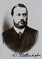 Max Duttenhofer Rottweil 2014 2.jpg 2,499 × 3,483; 2.49 MB
-
 Neckarbrücke Pulverfabrik Rottweil 2.jpg 4,928 × 3,264; 7.15 MB
-
 Neckarbrücke, Pulverfabrik Rottweil 2014.jpg 4,928 × 3,264; 6.96 MB
-
 Neckarstraße 102 103 Rottweil 2014.jpg 4,928 × 3,264; 6.78 MB
-
 Neckarstraße 147 150 Pulverfabrik Rottweil 2014.jpg 4,928 × 3,264; 6.5 MB
-
 Neckarstraße 147 Pulverfabrik Rottweil.jpg 4,928 × 3,264; 7.22 MB
-
 Neckarstraße 150 153 Pulverfabrik Rottweil 2014.jpg 4,928 × 3,264; 7.19 MB
-
 Neckarstraße 152 153 Pulverfabrik Rottweil 2014.jpg 4,928 × 3,264; 7.3 MB
-
 Neckarstraße 152 Pulverfabrik Rottweil 2014 2.jpg 4,928 × 3,264; 7.1 MB
-
 Neckarstraße 152 Pulverfabrik Rottweil 2014.jpg 4,928 × 3,264; 6.67 MB
-
 Neckarstraße 153 Pulverfabrik Rottweil 2014.jpg 4,928 × 3,264; 7.05 MB
-
 Neckarstraße 171 172 293 Pulverfabrik Rottweil 2014.jpg 3,264 × 4,928; 6.6 MB
-
 Neckarstraße 181 200 203 Pulverfabrik Rottweil 2014.jpg 4,928 × 3,264; 7.01 MB
-
 Neckarstraße 200 203 Pulverfabrik Rottweil 2014.jpg 4,928 × 3,264; 7.33 MB
-
 Neckarstraße 200 Pulverfabrik Rottweil 2014.jpg 3,264 × 4,928; 6.58 MB
-
 Neckarstraße 200 Rottweil 2014.jpg 1,680 × 2,466; 1.22 MB
-
 Neckarstraße 202 back Pulverfabrik Rottweil 2014.jpg 4,148 × 2,872; 3.25 MB
-
 Neckarstraße 210 Pulverfabrik Rottweil 2014.jpg 4,928 × 3,264; 7.05 MB
-
 Neckartal 101 Rottweil 2014.jpg 4,928 × 3,264; 7.17 MB
-
 Neckartal 180 Pulverfabrik Rottweil 2014.jpg 4,928 × 3,264; 6.89 MB
-
 Neckartal 247 Büro Pulverfabrik Rottweil 2014 1.jpg 4,928 × 3,264; 7.1 MB
-
 Neckartal 247 Büro Pulverfabrik Rottweil 2014 2.jpg 4,928 × 3,264; 7 MB
-
 Neckartal 247 Büro Pulverfabrik Rottweil 2014 3.jpg 4,928 × 3,264; 6.91 MB
-
 Panorama Pulverfabrik Rottweil.jpg 4,593 × 2,408; 3.29 MB
-
 Pulsometer Rottweil 2014 1.jpg 4,928 × 3,264; 6.56 MB
-
 Pulsometer Rottweil 2014 2.jpg 4,928 × 3,264; 6.74 MB
-

-

-

-

-

-
-
 Rottweil 27.04.2013 17-46-02.jpg 4,080 × 2,711; 8.17 MB
-
 Rottweil 27.04.2013 17-46-29.jpg 4,485 × 2,980; 11.65 MB
-
 Rottweil Chemiestadt Treppe.jpg 4,672 × 3,104; 12.5 MB
-
 Staustufe Neckar Rottweil Untere Mühle 1.jpg 4,928 × 3,264; 7.02 MB
-
 Staustufe Neckar Rottweil Untere Mühle 2.jpg 4,928 × 3,264; 6.92 MB
-
 Testturm Rottweil April 23 Kraftwerk.jpg 3,024 × 4,032; 4.64 MB
-
 Thyssenkrupp-Testturm-Aussicht Neckartal.jpg 4,320 × 3,240; 5 MB
-
 Toilette Pulverfabrik Rottweil.jpg 4,144 × 2,735; 3.56 MB
-
 Turbinenanlage Neckarstraße 129 Rottweil 2014 1.jpg 4,928 × 3,264; 6.72 MB
-
 Turbinenanlage Neckarstraße 129 Rottweil 2014 10.jpg 4,928 × 3,264; 7.08 MB
-
 Turbinenanlage Neckarstraße 129 Rottweil 2014 11.jpg 4,928 × 3,264; 6.93 MB
-
 Turbinenanlage Neckarstraße 129 Rottweil 2014 12.jpg 3,264 × 4,928; 7.05 MB
-
 Turbinenanlage Neckarstraße 129 Rottweil 2014 13.jpg 3,264 × 4,928; 6.82 MB
-
 Turbinenanlage Neckarstraße 129 Rottweil 2014 2.jpg 4,928 × 3,264; 6.48 MB
-
 Turbinenanlage Neckarstraße 129 Rottweil 2014 3.jpg 4,928 × 3,264; 6.82 MB
-
 Turbinenanlage Neckarstraße 129 Rottweil 2014 4.jpg 3,264 × 4,928; 7.19 MB
-
 Turbinenanlage Neckarstraße 129 Rottweil 2014 5.jpg 4,928 × 3,264; 7.01 MB
-
 Turbinenanlage Neckarstraße 129 Rottweil 2014 6.jpg 4,928 × 3,264; 6.86 MB
-
 Turbinenanlage Neckarstraße 129 Rottweil 2014 7.jpg 4,928 × 3,264; 6.77 MB
-
 Turbinenanlage Neckarstraße 129 Rottweil 2014 8.jpg 4,928 × 3,264; 6.68 MB
-
 Turbinenanlage Neckarstraße 129 Rottweil 2014 9.jpg 4,928 × 3,264; 6.77 MB
-
 Untere Mühle Rottweil 2014 1.jpg 4,928 × 3,264; 6.58 MB
-
 Untere Mühle Rottweil 2014 2.jpg 4,928 × 3,264; 7.07 MB
-
 Untere Mühle Rottweil 2014 3.jpg 4,928 × 3,264; 7.09 MB
-
 Untere Mühle Rottweil 2014 4.jpg 4,928 × 3,264; 7.15 MB
-
 Untere Mühle Rottweil 2014 5.jpg 4,928 × 3,264; 6.4 MB
-
 Untere Mühle Rottweil 2014 6.jpg 3,016 × 4,250; 4.09 MB
-
 Untere Mühle Rottweil 2014 7.jpg 3,449 × 2,388; 2.72 MB
-
 Wasserturbine Rottweil Neckarstrasse 93.jpg 4,928 × 3,264; 6.92 MB
-
 Werkstättengebäude Neckartal 142 Pulverfabrik Rottweil 2014 1.jpg 4,928 × 3,264; 7.2 MB
-
 Werkstättengebäude Neckartal 142 Pulverfabrik Rottweil 2014 2.jpg 4,928 × 3,264; 6.99 MB
-
 Werkstättengebäude Neckartal 142 Pulverfabrik Rottweil 2014 3.jpg 4,928 × 3,264; 7.41 MB
-
 Werkstättengebäude Neckartal 142 Pulverfabrik Rottweil 2014 4.jpg 4,928 × 3,264; 6.39 MB
-
 Werkstättengebäude Neckartal 142 Pulverfabrik Rottweil 2014.jpg 4,928 × 3,264; 6.84 MB
-
 WLM13 Rottweil Festsaal Bascule Griff.jpg 1,308 × 1,900; 611 KB
-
 WLM13 Rottweil Festsaal Kölner Wappen.jpg 2,048 × 1,536; 546 KB
-
 WLM13 Rottweil Pulverfabrik Festsaal.jpg 2,048 × 1,536; 542 KB
-
 Zwirnerei Texturierung Pulverfabrik Rottweil 2014 2.jpg 3,264 × 4,928; 6.79 MB
-
 Zwirnerei Texturierung Pulverfabrik Rottweil 2014.jpg 4,928 × 3,264; 7.19 MB


_850_Arbeiter,_6000_Tonnen_Pulver,_ab_1919_auch_Kunstseide-Viskose,_z._B._f%C3%BCr_Fallschirme,_schrittweise_Umnutzung_des_Areals_ab_1993_-_panoramio.jpg)


_850_Arbeiter,_6000_Tonnen_Pulver,_ab_1919_auch_Kunstseide-Viskose,_z._B._f%C3%BCr_Fallschirme,_schrittweise_Umnutzung_des_Areals_ab_1993_-_panoramio_(1).jpg)
_850_Arbeiter,_6000_Tonnen_Pulver,_ab_1919_auch_Kunstseide-Viskose,_z._B._f%C3%BCr_Fallschirme,_schrittweise_Umnutzung_des_Areals_ab_1993_-_panoramio_(2).jpg)
_850_Arbeiter,_6000_Tonnen_Pulver,_ab_1919_auch_Kunstseide-Viskose,_z._B._f%C3%BCr_Fallschirme,_schrittweise_Umnutzung_des_Areals_ab_1993_-_panoramio_(3).jpg)
_850_Arbeiter,_6000_Tonnen_Pulver,_ab_1919_auch_Kunstseide-Viskose,_z._B._f%C3%BCr_Fallschirme,_schrittweise_Umnutzung_des_Areals_ab_1993_-_panoramio_(4).jpg)
_850_Arbeiter,_6000_Tonnen_Pulver,_ab_1919_auch_Kunstseide-Viskose,_z._B._f%C3%BCr_Fallschirme,_schrittweise_Umnutzung_des_Areals_ab_1993_-_panoramio_(5).jpg)
_850_Arbeiter,_6000_Tonnen_Pulver,_ab_1919_auch_Kunstseide-Viskose,_z._B._f%C3%BCr_Fallschirme,_schrittweise_Umnutzung_des_Areals_ab_1993_-_panoramio.jpg)


