Category:Pudsey
town in the City of Leeds, West Yorkshire, England  | |||||
| Upload media | |||||
| Instance of | |||||
|---|---|---|---|---|---|
| Location | Leeds, West Yorkshire, Yorkshire and the Humber, England | ||||
 | |||||
Pudsey is a market town in West Yorkshire, England. Created as an urban district in 1894, it became a municipal borough in 1900, and was incorporated into the City of Leeds in 1974. It is located midway between Bradford city centre and Leeds city centre. Historically in the West Riding of Yorkshire, it had a population of 22,408 in 2011. The Municipal Borough of Pudsey consisted only of addresses with an LS28 postcode, specifically Calverley, Farsley, Pudsey and Stanningley. Addresses with an LS28 postcode use the Leeds 0113 telephone prefix. It also lends its name to the local parliamentary constituency of Pudsey, of which it is a part.
Subcategories
This category has the following 23 subcategories, out of 23 total.
A
B
- Black Carr Wood (12 F)
C
F
- Fences in Pudsey (6 F)
- Fulneck Golf Course (13 F)
N
- North Wood, Tong, Bradford (2 F)
O
- Owlcotes Hill, Pudsey (5 F)
P
- Post boxes in Pudsey (5 F)
- Pudsey Bear (6 F)
S
T
Media in category "Pudsey"
The following 194 files are in this category, out of 194 total.
-
 10 Para DZ Flash.jpg 125 × 121; 5 KB
-
 A pair of horses - geograph.org.uk - 4852789.jpg 1,024 × 767; 127 KB
-
 Adas Place - Arthur Street - geograph.org.uk - 1158073.jpg 640 × 480; 275 KB
-
 Alley running from Lowtown to Claremont Grove - geograph.org.uk - 5661137.jpg 674 × 1,024; 162 KB
-
 Allotments - Crimbles Place - geograph.org.uk - 450887.jpg 640 × 423; 118 KB
-
 Allotments - end of Longfield Road - geograph.org.uk - 2132605.jpg 640 × 480; 87 KB
-
 Allotments behind Pudsey cemetery - geograph.org.uk - 6033474.jpg 1,024 × 768; 260 KB
-
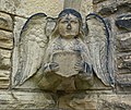 Angel, Pudsey (7171947976).jpg 2,697 × 2,270; 5.49 MB
-
 Arms of the Municipal Borough of Pudsey.svg 628 × 886; 1.38 MB
-
 Bankhouse Bottom - Lower Bankhouse - geograph.org.uk - 2313607.jpg 640 × 480; 60 KB
-
 Bankhouse Farm - Scholebrook Lane - geograph.org.uk - 2314769.jpg 640 × 480; 87 KB
-

-
 Barrier on the Leeds Country Way - geograph.org.uk - 4852097.jpg 1,024 × 768; 339 KB
-
 Bilingual sign in Pudsey - geograph.org.uk - 5946802.jpg 1,024 × 768; 190 KB
-
 Bridleway - Tong Road - geograph.org.uk - 2324848.jpg 640 × 480; 106 KB
-
 Bridleway approaching Smalewell Road - geograph.org.uk - 5906084.jpg 1,024 × 768; 228 KB
-
 Bridleway From Priesthorpe Lane - geograph.org.uk - 1320113.jpg 640 × 480; 155 KB
-
 Bridleway to Tong from Bankhouse Bottom - geograph.org.uk - 2313604.jpg 480 × 640; 108 KB
-
 Bridleway, Bankhouse Bottom - geograph.org.uk - 5108972.jpg 1,024 × 682; 303 KB
-
 Causeway alongside a beck - geograph.org.uk - 4852459.jpg 768 × 1,024; 393 KB
-
 Claremont, Pudsey, Leeds - geograph.org.uk - 5088447.jpg 1,280 × 853; 567 KB
-
 Clearing with gorse - geograph.org.uk - 4852415.jpg 1,024 × 768; 312 KB
-

-
 Damaged Hough Top trig point on playing fields - geograph.org.uk - 5661529.jpg 1,024 × 683; 158 KB
-
 Dawn over Yorkshire. - geograph.org.uk - 134091.jpg 640 × 480; 34 KB
-
 Dead end off Lidget Hill, Pudsey - geograph.org.uk - 6091519.jpg 1,024 × 768; 117 KB
-
 Delph End - geograph.org.uk - 1396270.jpg 640 × 480; 138 KB
-
 Derelict barn at Wild Grove Farm - geograph.org.uk - 4852045.jpg 1,024 × 768; 247 KB
-
 Disused quarry at Windmill Hill (Detail) - geograph.org.uk - 4852257.jpg 768 × 1,024; 298 KB
-
 Disused quarry at Windmill Hill - geograph.org.uk - 4852250.jpg 1,024 × 768; 375 KB
-
 Driveway to Pudsey Congs Cricket Club, Pudsey - geograph.org.uk - 6112231.jpg 1,716 × 1,224; 543 KB
-
 Drunken Sign at Bankhouse Bottom - geograph.org.uk - 442551.jpg 480 × 640; 146 KB
-
 Dry stone wall beside Valley Road opposite ^216 - geograph.org.uk - 5892324.jpg 1,024 × 683; 131 KB
-
 East View Cottages - Priestley Gardens - geograph.org.uk - 1175822.jpg 640 × 449; 199 KB
-
-
 Entrance to Grove View - geograph.org.uk - 4852051.jpg 1,024 × 768; 204 KB
-
 Entrance to the former Smalewell sewage works - geograph.org.uk - 4852086.jpg 1,024 × 768; 356 KB
-
 Evening grasses by Bankhouse Lane - geograph.org.uk - 5906120.jpg 1,024 × 768; 98 KB
-
 Fallen tree across the Pudsey Beck - geograph.org.uk - 4852829.jpg 1,024 × 768; 401 KB
-
 Falling trees blocking the beck - geograph.org.uk - 4852812.jpg 1,024 × 768; 396 KB
-
 Field - Tong Road - geograph.org.uk - 2324856.jpg 640 × 480; 71 KB
-
 Fields west of Pudsey Beck at Troydale - geograph.org.uk - 5645163.jpg 1,024 × 768; 97 KB
-
 Fields west of Tyersal Beck - geograph.org.uk - 4852042.jpg 1,024 × 768; 179 KB
-
 Footpath - Owlcotes Gardens - geograph.org.uk - 1296614.jpg 480 × 640; 211 KB
-
 Footpath - School Street - geograph.org.uk - 1287191.jpg 480 × 640; 297 KB
-
 Footpath alongside Cemetery Wall - geograph.org.uk - 623164.jpg 480 × 640; 43 KB
-

-
 Footpath leading from New Pudsey Station - geograph.org.uk - 907229.jpg 457 × 640; 313 KB
-
 Footpath off Roker Lane, Pudsey - geograph.org.uk - 6112224.jpg 2,000 × 1,500; 926 KB
-

-
 Footpath to Fulneck from Ashdene Close - geograph.org.uk - 6084001.jpg 640 × 480; 104 KB
-

-

-

-
 Former Phoenix Park Golf Course - geograph.org.uk - 6129690.jpg 800 × 637; 129 KB
-
 Former quarry below Westroyd Hill - geograph.org.uk - 4852354.jpg 1,024 × 768; 392 KB
-
 Foundation stones (1) - geograph.org.uk - 5906130.jpg 1,024 × 768; 108 KB
-
 Foundation stones (2) - geograph.org.uk - 5906131.jpg 1,024 × 768; 153 KB
-
 Frog - Wildlife in Pudsey - geograph.org.uk - 2522671.jpg 640 × 502; 128 KB
-
 Gateposts or boundary stones^ - geograph.org.uk - 4852422.jpg 1,024 × 768; 373 KB
-
 Gibraltar Road - geograph.org.uk - 4852093.jpg 1,024 × 768; 383 KB
-

-
 Ginnel from Windmill Hill to Moorfield Gardens - geograph.org.uk - 5906078.jpg 1,024 × 768; 199 KB
-
 Greenside, Pudsey - geograph.org.uk - 6174885.jpg 1,024 × 768; 121 KB
-
 Grove View - geograph.org.uk - 4852072.jpg 1,024 × 768; 163 KB
-
 Heights House, Pudsey, Leeds - geograph.org.uk - 4916670.jpg 1,280 × 720; 750 KB
-
 Hillfoot Cottages - geograph.org.uk - 412675.jpg 640 × 453; 123 KB
-
 Himalayan balsam at the side of a bridleway - geograph.org.uk - 5906088.jpg 1,024 × 768; 387 KB
-
 Horse in a field at Windmill Hill - geograph.org.uk - 5906086.jpg 1,024 × 768; 270 KB
-
 Horses on a bridleway - geograph.org.uk - 4852433.jpg 1,024 × 768; 217 KB
-
 Hough Top Trig Pillar - Pudsey - geograph.org.uk - 431598.jpg 640 × 473; 118 KB
-
 House - Sunfield Place - geograph.org.uk - 443343.jpg 640 × 422; 89 KB
-

-
 Houses on Longfield Road, Pudsey - geograph.org.uk - 5946787.jpg 1,024 × 768; 159 KB
-
 Houses on Lower Tofts Road, Pudsey - geograph.org.uk - 6033464.jpg 1,024 × 768; 195 KB
-
 Houses on Windmill Hill - geograph.org.uk - 390394.jpg 638 × 521; 92 KB
-
 Housing off Hough Side Road, Pudsey - geograph.org.uk - 5946894.jpg 1,024 × 768; 137 KB
-
 Housing on Sycamore Chase - geograph.org.uk - 5946887.jpg 1,024 × 768; 219 KB
-
 JT's Lounge ^ Sports Bar - Lowtown - geograph.org.uk - 5756097.jpg 577 × 640; 81 KB
-

-

-
 Leeds Country Way beside Pudsey Beck - geograph.org.uk - 1141488.jpg 640 × 480; 87 KB
-

-
 Leeds Country Way heading East towards Windmill Hill - geograph.org.uk - 5210891.jpg 1,600 × 1,067; 716 KB
-
 Leeds Country Way towards Pudsey - geograph.org.uk - 3968685.jpg 1,600 × 1,064; 876 KB
-
 Leeds Country Way towards Pudsey - geograph.org.uk - 3968687.jpg 1,600 × 1,064; 807 KB
-
 Leeds Country Way towards Pudsey - geograph.org.uk - 3968690.jpg 1,600 × 1,064; 858 KB
-
 Lynnwood Gardens - geograph.org.uk - 473077.jpg 640 × 377; 68 KB
-
 Meadowhurst House and Oliver Croft. Pudsey - geograph.org.uk - 6033484.jpg 1,024 × 768; 296 KB
-
 Mill Cottage, Mount Pleasant Road - geograph.org.uk - 5752423.jpg 1,024 × 666; 196 KB
-
 Mill Gates.jpg 1,920 × 1,920; 1.76 MB
-
 Motto on the former Pudsey Grammar School - geograph.org.uk - 6091502.jpg 1,024 × 768; 162 KB
-
 Narrow stile on the Leeds Country Way - geograph.org.uk - 4852369.jpg 1,024 × 768; 366 KB
-
 Netball in Pudsey.jpg 2,896 × 1,944; 4.82 MB
-
 Old Marsh - Marsh - geograph.org.uk - 1296789.jpg 640 × 480; 292 KB
-

-
 Omega Stone and Otley Stoves - geograph.org.uk - 4852063.jpg 1,024 × 768; 225 KB
-
 On Leeds Country Way alongside Pudsey Beck - geograph.org.uk - 5162810.jpg 1,024 × 768; 127 KB
-
 Outbuildings at Wild Grove Farm - geograph.org.uk - 4852048.jpg 1,024 × 768; 105 KB
-
 Panorama from The Heights, Pudsey - geograph.org.uk - 35357.jpg 640 × 107; 26 KB
-
 Pastures near Beulah Farm - geograph.org.uk - 5162138.jpg 1,024 × 768; 185 KB
-
 Path from Lower Tofts Road to Tofts Road, Pudsey - geograph.org.uk - 6033471.jpg 768 × 1,024; 297 KB
-
 Path long the west side of Pudsey cemetery - geograph.org.uk - 6033475.jpg 1,024 × 768; 307 KB
-
 Playground at Troydale - geograph.org.uk - 4852832.jpg 1,024 × 768; 339 KB
-
 Playing Field - New Park View - geograph.org.uk - 1286259.jpg 640 × 480; 322 KB
-
 Post Hill Terrace - geograph.org.uk - 5946899.jpg 1,024 × 768; 158 KB
-
 Private road off Kent Road, Pudsey - geograph.org.uk - 5946893.jpg 1,024 × 768; 242 KB
-
 Pudsey - rear of Oakroyd Terrace - geograph.org.uk - 3221193.jpg 1,600 × 1,189; 789 KB
-
 Pudsey Beck and the Leeds Country Way - geograph.org.uk - 6112219.jpg 2,000 × 1,500; 1.34 MB
-
 Pudsey House - geograph.org.uk - 6091524.jpg 1,024 × 768; 173 KB
-
 Pudsey map.jpg 504 × 576; 108 KB
-

-
 Queen's Park, Pudsey - geograph.org.uk - 6033487.jpg 1,024 × 768; 79 KB
-
 Railway east of Ducketts Crossing - geograph.org.uk - 4851950.jpg 1,024 × 768; 188 KB
-

-
 Railway west of Ducketts Crossing - geograph.org.uk - 4851948.jpg 1,024 × 768; 173 KB
-
 Robin Lane car park, Pudsey - geograph.org.uk - 5946765.jpg 1,024 × 768; 105 KB
-
 Rock outcrop in Black Carr Wood - geograph.org.uk - 4852385.jpg 1,024 × 768; 404 KB
-
 Setted path - geograph.org.uk - 4852055.jpg 1,024 × 768; 381 KB
-
 Sewer pipe crossing the Tyersal Beck - geograph.org.uk - 4852065.jpg 1,024 × 768; 407 KB
-
 Shops and café, Waterloo Road, Pudsey - geograph.org.uk - 6111342.jpg 2,000 × 1,430; 527 KB
-
 Site of the former Smalewell sewage works - geograph.org.uk - 4852088.jpg 1,024 × 768; 395 KB
-
 Small pond off Scholebrook Lane - geograph.org.uk - 5906103.jpg 1,024 × 768; 217 KB
-
 Snowdrops on Wild Grove - geograph.org.uk - 4852040.jpg 1,024 × 768; 316 KB
-
 South Park Terrace - geograph.org.uk - 4852779.jpg 1,024 × 767; 142 KB
-
 South-west entrance to Pudsey cemetery - geograph.org.uk - 6033489.jpg 768 × 1,024; 237 KB
-
 Southroyd Park, Pudsey - geograph.org.uk - 1724815.jpg 640 × 480; 89 KB
-
 Springleigh Cottage - Troydale Lane - geograph.org.uk - 396112.jpg 638 × 369; 56 KB
-
 St James Crescent (East) - geograph.org.uk - 6111348.jpg 2,000 × 1,357; 963 KB
-
 St James Crescent, Pudsey - geograph.org.uk - 6111351.jpg 2,000 × 1,500; 1.06 MB
-

-
 Stable yard at Wild Grove Farm - geograph.org.uk - 4852043.jpg 1,024 × 768; 206 KB
-
 Stile leading to Owlcotes Gardens - geograph.org.uk - 1362892.jpg 640 × 480; 317 KB
-
 Stile on the Leeds Country Way - geograph.org.uk - 958612.jpg 640 × 480; 128 KB
-
 Stile on the Leeds Country Way, Pudsey - geograph.org.uk - 6111403.jpg 2,000 × 1,500; 1.01 MB
-
 Stone stile on the Leeds Country Way - geograph.org.uk - 4852792.jpg 1,024 × 767; 333 KB
-
 Sunfield Graveyard - Stanningley Bottom - geograph.org.uk - 443359.jpg 640 × 418; 124 KB
-
 Sunfield House - Sunfield - geograph.org.uk - 443361.jpg 640 × 470; 101 KB
-
 Sunnybank Lane - geograph.org.uk - 789154.jpg 640 × 480; 110 KB
-
 Sycamore Chase open space (2) - geograph.org.uk - 5946886.jpg 1,024 × 768; 285 KB
-
 Sycamore Chase open space - geograph.org.uk - 5946812.jpg 1,024 × 768; 264 KB
-
 Telephone Exchange - Vernon Place - geograph.org.uk - 594525.jpg 640 × 432; 37 KB
-
 The Banks Ford - geograph.org.uk - 5764191.jpg 4,032 × 3,024; 6.81 MB
-
 The Crimbles - Kent Road - geograph.org.uk - 450885.jpg 640 × 460; 79 KB
-

-
 Trees on Longfield Road, Pudsey - geograph.org.uk - 5946795.jpg 1,024 × 768; 438 KB
-
 Trolley in the Tyersal Beck - geograph.org.uk - 4852394.jpg 1,024 × 768; 422 KB
-
 Troydale bridge - geograph.org.uk - 4852836.jpg 1,024 × 767; 308 KB
-
 Troydale Park - geograph.org.uk - 4852841.jpg 1,024 × 768; 165 KB
-
 Tyersal Lane - geograph.org.uk - 4852259.jpg 1,024 × 768; 404 KB
-
 Tyersal Lane Ford - geograph.org.uk - 5764180.jpg 4,032 × 3,024; 6.67 MB
-
 Union Bridge - geograph.org.uk - 4852818.jpg 1,024 × 768; 233 KB
-
 Unofficial path off Longfield Road - geograph.org.uk - 5946806.jpg 768 × 1,024; 312 KB
-
 Valley Farm, near Union Bridge - geograph.org.uk - 4852816.jpg 1,024 × 766; 254 KB
-
 Valley Green, Pudsey, Leeds - geograph.org.uk - 5088636.jpg 1,280 × 853; 487 KB
-
 Valley Green, Pudsey, Leeds - geograph.org.uk - 5088639.jpg 1,280 × 853; 453 KB
-
 Valley Square - geograph.org.uk - 567759.jpg 640 × 431; 36 KB
-
 View North-west from Post Hill - geograph.org.uk - 5645151.jpg 1,024 × 768; 193 KB
-
 View West from Post Hill - geograph.org.uk - 5645150.jpg 1,024 × 768; 176 KB
-
 Wheater's Fold - Stanningley - geograph.org.uk - 594527.jpg 640 × 479; 45 KB
-
 Wild Grove House - geograph.org.uk - 4852047.jpg 1,024 × 768; 214 KB
-
 Woodhall Plantation - Woodhall Lane - geograph.org.uk - 789214.jpg 640 × 480; 124 KB
-
 Baptist Way - geograph.org.uk - 503413.jpg 640 × 437; 42 KB
-
-
 Bradley Lane - geograph.org.uk - 473051.jpg 598 × 640; 68 KB
-
 Claremont Grove Community Centre - geograph.org.uk - 421903.jpg 640 × 461; 87 KB
-

-
 Fairfield Mount - geograph.org.uk - 510214.jpg 640 × 454; 72 KB
-
 Footpath alongside allotments - geograph.org.uk - 421879.jpg 456 × 640; 107 KB
-
 Footpath around Round Hill - geograph.org.uk - 473064.jpg 527 × 640; 75 KB
-
 Former Mill Dam - off Lowtown - geograph.org.uk - 413775.jpg 640 × 440; 107 KB
-
 Former Mill Dam - off Lowtown - geograph.org.uk - 413783.jpg 640 × 439; 130 KB
-

-

-
-
 Zig-zag path - geograph.org.uk - 5946898.jpg 1,024 × 768; 381 KB
-
 Moorhouse Place - Delph End - geograph.org.uk - 473052.jpg 640 × 504; 66 KB
-
 No 3 Green Lane - geograph.org.uk - 390438.jpg 442 × 635; 70 KB
-
 Ornate Interiors, Acorn Works - geograph.org.uk - 590017.jpg 640 × 493; 282 KB
-

-
 Rear View of former Courtaulds Mill - geograph.org.uk - 589970.jpg 640 × 427; 196 KB
-

-
 Stone Lodge - Green Top - geograph.org.uk - 390447.jpg 634 × 536; 65 KB
-
 Sunfield Medical Centre - Sunfield Place - geograph.org.uk - 1287211.jpg 640 × 485; 232 KB
-
 Tofts House Close - geograph.org.uk - 561571.jpg 640 × 480; 36 KB
-
 Vicarage Drive - geograph.org.uk - 581791.jpg 528 × 640; 26 KB
-
 Vickersdale Grove - Arthur Street - geograph.org.uk - 1158070.jpg 640 × 480; 245 KB
-
 Victoria Terrace - geograph.org.uk - 503405.jpg 640 × 380; 47 KB
-
 Westroyd Farm - Westroyd Crescent - geograph.org.uk - 390419.jpg 635 × 421; 74 KB
-
 Wildgrove - geograph.org.uk - 393410.jpg 634 × 476; 106 KB
-
 Wildgrove House - Wildgrove - geograph.org.uk - 393418.jpg 638 × 504; 100 KB
-
 Windmill Hill - geograph.org.uk - 25337.jpg 640 × 480; 73 KB
-
 ^11 Whitelands - geograph.org.uk - 5752971.jpg 1,024 × 673; 247 KB
-
 ^13 Lumby Lane - geograph.org.uk - 5892169.jpg 1,024 × 648; 150 KB


.jpg)


_-_geograph.org.uk_-_4852257.jpg)


_-_geograph.org.uk_-_5906130.jpg)
_-_geograph.org.uk_-_5906131.jpg)


_-_geograph.org.uk_-_6111348.jpg)


_-_geograph.org.uk_-_5946886.jpg)


