Category:Public transport maps of Ukraine
Jump to navigation
Jump to search
Countries of Europe: Austria · Azerbaijan‡ · Belarus · Belgium · Bosnia and Herzegovina · Bulgaria · Croatia · Czech Republic · Denmark · Estonia · Finland · France‡ · Georgia‡ · Germany · Greece · Hungary · Republic of Ireland · Italy · Kazakhstan‡ · Latvia · Liechtenstein · Lithuania · Luxembourg · Malta · Moldova · Netherlands‡ · Norway · Poland · Portugal‡ · Romania · Russia‡ · Serbia · Slovakia · Slovenia · Spain‡ · Sweden · Switzerland · Turkey‡ · Ukraine · United Kingdom
Specific status: Faroe Islands – Limited recognition: Kosovo
‡: partly located in Europe
Specific status: Faroe Islands – Limited recognition: Kosovo
‡: partly located in Europe
Subcategories
This category has the following 4 subcategories, out of 4 total.
R
- Rail transport maps of Ukraine (41 F)
T
Media in category "Public transport maps of Ukraine"
The following 21 files are in this category, out of 21 total.
-
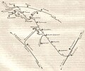
 Karte der ÖPNV-Systeme in den Staaten der ehemaligen Sowjetunion.png 1,571 × 3,027; 1.44 MB
-
 Map of tram system in Avdiivka (uk).svg 868 × 752; 135 KB
-
 Map of tram system in Kamianske (uk).svg 845 × 693; 157 KB
-
 Map of tram system in Konotop (uk).svg 1,130 × 910; 172 KB
-
 Map of tram system in Kostiantynivka (uk).svg 2,189 × 1,766; 138 KB
-
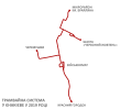 Map of tram system in Yenakiieve (uk).svg 636 × 524; 173 KB
-
 Tram line 1, Avdiivka.svg 868 × 752; 11 KB
-
 Tram line 1, Kamianske.svg 845 × 693; 10 KB
-
 Tram line 1, Konotop.svg 1,130 × 910; 11 KB
-
 Tram line 1, Kostiantynivka.svg 2,189 × 1,766; 12 KB
-
 Tram line 1, Yenakiieve.svg 636 × 524; 8 KB
-
 Tram line 2, Avdiivka.svg 868 × 752; 12 KB
-
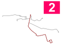 Tram line 2, Kamianske.svg 845 × 693; 11 KB
-
 Tram line 2, Konotop.svg 1,130 × 910; 13 KB
-
 Tram line 2, Kostiantynivka.svg 2,189 × 1,766; 13 KB
-
 Tram line 3, Kamianske.svg 845 × 693; 10 KB
-
 Tram line 3, Konotop.svg 1,130 × 910; 11 KB
-
 Tram line 3, Yenakiieve.svg 636 × 524; 8 KB
-
 Tram line 4, Kamianske.svg 845 × 693; 13 KB
-
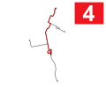 Tram line 4, Yenakiieve.svg 636 × 524; 9 KB
-

.svg)
.svg)
.svg)
.svg)
.svg)


