Category:Public transport maps of India
Jump to navigation
Jump to search
Countries of Asia: Azerbaijan‡ · Cambodia · People's Republic of China · Egypt‡ · Georgia‡ · India · Indonesia‡ · Iran · Israel · Japan · Kazakhstan‡ · Kyrgyzstan · Laos · Malaysia · Myanmar · North Korea · Pakistan · Philippines · Qatar · Russia‡ · Saudi Arabia · Singapore · South Korea · Sri Lanka · Thailand · Turkey‡ · Turkmenistan · United Arab Emirates · Uzbekistan · Vietnam
Limited recognition: Taiwan – Other territories: Hong Kong · Macau
‡: partly located in Asia
Limited recognition: Taiwan – Other territories: Hong Kong · Macau
‡: partly located in Asia
Subcategories
This category has the following 12 subcategories, out of 12 total.
Media in category "Public transport maps of India"
The following 13 files are in this category, out of 13 total.
-
 APSRTC Bus Depots.jpg 3,508 × 2,480; 1.35 MB
-
 India HSR potential route.png 669 × 650; 81 KB
-
 Indian Railways Duronto map.gif 892 × 1,050; 23 KB
-
-

-
 Urban Transit in India bn.svg 512 × 652; 5.77 MB
-
 Urban Transit in India.svg 6,859 × 8,733; 3.45 MB
-
 Urban Transit Systems in India-bn.svg 1,486 × 1,734; 323 KB
-
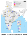
 Urban Transit Systems in India.jpg 6,859 × 8,733; 2.47 MB
-
 Urban Transit Systems in India.svg 1,486 × 1,734; 317 KB
-
 Vande Bharat Express-bn.svg 1,486 × 1,734; 522 KB
-
 Vande Bharat Express.svg 1,486 × 1,734; 364 KB
-
 भारतीय-रेल दुरंत मानचित्र.gif 892 × 1,050; 23 KB


,_suburban_rail,_monorail,_bus_rapid_transit_and_tram.png)