Category:Prudhoe
Jump to navigation
Jump to search
town in Northumberland, England  | |||||
| Upload media | |||||
| Instance of | |||||
|---|---|---|---|---|---|
| Location | Northumberland, North East England, England | ||||
| Different from | |||||
 | |||||
English: Prudhoe is a small town just south of the River Tyne, in the southern part of the county of Northumberland, England. Prudhoe has a population of over 11,500. The town is sited on a steep, north-facing hill in the Tyne valley and nearby settlements include Ovingham, Ovington, Wylam, Stocksfield, Crawcrook (in Tyne and Wear), Hedley on the Hill, and Mickley.
Nederlands: Prudhoe is een plaats en civil parish in het in het Engelse graafschap Northumberland. De plaats telt 11.500 inwoners.
Polski: Prudhoe - miasto w Wielkiej Brytanii, w Anglii, w regionie North East England, w hrabstwie Northumberland. W 2001r. miasto to zamieszkiwało 11 500 osób.
Română: Prudhoe este un oraş în comitatul Northumberland, regiunea North West, Anglia. Oraşul se află în districtul Tynedale.
Subcategories
This category has the following 6 subcategories, out of 6 total.
Media in category "Prudhoe"
The following 200 files are in this category, out of 387 total.
(previous page) (next page)-
 "Where did that one go" - geograph.org.uk - 5132894.jpg 640 × 480; 334 KB
-
 A choice of routes - geograph.org.uk - 5355640.jpg 6,000 × 4,000; 6.31 MB
-
 A friendly horse - geograph.org.uk - 5132072.jpg 640 × 480; 342 KB
-
 A695 towards Stocksfield - geograph.org.uk - 3432539.jpg 640 × 480; 72 KB
-
 Adam ^ Eve, Station Road, Prudhoe - geograph.org.uk - 2039641.jpg 1,024 × 769; 243 KB
-

-
 Allotments at Hagg Bank - geograph.org.uk - 5614382.jpg 640 × 480; 280 KB
-
 Barns on Mickley Moor - geograph.org.uk - 5356025.jpg 6,000 × 4,000; 5.35 MB
-

-
 Bowler's Hill, High Mickley - geograph.org.uk - 2632788.jpg 1,024 × 768; 248 KB
-
 Bowling green in Prudhoe - geograph.org.uk - 5360656.jpg 6,000 × 4,000; 5.9 MB
-
 Bowling green, Prudhoe Waterworld - geograph.org.uk - 2926482.jpg 1,024 × 768; 291 KB
-
 Branch End Garage - geograph.org.uk - 6092739.jpg 640 × 480; 254 KB
-
 Bridges crossing the Tyne at Ovingham - geograph.org.uk - 5780901.jpg 2,000 × 1,333; 493 KB
-
 Bridle way along track to Mickley Moor Farm - geograph.org.uk - 3864072.jpg 3,264 × 2,448; 2.65 MB
-
 Bridlepath Gate into Hyons East Wood - geograph.org.uk - 3802297.jpg 3,264 × 2,448; 3.5 MB
-
 Bridleway approaching Mickley Moor West Farm - geograph.org.uk - 5355995.jpg 6,000 × 4,000; 5.21 MB
-
 Bridleway near East Farm, High Mickley - geograph.org.uk - 2632823.jpg 1,024 × 768; 297 KB
-
 Bridleway on Broom Hill - geograph.org.uk - 5355980.jpg 5,700 × 3,800; 4.05 MB
-
 Bridleway south of Durham Riding - geograph.org.uk - 2634337.jpg 1,024 × 768; 296 KB
-
 Bridleway to Prudhoe - geograph.org.uk - 2635021.jpg 1,024 × 768; 281 KB
-
 Bridleway west of Moor Road - geograph.org.uk - 2933352.jpg 1,024 × 768; 235 KB
-
 Bridleway west of Nanny's Nursery - geograph.org.uk - 2635078.jpg 1,024 × 768; 257 KB
-
 British Legion Houses, South Road, Prudhoe - geograph.org.uk - 2635139.jpg 1,024 × 769; 264 KB
-
 Byway east of Hyons Wood - geograph.org.uk - 2634295.jpg 1,024 × 768; 394 KB
-
 Byway east of Hyons Wood - geograph.org.uk - 2634317.jpg 1,024 × 768; 299 KB
-

-
 Byway to Eltringham - geograph.org.uk - 2599643.jpg 1,024 × 768; 349 KB
-
 Byway to Eltringham - geograph.org.uk - 2599724.jpg 1,024 × 768; 417 KB
-
 Byway to Eltringham - geograph.org.uk - 2599772.jpg 1,024 × 768; 343 KB
-
-
 Cemetery, Moor Road, Prudhoe - geograph.org.uk - 2927591.jpg 1,024 × 768; 426 KB
-
 Cemetery, Prudhoe, Northumberland.jpg 3,264 × 2,448; 2.9 MB
-
 Chalk hills along the River Tyne - geograph.org.uk - 2039378.jpg 1,024 × 768; 279 KB
-
 Cheery blossom on Hillcrest, Prudhoe - geograph.org.uk - 2922134.jpg 1,024 × 641; 261 KB
-
 Cherryburn Cottage - geograph.org.uk - 5838009.jpg 1,024 × 677; 254 KB
-
 Chimney from Wylam Pumping Station - geograph.org.uk - 5446817.jpg 5,472 × 3,078; 7.11 MB
-
 Cobbled yard at Cherryburn - geograph.org.uk - 5921460.jpg 2,000 × 1,421; 2.62 MB
-
 Copse south of the Eltringham byway - geograph.org.uk - 2601345.jpg 1,024 × 769; 313 KB
-
 Cottage and tractor, High Mickley - geograph.org.uk - 2632804.jpg 1,024 × 769; 307 KB
-
 Cottage, South Road, Prudhoe - geograph.org.uk - 2922151.jpg 1,024 × 769; 238 KB
-
 Council depot, Low Prudhoe - geograph.org.uk - 5780923.jpg 2,000 × 1,333; 273 KB
-
 Country road near High Mickley - geograph.org.uk - 6092999.jpg 640 × 480; 281 KB
-
 Covered reservoir at Bowler's Hill - geograph.org.uk - 6093003.jpg 640 × 480; 267 KB
-
 Covered reservoir off Lumley's Lane - geograph.org.uk - 2632841.jpg 1,024 × 768; 243 KB
-
 Crook Wood from Bullion Hills - geograph.org.uk - 3858570.jpg 3,264 × 2,448; 2.86 MB
-
-
 Cycle path alongside River Tyne - geograph.org.uk - 5301960.jpg 5,312 × 2,988; 3.74 MB
-
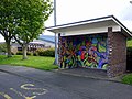 Decorated bus shelter, Stonyflat Bank, Prudhoe - geograph.org.uk - 2926518.jpg 1,024 × 769; 278 KB
-
 Distant rain over the Tyne valley at Prudhoe, Northumberland (9489181632).jpg 4,604 × 2,285; 1.54 MB
-
 Disused building of Prudhoe Hospital - geograph.org.uk - 2936453.jpg 1,024 × 768; 287 KB
-
 Disused building of Prudhoe Hospital - geograph.org.uk - 2936467.jpg 1,024 × 769; 272 KB
-
 Disused building of Prudhoe Hospital - geograph.org.uk - 2937732.jpg 1,024 × 768; 219 KB
-
 Disused building of Prudhoe Hospital - geograph.org.uk - 2937785.jpg 792 × 1,024; 232 KB
-
 Disused buildings of Prudhoe Hospital - geograph.org.uk - 2936434.jpg 1,024 × 769; 231 KB
-
 Disused buildings of Prudhoe Hospital - geograph.org.uk - 2937754.jpg 1,024 × 769; 230 KB
-
 Disused buildings of Prudhoe Hospital - geograph.org.uk - 2937804.jpg 1,024 × 769; 217 KB
-
 Disused buildings of Prudhoe Hospital - geograph.org.uk - 2937850.jpg 1,024 × 769; 193 KB
-

-
 Diverted Express near Prudhoe - geograph.org.uk - 3844959.jpg 1,000 × 667; 689 KB
-
 Dr Syntax public house, West Road, Prudhoe - geograph.org.uk - 2635621.jpg 1,024 × 768; 226 KB
-
 Drill Hall, Swalwell Close, Prudhoe - geograph.org.uk - 2923591.jpg 1,024 × 767; 242 KB
-
 Dukeshagg Farm - geograph.org.uk - 6093156.jpg 640 × 480; 262 KB
-
 Durham Riding - geograph.org.uk - 2634412.jpg 1,024 × 768; 309 KB
-
 Durham Riding from the north - geograph.org.uk - 2635007.jpg 1,024 × 768; 283 KB
-
 East Centre, Stonyflat Bank - geograph.org.uk - 2926665.jpg 1,024 × 640; 181 KB
-
 East Farm - geograph.org.uk - 5356775.jpg 6,000 × 4,000; 5.17 MB
-
 East House Hagg F arm - geograph.org.uk - 5614375.jpg 640 × 480; 311 KB
-
 Edgewell Cemetery - geograph.org.uk - 5358507.jpg 6,000 × 4,000; 5.6 MB
-
 Edgewell Cemetery - geograph.org.uk - 5359056.jpg 6,000 × 4,000; 7.47 MB
-
 Edgewell House Road - geograph.org.uk - 3864050.jpg 3,264 × 2,448; 2.41 MB
-
 Edward VII postbox near Prudhoe station - geograph.org.uk - 1022432.jpg 480 × 640; 138 KB
-

-

-

-
 Engine Road - geograph.org.uk - 2933619.jpg 1,024 × 768; 229 KB
-

-

-
 Errington Place, Prudhoe - geograph.org.uk - 2923631.jpg 1,024 × 641; 215 KB
-
 Farm track near Mickley Moor West Farm - geograph.org.uk - 6092994.jpg 640 × 480; 351 KB
-
 Farmland at Troughstone Hill on Modigars Lane Bridleway - geograph.org.uk - 3865255.jpg 3,264 × 2,448; 3.08 MB
-

-
 Ferndene, Prudhoe - geograph.org.uk - 2927631.jpg 1,024 × 768; 218 KB
-
 Field entrance on Mickley Moor - geograph.org.uk - 5356045.jpg 6,000 × 4,000; 6.78 MB
-
 Field gate on Lumley's Lane bridleway - geograph.org.uk - 2634239.jpg 1,024 × 769; 323 KB
-
 Field north of Eltringham byway - geograph.org.uk - 2601329.jpg 1,024 × 768; 217 KB
-

-
 Fields and fence near Hagg Bank - geograph.org.uk - 5132891.jpg 640 × 480; 315 KB
-
 Fields by High Mickley - geograph.org.uk - 5355569.jpg 6,000 × 4,000; 4.2 MB
-
 Fields west of Moor Road - geograph.org.uk - 2933503.jpg 1,024 × 768; 253 KB
-

-
 Floral display outside the leisure centre - geograph.org.uk - 5359763.jpg 6,000 × 4,000; 7.51 MB
-

-
 Footbridge below Hagg Bank - geograph.org.uk - 5689226.jpg 640 × 480; 372 KB
-
 Footbridge over Stanley Burn - geograph.org.uk - 2936390.jpg 1,024 × 768; 372 KB
-
 Footbridge over Stanley Burn near Durham Riding - geograph.org.uk - 3802304.jpg 3,264 × 2,448; 4.57 MB
-
 Footbridge over unnamed tributary of Stanley Burn - geograph.org.uk - 3340381.jpg 4,000 × 3,000; 5.1 MB
-
 Footbridge south of Durham Riding - geograph.org.uk - 2634368.jpg 1,024 × 768; 295 KB
-
 Footpath behind the houses - geograph.org.uk - 5360662.jpg 6,000 × 4,000; 6.78 MB
-
-
 Footpath Crossing on Modigars Lane - geograph.org.uk - 2873299.jpg 3,264 × 2,448; 1.69 MB
-
 Footpath from Nanny's Nursery to Prudhoe - geograph.org.uk - 3861254.jpg 3,264 × 2,448; 2.85 MB
-
 Footpath near Crook Wood - geograph.org.uk - 3859044.jpg 3,264 × 2,448; 3.1 MB
-
 Footpath near High Mickley - geograph.org.uk - 2632722.jpg 1,024 × 768; 249 KB
-
 Footpath near High Mickley - geograph.org.uk - 5355950.jpg 5,700 × 3,800; 7.48 MB
-
 Footpath north of Bullion Hills - geograph.org.uk - 2601853.jpg 1,024 × 768; 249 KB
-
 Footpath off the A695 - geograph.org.uk - 3432540.jpg 640 × 480; 158 KB
-
 Footpath on The Spetchells - geograph.org.uk - 5778722.jpg 2,000 × 1,333; 481 KB
-
 Footpath south-west of Hagg Bank - geograph.org.uk - 6265915.jpg 1,024 × 768; 538 KB
-
 Footpath T-junction - geograph.org.uk - 3861284.jpg 3,264 × 2,448; 3.28 MB
-
 Footpath to High Mickley - geograph.org.uk - 2632703.jpg 1,024 × 768; 224 KB
-
 Footpath to Low Guards Wood, South Park - geograph.org.uk - 2933437.jpg 1,024 × 640; 200 KB
-
 Footpath to Nanny's Nursery from Mickley Moor - geograph.org.uk - 3861270.jpg 3,264 × 2,448; 3.24 MB
-
 Footpath, Crook Wood - geograph.org.uk - 2602023.jpg 1,024 × 768; 444 KB
-
 Former playing field, Prudhoe Hospital - geograph.org.uk - 2937812.jpg 1,024 × 768; 195 KB
-
 Former Recreation Hall, Prudhoe Hospital - geograph.org.uk - 2927626.jpg 1,024 × 768; 234 KB
-

-
 Fox ^ Hounds, South Road, Prudhoe - geograph.org.uk - 2635462.jpg 1,024 × 769; 235 KB
-
 Front Street, Hagg Bank - geograph.org.uk - 5754670.jpg 1,024 × 768; 292 KB
-
 Front Street, Prudhoe - geograph.org.uk - 2925313.jpg 1,024 × 768; 198 KB
-
 Front Street, Prudhoe - geograph.org.uk - 2925336.jpg 1,024 × 769; 223 KB
-
 Frozen Pond at Hagg Bank - geograph.org.uk - 2827526.jpg 4,000 × 3,000; 2.61 MB
-
 Fuse Media Centre, Moor Road - geograph.org.uk - 2921938.jpg 1,024 × 646; 126 KB
-
 Hadrian Cycleway at Prudhoe - geograph.org.uk - 2231959.jpg 640 × 480; 155 KB
-
 Hadrian's Cycleway, Tyne Riverside Park, Prudhoe - geograph.org.uk - 2038553.jpg 1,024 × 769; 383 KB
-
 Hadrian's Cycleway, Tyne Riverside Park, Prudhoe - geograph.org.uk - 2039608.jpg 1,024 × 768; 405 KB
-
 Hadrian's Cycleway, Tyne Riverside Park, Prudhoe - geograph.org.uk - 2041320.jpg 1,024 × 768; 337 KB
-
 Hag Bank - geograph.org.uk - 2550887.jpg 600 × 450; 328 KB
-
 Hag Bank - geograph.org.uk - 2550890.jpg 600 × 450; 303 KB
-
 Hammerite Paint Factory, Prudhoe - geograph.org.uk - 2599600.jpg 1,024 × 768; 196 KB
-
 Hedley on the Hill , a linear village atop a ridge - geograph.org.uk - 2708623.jpg 3,752 × 2,369; 436 KB
-
 Highfield Lane, Prudhoe - geograph.org.uk - 2922199.jpg 1,024 × 768; 289 KB
-
 Hillside above West Mickley - geograph.org.uk - 5355527.jpg 6,000 × 4,000; 6.14 MB
-
 Horses at East Farm, High Mickley - geograph.org.uk - 6093001.jpg 640 × 480; 267 KB
-
 Horses in a buttercup meadow - geograph.org.uk - 3526527.jpg 640 × 480; 88 KB
-
 House off Moor Road - geograph.org.uk - 2933336.jpg 1,024 × 768; 371 KB
-
 House on The Drive, Prudhoe Hospital - geograph.org.uk - 2937823.jpg 1,024 × 768; 249 KB
-
 Houses in West Mickley - geograph.org.uk - 1022417.jpg 640 × 480; 80 KB
-
 Houses on Bowler's Hill, High Mickley - geograph.org.uk - 6092753.jpg 640 × 480; 288 KB
-
 Houses on The Drive, Prudhoe Hospital - geograph.org.uk - 2937836.jpg 1,024 × 640; 228 KB
-
 Houses on West Road, Prudhoe - geograph.org.uk - 6093011.jpg 640 × 480; 247 KB
-
 Housing development on Western Avenue - geograph.org.uk - 5362255.jpg 6,000 × 4,000; 5.95 MB
-
 Hoverfly (Eristalis tenax), Prudhoe, Northumberland (7791371964).jpg 1,312 × 1,374; 373 KB
-
 Humbles Wood development, Prudhoe - geograph.org.uk - 2933314.jpg 1,024 × 768; 261 KB
-
 Humbles Wood Farm Country Store - geograph.org.uk - 6093213.jpg 640 × 480; 251 KB
-

-

-
-
-
 Islands in the River Tyne above Ovingham Bridge - geograph.org.uk - 2598843.jpg 1,024 × 769; 275 KB
-
 Jimmy Forsyth, photographer, 1913-2009. (5160915477).jpg 960 × 655; 179 KB
-
-
 Kep Well, Prudhoe - geograph.org.uk - 2923773.jpg 1,024 × 768; 422 KB
-
 Kepwell Bank Top - geograph.org.uk - 1038448.jpg 640 × 479; 77 KB
-
 Kepwell Bank, Prudhoe - geograph.org.uk - 2923747.jpg 1,024 × 768; 331 KB
-
 Lane on The Spetchells - geograph.org.uk - 5778711.jpg 2,000 × 1,333; 1,010 KB
-
 Lane to Hagg Farm, Wylam - geograph.org.uk - 5778689.jpg 2,000 × 1,333; 882 KB
-
 Looking across the Tyne to Wylam Pumping Station - geograph.org.uk - 5778695.jpg 2,000 × 1,333; 739 KB
-
 Low Prudhoe - geograph.org.uk - 2194513.jpg 3,873 × 2,569; 1.18 MB
-
 Low Prudhoe Industrial Estate, Princess Way - geograph.org.uk - 2040796.jpg 1,024 × 768; 232 KB
-
 Lumley's Lane - geograph.org.uk - 2632856.jpg 1,024 × 768; 273 KB
-
 Lumley's Lane - geograph.org.uk - 2634159.jpg 1,024 × 768; 358 KB
-
 Lumley's Lane - hedge-lined hollow-way - geograph.org.uk - 2634197.jpg 1,024 × 768; 418 KB
-
 Lumley's Lane above Hyons Wood - geograph.org.uk - 2634224.jpg 1,024 × 768; 355 KB
-
 Marshy hollow in the Spetchells - geograph.org.uk - 3526528.jpg 640 × 480; 108 KB
-
 Meadow, Tyne Riverside Park, Prudhoe - geograph.org.uk - 2041237.jpg 1,024 × 768; 332 KB
-
 Meander in Stanley Burn - geograph.org.uk - 3340429.jpg 4,000 × 3,000; 5 MB
-
 Mickley Grange Farm - geograph.org.uk - 2171226.jpg 3,264 × 2,448; 1.5 MB
-
 Monkey-puzzle tree, Prudhoe Hospital - geograph.org.uk - 2937775.jpg 897 × 1,024; 310 KB
-
 Moor Road - geograph.org.uk - 6093162.jpg 640 × 480; 332 KB
-
 Moor Road crosses Stanley Burn - geograph.org.uk - 2933368.jpg 1,024 × 768; 379 KB
-
 Moor Road west of Dukeshagg Wood - geograph.org.uk - 2933463.jpg 834 × 1,024; 325 KB
-
 Moor Road west of Dukeshagg Wood - geograph.org.uk - 2933491.jpg 1,024 × 768; 366 KB
-
 Moor Road, Prudhoe - geograph.org.uk - 2927598.jpg 1,024 × 768; 348 KB
-
 Mount Pleasant Methodist Church - geograph.org.uk - 6092751.jpg 640 × 480; 283 KB
-
 New bungalow at Mickley Moor West Farm - geograph.org.uk - 6092742.jpg 640 × 480; 239 KB
-
 New housing off Castlefields Drive - geograph.org.uk - 5362237.jpg 6,000 × 4,000; 5.49 MB
-
 North entrance to Cockshot Dene - geograph.org.uk - 6265841.jpg 1,024 × 768; 494 KB
-

-
 Northern entrance to former Prudhoe Hospital - geograph.org.uk - 2940561.jpg 1,024 × 641; 330 KB
-
 Notice board about the Kep Well - geograph.org.uk - 1038434.jpg 640 × 480; 82 KB
-
 Office block near Prudhoe Station - geograph.org.uk - 3434667.jpg 800 × 506; 95 KB
-
 Offices in Station Road - geograph.org.uk - 1022442.jpg 640 × 480; 112 KB
-
 Oil seed rape near High Mickley - geograph.org.uk - 5358489.jpg 6,000 × 4,000; 6.03 MB
-
 Old pumping station on the Tyne - geograph.org.uk - 5689218.jpg 480 × 640; 316 KB
-
 On second thoughts, maybe not... - geograph.org.uk - 5689222.jpg 640 × 480; 314 KB
-
 Ornamental fountain, Prudhoe Hospital - geograph.org.uk - 2937759.jpg 835 × 1,024; 319 KB
-
 Otter Burn, Eltringham Wood - geograph.org.uk - 2598888.jpg 1,024 × 768; 414 KB
-
-
 Outbuildings south-west of Prudhoe Hall - geograph.org.uk - 2937722.jpg 1,024 × 768; 253 KB
-
 Outflow pipe into the River Tyne - geograph.org.uk - 5778704.jpg 2,000 × 1,333; 556 KB
-
 Ovingham Bridge - geograph.org.uk - 2745764.jpg 1,600 × 701; 278 KB
-
 Ovingham Bridge - geograph.org.uk - 4788985.jpg 1,024 × 767; 288 KB
-
 Ovingham Bridge - geograph.org.uk - 5262434.jpg 480 × 640; 244 KB
-
 Ovingham Bridge - geograph.org.uk - 5262841.jpg 640 × 480; 267 KB
-
 Ovingham Bridge - geograph.org.uk - 5362258.jpg 6,000 × 4,000; 4.25 MB
-
 Ovingham Bridge from the Spetchells - geograph.org.uk - 2038759.jpg 1,024 × 768; 335 KB
-
 Ovingham Bridges - geograph.org.uk - 2038443.jpg 1,024 × 768; 295 KB
-
 Park Burn, Tyne Riverside Park - geograph.org.uk - 2039395.jpg 1,024 × 768; 373 KB
-


_and_side_road_in_West_Mickley_-_geograph.org.uk_-_1022415.jpg)


.jpg)


_-_geograph.org.uk_-_1038471.jpg)
_-_royal_cipher_-_geograph.org.uk_-_1038474.jpg)


,_Prudhoe,_Northumberland_(7791371964).jpg)


.jpg)


_-_geograph.org.uk_-_1038483.jpg)


