Category:Preston Bissett
Jump to navigation
Jump to search
English: Preston Bissett is a village and also a civil parish within Aylesbury Vale district in Buckinghamshire, England. It is located about four miles SSW of Buckingham, six miles north east of Bicester in Oxfordshire.
village in Buckinghamshire, United Kingdom  | |||||
| Upload media | |||||
| Instance of | |||||
|---|---|---|---|---|---|
| Location | Buckinghamshire, South East England, England | ||||
 | |||||
Subcategories
This category has only the following subcategory.
Media in category "Preston Bissett"
The following 46 files are in this category, out of 46 total.
-
 Bushey Lane, Preston Bissett - geograph.org.uk - 1248997.jpg 640 × 480; 73 KB
-
 Bushey Lane, Preston Bissett - geograph.org.uk - 1249017.jpg 640 × 480; 82 KB
-
 Bushey Lane, Preston Bissett - geograph.org.uk - 5948313.jpg 1,024 × 684; 271 KB
-
 Casemore Farm - geograph.org.uk - 135004.jpg 640 × 480; 94 KB
-
 Church House, Preston Bissett - geograph.org.uk - 4305830.jpg 4,320 × 3,240; 4.02 MB
-
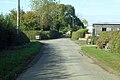
 Entering Preston Bissett - geograph.org.uk - 2181140.jpg 640 × 480; 87 KB
-
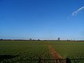
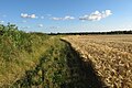
 Footpath across fields - geograph.org.uk - 5354869.jpg 640 × 480; 60 KB
-
 Footpath by the church - geograph.org.uk - 5038884.jpg 1,600 × 1,066; 591 KB
-
 Footpath in Preston Bissett - geograph.org.uk - 4393957.jpg 999 × 1,500; 439 KB
-

-
 Footpath to Cowley Lodge - geograph.org.uk - 5066799.jpg 1,066 × 1,600; 413 KB
-
 Footpath to Cowley Lodge - geograph.org.uk - 5066893.jpg 1,066 × 1,600; 582 KB
-
 Footpath to Pound Lane - geograph.org.uk - 5038886.jpg 1,066 × 1,600; 482 KB
-
 Footpath to Preston Bissett - geograph.org.uk - 4305778.jpg 4,320 × 3,240; 3.68 MB
-
 Footpath to Preston Bissett - geograph.org.uk - 4393948.jpg 1,500 × 999; 250 KB
-
 Footpath towards Godington - geograph.org.uk - 5038870.jpg 1,600 × 1,066; 451 KB
-
 Footpath towards Preston Bissett - geograph.org.uk - 5038873.jpg 1,600 × 1,066; 456 KB
-
 Ford at Twyford Mill - geograph.org.uk - 450417.jpg 640 × 480; 90 KB
-
 Former school building, Preston Bissett - geograph.org.uk - 4305800.jpg 3,779 × 3,037; 3.92 MB
-
 Lane north from Copperhouse Farm - geograph.org.uk - 5948304.jpg 1,024 × 684; 335 KB
-
 Main Street in Preston Bissett - geograph.org.uk - 4393954.jpg 1,500 × 999; 178 KB
-
 Main Street into Preston Bissett - geograph.org.uk - 4393953.jpg 1,500 × 999; 185 KB
-
 Main Street, Preston Bissett - geograph.org.uk - 1046352.jpg 640 × 480; 46 KB
-
 Nurseries, Preston Bissett - geograph.org.uk - 1248984.jpg 640 × 480; 65 KB
-
 Old School, Preston Bissett - geograph.org.uk - 1046346.jpg 640 × 480; 56 KB
-
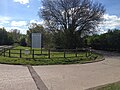
 Preston Bisset Parish Hall - geograph.org.uk - 5038548.jpg 1,600 × 1,066; 291 KB
-
 Preston Bissett.jpg 640 × 480; 82 KB
-
 Road nearing Casemore Farm - geograph.org.uk - 2181146.jpg 640 × 480; 73 KB
-
 Road towards Gawcott - geograph.org.uk - 5948217.jpg 1,024 × 684; 179 KB
-
 St John the Baptist and its churchyard - geograph.org.uk - 5038879.jpg 1,600 × 1,066; 559 KB
-
 St John the Baptist church in Preston Bissett - geograph.org.uk - 4393956.jpg 1,500 × 973; 195 KB
-
 St John the Baptist, Preston Bissett - geograph.org.uk - 4305855.jpg 4,320 × 3,240; 4.57 MB
-
 Stream by the footpath - geograph.org.uk - 5066788.jpg 1,600 × 1,066; 572 KB
-
 Thatched house on Main Street - geograph.org.uk - 4393955.jpg 1,500 × 999; 143 KB
-
 The road to Casemore Farm - geograph.org.uk - 4393950.jpg 1,500 × 999; 149 KB
-
 The road to Edgcott - geograph.org.uk - 4393949.jpg 1,500 × 999; 293 KB
-
 The road to Gawcott - geograph.org.uk - 4382485.jpg 1,500 × 999; 221 KB
-
 The road to Gawcott - geograph.org.uk - 4382488.jpg 1,500 × 999; 178 KB
-
 The road to Preston Bissett - geograph.org.uk - 4393946.jpg 1,500 × 999; 166 KB
-
 The road to Preston Bissett - geograph.org.uk - 4393947.jpg 1,500 × 999; 104 KB
-
 The road to Preston Bissett - geograph.org.uk - 4393951.jpg 1,500 × 999; 180 KB
-
 The road to Preston Bissett - geograph.org.uk - 4393952.jpg 1,500 × 999; 244 KB
-
 Three Bridge Mill Industrial Units - geograph.org.uk - 5354861.jpg 640 × 480; 95 KB
-
 Trees on the road to Casemore Farm - geograph.org.uk - 5038865.jpg 1,600 × 1,066; 442 KB
-
 Weir at Three Bridge Mill - geograph.org.uk - 5354859.jpg 640 × 480; 147 KB
-
 Wooly fence on the path to Cowley Lodge - geograph.org.uk - 5095992.jpg 1,600 × 1,066; 586 KB


