Category:Preston, Cotswold
Jump to navigation
Jump to search
village and civil parish in Cotswold, Gloucestershire, England | |||||
| Upload media | |||||
| Instance of | |||||
|---|---|---|---|---|---|
| Location | Cotswold, Gloucestershire, South West England, England | ||||
 | |||||
Subcategories
This category has only the following subcategory.
Media in category "Preston, Cotswold"
The following 97 files are in this category, out of 97 total.
-
 A stretch of empty road on A419 - geograph.org.uk - 3675728.jpg 2,067 × 1,197; 1.14 MB
-

-
 A417 - Witpit Lane bridge, Preston - geograph.org.uk - 2089546.jpg 640 × 480; 51 KB
-
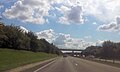
 A417 approaching junction to A419 - geograph.org.uk - 4104941.jpg 1,024 × 677; 186 KB
-
 A417 at London Road overbridge - geograph.org.uk - 4240921.jpg 640 × 480; 46 KB
-
 A417 bridge over A419 - geograph.org.uk - 3274929.jpg 1,024 × 768; 443 KB
-
 A417 east of Cirencester - geograph.org.uk - 2089548.jpg 640 × 480; 45 KB
-
 A417 east of Preston - geograph.org.uk - 4240918.jpg 640 × 480; 37 KB
-
 A417 near Ermine Farm - geograph.org.uk - 4240915.jpg 640 × 481; 38 KB
-
 A417 near Preston - geograph.org.uk - 2089543.jpg 640 × 480; 51 KB
-
 A419 Cirencester Bypass - geograph.org.uk - 2999446.jpg 640 × 479; 96 KB
-
 A419 dual carriageway near Cirencester - geograph.org.uk - 5755460.jpg 4,000 × 3,000; 4.69 MB
-
 A419 half a mile to Burford Road junction - geograph.org.uk - 3675742.jpg 2,193 × 1,338; 1.37 MB
-
 A419 near St Augustine Farm - geograph.org.uk - 2052172.jpg 640 × 480; 41 KB
-
 A429 near Baunton - geograph.org.uk - 2052199.jpg 640 × 480; 52 KB
-
 A429 near Whiteway Farm - geograph.org.uk - 2052194.jpg 640 × 480; 67 KB
-
 A429 Stow Road - geograph.org.uk - 2052192.jpg 640 × 480; 60 KB
-
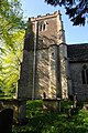
 All Saints church, Preston - geograph.org.uk - 5771467.jpg 1,024 × 680; 400 KB
-
 Approaching St Augustine Farm - geograph.org.uk - 4960450.jpg 3,264 × 2,448; 3.3 MB
-
 Autumn colours - geograph.org.uk - 6271152.jpg 1,536 × 2,048; 1.29 MB
-
 Barn in a field - geograph.org.uk - 5375313.jpg 640 × 480; 65 KB
-
 Barn, St Augustine Farm - geograph.org.uk - 4960376.jpg 3,264 × 2,448; 3.34 MB
-
 Bridge over the A419 - geograph.org.uk - 2052176.jpg 640 × 480; 42 KB
-

-
 Burford Road crosses the Stow Road - geograph.org.uk - 4512914.jpg 1,500 × 999; 206 KB
-
 Burford Road, Cirencester - geograph.org.uk - 3296413.jpg 4,000 × 3,000; 2.82 MB
-

-
 Chicken run^ - geograph.org.uk - 5375362.jpg 1,024 × 768; 152 KB
-

-
 Cirencester Bypass, London Road Bridge - geograph.org.uk - 3411008.jpg 640 × 480; 367 KB
-
 Ermin Farm - geograph.org.uk - 3921263.jpg 2,885 × 2,504; 2.92 MB
-

-
 Field edge - geograph.org.uk - 6082045.jpg 2,048 × 1,536; 1.01 MB
-
 Field next to Ermin Way - geograph.org.uk - 3922096.jpg 2,222 × 2,301; 2.85 MB
-
 Field off the Fosse Way - geograph.org.uk - 2648849.jpg 640 × 480; 74 KB
-
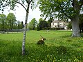
 Fields near Preston - geograph.org.uk - 145195.jpg 640 × 480; 77 KB
-
 Fields Near Preston - geograph.org.uk - 2999525.jpg 640 × 480; 83 KB
-
 Fields next to Ermin Way - geograph.org.uk - 3922089.jpg 4,596 × 2,723; 4.16 MB
-
 Foot crossing over A417 near Preston - geograph.org.uk - 5526969.jpg 640 × 438; 55 KB
-
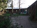
 Hunters Care Centre - geograph.org.uk - 6271148.jpg 2,048 × 1,536; 1.11 MB
-
 Hunters Care Centre - geograph.org.uk - 6271151.jpg 2,048 × 1,536; 1.13 MB
-
 Isolated gravestone, St Augustine Farm - geograph.org.uk - 4960457.jpg 3,264 × 2,448; 3.11 MB
-
 Lane near Preston - geograph.org.uk - 145199.jpg 640 × 480; 103 KB
-
 Lane to Abbey Home Farm, off Burford Road, Cirencester - geograph.org.uk - 3296403.jpg 4,000 × 3,000; 2.82 MB
-
 Layby near St Augustine Farm on A419 - geograph.org.uk - 5526975.jpg 640 × 346; 46 KB
-
 Layby on the A419 near St Augustine Farm - geograph.org.uk - 3411213.jpg 640 × 480; 328 KB
-
 Layby on the Fosse Way - geograph.org.uk - 2999458.jpg 640 × 480; 98 KB
-
 London Road bridges the A417 - geograph.org.uk - 3696715.jpg 4,596 × 2,376; 2.01 MB
-
 London Road Junction - geograph.org.uk - 2999417.jpg 640 × 479; 60 KB
-
 London Road overbridge - geograph.org.uk - 5526953.jpg 640 × 414; 56 KB
-
 Market garden - geograph.org.uk - 6082036.jpg 2,048 × 1,536; 830 KB
-
 Midland and South Western Junction Railway - geograph.org.uk - 3795036.jpg 1,280 × 960; 1.07 MB
-
 Midland and South Western Junction Railway - geograph.org.uk - 3795047.jpg 1,280 × 960; 922 KB
-

-
 Minor road meets the A417 - geograph.org.uk - 1747594.jpg 640 × 480; 127 KB
-
 Muddy verge to lay-by near St Augustine Farm - geograph.org.uk - 3274942.jpg 768 × 1,024; 491 KB
-
 Oilseed rape crop - geograph.org.uk - 5771482.jpg 1,024 × 680; 370 KB
-
 Old railway route - geograph.org.uk - 6082040.jpg 2,048 × 1,536; 1.27 MB
-
-
 Overbridge near Ermin Farm - geograph.org.uk - 5527025.jpg 640 × 385; 47 KB
-
 Parking Area, A417 - geograph.org.uk - 4104927.jpg 1,600 × 1,073; 510 KB
-
 Pasture Field near Cirencester - geograph.org.uk - 2998579.jpg 640 × 480; 68 KB
-
 Path heading to A417 - geograph.org.uk - 3279431.jpg 640 × 480; 104 KB
-
 Path heading to the A419 - geograph.org.uk - 3274954.jpg 640 × 480; 72 KB
-
 Path heading towards Preston - geograph.org.uk - 3279455.jpg 640 × 480; 100 KB
-
 Path leading to Preston church - geograph.org.uk - 5771477.jpg 1,024 × 680; 366 KB
-
 Path to Preston church - geograph.org.uk - 5772334.jpg 680 × 1,024; 361 KB
-
 Pear Tree Cottage, Preston - geograph.org.uk - 1734174.jpg 900 × 599; 826 KB
-
 Pig farm north of Cirencester - geograph.org.uk - 4959233.jpg 1,600 × 1,198; 811 KB
-

-
 Preston church - geograph.org.uk - 5771471.jpg 680 × 1,024; 336 KB
-
 Preston church - geograph.org.uk - 5771474.jpg 1,024 × 680; 277 KB
-
 Preston Church Farm House - geograph.org.uk - 1734195.jpg 900 × 600; 971 KB
-
 Preston Church Path and Manor House - geograph.org.uk - 1734159.jpg 900 × 599; 1,020 KB
-
 Preston Mill - geograph.org.uk - 3002100.jpg 640 × 480; 114 KB
-
 Preston Place, Preston - geograph.org.uk - 4948421.jpg 3,264 × 2,448; 3.49 MB
-
 Preston Street, Cotswolds - geograph.org.uk - 22364.jpg 640 × 480; 182 KB
-
 Preston, Gloucestershire, All Saints - geograph.org.uk - 5905177.jpg 4,608 × 3,456; 5.19 MB
-
 Public footpath across the A419 near Preston - geograph.org.uk - 4947220.jpg 3,264 × 2,448; 3.27 MB
-
 Public Footpath through Churchyard - geograph.org.uk - 3279622.jpg 640 × 480; 130 KB
-

-
 Siddington, lay-by - geograph.org.uk - 5262958.jpg 1,024 × 768; 128 KB
-

-
 St Augustine Farm - geograph.org.uk - 4960364.jpg 3,264 × 2,448; 3.19 MB
-
 The A417 crosses the A419 - geograph.org.uk - 2052180.jpg 640 × 480; 41 KB
-

-
 The A419 bypassing Cirencester - geograph.org.uk - 5771480.jpg 1,024 × 680; 209 KB
-

-
 The road towards Harnhill - geograph.org.uk - 714151.jpg 640 × 480; 110 KB
-
 Unexpected - geograph.org.uk - 5375336.jpg 640 × 480; 41 KB
-
 Witpit Copse from Witpit Lane, near Preston - geograph.org.uk - 3251290.jpg 4,000 × 3,000; 2.85 MB
-
 Witpit Copse on Witpit Lane Preston - geograph.org.uk - 145192.jpg 640 × 480; 99 KB
-
 Witpit Lane - geograph.org.uk - 4948387.jpg 3,264 × 2,448; 3.52 MB
-
 Witpit Lane bridge, crossing A419 - geograph.org.uk - 3274938.jpg 1,024 × 768; 484 KB
-
 Witpit Lane crosses the A417 - geograph.org.uk - 3696711.jpg 4,411 × 2,677; 2.14 MB
-
 Witpit Lane overbridge - geograph.org.uk - 5526964.jpg 640 × 426; 56 KB
-
 Yurts - geograph.org.uk - 5375327.jpg 1,024 × 768; 314 KB


