Category:Potton, Quebec
Jump to navigation
Jump to search
township municipality in Quebec, Canada .JPG)  | |||||
| Upload media | |||||
| Pronunciation audio | |||||
|---|---|---|---|---|---|
| Instance of |
| ||||
| Location | Memphrémagog, Estrie, Quebec, Canada | ||||
| Inception |
| ||||
| Population |
| ||||
| Area |
| ||||
| Different from | |||||
| official website | |||||
 | |||||
Subcategories
This category has the following 3 subcategories, out of 3 total.
F
- Pont de la Frontière (6 F)
M
- Grange ronde de Mansonville (3 F)
Media in category "Potton, Quebec"
The following 8 files are in this category, out of 8 total.
-
 Chairlift at Owls head Quebec.JPG 2,816 × 2,112; 2.92 MB
-
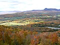 Fall Colours - View from Owl's Head.JPG 2,816 × 2,112; 2.59 MB
-
 Highwater Quebec Border Station.jpg 1,474 × 798; 49 KB
-
 Lac Memphremagog from Owls Head.JPG 2,816 × 2,112; 2.58 MB
-
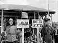 Mountie and Trooper 1941.jpg 640 × 471; 51 KB
-
 Pont Ruiter au village Dunkin, comté de Brome.jpg 775 × 502; 304 KB
-
 Potton Quebec location diagram.PNG 750 × 730; 78 KB
-
 TenueMaconniqueMontOwlHead.jpg 2,116 × 1,840; 2.82 MB


