Category:Potters Crouch
Jump to navigation
Jump to search
human settlement in United Kingdom  | |||||
| Upload media | |||||
| Instance of | |||||
|---|---|---|---|---|---|
| Location |
| ||||
 | |||||
English: Potters Crouch is a hamlet in the civil parish of St Michael, in the St Albans district, in the county of Hertfordshire, England.
Media in category "Potters Crouch"
The following 18 files are in this category, out of 18 total.
-
 Appspond-Lane-20051002-021.jpg 3,031 × 2,006; 1.47 MB
-
 Arable land near Potters Crouch - geograph.org.uk - 755542.jpg 640 × 359; 63 KB
-
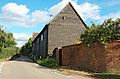
 Barn-like house, Potters Crouch - geograph.org.uk - 996.jpg 640 × 480; 41 KB
-
 Bedmond-Lane-20051002-017.jpg 3,031 × 2,006; 1.75 MB
-
 Footpath near Potters Crouch - geograph.org.uk - 755573.jpg 640 × 359; 92 KB
-
 Footpath south from Appspond Lane - geograph.org.uk - 755546.jpg 640 × 480; 97 KB
-

-
 Potters Crouch Triangulation Pillar - geograph.org.uk - 565680.jpg 640 × 466; 120 KB
-
 Potters Crouch, Blunts Lane - geograph.org.uk - 566483.jpg 640 × 480; 152 KB
-

-
 Potters-Crouch-East-Farm-20051002-015.jpg 3,031 × 2,006; 1.55 MB
-
 Potters-Crouch-East-Farm-20051002-016.jpg 3,031 × 2,006; 1.69 MB
-
 Potters-Crouch-Farm-20051002-018.jpg 3,031 × 2,006; 1.25 MB
-
 Potters-Crouch-Farm-20051002-019.jpg 3,031 × 2,006; 1.31 MB
-
 Potters-Crouch-Farm-20051002-020.jpg 3,031 × 2,006; 1.54 MB
-
 Pylon and copse - geograph.org.uk - 786.jpg 640 × 480; 33 KB
-
 St Albans, Public Footpath No. 36 - geograph.org.uk - 1347348.jpg 640 × 480; 125 KB
-
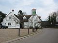 The 'Holly Bush' at Potters Crouch - geograph.org.uk - 798.jpg 640 × 481; 43 KB


