Category:Potter's Barn, Waterloo
Jump to navigation
Jump to search
| Object location | | View all coordinates using: OpenStreetMap |
|---|
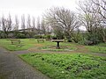
park in Sefton, Merseyside, UK  | |||||
| Upload media | |||||
| Instance of | |||||
|---|---|---|---|---|---|
| Location | Sefton, Merseyside, North West England, England | ||||
| Heritage designation |
| ||||
 | |||||
Potter’s Barn is a replica of La Haye Sainte, the farmhouse on the battlefield at Waterloo, where some of the heaviest fighting occurred. The building was the brainchild of William Potter, a china merchant from Liverpool. Unfortunately, William Potter’s firm went bankrupt in 1841 and the building was never completed.
Media in category "Potter's Barn, Waterloo"
The following 13 files are in this category, out of 13 total.
-
 Inside Potters Barn, Waterloo, Merseyside.jpg 4,320 × 3,240; 4.21 MB
-
 Interior of Potter's Barn.jpg 4,573 × 2,587; 17.77 MB
-
 Potter's Barn, Waterloo - geograph.org.uk - 1437651.jpg 640 × 480; 93 KB
-
 Potter's Barn, Waterloo, Merseyside (1).jpg 4,320 × 3,240; 3.7 MB
-
 Potter's Barn, Waterloo, Merseyside (2).jpg 4,320 × 3,240; 5.07 MB
-
 Potters Barn 1.jpg 4,752 × 2,277; 15.4 MB
-
 Potters Barn 2.jpg 4,537 × 3,241; 13.96 MB
-
 Potters Barn 3.jpg 5,034 × 3,316; 28.24 MB
-
 Potters Barn 4.jpg 5,065 × 3,375; 20.27 MB
-
 Potters Barn 5.jpg 4,807 × 3,381; 19.6 MB
-
 Potters Barn 6.jpg 4,869 × 3,048; 19.85 MB
-
 Potters Barn 7.jpg 5,040 × 3,141; 24.3 MB
-
 Potters Barn 8.jpg 4,830 × 3,020; 17.59 MB


.jpg)
.jpg)


