Category:Postcode maps
Jump to navigation
Jump to search
type of map | |||||
| Upload media | |||||
| |||||
Postcode maps describe areas sharing the same postcode.
The majority of the world's countries have a postcode system for simplifying and accelerating mail delivery. Postcodes thus usually describe a geographically confined area.
The postcode system covers all areas of a country, meaning every location in that country is assigned to a single postcode.
In almost all cases, postcodes form a hierarchical system, meaning that the first one, two or three digits of the full postcode describe a broader division into postcode regions, while the latter digits define more detailed sub-divisions of these regions.
Subcategories
This category has the following 15 subcategories, out of 15 total.
A
- Postcode maps of Austria (4 F)
B
- Postcode maps of Bangladesh (3 F)
- Postcode maps of Belgium (2 F)
F
- Postcode maps of France (1 F)
G
- Postcode maps of Germany (21 F)
I
- Postcode maps of India (2 F)
- Postcode maps of Italy (3 F)
N
P
- Postcode maps of Poland (2 F)
S
- Postcode maps of Spain (1 F)
- Postcode maps of Sweden (1 F)
- Postcode maps of Switzerland (3 F)
U
Media in category "Postcode maps"
The following 37 files are in this category, out of 37 total.
-
 2 digit postcode armenija.png 885 × 885; 83 KB
-
 2 digit postcode australia.png 885 × 885; 86 KB
-
 2 digit postcode azerbaijan.png 885 × 885; 112 KB
-
 2 digit postcode brazil.png 885 × 885; 105 KB
-
 2 digit postcode bulgaria.png 885 × 885; 128 KB
-
 2 digit postcode china.png 885 × 885; 111 KB
-
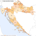 2 digit postcode croatia.png 885 × 885; 77 KB
-
 2 digit postcode cyprus.png 885 × 885; 81 KB
-
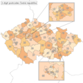 2 digit postcode czech republic.png 885 × 885; 40 KB
-
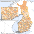 2 digit postcode finland.png 885 × 885; 177 KB
-
 2 digit postcode greece.png 885 × 885; 153 KB
-
 2 digit postcode guatemala.png 885 × 885; 69 KB
-
 2 digit postcode hungary.png 885 × 885; 126 KB
-
 2 digit postcode iceland.png 885 × 885; 105 KB
-
 2 digit postcode iraq.png 885 × 885; 59 KB
-
 2 digit postcode israel.png 885 × 885; 118 KB
-
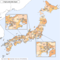 2 digit postcode japan.png 885 × 885; 142 KB
-
 2 digit postcode kosovo.png 885 × 885; 69 KB
-
 2 digit postcode latvia.png 885 × 885; 77 KB
-
 2 digit postcode lithuania.png 885 × 885; 142 KB
-
 2 digit postcode malaysia.png 885 × 885; 125 KB
-
 2 digit postcode portugal.png 885 × 885; 109 KB
-
 2 digit postcode romania.png 885 × 885; 89 KB
-
 2 digit postcode slovakia.png 885 × 788; 23 KB
-
 2 digit postcode turkey.png 885 × 885; 120 KB
-
 Canadian Postal Code Map.png 924 × 782; 55 KB
-
 Canadian postal district map.svg 1,000 × 846; 237 KB
-
 2 digit postcode danmark.png 885 × 885; 100 KB
-
 Indonesian postal code zones map.png 2,560 × 1,176; 221 KB
-
 Kazakhstan postcode map.png 869 × 484; 28 KB
-
 Map of Russian postal codes.svg 1,460 × 860; 174 KB
-
 MoscowPostalAreas1985-2009.jpg 1,449 × 868; 435 KB
-
 Postal codes in Belarus.png 2,000 × 1,785; 1,014 KB
-
 Postcodes of Iran map.svg 739 × 670; 318 KB
-
 Silhouette of Danish postcode 2400.svg 574 × 779; 24 KB
-
 Sub-regiões de CEP de Minas Gerais.svg 785 × 750; 446 KB
-
 Vietnam Postal Codes.png 992 × 1,403; 223 KB


