Category:Portbury
Jump to navigation
Jump to search
village in North Somerset, England, UK  | |||||
| Upload media | |||||
| Instance of | |||||
|---|---|---|---|---|---|
| Location | North Somerset, Somerset, South West England, England | ||||
 | |||||
Subcategories
This category has the following 8 subcategories, out of 8 total.
G
- Gordano Services (38 F)
M
- St Mary's church, Portbury (9 F)
O
- Oakham Treasures (107 F)
P
- Portbury railway station (11 F)
- Portbury War Memorial (1 F)
- Portway Standing Stone (3 F)
R
S
- Sheepway, Somerset (6 F)
Media in category "Portbury"
The following 200 files are in this category, out of 267 total.
(previous page) (next page)-
 'The Priory', Portbury - geograph.org.uk - 6325489.jpg 1,024 × 775; 183 KB
-
 108 Granite Pillars, Portishead - geograph.org.uk - 6082894.jpg 3,648 × 2,736; 1.76 MB
-
 1GL Bolt, Portbury, St Mary's Church - geograph.org.uk - 6090503.jpg 1,280 × 960; 395 KB
-
 46443 "Avon Gorge Special" - 8773515430.jpg 973 × 680; 515 KB
-
 A clue on Sheepway - geograph.org.uk - 6352674.jpg 2,472 × 3,296; 3.45 MB
-
 A decorated tree - geograph.org.uk - 6353467.jpg 2,472 × 3,296; 3.59 MB
-
 A familiar phrase - geograph.org.uk - 6353386.jpg 3,296 × 2,472; 3.06 MB
-
 A gloomy day on the M5 - geograph.org.uk - 6352653.jpg 3,296 × 2,472; 3.28 MB
-
 A grassy coombe below Windmill Hill - geograph.org.uk - 2086286.jpg 3,072 × 2,304; 2.88 MB
-
 A large guard on the corner - geograph.org.uk - 6352619.jpg 2,472 × 3,296; 3.37 MB
-
 A muddy rhyne draining the salt marsh at Sheepway - geograph.org.uk - 2374727.jpg 3,072 × 2,304; 3.45 MB
-
 A small green by the war memorial - geograph.org.uk - 6352637.jpg 3,296 × 2,472; 3.47 MB
-
 A traditional enclosure - geograph.org.uk - 6352717.jpg 3,296 × 2,472; 3.64 MB
-
 A369 at Easton in Gordano.jpg 500 × 334; 124 KB
-
 A369 at Portbury Common roundabout - geograph.org.uk - 5813349.jpg 1,024 × 768; 84 KB
-
 A369 south of Sheepway - geograph.org.uk - 5812525.jpg 1,024 × 769; 163 KB
-
 Access road from Bristol Ports to the sewage works - geograph.org.uk - 2374698.jpg 3,072 × 2,304; 4.11 MB
-

-

-
 Approaching a steep bridge on Naish Hill - geograph.org.uk - 3032639.jpg 1,024 × 720; 163 KB
-
 Approaching Oakham Treasures - geograph.org.uk - 2938638.jpg 1,024 × 687; 142 KB
-

-
 Area of scrub, Portbury Wharf - geograph.org.uk - 6341936.jpg 1,024 × 746; 186 KB
-
 Birch Wood in the gloom - geograph.org.uk - 6353469.jpg 3,296 × 2,472; 3.46 MB
-
 Bluebell time in Prior's Wood - geograph.org.uk - 1282124.jpg 640 × 480; 156 KB
-
 Boundary stone by the big tree - geograph.org.uk - 6352733.jpg 2,472 × 3,296; 3.41 MB
-
 Boundary stone on Charlton Drive - geograph.org.uk - 6352729.jpg 2,472 × 3,296; 3.27 MB
-
 Bristol - Portishead Railway - geograph.org.uk - 212332.jpg 600 × 436; 94 KB
-
 Bueno Apetito^ - geograph.org.uk - 1459359.jpg 640 × 480; 180 KB
-
 Bus stop outside Elm Tree Park - geograph.org.uk - 6325631.jpg 1,024 × 737; 170 KB
-
 Car access to Gordano service area - geograph.org.uk - 2080953.jpg 640 × 480; 74 KB
-
 Caswell Lane - geograph.org.uk - 6325479.jpg 1,024 × 775; 198 KB
-
-
 Charolais cattle at Oakham Farm - geograph.org.uk - 2085881.jpg 3,072 × 2,304; 2.78 MB
-
 Clubhouse, Gordano Rugby Club - geograph.org.uk - 6325481.jpg 1,024 × 793; 156 KB
-
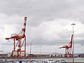 Cranes on Gordano quay - geograph.org.uk - 212382.jpg 600 × 450; 51 KB
-
 Cut Mark, Portbury, Sheepway, Railway Bridge - geograph.org.uk - 6082418.jpg 1,280 × 960; 449 KB
-
 Cut Mark, Portbury, Station Road - geograph.org.uk - 6090300.jpg 1,280 × 960; 429 KB
-

-
 Dockside car pound - geograph.org.uk - 2374705.jpg 3,072 × 2,304; 2.54 MB
-
 Dreadful mess of a pond top Priors Wood - geograph.org.uk - 1635423.jpg 640 × 427; 116 KB
-
 Driveway, 'Bracken' - geograph.org.uk - 6325467.jpg 1,024 × 799; 256 KB
-
 Drove Rhyne - geograph.org.uk - 4517825.jpg 1,920 × 1,440; 922 KB
-
 Drove Rhyne - geograph.org.uk - 4517830.jpg 1,920 × 1,440; 854 KB
-
 East Pier at Royal Portbury Dock - geograph.org.uk - 1402378.jpg 640 × 480; 199 KB
-
 Edge of Portbury - geograph.org.uk - 1003156.jpg 640 × 480; 58 KB
-
 Electrical marker - geograph.org.uk - 6352647.jpg 2,472 × 3,296; 3.31 MB
-
 Electrical utility marker - geograph.org.uk - 6352614.jpg 2,472 × 3,296; 3.29 MB
-
 Electricity - geograph.org.uk - 212120.jpg 600 × 450; 65 KB
-
 Elm Tree Cottage - geograph.org.uk - 6325642.jpg 1,024 × 768; 171 KB
-
 Embankment - geograph.org.uk - 1054482.jpg 480 × 640; 57 KB
-

-

-
 Footbridge over the A369 and M5 - geograph.org.uk - 6325615.jpg 1,024 × 776; 248 KB
-
 Footpath near Portbury - geograph.org.uk - 5475021.jpg 3,672 × 4,896; 5.8 MB
-
 Footpath through Briary Wood - geograph.org.uk - 3072743.jpg 1,500 × 1,992; 527 KB
-
 Footpath through Briery Wood - geograph.org.uk - 3072924.jpg 2,000 × 1,511; 333 KB
-
 Footpath to Portbury - geograph.org.uk - 3072918.jpg 2,000 × 1,486; 573 KB
-
 For thirsty patrons if the pub is shut^ - geograph.org.uk - 6354393.jpg 3,296 × 2,472; 3.44 MB
-
 Former Mill Pond (^) in Mill Lane - geograph.org.uk - 2085511.jpg 3,072 × 2,304; 3.97 MB
-
 Former Priory in Portbury - geograph.org.uk - 1282162.jpg 640 × 480; 113 KB
-
 Former railway station at Portbury - geograph.org.uk - 6325618.jpg 1,024 × 768; 228 KB
-
 Gordano R.F.C. - geograph.org.uk - 6352703.jpg 3,296 × 2,472; 2.7 MB
-
 Gordano Services - geograph.org.uk - 6258405.jpg 4,608 × 2,184; 2.73 MB
-

-
 Graveyard, Portbury - geograph.org.uk - 6226374.jpg 4,032 × 1,908; 3.75 MB
-
 Grazing meadow with cattle trough - geograph.org.uk - 2086283.jpg 3,072 × 2,304; 3.22 MB
-
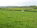
 Grazing on Portbury Common - geograph.org.uk - 212347.jpg 600 × 450; 51 KB
-
 Half a mile to junction 19 - geograph.org.uk - 4740025.jpg 640 × 417; 112 KB
-
 Holford House - geograph.org.uk - 6325640.jpg 1,024 × 800; 198 KB
-
 Horses grazing at Race Course Farm - geograph.org.uk - 2085500.jpg 3,072 × 2,304; 3.32 MB
-
-
 House at Sheepway - geograph.org.uk - 6325653.jpg 1,024 × 797; 225 KB
-
 Houses in Mill Lane - geograph.org.uk - 2938642.jpg 1,024 × 769; 178 KB
-
 Ill met by Moonlight - panoramio.jpg 2,676 × 2,256; 5.33 MB
-
 Junction 19 northbound of the M5 - geograph.org.uk - 2214645.jpg 640 × 480; 169 KB
-
 Junction 19 on the M5 - geograph.org.uk - 3093602.jpg 1,024 × 768; 157 KB
-
 Junction with Martcombe Road - geograph.org.uk - 4533121.jpg 1,024 × 798; 188 KB
-
 Keeping a running score - geograph.org.uk - 6353471.jpg 3,296 × 2,472; 3.58 MB
-
 Locking in (3297855296) (2).jpg 1,000 × 659; 651 KB
-
 Looking toward Portishead - geograph.org.uk - 6074585.jpg 1,600 × 1,200; 249 KB
-
 Looking towards Portishead - geograph.org.uk - 1054478.jpg 640 × 475; 143 KB
-
 Looking towards the Severn Bridges - geograph.org.uk - 3158343.jpg 4,592 × 3,056; 2.77 MB
-

-
 Lych Gate, St Mary's Church, Portbury - geograph.org.uk - 6226375.jpg 4,608 × 2,184; 2.98 MB
-
 M5 at junction 19 - geograph.org.uk - 2104024.jpg 640 × 480; 76 KB
-
 M5 at Naish Hill Bridge - geograph.org.uk - 4417732.jpg 1,600 × 1,062; 531 KB
-
 M5 east of Stratton Farm - geograph.org.uk - 3179638.jpg 3,287 × 2,421; 989 KB
-
 M5 footbridge joining sections of Station Road - geograph.org.uk - 2937655.jpg 1,024 × 673; 111 KB
-
 M5 heading south west - geograph.org.uk - 3753767.jpg 2,683 × 1,701; 1.98 MB
-
 M5 junction 19 - geograph.org.uk - 4740042.jpg 640 × 422; 49 KB
-
 M5 Junction 19 slip road westbound - geograph.org.uk - 3179616.jpg 3,343 × 2,536; 1.35 MB
-
 M5 looking west from Jn 19 - geograph.org.uk - 2937647.jpg 1,024 × 670; 101 KB
-

-
 M5 Motorway - junction 19 roundabout - geograph.org.uk - 2081064.jpg 640 × 480; 62 KB
-

-
 M5 near Clapton in Gordano - geograph.org.uk - 2302144.jpg 2,380 × 1,560; 2.8 MB
-
 M5 near Portbury (1) - geograph.org.uk - 1993149.jpg 1,024 × 678; 201 KB
-
 M5 near Portbury (2) - geograph.org.uk - 2305364.jpg 2,494 × 1,634; 3 MB
-
 M5 north of Portbury - geograph.org.uk - 3753761.jpg 2,768 × 1,838; 2.21 MB
-
 M5 Northbound - geograph.org.uk - 3803098.jpg 640 × 480; 227 KB
-
 M5 northbound approaching Avonmouth - geograph.org.uk - 1654089.jpg 640 × 480; 109 KB
-
 M5 northbound junction 19 - geograph.org.uk - 1654091.jpg 640 × 480; 88 KB
-
 M5 passing under power lines - geograph.org.uk - 3032934.jpg 1,024 × 632; 70 KB
-
 M5 southbound - geograph.org.uk - 212363.jpg 600 × 400; 50 KB
-
 M5 towards Clapton in Gordano - geograph.org.uk - 3753791.jpg 2,627 × 1,810; 2.17 MB
-
 Mill Lane Bluebells in Portbury - panoramio.jpg 2,832 × 2,128; 2.2 MB
-
 Mill Lane Bluebells, Portbury - panoramio.jpg 2,832 × 2,128; 2.18 MB
-
 Mill Lane, Portbury - geograph.org.uk - 4533605.jpg 1,024 × 789; 169 KB
-
 MoT parking - geograph.org.uk - 6352606.jpg 3,296 × 2,472; 3.29 MB
-

-
 Naish Hill bridge - geograph.org.uk - 2937693.jpg 1,024 × 742; 82 KB
-
 Naish Hill bridge M5 south - geograph.org.uk - 4032711.jpg 640 × 428; 48 KB
-
 Nature Reserve Pathway - geograph.org.uk - 1860752.jpg 640 × 425; 57 KB
-
 NCN26 at Sheepway - geograph.org.uk - 4518866.jpg 1,920 × 1,440; 1,018 KB
-
 NCN26 at Sheepway - geograph.org.uk - 4518886.jpg 1,920 × 2,560; 1.67 MB
-
 NCN26 at The Drove - geograph.org.uk - 4518844.jpg 1,920 × 1,440; 587 KB
-
 NCN26 by Drove Rhyne - geograph.org.uk - 4517834.jpg 1,920 × 1,336; 467 KB
-
 New cars, Royal Portbury Dock Industrial Estate - geograph.org.uk - 4518854.jpg 1,920 × 998; 258 KB
-
 No parking on the stream - geograph.org.uk - 6352689.jpg 3,296 × 2,472; 3.36 MB
-
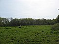
 North Somerset , Grassy Field - geograph.org.uk - 5900814.jpg 6,000 × 4,000; 6.81 MB
-
 North Somerset , M5 Motorway - geograph.org.uk - 3723349.jpg 4,180 × 2,676; 4.84 MB
-
 North Somerset , M5 Motorway - geograph.org.uk - 5951243.jpg 6,000 × 4,000; 6.76 MB
-
 North Somerset , M5 Motorway - geograph.org.uk - 5951244.jpg 6,000 × 4,000; 6.43 MB
-
 North Somerset , M5 Motorway - geograph.org.uk - 5951246.jpg 6,000 × 4,000; 6.53 MB
-
 North Somerset , M5 Motorway - geograph.org.uk - 6107209.jpg 6,000 × 4,000; 6.48 MB
-
 North Somerset , M5 Motorway Northbound - geograph.org.uk - 3723325.jpg 4,288 × 2,848; 5 MB
-
 North Somerset , M5 Motorway Southbound - geograph.org.uk - 2795463.jpg 3,389 × 2,252; 2.52 MB
-
 North Somerset , M5 Motorway ^ Portbury Church - geograph.org.uk - 2795462.jpg 4,194 × 2,700; 3.23 MB
-
 North Somerset , Portbury Interchange - geograph.org.uk - 3723341.jpg 4,288 × 2,848; 5.26 MB
-
 North Somerset , Royal Portbury Dock Road - geograph.org.uk - 3723334.jpg 4,218 × 2,740; 6.16 MB
-
 North Somerset , Severn Scenery - geograph.org.uk - 3723313.jpg 4,284 × 2,842; 5.66 MB
-
 North Somerset , The M5 Motorway - geograph.org.uk - 3723338.jpg 4,106 × 2,542; 5.91 MB
-
 North Somerset , The Portbury Hundred - geograph.org.uk - 3723329.jpg 4,174 × 2,664; 5.73 MB
-
 Northbound M5 - geograph.org.uk - 3803095.jpg 640 × 480; 210 KB
-

-

-
 Northbound M5, Caswell Hill - geograph.org.uk - 3806822.jpg 640 × 427; 211 KB
-
 Northbound M5, Junction 19 - geograph.org.uk - 3803697.jpg 640 × 480; 231 KB
-
 Northbound M5, Junction 19 - geograph.org.uk - 3806831.jpg 640 × 427; 270 KB
-
 Northbound M5, Portbury - geograph.org.uk - 3806825.jpg 640 × 427; 230 KB
-
 Oakham farm - geograph.org.uk - 2479398.jpg 640 × 480; 81 KB
-
 Oakham Treasures interior (1), Portbury - geograph.org.uk - 5561690.jpg 2,688 × 1,520; 1.34 MB
-
 Oakham Treasures interior (2), Portbury - geograph.org.uk - 5564947.jpg 2,816 × 2,112; 2.71 MB
-
 Old bolt - geograph.org.uk - 3393608.jpg 2,304 × 1,704; 1.75 MB
-

-
 Ordnance Survey 1GL Bolt - geograph.org.uk - 4417735.jpg 640 × 480; 95 KB
-
 Ornate kissing gate - geograph.org.uk - 1054480.jpg 640 × 480; 155 KB
-
 Outbuildings at Sheepway Gate Farm - geograph.org.uk - 6325658.jpg 1,024 × 768; 188 KB
-
 Outbuildings at Upper Caswell Farm - geograph.org.uk - 6325470.jpg 1,024 × 768; 166 KB
-

-
 Path from Prior's Wood - geograph.org.uk - 2209469.jpg 640 × 480; 113 KB
-
 Path to Portbury Wharf nature reserve - geograph.org.uk - 6341955.jpg 1,024 × 771; 231 KB
-
 Pigs feeding in Prior's Wood - geograph.org.uk - 1282130.jpg 640 × 480; 144 KB
-
 Plaque on the standing stone - geograph.org.uk - 3401358.jpg 2,304 × 1,704; 2.32 MB
-
 Ploughing Caswell Lane - geograph.org.uk - 1702703.jpg 778 × 519; 110 KB
-
 Pond at Oakham Farm - geograph.org.uk - 2085869.jpg 3,072 × 2,304; 3.7 MB
-
 Portbury , M5 Motorway - geograph.org.uk - 6283800.jpg 6,000 × 4,000; 4.28 MB
-
 Portbury , M5 Motorway - geograph.org.uk - 6283802.jpg 6,000 × 4,000; 4.24 MB
-
 Portbury , M5 Motorway - geograph.org.uk - 6283803.jpg 6,000 × 4,000; 4.24 MB
-
 Portbury - geograph.org.uk - 2479409.jpg 640 × 480; 91 KB
-
 Portbury allotments - geograph.org.uk - 6352683.jpg 3,296 × 2,472; 3.47 MB
-
 Portbury C of E Primary School - geograph.org.uk - 5445051.jpg 640 × 480; 131 KB
-
 Portbury Camp Somerset Map.jpg 360 × 425; 24 KB
-
 Portbury Church - geograph.org.uk - 5475024.jpg 4,896 × 3,672; 6.06 MB
-
 Portbury Common - geograph.org.uk - 212344.jpg 600 × 400; 42 KB
-
 Portbury from air, 2000 - geograph.org.uk - 5575544.jpg 2,181 × 1,445; 287 KB
-
 Portbury Lane in Windmill Wood - geograph.org.uk - 5639741.jpg 1,600 × 1,280; 865 KB
-
 Portbury MMB 01 M5.jpg 2,400 × 1,600; 1.65 MB
-
 Portbury MMB 02.jpg 2,400 × 1,600; 2.04 MB
-
 Portbury MMB 03 M5.jpg 2,400 × 1,600; 1.46 MB
-
 Portbury Priory - geograph.org.uk - 3188124.jpg 3,154 × 4,729; 2.03 MB
-
 Portbury Railway Station - geograph.org.uk - 6066044.jpg 1,024 × 722; 155 KB
-
 Portbury Standing Stone - geograph.org.uk - 5475015.jpg 3,672 × 4,896; 5.55 MB
-
 Portbury Standing Stone - geograph.org.uk - 6226376.jpg 1,865 × 3,935; 1.89 MB
-
 Portbury village hall - geograph.org.uk - 6352601.jpg 3,296 × 2,472; 3.53 MB
-
 Portbury war memorial - geograph.org.uk - 6352630.jpg 2,472 × 3,296; 3.54 MB
-
 Portbury's hall - geograph.org.uk - 6352609.jpg 3,296 × 2,472; 3.45 MB
-
 Portbury, St Mary's Church - geograph.org.uk - 6090510.jpg 960 × 1,280; 409 KB
-
 Portbury, Station Road - geograph.org.uk - 6090301.jpg 1,280 × 960; 329 KB
-
 Portbury, Village Club - geograph.org.uk - 6090498.jpg 1,280 × 960; 229 KB
-
 Postbox at Sheepway - geograph.org.uk - 1459267.jpg 640 × 480; 223 KB
-
 Prior's Wood - geograph.org.uk - 2209500.jpg 640 × 480; 118 KB
-
 Priors Wood fields west Erosion - geograph.org.uk - 1883278.jpg 1,308 × 593; 108 KB
-
 Priory Road, Portbury - geograph.org.uk - 6325492.jpg 1,024 × 785; 118 KB
-
 Pylons to Portishead and Portbury dock - geograph.org.uk - 2966464.jpg 3,648 × 2,432; 2.14 MB
-
 Racecourse Farm, by Portbury Lane - geograph.org.uk - 5639745.jpg 1,600 × 1,198; 649 KB
-
 Ranch style fencing Sheepway - geograph.org.uk - 2991684.jpg 1,024 × 712; 200 KB
-
 Redding Cottages - geograph.org.uk - 6325465.jpg 1,024 × 810; 224 KB
-
 Riding over the Portbury Hundred - geograph.org.uk - 6352677.jpg 3,296 × 2,472; 3.36 MB
-
 Ruined farm house off Mill Lane - geograph.org.uk - 2085524.jpg 3,072 × 2,304; 4.36 MB
-
 Running down off Conygar Hill - geograph.org.uk - 6352696.jpg 2,472 × 3,296; 3.47 MB
-
 S9976, Portbury, Village Club - geograph.org.uk - 6090497.jpg 960 × 1,280; 355 KB
-
 Salt marsh by the Bristol Channel - geograph.org.uk - 1054481.jpg 640 × 480; 77 KB
-
 School's out^ - geograph.org.uk - 3393752.jpg 2,304 × 1,704; 1.46 MB
-
 Security Fencing Portbury Docks - geograph.org.uk - 5261240.jpg 640 × 427; 71 KB
-
 Ser Only - geograph.org.uk - 2080946.jpg 640 × 480; 59 KB
-

-
 Sheepway - geograph.org.uk - 4518903.jpg 1,920 × 1,440; 587 KB
-
 Sheepway - geograph.org.uk - 6325666.jpg 1,024 × 786; 209 KB


_in_Mill_Lane_-_geograph.org.uk_-_2085511.jpg)


_(2).jpg)


_-_geograph.org.uk_-_1993149.jpg)
_-_geograph.org.uk_-_2305364.jpg)


_-_geograph.org.uk_-_3806834.jpg)


,_Portbury_-_geograph.org.uk_-_5561690.jpg)
,_Portbury_-_geograph.org.uk_-_5564947.jpg)


