Category:Porlock
Jump to navigation
Jump to search
English: Porlock is a coastal village in Somerset, England, situated in a deep hollow below Exmoor, estimate).
Français : Porlock est un village côtier du Somerset, en Angleterre, situé dans une profonde dépression près de Exmoor, à 8 km à l'ouest de Minehead. En 2002, la population du village était estimée à personnes.
village and civil parish in Somerset, England  | |||||
| Upload media | |||||
| Instance of | |||||
|---|---|---|---|---|---|
| Located in protected area | |||||
| Location | Somerset West and Taunton, Somerset, South West England, England | ||||
 | |||||
Subcategories
This category has the following 10 subcategories, out of 10 total.
A
- Alderman's Barrow (1 F)
B
P
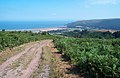
- Porlock Bay (15 F)
- Porlock Stone Circle (4 F)
- Porlock Weir harbour (45 F)
S
T
W
- Whit Stones (3 F)
Media in category "Porlock"
The following 200 files are in this category, out of 1,031 total.
(previous page) (next page)-
 'Miller's at the Anchor', Porlock Weir - geograph.org.uk - 3405999.jpg 1,600 × 1,254; 269 KB
-
 'The Chapel of Our Lady of the Secret', Greencombe Gardens - geograph.org.uk - 6204665.jpg 3,648 × 2,432; 3.39 MB
-
 'Whit Stones' on Porlock Common - geograph.org.uk - 5964218.jpg 1,024 × 768; 262 KB
-
 A A Box at top of Porlock Hill - geograph.org.uk - 808970.jpg 640 × 427; 72 KB
-
 A Bridleway - geograph.org.uk - 857398.jpg 640 × 427; 98 KB
-
 A Clearing in Yearnor Wood - geograph.org.uk - 2465294.jpg 768 × 1,024; 357 KB
-

-

-
 A recent landslip at Gore Point - geograph.org.uk - 4872773.jpg 3,648 × 2,048; 2.08 MB
-
 A storm beach in the centre of Porlock Bay - geograph.org.uk - 4668888.jpg 1,368 × 1,824; 640 KB
-
 A stream in Worthy Combe - geograph.org.uk - 3527114.jpg 1,500 × 985; 308 KB
-
 A stream in Worthy Combe - geograph.org.uk - 3527121.jpg 1,500 × 1,000; 265 KB
-
 A stream in Worthy Combe - geograph.org.uk - 3527126.jpg 1,500 × 984; 279 KB
-
 A stream on the beach - geograph.org.uk - 3523222.jpg 1,500 × 1,000; 400 KB
-
 A stream runs down to the sea - geograph.org.uk - 3527051.jpg 1,500 × 994; 286 KB
-
 A view along the coastline - geograph.org.uk - 3523219.jpg 1,500 × 1,000; 222 KB
-
 A yacht by the saltmarsh - geograph.org.uk - 3520895.jpg 1,500 × 986; 138 KB
-
 A39 at Porlock Hill steepens somewhat - geograph.org.uk - 5120161.jpg 3,648 × 2,432; 6.77 MB
-
 A39 By the Culbone Stables Inn - geograph.org.uk - 2177881.jpg 800 × 600; 159 KB
-
 A39 near Whitstone Post.jpg 4,618 × 3,464; 3.06 MB
-
 AA Box 137 - geograph.org.uk - 1077678.jpg 536 × 640; 101 KB
-
 AA box on Porlock Common - geograph.org.uk - 3417454.jpg 1,024 × 796; 211 KB
-
 AA telephone box, at Pittcombe Head - geograph.org.uk - 2343892.jpg 1,024 × 748; 246 KB
-
 Abbeyfield House and Garden, Porlock - geograph.org.uk - 5398529.jpg 1,024 × 768; 293 KB
-
 Above Porlock on the A39 - geograph.org.uk - 5120163.jpg 3,648 × 2,432; 3.8 MB
-
 Above Weir Water valley - geograph.org.uk - 3926335.jpg 1,024 × 768; 228 KB
-
 Above Weirwood Common - geograph.org.uk - 1987583.jpg 640 × 427; 225 KB
-
 Across Whitstones moor - geograph.org.uk - 5124220.jpg 3,648 × 2,432; 5.39 MB
-
 Acute bend on Porlock hill - geograph.org.uk - 2343822.jpg 1,024 × 768; 267 KB
-
 Admiralty Chart No 1181 Anchorages on the South Shore of the Bristol Channel, Published 1884.jpg 16,295 × 12,096; 60.93 MB
-
 All aground at half tide - geograph.org.uk - 4944641.jpg 3,648 × 2,048; 1.63 MB
-
 Allerpark Combe - geograph.org.uk - 4407078.jpg 1,920 × 1,440; 1,012 KB
-
 Along the track from the cattle grid - geograph.org.uk - 5120169.jpg 3,648 × 2,432; 3.74 MB
-
 American Airforce Memorial - geograph.org.uk - 1658764.jpg 640 × 430; 190 KB
-
 Ancient tree - geograph.org.uk - 1250619.jpg 428 × 640; 81 KB
-
 Arum Lillies at Greencombe Gardens - geograph.org.uk - 4980534.jpg 1,024 × 768; 315 KB
-
 Arum lillies by the stream, Porlock - geograph.org.uk - 5398539.jpg 1,024 × 768; 302 KB
-
 Ash Farm - geograph.org.uk - 5846570.jpg 6,000 × 4,000; 6.78 MB
-

-
 Autumn in Hawkcombe - geograph.org.uk - 5964240.jpg 1,024 × 768; 330 KB
-
 B3225 at Porlock Weir - geograph.org.uk - 4407346.jpg 2,167 × 1,403; 803 KB
-
 B3225 east of West Porlock - geograph.org.uk - 2092343.jpg 780 × 800; 137 KB
-
 Back gate to Park House, The Parks - geograph.org.uk - 1659064.jpg 640 × 430; 137 KB
-
 Bank by Porlock Marsh - geograph.org.uk - 4407873.jpg 1,920 × 2,609; 1.43 MB
-
 Barn and Dead Tree - geograph.org.uk - 2463602.jpg 1,024 × 768; 169 KB
-
 Barns near West Porlock - geograph.org.uk - 1658849.jpg 640 × 430; 140 KB
-
 Barns on the edge of Porlock - geograph.org.uk - 1658614.jpg 640 × 430; 122 KB
-
 Barns, off Sparkhayes Lane - geograph.org.uk - 2412656.jpg 1,024 × 768; 189 KB
-
 Beach, Porlock Weir - geograph.org.uk - 4407527.jpg 1,920 × 1,067; 800 KB
-
 Behind the shingle ridge, Porlock Beach - geograph.org.uk - 1658365.jpg 640 × 430; 139 KB
-

-
 Bend in the road from Robber's Bridge to the A39 - geograph.org.uk - 3007631.jpg 1,600 × 1,200; 465 KB
-
 Berry Castle Wood - geograph.org.uk - 3722548.jpg 1,024 × 768; 240 KB
-
 Birds at Porlock Weir - geograph.org.uk - 2781646.jpg 604 × 640; 372 KB
-
 Black Barrow - geograph.org.uk - 857491.jpg 640 × 427; 79 KB
-
 Bluebells on the bridge - geograph.org.uk - 3527926.jpg 1,500 × 997; 136 KB
-
 Boardwalk on Porlock Bay marshes - geograph.org.uk - 5258509.jpg 1,024 × 795; 214 KB
-
 Boardwalk on Sparkhayes Marsh - geograph.org.uk - 6089053.jpg 6,000 × 4,000; 4.72 MB
-
 Boardwalk, Porlock Marsh - geograph.org.uk - 4407916.jpg 1,920 × 1,341; 557 KB
-
 Boats at Porlock Weir - geograph.org.uk - 2781650.jpg 640 × 427; 250 KB
-
 Boats at Porlock Weir - geograph.org.uk - 4891865.jpg 3,456 × 2,304; 2 MB
-
 Bossington Beach & Porlock Weir (6743202363).jpg 4,288 × 2,848; 4.24 MB
-
 Bossington Beach - geograph.org.uk - 2355858.jpg 1,024 × 768; 149 KB
-
 Bossington Beach - geograph.org.uk - 2412481.jpg 1,024 × 768; 247 KB
-
 Bossington Beach - geograph.org.uk - 6089894.jpg 6,000 × 4,000; 6.07 MB
-
 Bossington Beach - geograph.org.uk - 6089898.jpg 6,000 × 4,000; 5.43 MB
-
 Bossington Hill view over Porlock (6743162781).jpg 3,648 × 2,736; 3.82 MB
-
 Bossington Hill, emerging from low cloud - geograph.org.uk - 3125005.jpg 1,024 × 768; 78 KB
-
 Breach in shingle ridge, Porlock - geograph.org.uk - 103566.jpg 583 × 390; 60 KB
-
 Bridge across the river - geograph.org.uk - 1658656.jpg 640 × 430; 167 KB
-
 Bridleway between farm buildings. - geograph.org.uk - 393311.jpg 640 × 419; 104 KB
-
 Bridleway in Shillett Wood - geograph.org.uk - 2787633.jpg 640 × 427; 260 KB
-
 Bridleway near Whitstone Post.jpg 4,618 × 3,464; 2.67 MB
-
 Bristol Channel , South Wales - geograph.org.uk - 6258943.jpg 6,000 × 4,000; 7.77 MB
-
 Bristol Channel , South Wales - geograph.org.uk - 6258946.jpg 6,000 × 4,000; 7.22 MB
-
 Bristol Channel , South Wales - geograph.org.uk - 6258948.jpg 6,000 × 4,000; 7.67 MB
-
 Bristol Channel , South Wales - geograph.org.uk - 6258949.jpg 6,000 × 4,000; 5.58 MB
-
 Bristol Channel , South Wales - geograph.org.uk - 6258955.jpg 6,000 × 4,000; 5.84 MB
-
 Bristol Channel , South Wales - geograph.org.uk - 6258958.jpg 6,000 × 4,000; 6.11 MB
-
 Bristol Channel , South Wales - geograph.org.uk - 6258963.jpg 6,000 × 4,000; 6.99 MB
-

-
 Bus stop on B3225, High Street, Porlock - geograph.org.uk - 6205208.jpg 3,648 × 2,432; 2.33 MB
-

-
 By the A39 towards Porlock - geograph.org.uk - 5124194.jpg 3,048 × 1,779; 2.88 MB
-
 By the cattle grid on the A39 - geograph.org.uk - 5120167.jpg 3,648 × 2,432; 3.38 MB
-
 Car by footpath to Hacketty Way - geograph.org.uk - 933948.jpg 640 × 480; 121 KB
-
 Car park access off A39 on Porlock Common - geograph.org.uk - 6032543.jpg 1,600 × 1,007; 555 KB
-
 Car park in Parson's Street, Porlock - geograph.org.uk - 6205121.jpg 1,600 × 1,067; 457 KB
-
 Car Park with a view - geograph.org.uk - 2701347.jpg 640 × 480; 53 KB
-

-
 Cattle grid at Pitcombe Head - geograph.org.uk - 6032544.jpg 1,600 × 1,200; 1.01 MB
-
 Cattle grid on Crawter Hill - geograph.org.uk - 3427534.jpg 1,024 × 768; 223 KB
-
 Cattle grid on the road to Yarner Farm - geograph.org.uk - 6287413.jpg 4,000 × 3,000; 4.61 MB
-
 Cattle grid, A39, Porlock Hill - geograph.org.uk - 6031287.jpg 1,600 × 1,143; 608 KB
-
 Cattle Grid, Luccombe Lane - geograph.org.uk - 1660476.jpg 640 × 430; 143 KB
-
 Chadwyck Close, Porlock - geograph.org.uk - 5258472.jpg 1,024 × 635; 122 KB
-
 Changing Rooms, Porlock Recreation Ground - geograph.org.uk - 6205082.jpg 1,600 × 1,067; 434 KB
-
 Church of St Dubricius, Porlock - geograph.org.uk - 6166231.jpg 4,000 × 3,000; 4.67 MB
-
 Clearing in Hawkcombe Wood - geograph.org.uk - 2642215.jpg 1,024 × 768; 309 KB
-
 Cliff eroded by wave action at Gore Point - geograph.org.uk - 4944682.jpg 3,648 × 2,048; 2.37 MB
-
 Clive Downs - the Porlock butcher - geograph.org.uk - 3760544.jpg 800 × 600; 335 KB
-
 Coach Rd, Doverhay, Porlock - geograph.org.uk - 1660047.jpg 640 × 430; 138 KB
-
 Coach Road, Porlock - geograph.org.uk - 933906.jpg 640 × 480; 94 KB
-
 Coarse grasses on Porlock Common - geograph.org.uk - 3722594.jpg 1,024 × 768; 219 KB
-
 Combe Meadow - geograph.org.uk - 1658995.jpg 640 × 430; 188 KB
-
 Combe Meadow - geograph.org.uk - 1659004.jpg 640 × 430; 189 KB
-
 Congestion in the High Street - geograph.org.uk - 3502711.jpg 1,500 × 1,000; 181 KB
-
 Conifer trees, The Parks - geograph.org.uk - 1659042.jpg 640 × 430; 186 KB
-
 Cottage at Porlock Weir - geograph.org.uk - 2781683.jpg 640 × 427; 243 KB
-
 Cottage gable - geograph.org.uk - 4247595.jpg 1,280 × 1,109; 1.16 MB
-

-
 Cottages at Porlock Weir - geograph.org.uk - 2781640.jpg 640 × 383; 221 KB
-
 Cottages at Porlock Weir - geograph.org.uk - 2781642.jpg 640 × 381; 260 KB
-
 Cottages at Porlock Weir - geograph.org.uk - 2781665.jpg 640 × 467; 323 KB
-
 Cottages at Porlock Weir - geograph.org.uk - 3255336.jpg 2,048 × 1,536; 523 KB
-
 Cottages at Porlock Weir - geograph.org.uk - 3696836.jpg 1,980 × 1,473; 1.22 MB
-
 Cottages by the harbour - geograph.org.uk - 3527090.jpg 1,500 × 1,000; 234 KB
-
 Cottages in Porlock Weir - geograph.org.uk - 5834803.jpg 6,000 × 4,000; 7.38 MB
-
 Cottages in Porlock Weir - geograph.org.uk - 5847739.jpg 5,790 × 3,859; 3.12 MB
-
 Cottages in Sparkhayes Lane - geograph.org.uk - 935306.jpg 480 × 640; 65 KB
-

-
 Cottages, Hawkcombe - geograph.org.uk - 4406909.jpg 1,920 × 1,440; 729 KB
-

-
 Courtmead Lane - geograph.org.uk - 1658878.jpg 640 × 430; 170 KB
-
 Courtmead Lane - geograph.org.uk - 1658884.jpg 640 × 430; 190 KB
-
 Courtmead Lane - geograph.org.uk - 4407763.jpg 1,920 × 1,293; 841 KB
-
 Courtyard within Pollards Court - geograph.org.uk - 927869.jpg 640 × 480; 93 KB
-
 Crawter Bank - geograph.org.uk - 1660536.jpg 640 × 430; 116 KB
-
 Culbone church - geograph.org.uk - 2959992.jpg 1,600 × 1,067; 463 KB
-
 Culbone church - geograph.org.uk - 2962960.jpg 1,600 × 1,067; 512 KB
-
 Culbone Church - geograph.org.uk - 3087462.jpg 640 × 480; 120 KB
-
 Culbone Church - geograph.org.uk - 3476740.jpg 640 × 496; 60 KB
-
 Culbone Church - geograph.org.uk - 3893199.jpg 640 × 427; 80 KB
-
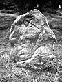 Culbone Inscribed Stone - geograph.org.uk - 6005623.jpg 1,007 × 1,343; 496 KB
-
 Culbone Stables Inn - geograph.org.uk - 2343919.jpg 1,024 × 768; 152 KB
-
 Dead Tree, Allerpark Combe - geograph.org.uk - 1659032.jpg 640 × 430; 177 KB
-
 Dead trees, the marsh - geograph.org.uk - 1658801.jpg 640 × 430; 127 KB
-
 Dead trees, the marsh - geograph.org.uk - 1658840.jpg 640 × 430; 132 KB
-
 Dead Trees, The Marsh - geograph.org.uk - 1706996.jpg 640 × 500; 83 KB
-
 Dean's Orchard - geograph.org.uk - 1660551.jpg 640 × 430; 109 KB
-
 Decoy Linhay - geograph.org.uk - 4407781.jpg 1,920 × 1,393; 794 KB
-
 Detail of Porlock stone circle.jpg 1,552 × 2,592; 1.16 MB
-
 Disclaimer at Worthy Combe - geograph.org.uk - 6291151.jpg 5,472 × 3,648; 5.15 MB
-
 Disused Lime Kiln at Gore Point - geograph.org.uk - 2790465.jpg 3,072 × 2,304; 4.62 MB
-

-
 Dock at Porlock Weir - geograph.org.uk - 2781649.jpg 640 × 459; 253 KB
-
 Doverhay (road) Porlock - geograph.org.uk - 4755608.jpg 1,200 × 799; 356 KB
-
 Doverhay Down - geograph.org.uk - 213812.jpg 640 × 415; 84 KB
-
 Doverhay Farm - geograph.org.uk - 935237.jpg 640 × 480; 81 KB
-
 Doverhay Farm, Porlock - geograph.org.uk - 4804037.jpg 1,024 × 768; 232 KB
-
 Doverhay, Porlock - geograph.org.uk - 2231761.jpg 1,024 × 768; 168 KB
-
 Doverhay, Porlock - geograph.org.uk - 3658048.jpg 640 × 480; 77 KB
-
 Doverhay, Porlock - geograph.org.uk - 6205237.jpg 3,648 × 2,432; 2.87 MB
-
 Dovery Manor Museum - geograph.org.uk - 933896.jpg 480 × 640; 98 KB
-
 Dovery Manor Museum, Porlock - geograph.org.uk - 2231718.jpg 1,024 × 768; 164 KB
-
 Dovery Manor Museum, Porlock - geograph.org.uk - 4980444.jpg 1,024 × 780; 243 KB
-
 Dunster Steep to Porlock - geograph.org.uk - 3561570.jpg 1,500 × 1,000; 272 KB
-
 Dunster Steep, Porlock - geograph.org.uk - 3581475.jpg 1,500 × 1,000; 1.4 MB
-
 Englands Road, Porlock - geograph.org.uk - 3405995.jpg 1,600 × 1,146; 352 KB
-
 Entering Porlock Harbour - geograph.org.uk - 6290112.jpg 5,472 × 3,648; 2.84 MB
-
 Entering Porlock on the Toll Road - geograph.org.uk - 1659227.jpg 640 × 430; 140 KB
-
 Entering West Porlock - geograph.org.uk - 1658903.jpg 640 × 430; 126 KB
-
 Entrance to Greencombe Gardens, Porlock - geograph.org.uk - 6204618.jpg 1,600 × 1,067; 448 KB
-
 Entrance to Porlock churchyard - geograph.org.uk - 1710423.jpg 640 × 480; 108 KB
-
 Entrance to Porlock Recreation Ground - geograph.org.uk - 6205077.jpg 1,600 × 1,067; 403 KB
-
 Entrance to Porlock Weir harbour - geograph.org.uk - 4301406.jpg 1,600 × 1,058; 220 KB
-
 Entrance to St. Dubricius Cof E First School - geograph.org.uk - 6205059.jpg 1,600 × 1,067; 418 KB
-
 Entrance to Worthy Toll Road - geograph.org.uk - 1239544.jpg 640 × 480; 104 KB
-
 Estate workshop, Greencombe Gardens - geograph.org.uk - 6204626.jpg 1,600 × 1,067; 518 KB
-
 Evening view through a gateway, near Culbone - geograph.org.uk - 6287831.jpg 4,000 × 3,000; 5.01 MB
-
 Exmoor from the top of VDV753.jpg 1,024 × 768; 189 KB
-
 Exmoor Glass at Porlock Weir - geograph.org.uk - 3527080.jpg 1,500 × 1,000; 294 KB
-
 Exmoor ponies above Porlock - geograph.org.uk - 6244833.jpg 2,568 × 1,729; 1.11 MB
-
 Exmoor ponies on Porlock Common - geograph.org.uk - 3722511.jpg 1,024 × 768; 289 KB
-
 Exmoor ponies on Porlock Common.jpg 3,496 × 2,644; 3.95 MB
-
 Exmoor pony, near Whit Stones - geograph.org.uk - 2301180.jpg 1,024 × 768; 202 KB
-
 Exmoor, Porlock Common - geograph.org.uk - 1762120.jpg 800 × 535; 435 KB
-
 Exmoor- Porlock Weir Lagoon (5929670353).jpg 1,059 × 720; 209 KB
-
 Exmoor- Stranded Tree (5929661339).jpg 960 × 720; 67 KB
-
 Farm Track on Porlock Common - geograph.org.uk - 3722574.jpg 1,024 × 768; 176 KB
-
 Farmland at Oare Post - geograph.org.uk - 1987587.jpg 640 × 426; 262 KB
-
 Farmland near Eastcott Farm - geograph.org.uk - 2177850.jpg 800 × 600; 106 KB
-
 Farmland NW of Greencombe Gardens - geograph.org.uk - 6204649.jpg 1,600 × 1,067; 478 KB
-
 Feeder stream on Lucott Moor - geograph.org.uk - 3925306.jpg 1,024 × 768; 250 KB
-
 Fence crossing the river - geograph.org.uk - 1658698.jpg 640 × 430; 184 KB
-
 Fern and nettle by the stream - geograph.org.uk - 3527924.jpg 1,500 × 1,000; 174 KB
-
 Ferns at the side of Luccombe Lane - geograph.org.uk - 1660457.jpg 640 × 430; 187 KB
-
 Ferns in Combe Meadow - geograph.org.uk - 3537866.jpg 1,500 × 1,000; 256 KB
-
 Ferns on a wall - geograph.org.uk - 3537899.jpg 1,500 × 1,000; 295 KB
-
 Field boundaries close to the cattle grid, Lucott Moor - geograph.org.uk - 4117142.jpg 2,560 × 1,920; 2.1 MB
-
 Field entrance above Porlock Weir - geograph.org.uk - 5834813.jpg 6,000 × 4,000; 6.21 MB
-
 Field in Pitt Combe - geograph.org.uk - 5846647.jpg 6,000 × 4,000; 5.67 MB
-
 Field of buttercups next to Porlock Beach - geograph.org.uk - 5847763.jpg 6,000 × 4,000; 5.14 MB
-
 Fields near Gore Point - geograph.org.uk - 5834834.jpg 6,000 × 4,000; 5.42 MB
-
 Fields near Porlock - geograph.org.uk - 2265152.jpg 1,024 × 689; 77 KB
-
 Fields near Porlock from toll booth on New Road - geograph.org.uk - 3416108.jpg 1,600 × 1,163; 351 KB
-
 Finger post beside the A39 - geograph.org.uk - 4247729.jpg 846 × 1,280; 1.62 MB
-
 Fingerpost detail - geograph.org.uk - 4247769.jpg 1,280 × 720; 1,019 KB
-
 First Rocks - geograph.org.uk - 3578934.jpg 1,024 × 768; 230 KB
-
 First Rocks at Porlock Weir - geograph.org.uk - 3527056.jpg 1,500 × 1,000; 121 KB


.jpg)


.jpg)


_Porlock_-_geograph.org.uk_-_4755608.jpg)


.jpg)
.jpg)


