Category:Ponds in West Sussex
Jump to navigation
Jump to search
Subcategories
This category has the following 4 subcategories, out of 4 total.
Media in category "Ponds in West Sussex"
The following 200 files are in this category, out of 376 total.
(previous page) (next page)-
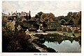
 From the south Sedgwick Park in Gardens Old & New Vol 2 IMG2GO AI.jpg 1,477 × 1,002; 640 KB
-
-
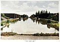
 From the south Sedgwick Park in Gardens Old & New Vol 2.jpg 1,477 × 1,002; 435 KB
-

-
-
-
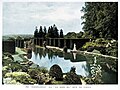
 The White Sea Sedgwick Park in Gardens Old & New Vol 2 IMG2GO AI.jpg 1,414 × 989; 560 KB
-
-
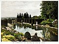
 The White Sea Sedgwick Park in Gardens Old & New Vol 2.jpg 1,414 × 989; 385 KB
-
 Courtyard pond water fountain at Parham House, West Sussex, England.jpg 3,000 × 2,000; 6.03 MB
-
 Courtyard pond water lily Nymphaea at Parham House, West Sussex, England.jpg 3,000 × 2,000; 3.54 MB
-
 Courtyard pondside flowers at Parham House, West Sussex, England.jpg 3,000 × 2,000; 4.88 MB
-
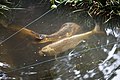
 Highdown Gardens, Worthing, Cave Pond carp 1.jpg 5,427 × 3,618; 20.85 MB
-
 Highdown Gardens, Worthing, Cave Pond carp 2 - Jpeg from RAW.jpg 5,815 × 3,877; 35.95 MB
-
 Highdown Gardens, Worthing, Cave Pond carp 2 - DXO demisting and cloneouts.jpg 5,815 × 3,877; 37 MB
-
 Aldwick Duck Pond - geograph.org.uk - 229766.jpg 640 × 480; 129 KB
-
 Batts Pond, Batts Pond Lane - geograph.org.uk - 739555.jpg 640 × 480; 125 KB
-

-
 Benbow Pond - geograph.org.uk - 260024.jpg 640 × 480; 114 KB
-
 Benbow Pond, Cowdray Park - geograph.org.uk - 416581.jpg 640 × 480; 92 KB
-
 Black Pond from Rake Hanger - geograph.org.uk - 300687.jpg 640 × 480; 110 KB
-
 Brackish Pool - geograph.org.uk - 113249.jpg 640 × 480; 91 KB
-
 Brewhouse pond - geograph.org.uk - 84674.jpg 600 × 447; 85 KB
-
 Burton Mill Pond - geograph.org.uk - 1260268.jpg 640 × 427; 95 KB
-
 Burton Mill Pond - geograph.org.uk - 1318507.jpg 640 × 480; 115 KB
-
 Burton Mill Pond - geograph.org.uk - 1318516.jpg 640 × 480; 94 KB
-
-
 By Burton Mill - geograph.org.uk - 1318526.jpg 640 × 480; 122 KB
-
 Canada goose family.jpg 4,608 × 3,456; 3.62 MB
-
 Canada goose family.JPG 4,608 × 3,456; 3.6 MB
-
 Carterslodge Pond, frozen - geograph.org.uk - 1660223.jpg 640 × 428; 109 KB
-
 Chatfield's Farm pond - geograph.org.uk - 566208.jpg 640 × 480; 88 KB
-
 Chidmere Pond - geograph.org.uk - 227850.jpg 640 × 479; 226 KB
-
 Cognor Wood spring, Kingsley Green 01.jpg 4,128 × 3,096; 10.41 MB
-
 Cognor Wood spring, Kingsley Green 02.jpg 4,128 × 3,096; 8.96 MB
-
 Colgate, Blindman's wood - geograph.org.uk - 646900.jpg 640 × 480; 132 KB
-
 Colgate, woodland pond - geograph.org.uk - 646867.jpg 640 × 480; 128 KB
-
 Crab Pool at Snow Hill - geograph.org.uk - 1366232.jpg 640 × 427; 231 KB
-
 Crateman's Farm.JPG 4,608 × 3,456; 5.32 MB
-
 Cullimer's Pond - geograph.org.uk - 1264463.jpg 480 × 640; 123 KB
-
 Decoy Pond - geograph.org.uk - 1255063.jpg 480 × 640; 63 KB
-
 Decoy Pond - geograph.org.uk - 1255069.jpg 480 × 640; 113 KB
-
 Decoy Pond - geograph.org.uk - 1255078.jpg 480 × 640; 172 KB
-
 Dew pond North hill, Newtimber - geograph.org.uk - 388299.jpg 640 × 480; 103 KB
-
 Dew pond off South Downs Way - geograph.org.uk - 812649.jpg 640 × 480; 66 KB
-
 Dew pond on the eastern slope of West Hill - geograph.org.uk - 1745125.jpg 1,600 × 1,200; 555 KB
-
 Dew pond on West hill, Newtimber - geograph.org.uk - 388352.jpg 640 × 480; 69 KB
-
 Dewpond off South Downs Way - geograph.org.uk - 730131.jpg 640 × 480; 55 KB
-
 Dry pond - geograph.org.uk - 637409.jpg 640 × 480; 80 KB
-
 Duck Pond at Bigges Farm - geograph.org.uk - 1470423.jpg 640 × 480; 120 KB
-

-
 Duck pond at Saddlescombe Farm - geograph.org.uk - 1743771.jpg 1,600 × 1,200; 724 KB
-
-

-
 Duckpond on Nye's Hill Farm - geograph.org.uk - 252620.jpg 640 × 392; 76 KB
-
 Ducks at Nymans Gardens - geograph.org.uk - 1072015.jpg 640 × 480; 103 KB
-
 Ducks on a frozen Patching Pond - geograph.org.uk - 1629452.jpg 640 × 480; 99 KB
-

-
 Ducks on pond - geograph.org.uk - 1544736.jpg 640 × 480; 110 KB
-
 Duncton Mill - geograph.org.uk - 201282.jpg 640 × 480; 122 KB
-
 Fallen tree in stagnant pond - geograph.org.uk - 1691229.jpg 1,600 × 1,200; 843 KB
-
 Ferry Pool - geograph.org.uk - 501589.jpg 640 × 472; 139 KB
-
 Fishbourne Mill Pond, West Sussex showing weeping willow at east end of pond (2205o).jpg 4,000 × 3,000; 3.46 MB
-
 Fishing pond at Duncton Mill - geograph.org.uk - 1456838.jpg 640 × 480; 100 KB
-
 Fishing pond in Birchgrove Wood - geograph.org.uk - 1532360.jpg 640 × 480; 69 KB
-
 Fishing pond in Pheasant Copse - geograph.org.uk - 1480664.jpg 640 × 480; 83 KB
-
 Fishing shelter, Southwater Country Park - geograph.org.uk - 237462.jpg 640 × 429; 390 KB
-
 Flooded pit - geograph.org.uk - 1672212.jpg 640 × 428; 164 KB
-
 Folly Pond - geograph.org.uk - 406210.jpg 640 × 480; 168 KB
-
 Frozen Pond - geograph.org.uk - 1107381.jpg 458 × 640; 122 KB
-
 Frozen pond in Lower Calhams - geograph.org.uk - 1151584.jpg 640 × 360; 108 KB
-
 Frozen Pond near Longhovel Cottages - geograph.org.uk - 1107784.jpg 479 × 640; 125 KB
-
 Frozen Pond, Hassocks Golf Course - geograph.org.uk - 1632276.jpg 640 × 480; 62 KB
-
 Frozen Pond, Stoneman's Copse - geograph.org.uk - 1631754.jpg 640 × 480; 135 KB
-
 Furnace Pond - geograph.org.uk - 862160.jpg 640 × 480; 71 KB
-
 Furnace Pond in Furnace Wood - geograph.org.uk - 1165598.jpg 640 × 360; 70 KB
-
 Furnace Pond, Slaugham Common - geograph.org.uk - 895601.jpg 640 × 479; 74 KB
-
 Furnace Pond, Slaugham Common - geograph.org.uk - 896894.jpg 479 × 640; 107 KB
-
 Geese by pond at Goddenwick Farm - geograph.org.uk - 1780632.jpg 1,600 × 1,200; 779 KB
-
 Gosden Mill Pond - geograph.org.uk - 896593.jpg 640 × 479; 103 KB
-
 Great Spring Pond Petworth Park - geograph.org.uk - 1480644.jpg 640 × 480; 76 KB
-

-
 Half frozen pool - geograph.org.uk - 113187.jpg 640 × 480; 65 KB
-
 Hammer Pond by Stedlands Farm - geograph.org.uk - 303152.jpg 480 × 640; 103 KB
-

-
 Hawkins Pond, Horsham - geograph.org.uk - 364068.jpg 600 × 410; 73 KB
-
 Heyshoot Pond - geograph.org.uk - 204464.jpg 640 × 480; 148 KB
-
 Hobshort's Farm.JPG 4,608 × 3,456; 5.11 MB
-
 Hobshorts Farmhouse.jpg 4,608 × 3,456; 6.88 MB
-

-
 Island on riverside pool - geograph.org.uk - 1220804.jpg 640 × 480; 67 KB
-
 Jetty, Furnace Pond - geograph.org.uk - 896886.jpg 479 × 640; 142 KB
-
 Knepp Mill Pond - geograph.org.uk - 1719015.jpg 2,592 × 1,944; 2.13 MB
-
 Kneppmill Pond (geograph 4704191).jpg 4,608 × 3,456; 3.6 MB
-
 Kneppmill Pond, Shipley (geograph 4257416).jpg 640 × 420; 178 KB
-
 Kneppmill Pond.jpg 4,608 × 3,456; 3.91 MB
-
-
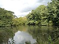
 Lake at bottom of garden - geograph.org.uk - 1133411.jpg 640 × 480; 130 KB
-
 Lake in front of Lower House Farm - geograph.org.uk - 1417195.jpg 640 × 360; 55 KB
-

-

-
-
 Lone duck on Peter Pond - geograph.org.uk - 805440.jpg 640 × 480; 52 KB
-
 Lot's Pond, Grubbings - geograph.org.uk - 596312.jpg 640 × 479; 140 KB
-
 Lovely pond at Bridge Farm - geograph.org.uk - 789076.jpg 640 × 480; 107 KB
-
 Lower North Pond, Shillinglee - geograph.org.uk - 1411642.jpg 640 × 480; 254 KB
-
 Lower Pond - geograph.org.uk - 732248.jpg 640 × 359; 46 KB
-
 Manmade pond on the Eastlands Estate - geograph.org.uk - 1282052.jpg 640 × 480; 97 KB
-
 Mansion Pond - geograph.org.uk - 1260460.jpg 640 × 480; 88 KB
-
 Match Pond At Sumners Ponds - geograph.org.uk - 565140.jpg 640 × 480; 252 KB
-
 Millpond at Mill Farm - geograph.org.uk - 1731107.jpg 1,600 × 1,200; 316 KB
-
 Millpond near Mill Lane - geograph.org.uk - 1601182.jpg 640 × 480; 92 KB
-
 Millpond near Milland - geograph.org.uk - 1192112.jpg 640 × 377; 83 KB
-
 MOD notice at Stanbury Point - geograph.org.uk - 1715362.jpg 2,592 × 1,944; 2.15 MB
-
 New Pond in Autumn - geograph.org.uk - 1045270.jpg 640 × 480; 59 KB
-
 New Pond, Leonardslee - geograph.org.uk - 896632.jpg 640 × 479; 86 KB
-
 North Park Furnace, Fernhurst 24.jpg 3,000 × 4,000; 2.76 MB
-
 North Park Furnace, Fernhurst 54.jpg 4,000 × 3,000; 4 MB
-
 North Park Furnace, Fernhurst 66.jpg 4,000 × 3,000; 4 MB
-
 North Park Furnace, Fernhurst 67.jpg 4,000 × 3,000; 3.86 MB
-
 North Park Furnace, Fernhurst 68.jpg 4,000 × 3,000; 4.97 MB
-
 Old Hammer Pond on the Knepp Estate (geograph 4704336).jpg 4,608 × 3,456; 3.58 MB
-
 Ornamental pond (2542081284).jpg 3,872 × 2,592; 6.9 MB
-
 Outbuildings at Sakeham Farm.jpg 2,048 × 1,536; 1.62 MB
-
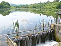
 Outfall from Furnace Pond - geograph.org.uk - 1611356.jpg 640 × 360; 72 KB
-
 Outflow from millpond - geograph.org.uk - 1731183.jpg 1,600 × 1,200; 489 KB
-
 Over flow - geograph.org.uk - 1125583.jpg 640 × 480; 99 KB
-
 Overflow from Slaugham Pond - geograph.org.uk - 1134316.jpg 640 × 480; 99 KB
-
 Overgrown pond on River Common - geograph.org.uk - 1730020.jpg 1,600 × 1,200; 630 KB
-
 Owlbeech wood pond - geograph.org.uk - 637424.jpg 640 × 480; 107 KB
-
 Owlbeech wood pond - geograph.org.uk - 637432.jpg 640 × 480; 114 KB
-
 Partly frozen duck pond - geograph.org.uk - 1660357.jpg 640 × 428; 144 KB
-
 Patching Pond - geograph.org.uk - 1329183.jpg 640 × 480; 139 KB
-
 Patching Pond - geograph.org.uk - 1629456.jpg 640 × 480; 79 KB
-
 Pepper's Pond - geograph.org.uk - 1317997.jpg 640 × 480; 143 KB
-
 Petworth Deer Park, Lake and House. - geograph.org.uk - 175591.jpg 640 × 437; 115 KB
-
 Petworth House and park - geograph.org.uk - 365.jpg 640 × 479; 60 KB
-
 Petworth House and Park from across pond.jpg 4,592 × 3,056; 10.15 MB
-
 Petworth panoràmica.jpg 7,632 × 1,681; 3.04 MB
-
 Picturesque pond at Bignor Mill - geograph.org.uk - 1247955.jpg 640 × 480; 119 KB
-

-
 Pond adjacent to Broadbridge Farm - geograph.org.uk - 1319592.jpg 640 × 480; 118 KB
-
 Pond and house at Linchmere Marsh - geograph.org.uk - 975060.jpg 640 × 480; 147 KB
-

-
 Pond and permissive path - geograph.org.uk - 672415.jpg 640 × 480; 123 KB
-
 Pond at bottom of valley. - geograph.org.uk - 1206443.jpg 480 × 640; 152 KB
-
 Pond at Cowdown Farm - geograph.org.uk - 356017.jpg 640 × 477; 114 KB
-
 Pond at entrance to Lydhurst - geograph.org.uk - 1602060.jpg 640 × 480; 112 KB
-
 Pond at Hatterell's farm - geograph.org.uk - 400018.jpg 640 × 480; 107 KB
-
 Pond at Henfield - geograph.org.uk - 571131.jpg 640 × 480; 123 KB
-
 Pond at Jamesland farm, Copsale - geograph.org.uk - 414040.jpg 640 × 480; 144 KB
-
 Pond at Leonardslee Gardens - geograph.org.uk - 1291399.jpg 640 × 427; 94 KB
-
 Pond at Mitchell Park Farm - geograph.org.uk - 1749305.jpg 800 × 600; 128 KB
-
 Pond at North End Farm - geograph.org.uk - 1109104.jpg 640 × 479; 104 KB
-
 Pond at Nyetimber Farm - geograph.org.uk - 1184255.jpg 640 × 480; 133 KB
-
 Pond at River Park Farm - geograph.org.uk - 1213996.jpg 360 × 640; 54 KB
-
 Pond at South House Farm - geograph.org.uk - 1194500.jpg 640 × 480; 120 KB
-
 Pond at southern end of Weyhurst Copse - geograph.org.uk - 250710.jpg 640 × 480; 121 KB
-
 Pond at Standen House - geograph.org.uk - 1192785.jpg 640 × 360; 100 KB
-
 Pond at Threal's Farm - geograph.org.uk - 1671215.jpg 1,600 × 1,200; 578 KB
-
 Pond below aborted embankment - geograph.org.uk - 1754516.jpg 640 × 428; 177 KB
-
 Pond beside Dumpford Lane - geograph.org.uk - 1719756.jpg 1,024 × 769; 385 KB
-
 Pond beside Ford Clappers - geograph.org.uk - 1296533.jpg 640 × 480; 80 KB
-
 Pond by footpath near Byworth - geograph.org.uk - 1099656.jpg 640 × 360; 98 KB
-
 Pond by Highbuilding Farm - geograph.org.uk - 1166322.jpg 640 × 360; 74 KB
-
 Pond by Lower Barn, Shipley - geograph.org.uk - 431579.jpg 640 × 480; 130 KB
-
 Pond by Nuthurst road - geograph.org.uk - 403880.jpg 640 × 480; 159 KB
-
 Pond by Sun oak - geograph.org.uk - 407279.jpg 640 × 480; 200 KB
-
 Pond by the Arun Valley Line - geograph.org.uk - 1293446.jpg 640 × 430; 135 KB
-
 Pond eyes - geograph.org.uk - 1601180.jpg 640 × 480; 132 KB
-
 Pond fed by stream on Iron Hill - geograph.org.uk - 1127628.jpg 640 × 360; 78 KB
-
 Pond from Garden Wood Road - geograph.org.uk - 771681.jpg 479 × 640; 160 KB
-
 Pond halfway down Iron Gill - geograph.org.uk - 1603652.jpg 640 × 480; 100 KB
-
 Pond in a meadow near Old Park Copse - geograph.org.uk - 1333648.jpg 640 × 453; 108 KB
-
 Pond in Cognor Wood - geograph.org.uk - 975000.jpg 640 × 480; 169 KB
-
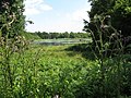
 Pond in field - geograph.org.uk - 1078892.jpg 640 × 480; 111 KB
-
 Pond in field - geograph.org.uk - 1133499.jpg 640 × 480; 102 KB
-

-
-

-
 Pond in Wisborough Green - geograph.org.uk - 1330689.jpg 640 × 480; 74 KB
-
 Pond in Wymarks Wood - geograph.org.uk - 34878.jpg 480 × 640; 151 KB
-
 Pond near Bepton Church - geograph.org.uk - 736153.jpg 640 × 480; 147 KB
-
 Pond near Bepton Church - geograph.org.uk - 736172.jpg 640 × 480; 166 KB
-
 Pond near Chatsfield Farm - geograph.org.uk - 1045279.jpg 640 × 480; 73 KB
-
 Pond near Clay Lane - geograph.org.uk - 1251280.jpg 480 × 640; 116 KB
-
 Pond near Decoy Wood - geograph.org.uk - 1255007.jpg 640 × 480; 46 KB
-
 Pond near Decoy Wood - geograph.org.uk - 1255013.jpg 640 × 487; 67 KB
-
 Pond near Halfway - geograph.org.uk - 684554.jpg 640 × 479; 93 KB
-

-
 Pond near Horton Wood - geograph.org.uk - 757013.jpg 479 × 640; 140 KB
-
 Pond near Lower Dairy - geograph.org.uk - 779155.jpg 479 × 640; 147 KB
-
 Pond near Lower Pratts Farm - geograph.org.uk - 1293785.jpg 640 × 430; 142 KB
-
 Pond near Loxwood - geograph.org.uk - 1541290.jpg 640 × 360; 95 KB
-
 Pond near Malham - geograph.org.uk - 778906.jpg 640 × 482; 64 KB
-
 Pond near Malham - geograph.org.uk - 778908.jpg 479 × 640; 118 KB
-
 Pond near New Place - geograph.org.uk - 297227.jpg 640 × 479; 189 KB
-
 Pond near Poynings - geograph.org.uk - 1037985.jpg 451 × 640; 76 KB
-
 Pond near Poynings - geograph.org.uk - 377067.jpg 640 × 479; 146 KB
-
 Pond near repaired bridleway - geograph.org.uk - 1196926.jpg 640 × 480; 128 KB


.jpg)


.jpg)
.jpg)


.jpg)
.jpg)


_at_Birchen_Bridge,_West_Sussex._-_geograph.org.uk_-_86303.jpg)


