Category:Political maps of Montgomery County, Ohio as of the 2000 United States Census
Jump to navigation
Jump to search
Media in category "Political maps of Montgomery County, Ohio as of the 2000 United States Census"
The following 34 files are in this category, out of 34 total.
-
 Map of Montgomery County Ohio Highlighting Brookville City.png 1,006 × 1,037; 62 KB
-
 Map of Montgomery County Ohio Highlighting Butler Township.png 1,006 × 1,037; 62 KB
-
 Map of Montgomery County Ohio Highlighting Carlisle Village.png 1,006 × 1,037; 62 KB
-
 Map of Montgomery County Ohio Highlighting Centerville City.png 1,006 × 1,037; 62 KB
-
 Map of Montgomery County Ohio Highlighting Clay Township.png 1,006 × 1,037; 62 KB
-
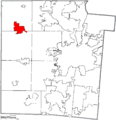
 Map of Montgomery County Ohio Highlighting Clayton City.png 1,006 × 1,037; 62 KB
-
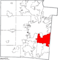
 Map of Montgomery County Ohio Highlighting Dayton City.png 1,006 × 1,037; 63 KB
-
 Map of Montgomery County Ohio Highlighting Englewood City.png 1,006 × 1,037; 62 KB
-
 Map of Montgomery County Ohio Highlighting Farmersville Village.png 1,006 × 1,037; 62 KB
-
 Map of Montgomery County Ohio Highlighting German Township.png 1,006 × 1,037; 62 KB
-
 Map of Montgomery County Ohio Highlighting Germantown City.png 1,006 × 1,037; 62 KB
-
 Map of Montgomery County Ohio Highlighting Harrison Township.png 1,006 × 1,037; 62 KB
-
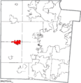
 Map of Montgomery County Ohio Highlighting Huber Heights City.png 1,006 × 1,037; 62 KB
-
 Map of Montgomery County Ohio Highlighting Jackson Township.png 1,006 × 1,037; 62 KB
-
 Map of Montgomery County Ohio Highlighting Jefferson Township.png 1,006 × 1,037; 62 KB
-
 Map of Montgomery County Ohio Highlighting Kettering City.png 1,006 × 1,037; 62 KB
-
 Map of Montgomery County Ohio Highlighting Miami Township.png 1,006 × 1,037; 62 KB
-
 Map of Montgomery County Ohio Highlighting Miamisburg City.png 1,006 × 1,037; 62 KB
-
 Map of Montgomery County Ohio Highlighting Moraine City.png 1,006 × 1,037; 62 KB
-
 Map of Montgomery County Ohio Highlighting New Lebanon Village.png 1,006 × 1,037; 62 KB
-
 Map of Montgomery County Ohio Highlighting Oakwood City.png 1,006 × 1,037; 62 KB
-
 Map of Montgomery County Ohio Highlighting Perry Township.png 1,006 × 1,037; 62 KB
-
 Map of Montgomery County Ohio Highlighting Phillipsburg Village.png 1,006 × 1,037; 62 KB
-
 Map of Montgomery County Ohio Highlighting Riverside City.png 1,006 × 1,037; 62 KB
-
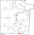 Map of Montgomery County Ohio Highlighting Springboro City.png 1,006 × 1,037; 62 KB
-
 Map of Montgomery County Ohio Highlighting Trotwood City.png 1,006 × 1,037; 62 KB
-
 Map of Montgomery County Ohio Highlighting Union City.png 1,006 × 1,037; 62 KB
-
 Map of Montgomery County Ohio Highlighting Vandalia City.png 1,006 × 1,037; 62 KB
-
 Map of Montgomery County Ohio Highlighting Verona Village.png 1,006 × 1,037; 62 KB
-
 Map of Montgomery County Ohio Highlighting Washington Township.png 1,006 × 1,037; 62 KB
-
 Map of Montgomery County Ohio Highlighting West Carrollton City.png 1,006 × 1,037; 62 KB
-
 Map of Montgomery County Ohio With Municipal and Township Labels.PNG 1,006 × 1,037; 106 KB
-
 Map of Montgomery County, Ohio No Text, Municipalities Distinct.png 1,006 × 1,037; 62 KB
-
 Map of Montgomery County, Ohio No Text.png 1,006 × 1,037; 61 KB


