Category:Plymouth Sound
Jump to navigation
Jump to search
bay at Plymouth, England  | |||||
| Upload media | |||||
| Instance of | |||||
|---|---|---|---|---|---|
| Part of | |||||
| Location |
| ||||
| Located in or next to body of water | |||||
| Inflows | |||||
 | |||||
Subcategories
This category has the following 19 subcategories, out of 19 total.
A
B
- Bovisand Bay, Devon (21 F)
C
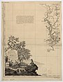
- Charts of Plymouth Sound (8 F)
D
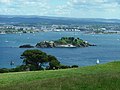
- Drake's Island (162 F)
M
- Mount Batten Breakwater (51 F)
P
- Penlee Point, Maker-with-Rame (27 F)
- Picklecombe Fort (20 F)
R
S
- Shag Stone (2 F)
- Ships in Plymouth Sound (154 F)
T
W
- West Hoe Harbour (52 F)
- Westlake Bay (7 F)
Media in category "Plymouth Sound"
The following 177 files are in this category, out of 177 total.
-
 B(1871) p015 FLYING SQUADRON, PLYMOUTH SOUND, JUNE, 1869.jpg 2,237 × 1,460; 1.65 MB
-
 Charles Edward Dixon HMS Formidable 1898 Plymouth Sound.jpg 4,548 × 3,183; 24.29 MB
-

-
-
 A marker buoy in Plymouth Sound - geograph.org.uk - 3439700.jpg 640 × 480; 54 KB
-
 A View from Staddon Cliffs.jpg 640 × 311; 46 KB
-
 Andurn Point - geograph.org.uk - 1271548.jpg 640 × 480; 91 KB
-
 Andurn Point - geograph.org.uk - 491230.jpg 640 × 480; 135 KB
-
 Armed Forces Day National Event in Plymouth MOD 45154073.jpg 3,477 × 2,011; 760 KB
-
 Armed Forces Day National Event in Plymouth MOD 45154074.jpg 3,241 × 2,157; 762 KB
-
 Armed Forces Day National Event in Plymouth MOD 45154075.jpg 3,241 × 2,157; 1.24 MB
-
 Barbican-plymouth.jpg 3,648 × 2,736; 2.98 MB
-
 Batten Bay - geograph.org.uk - 1580428.jpg 640 × 480; 101 KB
-
 Batten Bay.jpg 640 × 480; 68 KB
-
 Boat in Plymouth Sound (4183).jpg 4,288 × 2,848; 5.48 MB
-
 Boat in Plymouth Sound (4186).jpg 4,288 × 2,848; 5.28 MB
-
 Boat in Plymouth Sound (6147).jpg 4,288 × 2,848; 6.16 MB
-
 Boat in Plymouth Sound (6148).jpg 4,288 × 2,848; 6.12 MB
-
 Boat off Redding Point - geograph.org.uk - 5600443.jpg 640 × 425; 69 KB
-
 Bovisand , Plymouth Breakwater - geograph.org.uk - 3057330.jpg 4,224 × 2,750; 4.89 MB
-

-
 Coast path near Staddon Cottage (2) - geograph.org.uk - 1580083.jpg 640 × 494; 116 KB
-
 Coast path near Staddon Cottage - geograph.org.uk - 1580042.jpg 640 × 460; 70 KB
-
 Coastal Defences, Plymouth Sound - geograph.org.uk - 3284718.jpg 640 × 427; 56 KB
-
 Concrete Steps acscending.jpg 4,496 × 3,000; 5.01 MB
-
 Cremyll , Coastline - geograph.org.uk - 1145243.jpg 640 × 480; 54 KB
-
 Crepuscular rays over Plymouth Sound.jpg 3,768 × 2,181; 1.91 MB
-
 Defences in channel by Drake's Island.jpg 3,408 × 2,576; 4.17 MB
-
 Drake's Island - geograph.org.uk - 51145.jpg 640 × 480; 103 KB
-
 Firestone Bay from Mount Edgcumbe.jpg 3,928 × 2,720; 5.56 MB
-
 Fishing boat in Plymouth Sound (6150).jpg 4,288 × 2,848; 5.31 MB
-
 Fishing boat in Plymouth Sound (6157).jpg 4,288 × 2,848; 6.75 MB
-
 Fishing boat in Plymouth Sound (6161).jpg 4,288 × 2,848; 6.2 MB
-
 Foreshore at Mount Batten - geograph.org.uk - 1214680.jpg 640 × 427; 124 KB
-
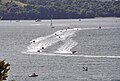 Formula 4-stroke powerboats in Plymouth Sound.jpg 3,956 × 2,660; 4.04 MB
-
 From the South West Coast Path - geograph.org.uk - 224327.jpg 640 × 427; 100 KB
-

-

-
 Heybrook Bay and Plymouth Sound.jpg 3,692 × 2,744; 2.52 MB
-
 Hoe Lake to Picklecombe - geograph.org.uk - 356426.jpg 640 × 480; 118 KB
-
 Jennycliff Beach - geograph.org.uk - 1247319.jpg 640 × 428; 105 KB
-
 Jennycliff Beach - geograph.org.uk - 1247332.jpg 640 × 428; 102 KB
-

-
 Kayaks in Westlake Bay.jpg 3,664 × 2,848; 5.41 MB
-
 Kingsand and cawsand from the sea - geograph.org.uk - 357165.jpg 640 × 425; 55 KB
-
-
 Landing craft and tugs off Drake's Island (4182).jpg 4,288 × 2,848; 4.47 MB
-
 Landing craft in Plymouth Sound (4172).jpg 4,288 × 2,848; 6.3 MB
-
 Landslide near Redding Point - geograph.org.uk - 5600447.jpg 640 × 426; 58 KB
-
 Lion's Den - Plymouth Hoe - geograph.org.uk - 1398587.jpg 640 × 404; 94 KB
-

-
 Low tide at Audurn Point - geograph.org.uk - 2485127.jpg 1,024 × 768; 242 KB
-
 Marine raider. - panoramio.jpg 2,816 × 2,120; 1.44 MB
-
 Me on board Marine raider. - panoramio.jpg 2,816 × 2,120; 1.38 MB
-
 Mount Batten, Plymouth - geograph.org.uk - 43502.jpg 640 × 427; 65 KB
-

-
 Mount Edgecombe to Picklecombe - geograph.org.uk - 355992.jpg 640 × 191; 17 KB
-

-
-

-
 On Dunstone Point - geograph.org.uk - 1555233.jpg 640 × 480; 87 KB
-
 On Staddon Heights - geograph.org.uk - 1580203.jpg 640 × 463; 89 KB
-
 P1 Powerboats in Plymouth Sound 3.jpg 3,129 × 2,431; 2.24 MB
-
 Pleasure boats in Plymouth Sound - geograph.org.uk - 1398565.jpg 640 × 404; 73 KB
-
 Plymouth , Coastline - geograph.org.uk - 1145096.jpg 640 × 480; 69 KB
-
 Plymouth , Coastline - geograph.org.uk - 1180745.jpg 640 × 480; 82 KB
-
 Plymouth , Coastline - geograph.org.uk - 1180746.jpg 640 × 480; 81 KB
-

-
 Plymouth , Plymouth Coastline - geograph.org.uk - 1145138.jpg 640 × 480; 56 KB
-
 Plymouth , Plymouth Sound - geograph.org.uk - 1178305.jpg 640 × 480; 55 KB
-
 Plymouth , Plymouth Sound - geograph.org.uk - 1445718.jpg 640 × 243; 25 KB
-
-

-

-
 Plymouth - btv1b53010225b.jpg 7,702 × 6,405; 11.51 MB
-
 Plymouth Breakwater and the Mewstone (3306).jpg 4,288 × 2,848; 5.23 MB
-
 Plymouth Cliff Road.jpg 2,741 × 690; 1,003 KB
-
 Plymouth from Kit Hill.jpg 3,856 × 2,758; 3.28 MB
-
 Plymouth from Mount Batten - geograph.org.uk - 1580485.jpg 640 × 364; 49 KB
-
 Plymouth harbour navigation marker - geograph.org.uk - 166384.jpg 640 × 480; 245 KB
-

-
 Plymouth Hoe - geograph.org.uk - 816593.jpg 640 × 457; 104 KB
-
 Plymouth Hoe - geograph.org.uk - 845367.jpg 640 × 480; 53 KB
-

-
 Plymouth Hoe from Staddon Heights.jpg 4,068 × 2,731; 4.77 MB
-
 Plymouth Silo. - panoramio.jpg 2,816 × 2,120; 1.44 MB
-
 Plymouth Sound , Coastal Scenery - geograph.org.uk - 3486029.jpg 4,288 × 2,848; 4.94 MB
-
 Plymouth Sound , Coastal Scenery - geograph.org.uk - 3486035.jpg 4,288 × 2,848; 5.16 MB
-
 Plymouth Sound , Coastline ^ Breakwater - geograph.org.uk - 3486026.jpg 4,288 × 2,848; 5.42 MB
-
 Plymouth Sound , Cornish Coastline - geograph.org.uk - 3486022.jpg 4,288 × 2,848; 4.83 MB
-
 Plymouth Sound , Picklecombe Point - geograph.org.uk - 3486033.jpg 4,288 × 2,848; 5.53 MB
-
 Plymouth Sound , Plymouth Hoe Scenery - geograph.org.uk - 3486034.jpg 4,288 × 2,848; 4.25 MB
-
 Plymouth Sound , Redding Point ^ Coastline - geograph.org.uk - 3486036.jpg 4,236 × 2,768; 3.58 MB
-
 Plymouth Sound , Staddon Point - geograph.org.uk - 3486032.jpg 4,288 × 2,848; 4.63 MB
-
 Plymouth Sound - geograph.org.uk - 38360.jpg 640 × 480; 103 KB
-
 Plymouth Sound - geograph.org.uk - 4077181.jpg 1,600 × 1,200; 590 KB
-
 Plymouth Sound - geograph.org.uk - 4870411.jpg 640 × 141; 12 KB
-
 Plymouth Sound - geograph.org.uk - 5265125.jpg 640 × 426; 74 KB
-
 Plymouth Sound - geograph.org.uk - 583685.jpg 640 × 427; 70 KB
-
 Plymouth Sound and the Hamoaze from Bovisand (8762).jpg 4,288 × 2,848; 4.83 MB
-
 Plymouth Sound at evening light - geograph.org.uk - 89777.jpg 640 × 480; 41 KB
-
 Plymouth Sound B.jpg 3,264 × 2,448; 2.84 MB
-
 Plymouth Sound Breakwater and fort - geograph.org.uk - 5631300.jpg 640 × 426; 26 KB
-
 Plymouth Sound C.jpg 3,264 × 2,448; 2.71 MB
-
 Plymouth Sound from Jennycliff (2437).jpg 4,288 × 2,848; 6.69 MB
-
 Plymouth Sound from Penlee Point (2776).jpg 4,288 × 2,848; 4.05 MB
-
 Plymouth Sound from Staddon Heights (6080).jpg 4,288 × 2,848; 4.86 MB
-
 Plymouth Sound from Staddon Heights (6081).jpg 4,288 × 2,848; 5.14 MB
-
 Plymouth Sound from Staddon Heights (6082).jpg 4,288 × 2,848; 5.66 MB
-
 Plymouth Sound from Staddon Heights (6088).jpg 4,288 × 2,848; 5.86 MB
-
 Plymouth Sound from Staddon Heights (6089).jpg 4,288 × 2,848; 6.07 MB
-
 Plymouth Sound from Staddon Heights (6090).jpg 4,288 × 2,848; 6.2 MB
-
 Plymouth Sound from Staddon Heights (6113).jpg 4,288 × 2,848; 4.37 MB
-
 Plymouth Sound from Staddon Heights (6127).jpg 4,288 × 2,848; 4.74 MB
-
 Plymouth sound from the Hoe - geograph.org.uk - 32448.jpg 640 × 216; 25 KB
-
 Plymouth Sound from the Hoe - geograph.org.uk - 583683.jpg 640 × 427; 70 KB
-
 Plymouth sound from wembury.jpg 2,592 × 1,944; 351 KB
-
 Plymouth Sound.jpg 2,048 × 1,536; 1 MB
-
 Plymouth Trawler Race - geograph.org.uk - 359362.jpg 640 × 444; 48 KB
-
 Plymouth, Hamoaze and Devil's Point - geograph.org.uk - 498631.jpg 640 × 414; 108 KB
-
 Plymouth, Jennycliff Bay - geograph.org.uk - 583099.jpg 640 × 429; 54 KB
-
 Plymouth, The Hoe - geograph.org.uk - 498671.jpg 640 × 427; 138 KB
-
 Plymouth, towards the Breakwater - geograph.org.uk - 498632.jpg 640 × 427; 101 KB
-
 Plymouth, UK - panoramio (2).jpg 3,264 × 2,448; 1.55 MB
-
 PlymouthSub.JPG 2,048 × 1,536; 852 KB
-
 Plynouth Sound A.jpg 3,264 × 2,448; 3.24 MB
-
 Queen's Ground port hand buoy - geograph.org.uk - 1476887.jpg 640 × 480; 101 KB
-
 Rams Cliff - geograph.org.uk - 1580104.jpg 640 × 480; 107 KB
-
 Redding Point - geograph.org.uk - 5600462.jpg 640 × 425; 73 KB
-

-
 Rocky foreshore at Devil's Point - geograph.org.uk - 917282.jpg 480 × 640; 77 KB
-
 Rocky foreshore on Leekbed Bay - geograph.org.uk - 1556904.jpg 640 × 480; 89 KB
-
 Royal Citadel, Plymouth1.jpg 640 × 459; 62 KB
-
-

-
 Sandway Point - geograph.org.uk - 150254.jpg 640 × 480; 87 KB
-
 Sea - panoramio (38).jpg 2,592 × 1,936; 1.83 MB
-
 Shag Stone - geograph.org.uk - 8430.jpg 640 × 480; 92 KB
-
 Shell Top and Plymouth Sound.jpg 3,769 × 2,742; 2.32 MB
-
 Ship anchored in Plymouth Sound - geograph.org.uk - 5631296.jpg 640 × 426; 28 KB
-
 Shoreline near Fort Picklecombe - geograph.org.uk - 224302.jpg 640 × 427; 84 KB
-
 Shower in Cawsand Bay (4612).jpg 4,288 × 2,848; 4.88 MB
-
 Shower in Cawsand Bay (4613).jpg 4,288 × 2,848; 5.14 MB
-
 Small Craft Moorings, Drake's Channel - geograph.org.uk - 85908.jpg 640 × 480; 63 KB
-
 South Hams , Bovisand Bay - geograph.org.uk - 3057322.jpg 4,288 × 2,848; 6.21 MB
-
 South Hams , Plymouth Sound - geograph.org.uk - 3057324.jpg 4,288 × 2,848; 4.77 MB
-
 South Hams , Plymouth Sound Scenery - geograph.org.uk - 3055652.jpg 4,200 × 2,710; 4.72 MB
-
 South Hams , Plymouth Sound ^ Coastline - geograph.org.uk - 3055640.jpg 4,206 × 2,720; 5.17 MB
-
 South Hams , Renney Point - geograph.org.uk - 3055606.jpg 4,218 × 2,740; 5.11 MB
-
 South Hams , Snorkeler at Heybrook Bay - geograph.org.uk - 3055578.jpg 4,288 × 2,848; 5.05 MB
-

-

-
 Speedboat in Plymouth Sound from Cremyll (0850).jpg 4,288 × 2,848; 5.61 MB
-
 Speedboat in Plymouth Sound from Cremyll (0851).jpg 4,288 × 2,848; 5.16 MB
-
 Speedboat in Plymouth Sound from Cremyll (0852).jpg 4,288 × 2,848; 5.31 MB
-
 Swimming Pool - geograph.org.uk - 907506.jpg 640 × 428; 81 KB
-
 Swimming Pool in Firestone Bay.jpg 2,841 × 1,773; 1.69 MB
-
 Tamar Estuary Nature Reserve - geograph.org.uk - 468858.jpg 640 × 427; 111 KB
-
 Tamar Estuary Nature Reserve - geograph.org.uk - 468863.jpg 640 × 427; 101 KB
-
 The coast path south of Ramscliff Point - geograph.org.uk - 1555285.jpg 480 × 640; 110 KB
-
 The Hamoaze from Staddon Heights (6168).jpg 4,288 × 2,848; 4.77 MB
-
 The Knap buoy, Plymouth Sound - geograph.org.uk - 6232323.jpg 1,264 × 1,000; 652 KB
-
 The Sound - geograph.org.uk - 47559.jpg 640 × 439; 45 KB
-
 Torpoint panorama - geograph.org.uk - 355939.jpg 640 × 193; 31 KB
-
 Tug in Plymouth Sound (5028).jpg 4,288 × 2,848; 4.61 MB
-
 View from Mount Edgcumbe - geograph.org.uk - 102079.jpg 640 × 431; 61 KB
-
 View from Smeaton's Tower Plymouth - geograph.org.uk - 422624.jpg 640 × 480; 194 KB
-
 View from Stalldown over Plymouth sound.jpg 2,048 × 1,536; 1.46 MB
-
 Wave-cut platform, Andurn Point - geograph.org.uk - 1579755.jpg 640 × 431; 99 KB
-
 Wembury, towards Plymouth Sound - geograph.org.uk - 680442.jpg 640 × 421; 141 KB
-
 Wenceslas Hollar - Plymouth Sound.jpg 2,602 × 1,259; 1,012 KB
-
 Wenceslas Hollar - Plymouth.jpg 2,590 × 1,222; 1.06 MB
-
 Western King Point - geograph.org.uk - 1735501.jpg 3,072 × 2,304; 2.55 MB
-

-
 Wooded coastline - geograph.org.uk - 5600451.jpg 640 × 425; 79 KB
-
 Wooded hillside - geograph.org.uk - 5600449.jpg 640 × 426; 83 KB
-
 Zeilschepen bij de pier van Plymouth Plymouth pier (titel op object), RP-F-F16389.jpg 6,144 × 4,132; 3.42 MB
_p015_FLYING_SQUADRON,_PLYMOUTH_SOUND,_JUNE,_1869.jpg)

.jpg)
s_Jefferys,_Geographer_to_his_Majesty_;_To_John_Baring_of..._-_btv1b53056953n_(09_of_12).jpg)


.jpg)
.jpg)
.jpg)
.jpg)


_-_geograph.org.uk_-_1580083.jpg)


.jpg)
.jpg)
.jpg)


,_RP-F-2000-126-32.jpg)
,_RP-F-2000-126-27.jpg)


.jpg)
.jpg)


.jpg)


.jpg)


.jpg)
.jpg)
.jpg)
.jpg)
.jpg)
.jpg)
.jpg)
.jpg)
.jpg)
.jpg)


.jpg)


.jpg)


.jpg)
.jpg)


.jpg)
.jpg)
.jpg)


.jpg)


.jpg)


,_RP-F-F16389.jpg)