Category:Plompetorenbrug
Jump to navigation
Jump to search
| Object location | | View all coordinates using: OpenStreetMap |
|---|
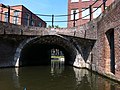
street in Utrecht, the Netherlands  | |||||
| Upload media | |||||
| Instance of | |||||
|---|---|---|---|---|---|
| Location | Utrecht, Netherlands | ||||
| Crosses | |||||
| Heritage designation |
| ||||
 | |||||
|
This is a category about rijksmonument number 47078
|
| Address |
|
Media in category "Plompetorenbrug"
The following 2 files are in this category, out of 2 total.
-
 Rijksmonument 47078 Plompetorenbrug Utrecht.JPG 2,592 × 1,936; 2.41 MB
-
 Rijksmonument-47078-20110906125830.jpg 2,592 × 1,936; 1.96 MB
