Category:Platberg
Jump to navigation
Jump to search
English: Platberg near Harrismith, Free State, South Africa. Outliers are Loskop and Baker's Kop.
| Object location | | View all coordinates using: OpenStreetMap |
|---|
mountain near Harrismith, Free State  | |||||
| Upload media | |||||
| Instance of | |||||
|---|---|---|---|---|---|
| Location |
| ||||
| Elevation above sea level |
| ||||
 | |||||
Media in category "Platberg"
The following 16 files are in this category, out of 16 total.
-
 10 of 'History of the Boers in South Africa ... with three maps' (11189449154), crop.jpg 1,253 × 1,026; 216 KB
-
 Baker's Kop, Harrismith, a.jpg 3,841 × 3,000; 4.6 MB
-
 Loskop, Harrismith, b.jpg 4,000 × 3,000; 3.65 MB
-
 Loskop, Harrismith.jpg 4,000 × 3,000; 3.66 MB
-
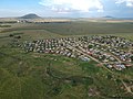
 Phahameng Location.jpg 3,968 × 2,976; 5.76 MB
-
 Phahameng.jpg 3,968 × 2,976; 5.67 MB
-
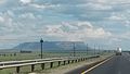 Platberg Harrismith South Africa.jpg 3,264 × 1,836; 887 KB
-
 Platberg, basalt op sandsteen.jpg 4,000 × 3,000; 4.22 MB
-
 Platberg, Harrismith, a.jpg 4,000 × 1,437; 2.87 MB
-
 Platberg, Harrismith, weshange.jpg 4,000 × 2,214; 5.34 MB
-
 Platberg, weshange.jpg 3,275 × 1,209; 2.82 MB
-
 Platberg.jpg 533 × 800; 38 KB
-
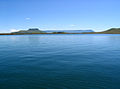 SterkfonteinDam-2006.jpg 788 × 582; 57 KB
-
 The National Archives UK - CO 1069-215-86, crop1.jpg 451 × 318; 36 KB
-
 The National Archives UK - CO 1069-215-86, crop2.jpg 433 × 326; 21 KB
-
 The National Archives UK - CO 1069-215-86.jpg 862 × 1,111; 136 KB
,_crop.jpg)


