Category:Piz Nair (Glarus Alps)
Jump to navigation
Jump to search
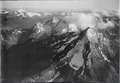
English: Piz Nair (3058 m) is a mountain of the Glarus Alps in Switzerland, above Tujetsch between the canton of Graubünden and the canton of Glarus.
Deutsch: Piz Nair (3058 m) ist ein Berg zwischen den Kantonen Graubünden und Glarus, Schweiz
Rumantsch: Piz Nair (3058 m) è ena Muntogna tranter igls cantuns Grischun e Glaruna, Svizra
| Object location | | View all coordinates using: OpenStreetMap |
|---|
mountain  | |||||
| Upload media | |||||
| Pronunciation audio | |||||
|---|---|---|---|---|---|
| Instance of | |||||
| Location | |||||
| Mountain range |
| ||||
| Topographic prominence |
| ||||
| Elevation above sea level |
| ||||
| Parent peak | |||||
 | |||||
Media in category "Piz Nair (Glarus Alps)"
The following 5 files are in this category, out of 5 total.
-
-
 ETH-BIB-Crispalt, Piz Nair, Piz Giuf, Val Milar v. O. aus 2600 m-Inlandflüge-LBS MH01-003938.tif 6,372 × 4,366; 79.69 MB
-
 ETH-BIB-Piz Giuv, Piz Nair, Adula v. N. aus 3300 m-Inlandflüge-LBS MH01-006316.tif 6,409 × 4,334; 79.61 MB
-
 ETH-BIB-Piz Nair, Piz Giuv-Inlandflüge-LBS MH05-07-14.tif 2,316 × 3,508; 23.3 MB
-
 Picswiss UR-22-06.jpg 333 × 500; 64 KB