Category:Pithoragarh district
Jump to navigation
Jump to search
district of Uttarakhand, India  .svg) | |||||
| Upload media | |||||
| Instance of | |||||
|---|---|---|---|---|---|
| Location |
| ||||
| Capital | |||||
| Inception |
| ||||
| Population |
| ||||
| Area |
| ||||
| official website | |||||
 | |||||
Subcategories
This category has the following 4 subcategories, out of 4 total.
Media in category "Pithoragarh district"
The following 27 files are in this category, out of 27 total.
-
 A View From East side of my village.jpg 2,048 × 1,536; 1.13 MB
-
 A View From East side.jpg 2,048 × 1,536; 871 KB
-
 A View From west side.jpg 2,048 × 1,536; 915 KB
-
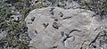 Ammonites Fossils.jpg 1,280 × 590; 174 KB
-
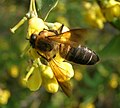 ApisLaboriosa1.jpg 1,540 × 1,390; 413 KB
-
 Bells at Kotgari devi temple.jpg 2,592 × 1,456; 995 KB
-
 Bonellis eagle.jpg 6,000 × 3,391; 8.88 MB
-
 Camping on saryu river - panoramio.jpg 4,164 × 2,706; 1.37 MB
-
 Click by Inder Kharayat 21 March 14.jpg 2,048 × 1,536; 775 KB
-
 Girl climbing tree for fodder Askot WLS AJTJ P1020901.jpg 4,000 × 3,000; 9.02 MB
-
 Inder Kharayat.jpg 2,048 × 1,536; 830 KB
-
 Kotgari devi temple.jpg 2,592 × 1,456; 866 KB
-
 KR17 DSC 6674 h bluetail female.jpg 725 × 1,088; 781 KB
-
LargeHawkCuckoo.ogg 14 s; 61 KB
-
 Lelu.jpg 4,000 × 3,000; 6.42 MB
-
 Mallikarjun.jpg 438 × 557; 89 KB
-
MelophusLathami.ogg 1.6 s; 13 KB
-
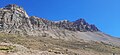
 Nanda Kot.jpg 2,512 × 1,645; 1.36 MB
-
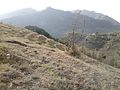
 Parvati Kund mountains.jpg 1,280 × 590; 144 KB
-
 Pithoragarh Dhawaj entrance from lacher.jpg 2,048 × 1,536; 793 KB
-
 Pithoragarh district.svg 1,250 × 1,125; 137 KB
-
 Pithoragarh(Asur Chula from sathshilling).jpg 2,048 × 1,536; 1.02 MB
-
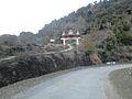
 Pithoragarh(Lacher temple entrance).jpg 2,048 × 1,536; 782 KB
-
 Road affected by flash flood, near Nachni, Pithoragarh District, Uttarakhand - 1.jpeg 3,200 × 2,400; 3.07 MB
-
 Road affected by flash flood, near Nachni, Pithoragarh District, Uttarakhand - 2.jpeg 3,200 × 2,400; 4.06 MB
-
 Temple side Sathshilling.jpg 2,048 × 1,536; 1.19 MB
-
 View on Ganai Gangoli-Bankot road.jpg 2,592 × 1,456; 1.26 MB


.jpg)
.jpg)


