Category:Peterculter (civil parish)
Jump to navigation
Jump to search
Scottish parish in Aberdeen, Scotland, UK | |||||
| Upload media | |||||
| Instance of | |||||
|---|---|---|---|---|---|
| Part of |
| ||||
| Named after | |||||
| Location |
| ||||
| Population |
| ||||
| Area |
| ||||
 | |||||
Subcategories
This category has the following 5 subcategories, out of 5 total.
Media in category "Peterculter (civil parish)"
The following 200 files are in this category, out of 370 total.
(previous page) (next page)-
 (The) Ploughman, Peterculter - geograph.org.uk - 4847301.jpg 2,076 × 1,559; 1.54 MB
-
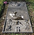 18th Century grave slab (I), Peterculter kirkyard - geograph.org.uk - 4847163.jpg 2,000 × 2,075; 2.03 MB
-
 18th Century grave slab (II), Peterculter kirkyard - geograph.org.uk - 4847175.jpg 1,950 × 2,270; 2.29 MB
-
 A 1-hp single-furrow plough - geograph.org.uk - 3517259.jpg 640 × 480; 116 KB
-
 A covered reservoir - geograph.org.uk - 1877202.jpg 640 × 480; 123 KB
-
 A flower meadow by the Dee - geograph.org.uk - 3516413.jpg 1,824 × 1,368; 1.12 MB
-
 A main entrance to Gairnhill Wood - geograph.org.uk - 2035424.jpg 1,237 × 835; 385 KB
-
 A misty morning on Guttrie hill - geograph.org.uk - 2238333.jpg 3,394 × 2,210; 7.41 MB
-
 A niche in the cemetery wall, Peterculter - geograph.org.uk - 3516085.jpg 2,736 × 3,648; 2.43 MB
-
 A picnic spot by the Deeside Way - geograph.org.uk - 3517304.jpg 1,824 × 1,368; 827 KB
-
 A road bridge abutment by the Old Deeside Railway track - geograph.org.uk - 3517344.jpg 2,736 × 3,648; 2.11 MB
-
 A rough patch - geograph.org.uk - 3566392.jpg 640 × 480; 267 KB
-
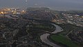 Aberdeen and the River Dee from the air - geograph.org.uk - 3710568.jpg 1,024 × 577; 135 KB
-

-

-

-

-

-
 Aberdeen Western Peripheral Route - geograph.org.uk - 5519405.jpg 640 × 427; 349 KB
-
 Aberdeen Western Peripheral Route - geograph.org.uk - 5519424.jpg 640 × 427; 379 KB
-
 Aberdeen Western Peripheral Route - geograph.org.uk - 5519431.jpg 640 × 427; 429 KB
-
 Aberdeen Western Peripheral Route - geograph.org.uk - 5628910.jpg 1,024 × 683; 293 KB
-
 Aberdeen Western Peripheral Route - geograph.org.uk - 6066417.jpg 1,024 × 768; 112 KB
-

-

-
 Access to Altries Croft - geograph.org.uk - 1380000.jpg 640 × 477; 122 KB
-
 Access to Beechwood House, Blacktop - geograph.org.uk - 1832307.jpg 640 × 450; 104 KB
-
 Access to Camphill School grounds - geograph.org.uk - 3516361.jpg 1,314 × 1,068; 581 KB
-
 Access to Colthill Farm - geograph.org.uk - 1832495.jpg 640 × 480; 128 KB
-
 Access to Gairn Farm - geograph.org.uk - 2035369.jpg 1,296 × 972; 400 KB
-
 Access to Gairnlea - geograph.org.uk - 2035356.jpg 1,296 × 972; 344 KB
-
 Access to Lower Kennerty Mill - geograph.org.uk - 1832902.jpg 640 × 480; 87 KB
-
 Access to Mains of Countesswells - geograph.org.uk - 1832460.jpg 640 × 480; 72 KB
-
 Access to Wardhead and Bogskeathy - geograph.org.uk - 1832514.jpg 640 × 480; 127 KB
-
 Access track to Bellfield - geograph.org.uk - 5491929.jpg 1,024 × 674; 175 KB
-
 Access track to Brookhill - geograph.org.uk - 1832479.jpg 640 × 480; 105 KB
-
 Almost a mansion - geograph.org.uk - 2941116.jpg 1,600 × 1,064; 644 KB
-
 An almost hidden footbridge - geograph.org.uk - 3516374.jpg 1,563 × 1,193; 814 KB
-
 An old 'wringer' - geograph.org.uk - 3517284.jpg 1,095 × 1,543; 499 KB
-
 Anguston quarry - geograph.org.uk - 3917081.jpg 4,800 × 1,622; 7.78 MB
-
 Approach to Invermoriston - geograph.org.uk - 2035067.jpg 1,188 × 829; 287 KB
-
 Approaching Bieldside - geograph.org.uk - 2513925.jpg 640 × 410; 90 KB
-

-

-
 Aqueduct valve chamber - geograph.org.uk - 2621017.jpg 2,229 × 1,671; 4.93 MB
-
 Aqueduct valve chamber - geograph.org.uk - 2621054.jpg 2,272 × 1,704; 4.6 MB
-
 Aqueduct valve chamber - geograph.org.uk - 5051442.jpg 2,880 × 1,920; 6.23 MB
-
 Autumn campus colours - geograph.org.uk - 4217870.jpg 1,600 × 1,064; 603 KB
-
 Autumn colours... - geograph.org.uk - 4218035.jpg 1,600 × 1,199; 843 KB
-
 Autumn trees beside the Deeside Way - geograph.org.uk - 6333879.jpg 6,000 × 4,000; 5.64 MB
-
 B979 approaching the A93 - geograph.org.uk - 3739709.jpg 640 × 428; 77 KB
-
 B979 near Camphill - geograph.org.uk - 3957467.jpg 1,600 × 1,200; 337 KB
-
 Baads and bales - geograph.org.uk - 6305549.jpg 5,184 × 3,888; 5.7 MB
-
 Baillieswells Road - geograph.org.uk - 3739748.jpg 640 × 480; 120 KB
-
 Baillieswells Road, Bieldside - geograph.org.uk - 3739742.jpg 640 × 480; 61 KB
-
 Baillieswells Road, Bieldside - geograph.org.uk - 3739745.jpg 640 × 480; 74 KB
-
 Baillieswells Road, Bieldside - geograph.org.uk - 3739747.jpg 640 × 480; 86 KB
-
 Bend on the river Dee at Peterculter - geograph.org.uk - 2173559.jpg 3,048 × 1,016; 3.36 MB
-
 Bends in the road at Blacktop - geograph.org.uk - 1832344.jpg 640 × 475; 89 KB
-
 Benthoul Croft - geograph.org.uk - 6305528.jpg 5,184 × 3,888; 6.12 MB
-
 Bieldside Cairn, Cults - geograph.org.uk - 3433657.jpg 4,320 × 3,240; 3.34 MB
-
 Bieldside Cairns, Cults - geograph.org.uk - 3433672.jpg 4,320 × 3,240; 5.36 MB
-
 Bieldside Church - geograph.org.uk - 5627889.jpg 1,024 × 683; 402 KB
-
 Bieldside Inn - geograph.org.uk - 4127759.jpg 3,264 × 2,448; 3.78 MB
-
 Binghill Recumbent Stone Circle (1) - geograph.org.uk - 4452911.jpg 640 × 427; 538 KB
-
 Binghill Recumbent Stone Circle (2) - geograph.org.uk - 4452917.jpg 640 × 427; 532 KB
-
 Binghill Recumbent Stone Circle (3) - geograph.org.uk - 4452920.jpg 640 × 427; 533 KB
-
 Binghill Recumbent Stone Circle (5) - geograph.org.uk - 4452927.jpg 640 × 427; 521 KB
-
 Boulders on Hill of Ardbeck - geograph.org.uk - 2256357.jpg 2,800 × 2,101; 6.53 MB
-
 Boulders on Hill of Ardbeck - geograph.org.uk - 2256375.jpg 2,900 × 1,934; 6.78 MB
-
 Boundary stone at Maryculter Bridge - geograph.org.uk - 4127003.jpg 3,264 × 2,448; 5.95 MB
-
 Bovine awareness sign - geograph.org.uk - 1832520.jpg 640 × 473; 89 KB
-
 Bride's Well - geograph.org.uk - 2837780.jpg 2,800 × 1,835; 7.24 MB
-
 Bright red house - geograph.org.uk - 4847138.jpg 3,008 × 2,000; 3.33 MB
-
 Broadleaf woodland near Countesswells House - geograph.org.uk - 3614571.jpg 1,024 × 696; 129 KB
-
 Broomhill - geograph.org.uk - 2035381.jpg 2,592 × 1,944; 881 KB
-
 Broomhill entrance to Gairnhill Wood - geograph.org.uk - 2035391.jpg 1,296 × 972; 489 KB
-
 Building the bridge over the Dee - geograph.org.uk - 5628899.jpg 1,024 × 683; 272 KB
-
 Business School, Robert Gordon University - geograph.org.uk - 4217878.jpg 1,600 × 1,064; 437 KB
-
 Cairnton Wood - geograph.org.uk - 5628957.jpg 1,024 × 683; 539 KB
-
 Cairnton Wood - geograph.org.uk - 5628960.jpg 1,024 × 683; 565 KB
-
 Campus path... - geograph.org.uk - 4218005.jpg 1,600 × 1,064; 585 KB
-
 Cars and trees - geograph.org.uk - 2638155.jpg 1,600 × 1,064; 854 KB
-
 Cattle at Cadgerford - geograph.org.uk - 5491976.jpg 1,024 × 682; 168 KB
-
 Church along Baillieswells Road - geograph.org.uk - 3614593.jpg 640 × 445; 93 KB
-
 Coldstream Burn - geograph.org.uk - 2851260.jpg 2,600 × 1,733; 7.12 MB
-
 Coldstream Burn - geograph.org.uk - 2851273.jpg 2,700 × 1,800; 7.76 MB
-
 Colourful effigy of Gilderoy - geograph.org.uk - 1832943.jpg 480 × 640; 131 KB
-
 Communication lines - geograph.org.uk - 6305565.jpg 5,184 × 3,888; 5.6 MB
-
 Confluence of the Culter Burn with the River Dee - geograph.org.uk - 2814812.jpg 3,190 × 2,127; 7.24 MB
-
 Construction, Westhill - geograph.org.uk - 3566413.jpg 640 × 480; 257 KB
-
 Contlaw Road - geograph.org.uk - 3957459.jpg 1,600 × 1,200; 594 KB
-
 Contlaw Road, Milltimber - geograph.org.uk - 3957465.jpg 1,600 × 1,200; 540 KB
-
 Contlaw Road, near Milltimber - geograph.org.uk - 3957461.jpg 1,600 × 1,200; 358 KB
-
 Copse off northern edge of Kingshill Wood - geograph.org.uk - 2034923.jpg 1,296 × 972; 308 KB
-
 Cottage at Blacktop - geograph.org.uk - 1832300.jpg 640 × 464; 68 KB
-
 Countryside view from North Deeside Road - geograph.org.uk - 3617888.jpg 829 × 1,054; 193 KB
-
 Craiglug - geograph.org.uk - 2035081.jpg 640 × 485; 100 KB
-
 Craiglug entrance into Kingshill Wood - geograph.org.uk - 2035450.jpg 1,296 × 972; 407 KB
-
 Craiglug farmhouse - geograph.org.uk - 2035262.jpg 1,296 × 972; 397 KB
-
 Culter Burn - geograph.org.uk - 3818319.jpg 2,800 × 1,867; 6.75 MB
-
 Culter Burn - geograph.org.uk - 3818331.jpg 2,800 × 1,858; 7.58 MB
-
 Culter Burn - geograph.org.uk - 4847352.jpg 3,008 × 2,000; 2.96 MB
-
 Culter Burn, Peterculter - geograph.org.uk - 1833054.jpg 480 × 640; 137 KB
-
 Culter House - geograph.org.uk - 2259603.jpg 2,900 × 1,903; 5.42 MB
-
 Cults Academy - geograph.org.uk - 2941462.jpg 1,600 × 1,064; 326 KB
-
 Cults Kirk Centre - geograph.org.uk - 5626552.jpg 1,024 × 683; 349 KB
-
 Cults Station - geograph.org.uk - 5626534.jpg 1,024 × 683; 429 KB
-
 Cults street scene along North Deeside Road - geograph.org.uk - 3645310.jpg 1,024 × 716; 152 KB
-
 Daffodil path to the War Memorial - geograph.org.uk - 1833064.jpg 640 × 480; 114 KB
-
 Dalamaik Church - geograph.org.uk - 2850068.jpg 2,760 × 1,840; 5.64 MB
-
 Dalmaik Church - geograph.org.uk - 2850141.jpg 2,800 × 1,866; 7.24 MB
-
 Deeside Golf Club - geograph.org.uk - 2532893.jpg 2,272 × 1,704; 4.35 MB
-
 Deeside Railway trackbed - geograph.org.uk - 5628947.jpg 1,024 × 683; 325 KB
-
 Deeside Railway trackbed - geograph.org.uk - 5628950.jpg 1,024 × 683; 289 KB
-
 Deeside Railway trackbed, Milltimber - geograph.org.uk - 5627920.jpg 1,024 × 683; 474 KB
-
 Deeside Railway trackbed, Milltimber - geograph.org.uk - 5628860.jpg 1,024 × 683; 442 KB
-
 Deeside Railway, Cults - geograph.org.uk - 5626535.jpg 1,024 × 683; 471 KB
-
 Deeside Way - geograph.org.uk - 5627902.jpg 1,024 × 683; 505 KB
-
 Deeside Way - geograph.org.uk - 5628913.jpg 1,024 × 683; 517 KB
-
 Deeside Way - geograph.org.uk - 6358499.jpg 6,000 × 4,000; 5.55 MB
-
 Deeside Way at Milltimber - geograph.org.uk - 6358518.jpg 6,000 × 4,000; 7.14 MB
-
 Deeside Way near Coalford, Aberdeen - geograph.org.uk - 6174865.jpg 2,400 × 1,590; 2.09 MB
-
 Deeside Way near Peterculter, Aberdeen - geograph.org.uk - 6174867.jpg 2,400 × 1,590; 2.02 MB
-
 Deeside Way to the east of the site of Peterculter station - geograph.org.uk - 6358494.jpg 6,000 × 4,000; 5.47 MB
-
 Deeside Way west of Peterculter - geograph.org.uk - 6333873.jpg 6,000 × 4,000; 6.21 MB
-
 Deeside Way, Milltimber - geograph.org.uk - 5628870.jpg 1,024 × 683; 353 KB
-
 Deeside Way, Peterculter - geograph.org.uk - 5628925.jpg 1,024 × 683; 497 KB
-
 Deeside Way, Peterculter - geograph.org.uk - 5628937.jpg 1,024 × 683; 518 KB
-
 Deeview Road South, Cults - geograph.org.uk - 2941112.jpg 1,600 × 1,064; 661 KB
-
 Downstream Culter Burn - geograph.org.uk - 1832785.jpg 640 × 480; 90 KB
-
 Downstream Culter Burn - geograph.org.uk - 1833043.jpg 640 × 480; 169 KB
-
 Downstream the River Dee - geograph.org.uk - 3516352.jpg 1,824 × 1,368; 911 KB
-
 Drain near Auchlea - geograph.org.uk - 3566404.jpg 640 × 480; 256 KB
-
 East end of the B9119 at Westhill - geograph.org.uk - 5491980.jpg 1,024 × 682; 167 KB
-
 East Kingsford industrial units - geograph.org.uk - 4180667.jpg 4,608 × 3,456; 3.56 MB
-
 East Lodge, Countesswells - geograph.org.uk - 1832456.jpg 640 × 463; 87 KB
-
 East Siverburn croft - geograph.org.uk - 1832259.jpg 640 × 480; 121 KB
-
 Eddieston smiddy - geograph.org.uk - 3158514.jpg 2,272 × 1,704; 4.41 MB
-
 Edge of Cairnton Wood - geograph.org.uk - 5628959.jpg 1,024 × 683; 468 KB
-
 Edgehill lodge... - geograph.org.uk - 6358556.jpg 5,599 × 3,944; 5.11 MB
-
 Entrance gates to Dalhebity - geograph.org.uk - 3739751.jpg 640 × 480; 103 KB
-
 Executive flats, Peterculter - geograph.org.uk - 4845806.jpg 3,008 × 2,000; 2.99 MB
-
 Farm building by Silverfold - geograph.org.uk - 1832264.jpg 640 × 468; 58 KB
-
 Farm track off North Deeside Road - geograph.org.uk - 3739726.jpg 640 × 480; 98 KB
-
 Farmland and pylons, Foggieton - geograph.org.uk - 3739753.jpg 640 × 480; 80 KB
-
 Farmland and woodland - geograph.org.uk - 3739756.jpg 640 × 480; 97 KB
-
 Farmland off North Deeside Road - geograph.org.uk - 3739729.jpg 640 × 480; 51 KB
-
 Farmland south of North Deeside Road - geograph.org.uk - 3739719.jpg 640 × 480; 76 KB
-
 Farmland, Longside - geograph.org.uk - 3739764.jpg 640 × 480; 96 KB
-
 Farmland, Milton of Murtle - geograph.org.uk - 3739734.jpg 640 × 480; 87 KB
-
 Feeding gulls - geograph.org.uk - 2825929.jpg 4,000 × 2,601; 5.56 MB
-
 Field behind Craigton Road - geograph.org.uk - 4009133.jpg 1,600 × 1,200; 322 KB
-
 Field boundary by Tigh na Bruach - geograph.org.uk - 2035028.jpg 1,296 × 972; 338 KB
-
 Field near Eddieston - geograph.org.uk - 6305489.jpg 5,184 × 3,888; 7.16 MB
-
 Field of daisies - geograph.org.uk - 4009147.jpg 1,600 × 1,200; 653 KB
-
 Field of turnips - geograph.org.uk - 6305456.jpg 5,184 × 3,888; 5.51 MB
-
 Field, Cadgerford - geograph.org.uk - 3566408.jpg 640 × 480; 252 KB
-
 Fields west of Milltimber - geograph.org.uk - 2692523.jpg 640 × 480; 80 KB
-
 Foggieton - geograph.org.uk - 3562545.jpg 640 × 480; 354 KB
-
 Foggieton - geograph.org.uk - 3562552.jpg 640 × 480; 331 KB
-
 Foggieton - geograph.org.uk - 3562561.jpg 640 × 480; 314 KB
-
 Foggieton Woods - geograph.org.uk - 2941472.jpg 1,064 × 1,600; 874 KB
-
 Footpath in Rotten o'Gairn Wood - geograph.org.uk - 2783298.jpg 640 × 480; 88 KB
-
 Former 'Culter' railway station - geograph.org.uk - 1832728.jpg 640 × 480; 119 KB
-
 Gairn Farm - geograph.org.uk - 2035417.jpg 1,296 × 972; 280 KB
-
 Gated entrance to Culter House - geograph.org.uk - 2238297.jpg 3,600 × 2,400; 6.21 MB
-
 Gated entry to a Forestry track - geograph.org.uk - 1832330.jpg 640 × 488; 106 KB
-
 Gateway for Treetops House - geograph.org.uk - 1832313.jpg 640 × 480; 80 KB
-
 Glimpse of suburbia - geograph.org.uk - 2941158.jpg 1,600 × 1,064; 500 KB
-
 Glimpse of the Dee - geograph.org.uk - 4217887.jpg 1,600 × 1,064; 810 KB
-
 Grassland, Blacktop - geograph.org.uk - 3562567.jpg 640 × 480; 259 KB
-
 Grazing, Cults - geograph.org.uk - 4096980.jpg 640 × 480; 64 KB
-
 Grazing, Loanhead - geograph.org.uk - 3739763.jpg 640 × 480; 108 KB
-
 Grazing, Milltimber Farm - geograph.org.uk - 3739708.jpg 640 × 480; 70 KB
-
 Green and Gold - geograph.org.uk - 5533454.jpg 640 × 427; 331 KB
-
 Gulls loafing on shingle in the River Dee - geograph.org.uk - 3516444.jpg 1,824 × 1,368; 1.02 MB
-
 Heritage Hall, Peterculter - geograph.org.uk - 1832718.jpg 640 × 480; 50 KB
-
 Herring Gulls on the Dee - geograph.org.uk - 3516464.jpg 1,824 × 1,368; 1.1 MB
-
 Hillhead Road, Milton of Murtle - geograph.org.uk - 3739735.jpg 640 × 480; 117 KB
-
 Hillview Crescent - geograph.org.uk - 3562505.jpg 640 × 480; 236 KB
-

-
 Housing development at Loanhead, Countesswells - geograph.org.uk - 5491932.jpg 1,024 × 682; 135 KB
-
 Inchgarth Mews - geograph.org.uk - 4096963.jpg 640 × 480; 73 KB
-
 Inchgarth Reservoir and the River Dee - geograph.org.uk - 5130790.jpg 1,024 × 768; 312 KB
-
 Inchgarth Road - geograph.org.uk - 4096961.jpg 640 × 480; 121 KB
-
 Inchgarth Road - geograph.org.uk - 4096964.jpg 640 × 480; 68 KB
-
 Junction of B9119 with A944 at Westhill (E) - geograph.org.uk - 5714551.jpg 4,150 × 2,383; 1.35 MB
-
 Junction of B979 with North Deeside Road - geograph.org.uk - 3918607.jpg 1,024 × 768; 252 KB
-

-
 Kennerty - geograph.org.uk - 5628938.jpg 1,024 × 683; 457 KB
-
 Kennerty Oat Meal Mills - geograph.org.uk - 1832929.jpg 640 × 480; 111 KB
-
 Kingcausie House - estate - geograph.org.uk - 3197579.jpg 3,888 × 2,592; 7.67 MB
-
 Kingshill Trig Point - geograph.org.uk - 2783311.jpg 1,600 × 1,200; 380 KB
-
 Kirk Brae Mews - geograph.org.uk - 4096976.jpg 640 × 480; 76 KB
-
 Kirk Brae, Cults - geograph.org.uk - 4096972.jpg 640 × 480; 72 KB
-
 Lane between Gairn Farm and Gairnlea - geograph.org.uk - 2035362.jpg 1,296 × 972; 455 KB
-
 Lane from Craiglug to Broomhill - geograph.org.uk - 2035447.jpg 1,285 × 719; 332 KB
-
 Lane side pit - geograph.org.uk - 2035410.jpg 1,296 × 972; 658 KB
-
 Levee for the River Dee - geograph.org.uk - 4126991.jpg 3,264 × 2,448; 4.99 MB
_Ploughman,_Peterculter_-_geograph.org.uk_-_4847301.jpg)
,_Peterculter_kirkyard_-_geograph.org.uk_-_4847163.jpg)
,_Peterculter_kirkyard_-_geograph.org.uk_-_4847175.jpg)


_-_geograph.org.uk_-_5708936.jpg)
_near_Milltimber_-_geograph.org.uk_-_5708922.jpg)
_near_Milltimber_-_geograph.org.uk_-_5708925.jpg)
_near_Milltimber_-_geograph.org.uk_-_5708927.jpg)
_near_Milltimber_-_geograph.org.uk_-_5708932.jpg)


_-_geograph.org.uk_-_4452911.jpg)
_-_geograph.org.uk_-_4452917.jpg)
_-_geograph.org.uk_-_4452920.jpg)
_-_geograph.org.uk_-_4452927.jpg)


_-_geograph.org.uk_-_5714551.jpg)


&filefrom=Loanhead+Farm+-+geograph.org.uk+-+2638111.jpg#mw-category-media)