Category:Perevalnoe
Jump to navigation
Jump to search
| Object location | | View all coordinates using: OpenStreetMap |
|---|
human settlement in Simferopol Raion, Autonomous Republic of Crimea, Ukraine  | |||||
| Upload media | |||||
| Instance of | |||||
|---|---|---|---|---|---|
| Location | Q4163653, Simferopol Raion, Autonomous Republic of Crimea, Ukraine | ||||
| Population |
| ||||
| Area |
| ||||
| Elevation above sea level |
| ||||
| official website | |||||
 | |||||
Русский: ru:Перевальное (Крым)
Українська: uk:Перевальне
Esperanto: eo:Perevalno (Simferopola distrikto)
Deutsch: de:Perewalne
English: en:Perevalnoe
Subcategories
This category has the following 2 subcategories, out of 2 total.
Media in category "Perevalnoe"
The following 22 files are in this category, out of 22 total.
-
 2014-03-09 - Perevalne military base - 0210.JPG 4,608 × 3,072; 3.48 MB
-
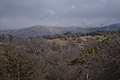
 Perevalnoe 1.JPG 2,816 × 2,112; 1.22 MB
-
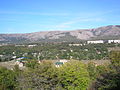
 Perevalnoe 2.JPG 2,816 × 2,112; 1.34 MB
-
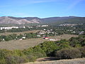
 Perevalnoe 3.JPG 2,816 × 2,112; 1.12 MB
-
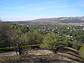
 Perevalnoe 4.JPG 2,816 × 2,112; 1.21 MB
-
 Perevalnoe 5.JPG 2,816 × 2,112; 1.15 MB
-
 Perevalnoe 6.JPG 2,816 × 2,112; 1.14 MB
-
 Perevalnoe 7.JPG 2,816 × 2,112; 1.15 MB
-
 Perevalnoe 8.JPG 2,816 × 2,112; 1.21 MB
-
 Perevalnoe 9.JPG 2,112 × 2,816; 1.38 MB
-
 Perevalnoye (Simferopol district).jpg 3,872 × 2,592; 4.32 MB
-
 Salgir valley panorama.jpg 5,937 × 1,115; 2.19 MB
-
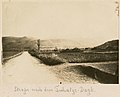 Strasse nach dem Tschatyr-Dagk (9457156727).jpg 1,000 × 805; 614 KB
-
 Вид на Перевальное с Чатыр-Даг.jpg 3,130 × 2,075; 4.21 MB
-
 Крым 2015 август - panoramio (1).jpg 4,608 × 2,592; 2.59 MB
-
 Крым 2015 август - panoramio (3).jpg 4,608 × 2,592; 2.77 MB
-
 Крым 2015 август - panoramio.jpg 4,608 × 2,592; 2.57 MB
-

-
 Подъем на Чатыр-Даг со стороны села Перевальное, вид на восток.jpg 3,130 × 2,075; 6.59 MB
-
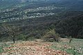
 Село Перевальное, вид с горы.jpg 3,130 × 2,075; 4.78 MB
-
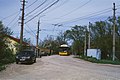 Троллейбусное кольцо в селе Перевальное 2021-05.jpg 3,130 × 2,075; 5.35 MB
-
 Троллейбусный разворот Перевальное 2021-05.jpg 4,032 × 2,268; 3.11 MB


.jpg)
.jpg)

.jpg)
.jpg)

_-_panoramio.jpg)


