Category:Penrhyn-coch
Jump to navigation
Jump to search
village in United Kingdom  | |||||
| Upload media | |||||
| Instance of | |||||
|---|---|---|---|---|---|
| Location | Ceredigion, Wales | ||||
 | |||||
Cymraeg: Pentref bach ydy Penrhyn-coch yng nghymuned Trefeurig, Ceredigion. Lleolir rhwng yr Afon Stewi a Nant Seilo, yn agos i lle maent yn ymuno ag Afon Clarach. Mae'r pentref tua 4½ milltir ir gogledd ddwyrain o Aberystwyth.
English: Penrhyn-coch is a small Welsh village, in the community of Trefeurig, Ceredigion, located between the Afon Stewi and Nant Seilo rivers, close to where they merge into the Afon Clarach. The village is approximately 4½ miles (7 km) north-east of Aberystwyth.
Subcategories
This category has only the following subcategory.
S
Media in category "Penrhyn-coch"
The following 8 files are in this category, out of 8 total.
-
 Fields east of Cefn Llwyd - geograph.org.uk - 1774903.jpg 640 × 428; 138 KB
-

-
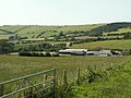 Pen-y-banc Farm - geograph.org.uk - 26721.jpg 640 × 480; 150 KB
-
 Penrhyncoch village centre - geograph.org.uk - 1291271.jpg 640 × 480; 70 KB
-
 Picnic area near Gogerddan - geograph.org.uk - 23381.jpg 640 × 480; 205 KB
-
 Western approach to Penrhyncoch - geograph.org.uk - 1291264.jpg 640 × 480; 96 KB
-
 Ysgol Penrhyn-coch - geograph.org.uk - 17522.jpg 640 × 480; 122 KB
-
 Dol Helyg - geograph.org.uk - 379386.jpg 640 × 480; 104 KB


