Category:Pennine Way, Derbyshire
Jump to navigation
Jump to search

Subcategories
This category has the following 4 subcategories, out of 4 total.
Media in category "Pennine Way, Derbyshire"
The following 200 files are in this category, out of 279 total.
(previous page) (next page)-
 578m top at Alport Low - geograph.org.uk - 758437.jpg 640 × 480; 81 KB
-

-
 A moorland scene - geograph.org.uk - 718334.jpg 640 × 480; 80 KB
-
 A Water Course on Near Broadslate - geograph.org.uk - 375752.jpg 640 × 480; 113 KB
-
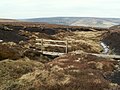 A wooden bridge over the ford - geograph.org.uk - 779778.jpg 640 × 480; 86 KB
-

-
 Bad news for walkers by the Pennine Way - geograph.org.uk - 4356599.jpg 1,920 × 2,044; 549 KB
-
 Barely seen grouse - geograph.org.uk - 1441156.jpg 640 × 480; 29 KB
-
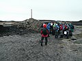
 Black Hill (Peak District) 2011.jpg 2,560 × 1,920; 1.04 MB
-
 Black Hill (Peak District).jpg 2,048 × 1,536; 1.16 MB
-
 Bleaklow Head Cairn - geograph.org.uk - 397902.jpg 640 × 480; 77 KB
-
-
 Bleaklow Head Cairn in thick clag. - geograph.org.uk - 481683.jpg 640 × 480; 43 KB
-

-
 Bleaklow Head from the cairn - geograph.org.uk - 856567.jpg 640 × 480; 69 KB
-
 Bleaklow6280.JPG 2,048 × 1,536; 745 KB
-
 Bleaklow6315.JPG 2,048 × 1,536; 747 KB
-
 Bleaklow6354.JPG 2,048 × 1,536; 793 KB
-
 Cairn above Jacob's Ladder, Edale - geograph.org.uk - 2852739.jpg 4,000 × 2,250; 2.36 MB
-
 Cairn and footpath signpost - geograph.org.uk - 4061339.jpg 800 × 600; 98 KB
-
 Cairn at the top of Jacob's Ladder - geograph.org.uk - 2061268.jpg 2,048 × 1,536; 1.37 MB
-
 Cairn at the top of Jacob's Ladder - geograph.org.uk - 3786104.jpg 4,608 × 3,456; 3.05 MB
-
 Cairn by the Pennine Way - geograph.org.uk - 3786059.jpg 4,608 × 3,456; 3.21 MB
-
 Cairn on Jacobs ladder. - geograph.org.uk - 2411934.jpg 640 × 480; 44 KB
-
 Cairn on the Pennine Way - geograph.org.uk - 991623.jpg 640 × 426; 114 KB
-

-

-

-
 Climbing Grindsbrook Clough - geograph.org.uk - 941039.jpg 640 × 480; 118 KB
-
 Crossroads signpost - geograph.org.uk - 2178020.jpg 3,872 × 2,592; 2.06 MB
-
 Crowden Brook towards Black Hill - geograph.org.uk - 616919.jpg 640 × 480; 120 KB
-
 Crowden Great Brook - geograph.org.uk - 1210453.jpg 640 × 480; 96 KB
-
 Crowden Great Brook - geograph.org.uk - 45269.jpg 640 × 480; 137 KB
-
 Crowden Great Brook Valley - geograph.org.uk - 1719342.jpg 2,560 × 1,920; 997 KB
-
 Crowden Lea, Upper Booth.jpg 4,000 × 3,000; 4.78 MB
-
 Decending (17088803878).jpg 4,608 × 2,592; 4.15 MB
-
 Descending from the Kinder Plateau - geograph.org.uk - 991669.jpg 640 × 426; 104 KB
-
 Devil's Dike (Drain) - geograph.org.uk - 1496908.jpg 640 × 480; 74 KB
-
 Devil's Dike part of the Pennine Way - geograph.org.uk - 739414.jpg 640 × 480; 90 KB
-

-
 Edale - geograph.org.uk - 250254.jpg 640 × 480; 131 KB
-
 Edale Moor - panoramio.jpg 2,304 × 3,072; 3.03 MB
-
 Edale Rocks near Kinder Low - geograph.org.uk - 616486.jpg 640 × 480; 112 KB
-
 Edale, UK - panoramio (10).jpg 3,888 × 2,592; 1.93 MB
-
 Edale, UK - panoramio (14).jpg 3,888 × 2,592; 1.33 MB
-
 Edale, UK - panoramio (15).jpg 3,888 × 2,592; 934 KB
-
 Edale, UK - panoramio (16).jpg 3,888 × 2,592; 1.55 MB
-
 Edale, UK - panoramio (17).jpg 3,888 × 2,592; 1.76 MB
-
 Edale, UK - panoramio (18).jpg 3,888 × 2,592; 1.85 MB
-
 Edale, UK - panoramio (7).jpg 3,888 × 2,592; 2.11 MB
-

-
 Fallen rocks - geograph.org.uk - 586401.jpg 640 × 481; 188 KB
-
 Featherbed Top - geograph.org.uk - 214851.jpg 640 × 480; 85 KB
-
 Flagged path above William Clough - geograph.org.uk - 991866.jpg 640 × 426; 112 KB
-
 Footpath Crossroads on the Pennine Way - geograph.org.uk - 1898906.jpg 2,779 × 2,472; 902 KB
-
 Ford on the Pennine Way - geograph.org.uk - 3856820.jpg 4,000 × 3,000; 3.21 MB
-
 From Pennine Way looking down Edale and over Mam Tor - geograph.org.uk - 3070711.jpg 4,000 × 2,136; 1.31 MB
-
 From Pennine Way on west side of Kinder Scout - geograph.org.uk - 3070706.jpg 3,539 × 2,303; 1.31 MB
-

-
 Gritstone,hags and groughs - geograph.org.uk - 1442130.jpg 640 × 480; 67 KB
-
 Hern Clough - geograph.org.uk - 739298.jpg 640 × 480; 91 KB
-
-
 John Track Well - geograph.org.uk - 371228.jpg 640 × 480; 163 KB
-

-
 Kinder Downfall in reverse - geograph.org.uk - 711661.jpg 640 × 480; 70 KB
-
 Kinder Gates - geograph.org.uk - 80997.jpg 640 × 480; 132 KB
-
 Kinder Scout (northwestern end) - geograph.org.uk - 80943.jpg 640 × 480; 138 KB
-
 Kinder Scout, the edge - geograph.org.uk - 1439217.jpg 640 × 480; 101 KB
-
 KinderEdaleRocks6450.JPG 2,048 × 1,536; 794 KB
-
 KinderJacobsLadder6455.JPG 2,048 × 1,536; 792 KB
-
 KinderJacobsLadder6456.JPG 2,048 × 1,536; 765 KB
-
 KinderJacobsLadder6457.JPG 2,048 × 1,536; 761 KB
-
 KinderJacobsLadder6458.JPG 2,048 × 1,536; 753 KB
-
 KinderJacobsLadder6460.JPG 2,048 × 1,536; 742 KB
-
 KinderJacobsLadder6461.JPG 2,048 × 1,536; 741 KB
-
 KinderJacobsLadder6464.JPG 2,048 × 1,536; 745 KB
-
 KinderJacobsLadder6466.JPG 2,048 × 1,536; 750 KB
-
 Lee Farm. Noe Valley - geograph.org.uk - 1025491.jpg 640 × 446; 108 KB
-

-

-
 Looking North East from Laddow Rocks - geograph.org.uk - 1736469.jpg 1,024 × 768; 227 KB
-

-
 Mill Hill in the Snow - geograph.org.uk - 210627.jpg 640 × 480; 71 KB
-
 Mill Hill towards Kinder - geograph.org.uk - 3079826.jpg 2,048 × 1,536; 590 KB
-
 Moorland and pool by the Pennine Way - geograph.org.uk - 3218961.jpg 1,024 × 768; 253 KB
-
 Moorland crossed by the Pennine Way - geograph.org.uk - 1750000.jpg 2,272 × 1,712; 575 KB
-
 Moorland east of The Pennine Way - geograph.org.uk - 5821215.jpg 5,184 × 3,888; 6.01 MB
-

-
 On The Pennine Way - geograph.org.uk - 4720846.jpg 4,608 × 3,456; 3.47 MB
-
 On The Pennine Way - geograph.org.uk - 4720884.jpg 4,608 × 3,456; 3.42 MB
-
 On The Pennine Way - geograph.org.uk - 4720896.jpg 4,608 × 3,456; 3.43 MB
-
 On the Pennine Way - geograph.org.uk - 4887916.jpg 4,608 × 3,072; 3.35 MB
-
 On The Pennine Way - geograph.org.uk - 4887945.jpg 4,608 × 3,072; 3.29 MB
-
 On The Pennine Way - geograph.org.uk - 4889771.jpg 4,608 × 3,072; 2.99 MB
-
 On The Pennine Way - geograph.org.uk - 4889777.jpg 4,608 × 3,072; 3.2 MB
-
 On The Pennine Way - geograph.org.uk - 5346701.jpg 1,920 × 1,280; 479 KB
-
 On the Pennine Way - geograph.org.uk - 5346706.jpg 1,920 × 1,280; 536 KB
-
 On The Pennine Way - geograph.org.uk - 5346711.jpg 1,920 × 1,280; 515 KB
-
 On The Pennine Way - geograph.org.uk - 5346724.jpg 1,920 × 1,280; 543 KB
-
 On The Pennine Way - geograph.org.uk - 5346732.jpg 1,920 × 1,280; 562 KB
-
 Path junction at Ashop head. - geograph.org.uk - 2984961.jpg 640 × 480; 74 KB
-
 Path Junction near Edale Cross - geograph.org.uk - 3260238.jpg 3,648 × 2,736; 802 KB
-
 Path to Kinder from William Clough - geograph.org.uk - 1472826.jpg 640 × 428; 63 KB
-
 Path-side Cairn - Kinder Scout - geograph.org.uk - 2805529.jpg 4,000 × 3,000; 4.09 MB
-
 Paths meeting below Mill Hill - geograph.org.uk - 3118760.jpg 4,381 × 2,921; 2.79 MB
-
 Peak & Northern Footpath Society sign - geograph.org.uk - 4042345.jpg 600 × 800; 133 KB
-
 Peak District 4533.jpeg 2,048 × 1,536; 894 KB
-
 Peak District 574738.jpeg 2,048 × 1,536; 997 KB
-
 Peak District 6475.jpeg 2,048 × 1,536; 1.02 MB
-
 Peat Bog - geograph.org.uk - 15986.jpg 640 × 480; 154 KB
-
 Peat Haggs - geograph.org.uk - 549833.jpg 640 × 480; 89 KB
-
 Pennine Way - descending Jacob's Ladder - geograph.org.uk - 951204.jpg 640 × 480; 158 KB
-
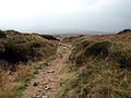
 Pennine Way - geograph.org.uk - 3016217.jpg 640 × 480; 75 KB
-
 Pennine Way - geograph.org.uk - 382139.jpg 480 × 640; 146 KB
-
 Pennine Way - geograph.org.uk - 4265970.jpg 640 × 480; 39 KB
-
 Pennine Way - geograph.org.uk - 4266080.jpg 3,648 × 2,736; 3.72 MB
-
 Pennine Way - geograph.org.uk - 4434411.jpg 4,608 × 3,456; 3.61 MB
-
 Pennine Way - geograph.org.uk - 4720924.jpg 4,593 × 3,293; 2.4 MB
-
 Pennine Way - geograph.org.uk - 4988989.jpg 3,648 × 2,736; 5.61 MB
-
 Pennine Way Above Crowden - geograph.org.uk - 2937808.jpg 640 × 480; 71 KB
-
 Pennine Way above Crowden Great Brook - geograph.org.uk - 947488.jpg 640 × 480; 149 KB
-
 Pennine Way above Reaps - geograph.org.uk - 4356531.jpg 1,920 × 2,560; 1.22 MB
-
 Pennine Way across Grains Moss - geograph.org.uk - 947515.jpg 640 × 480; 125 KB
-
 Pennine Way and Crowden Great Brook - geograph.org.uk - 947504.jpg 640 × 480; 151 KB
-
 Pennine Way and upper Edale - geograph.org.uk - 2826688.jpg 1,024 × 768; 201 KB
-
 Pennine Way approach to Kinder Scout - geograph.org.uk - 2128458.jpg 1,024 × 768; 288 KB
-
 Pennine Way Approaching Ashop Head - geograph.org.uk - 2525605.jpg 640 × 427; 238 KB
-
 Pennine Way at A57 Snake Pass summit - geograph.org.uk - 22692.jpg 640 × 480; 86 KB
-
 Pennine Way at Dun Hill - geograph.org.uk - 947568.jpg 640 × 480; 150 KB
-
 Pennine Way at Glead Hill - geograph.org.uk - 944600.jpg 640 × 480; 135 KB
-
 Pennine Way at Laddow Rocks - geograph.org.uk - 947465.jpg 640 × 480; 158 KB
-
 Pennine Way at Red Brook - geograph.org.uk - 2061301.jpg 2,048 × 1,536; 1.06 MB
-
 Pennine Way at Wildboar Grain - geograph.org.uk - 3079730.jpg 2,048 × 1,536; 562 KB
-
 Pennine Way Crowden - geograph.org.uk - 3044830.jpg 2,331 × 2,641; 2.14 MB
-
 Pennine Way From Jacobs Ladder - geograph.org.uk - 936779.jpg 640 × 480; 80 KB
-
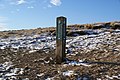
 Pennine Way guide stone - geograph.org.uk - 1065179.jpg 640 × 480; 155 KB
-
 Pennine Way near Edale Rocks - geograph.org.uk - 2061281.jpg 2,048 × 1,536; 1.04 MB
-
 Pennine Way near Jacob's Ladder - geograph.org.uk - 2060465.jpg 2,048 × 1,536; 1.2 MB
-
 Pennine Way near Kinder Downfall - geograph.org.uk - 2061333.jpg 2,048 × 1,536; 1.17 MB
-
 Pennine Way near Kinder Scout - geograph.org.uk - 2061312.jpg 2,048 × 1,536; 1.02 MB
-
 Pennine Way near Oaken Clough - geograph.org.uk - 947459.jpg 640 × 480; 145 KB
-
 Pennine Way near Reaps - geograph.org.uk - 3856835.jpg 4,000 × 3,000; 3.42 MB
-
 Pennine Way near Snake Pass - geograph.org.uk - 3856250.jpg 4,000 × 3,000; 2.88 MB
-
 Pennine Way near Torside Dam - geograph.org.uk - 4367472.jpg 1,920 × 1,289; 645 KB
-
 Pennine Way on Bleaklow - geograph.org.uk - 1003795.jpg 640 × 480; 157 KB
-
 Pennine Way on Bleaklow - geograph.org.uk - 1003808.jpg 640 × 480; 150 KB
-
 Pennine Way on Kinder Scout - geograph.org.uk - 2128326.jpg 768 × 1,024; 243 KB
-
 Pennine Way on Kinder Scout - geograph.org.uk - 2129815.jpg 768 × 1,024; 281 KB
-
 Pennine Way on Kinder Scout plateau - geograph.org.uk - 2061360.jpg 2,048 × 1,536; 1.08 MB
-
 Pennine Way over Laddow Rocks - geograph.org.uk - 3182431.jpg 800 × 600; 121 KB
-

-
 Pennine Way scene - geograph.org.uk - 3218987.jpg 1,024 × 768; 243 KB
-
 Pennine Way sign near Crowden - geograph.org.uk - 3874884.jpg 1,024 × 768; 336 KB
-
 Pennine Way southwest of Moss Castle - geograph.org.uk - 3079822.jpg 2,048 × 1,536; 601 KB
-
 Pennine Way towards Kinder Downfall - geograph.org.uk - 944612.jpg 640 × 480; 135 KB
-
 Pennine Way towards Kinder Scout - geograph.org.uk - 944573.jpg 640 × 480; 103 KB
-
 Pennine Way towards Mill Hill - geograph.org.uk - 944578.jpg 640 × 480; 123 KB
-
 Pennine Way turning northwards - geograph.org.uk - 4168594.jpg 640 × 427; 64 KB
-
 Pennine Way view over the edge - geograph.org.uk - 2943442.jpg 1,024 × 856; 199 KB
-
 Pennine Way, approach to Kinder Scout (8120078675).jpg 2,592 × 1,944; 1.53 MB
-
 Pennine Way, approach to Kinder Scout, Peak District, Derbyshire (8120081987).jpg 2,592 × 1,944; 2.35 MB
-
 Pennine Way, approach to Kinder Scout, Peak District, Derbyshire (8120097806).jpg 2,592 × 1,944; 2.2 MB
-
 Pennine Way, approach to Kinder Scout, Peak District, Derbyshire (8120101252).jpg 2,592 × 1,944; 2.41 MB
-
 Pennine Way, Edale from Kinder Scout, Peak District, Derbyshire (8120126842).jpg 2,592 × 1,944; 1.42 MB
-
 Pennine Way, Edale, Peak District, Derbyshire (8120071537).jpg 2,592 × 1,944; 1.31 MB
-
 Pennine Way, Edale, Peak District, Derbyshire (8120074145).jpg 2,592 × 1,944; 1.17 MB
-
 Pennine Way, Edale, Peak District, Derbyshire (8120076479).jpg 2,592 × 1,944; 1.42 MB
-
 Pennine Way, Edale, Peak District, Derbyshire (8120081770).jpg 2,592 × 1,944; 1.27 MB
-
 Pennine Way, rocks on Kinder Scout, Peak District, Derbyshire (8120093263).jpg 2,592 × 1,944; 1.15 MB
-
 Pennine Way, rocks on Kinder Scout, Peak District, Derbyshire (8120095901).jpg 2,592 × 1,944; 1.35 MB
-
 Pennine Way, rocks on Kinder Scout, Peak District, Derbyshire (8120100239).jpg 2,592 × 1,944; 1.46 MB
-
 Pennine Way, Torside Clough - geograph.org.uk - 2525912.jpg 427 × 640; 274 KB
-
 Pennine Way, view from Kinder Scout, Peak District, Derbyshire (8120091031).jpg 2,592 × 1,944; 1.59 MB
-
 Pennine Way, view from Kinder Scout, Peak District, Derbyshire (8120110556).jpg 2,592 × 1,944; 1.33 MB
-
 Pennine Way, view from Kinder Scout, Peak District, Derbyshire (8120114838).jpg 2,592 × 1,944; 1.11 MB
-
 Pennine Way,descent from Kinder Scout, Peak District, Derbyshire (8120125651).jpg 2,592 × 1,944; 1.4 MB
-
 Pennine Way,descent from Kinder Scout, Peak District, Derbyshire (8120132225).jpg 2,592 × 1,944; 1.41 MB
-
 Pennine Way,descent from Kinder Scout, Peak District, Derbyshire (8120132596).jpg 2,592 × 1,944; 1.57 MB
-
 Pennine Way,descent from Kinder Scout, Peak District, Derbyshire (8120142078).jpg 2,592 × 1,944; 1.3 MB
-
 Ramblers path.jpeg 1,536 × 2,048; 675 KB
-
 Red Brook - Kinder - geograph.org.uk - 433514.jpg 640 × 480; 138 KB
-
 Red Brook from the Pennine Way - geograph.org.uk - 711975.jpg 640 × 480; 70 KB
-
 Sheep grazing on Kinder Scout - geograph.org.uk - 991531.jpg 640 × 426; 94 KB
-
 Signpost at the Crossroads - geograph.org.uk - 2800992.jpg 3,000 × 4,000; 4.79 MB
-
 Sliddens looking to the Pennine Way - geograph.org.uk - 760747.jpg 640 × 480; 70 KB
-
 Snake Pass Summit - geograph.org.uk - 997343.jpg 640 × 480; 68 KB
-
 Snake Path Pennine Way crossing - geograph.org.uk - 4685766.jpg 3,456 × 4,608; 5.91 MB
-
 SnakePass6279.JPG 2,048 × 1,536; 749 KB
-
 Stake - geograph.org.uk - 22520.jpg 640 × 480; 78 KB
-
 Standing Stone by the Pennine Way - geograph.org.uk - 3786106.jpg 4,608 × 3,456; 3 MB
-
 Stile on the Pennine Way - geograph.org.uk - 991522.jpg 640 × 426; 104 KB
-
 Stile, Pennine Way - geograph.org.uk - 222480.jpg 640 × 480; 308 KB
-
 Swine's Back - geograph.org.uk - 379947.jpg 640 × 480; 59 KB
-

-

-
 The Former Crowden Youth Hostel - geograph.org.uk - 245544.jpg 640 × 531; 98 KB
-
 The lower reaches of Grindsbrook Clough - geograph.org.uk - 941031.jpg 640 × 469; 112 KB
-
 The Path Towards Kinder Scout from Mill Hill - geograph.org.uk - 2801288.jpg 4,000 × 3,000; 6.66 MB
-
 The Pennine Way - geograph.org.uk - 3746130.jpg 3,456 × 4,608; 2.97 MB
-
 The Pennine Way - geograph.org.uk - 375716.jpg 640 × 480; 86 KB


_2011.jpg)
.jpg)


.jpg)
.jpg)


.jpg)

_-_geograph.org.uk_-_1496908.jpg)


.jpg)
.jpg)
.jpg)
.jpg)
.jpg)
.jpg)
.jpg)


_-_geograph.org.uk_-_80943.jpg)


_Quarry_and_spoil_heaps,_from_the_Pennine_Way_-_geograph.org.uk_-_4168985.jpg)


.jpg)
.jpg)
.jpg)
.jpg)
.jpg)
.jpg)
.jpg)
.jpg)
.jpg)
.jpg)
.jpg)
.jpg)

.jpg)
.jpg)
.jpg)
.jpg)
.jpg)
.jpg)
.jpg)


