Category:Penistone
Jump to navigation
Jump to search
market town in the Metropolitan Borough of Barnsley, in South Yorkshire, England  | |||||
| Upload media | |||||
| Instance of | |||||
|---|---|---|---|---|---|
| Location | Barnsley, South Yorkshire, Yorkshire and the Humber, England | ||||
 | |||||

Penistone is a suburban town within the Metropolitan Borough of Barnsley, in South Yorkshire, England. The town lies close to the border between South Yorkshire and West Yorkshire.
Subcategories
This category has the following 10 subcategories, out of 10 total.
B
C
- Castle Dike, South Yorkshire (4 F)
- Catshaw (1 F)
H
M
- Millhouse Green (8 F)
P
- Penistone Agricultural Show (136 F)
- Penistone War Memorial (2 F)
- People of Penistone (1 F)
T
Media in category "Penistone"
The following 200 files are in this category, out of 639 total.
(previous page) (next page)-
 "Beware Of The Cat" at Cat Hill Farm - geograph.org.uk - 6015875.jpg 5,184 × 3,888; 4.98 MB
-
 "The Thimble" - cottage in Thurlstone - geograph.org.uk - 3570963.jpg 3,222 × 2,578; 1.66 MB
-

-
 1919 Peace Day Penistone West Riding of Yorkshire England.jpg 1,429 × 901; 684 KB
-
 3 Fryers - geograph.org.uk - 5557578.jpg 1,024 × 768; 282 KB
-
 A Boundary Wall - geograph.org.uk - 479723.jpg 640 × 480; 84 KB
-
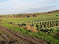 A Field of Cabbages and Sprouts - geograph.org.uk - 4761126.jpg 4,000 × 3,000; 3.55 MB
-
-
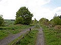
 A footpath from the Trans Pennine Trail - geograph.org.uk - 1277665.jpg 640 × 480; 155 KB
-
 A gennel in Thurlstone - geograph.org.uk - 3571439.jpg 2,637 × 3,516; 1.79 MB
-

-
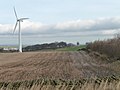 A new crop on Royd Moor - geograph.org.uk - 2758395.jpg 1,024 × 768; 110 KB
-
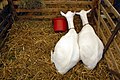 A pear of goats (239288860).jpg 2,048 × 1,371; 1 MB
-
 A Penistone street scene. - geograph.org.uk - 4293236.jpg 640 × 480; 114 KB
-

-
 A solid stile approaching Cubley - geograph.org.uk - 4883157.jpg 3,072 × 1,728; 3.83 MB
-
 A view from the ridge above Wortley, South Yorkshire (70521943).jpg 800 × 518; 113 KB
-
 A view of Scout Dike Reservoir - geograph.org.uk - 3570976.jpg 3,539 × 2,528; 1.79 MB
-

-
 A628 at Cooper Lane junction - geograph.org.uk - 3036984.jpg 640 × 480; 64 KB
-
 A628 at Hoylandswaine - geograph.org.uk - 3036991.jpg 640 × 481; 55 KB
-
 A628 at Leapings Lane - geograph.org.uk - 3037007.jpg 640 × 480; 54 KB
-
 A628 at Penistone Leisure Centre - geograph.org.uk - 3037004.jpg 640 × 480; 75 KB
-
 A628 bend north of Fullshaw - geograph.org.uk - 3037010.jpg 640 × 480; 78 KB
-
 A628 near High Lee Farm - geograph.org.uk - 3036995.jpg 640 × 480; 50 KB
-

-
 A629 Halifax Road at Hoyland Moor - geograph.org.uk - 5854375.jpg 1,024 × 716; 119 KB
-
 A629 near Westhorpe House - geograph.org.uk - 3431031.jpg 640 × 399; 37 KB
-
 A629 towards Huddersfield - geograph.org.uk - 4193108.jpg 640 × 480; 39 KB
-
 A629 towards Huddersfield - geograph.org.uk - 4193127.jpg 640 × 480; 54 KB
-
 Above the houses of Millhouse green. - geograph.org.uk - 4293244.jpg 640 × 480; 61 KB
-

-
 Accidents will happen (1347619313).jpg 1,371 × 2,048; 386 KB
-
 Acre Lane by Crab Tree Hill - geograph.org.uk - 6015860.jpg 3,655 × 4,951; 5.34 MB
-
 Almost dry - geograph.org.uk - 2345853.jpg 1,024 × 768; 158 KB
-
 And James came second (239286879).jpg 2,048 × 1,371; 796 KB
-
 And some as big as yer 'ead (239286162).jpg 2,048 × 1,371; 547 KB
-
 Anglers at Scout Dike reservoir - geograph.org.uk - 2345727.jpg 1,024 × 768; 144 KB
-
 Animal Shelter on Cat Hill Lane - geograph.org.uk - 5092627.jpg 1,600 × 1,065; 1,010 KB
-
 Approaching Cat Hill Foot Farm - geograph.org.uk - 2946959.jpg 3,072 × 2,304; 1.41 MB
-
 Approaching High Lea Farm - geograph.org.uk - 4037791.jpg 1,600 × 1,200; 601 KB
-
 Approaching Hoylandswaine Roundabout - geograph.org.uk - 4193124.jpg 640 × 480; 51 KB
-
 Approaching Penistone station - geograph.org.uk - 3314669.jpg 639 × 473; 56 KB
-
 At the viewpoint on Royd Moor Hill - geograph.org.uk - 3571368.jpg 2,636 × 3,514; 1.97 MB
-
 Autumnal Colours near Penistone Parish Church - geograph.org.uk - 3146185.jpg 4,000 × 3,000; 1.63 MB
-
 Back Lane Market Penistone - geograph.org.uk - 479704.jpg 640 × 480; 86 KB
-
 Barnsley Road at Wellhouse Lane, Penistone - geograph.org.uk - 5092115.jpg 1,600 × 1,065; 550 KB
-
 Barnsley's green fields - geograph.org.uk - 2345824.jpg 1,024 × 768; 139 KB
-
 BarnsleyWestGraph.png 945 × 520; 15 KB
-
 Below the first gauge, Scout Dike reservoir - geograph.org.uk - 3633090.jpg 768 × 1,024; 145 KB
-
 Benchmark and Bolt on tower of Penistone Church - geograph.org.uk - 2837020.jpg 1,356 × 1,600; 709 KB
-
 Benchmark on a trough near Cubley Hall Farm - geograph.org.uk - 2931117.jpg 3,072 × 2,304; 1.58 MB
-
 Benchmark on the high wall near Kirkwood Bridge - geograph.org.uk - 2881880.jpg 3,072 × 2,304; 1.11 MB
-
 Bilberry patch, Royd Moor reservoir - geograph.org.uk - 2352232.jpg 1,024 × 768; 254 KB
-
 Boulder Bridge, Penistone.jpg 4,320 × 3,240; 3.04 MB
-
 Boulder bridge. - geograph.org.uk - 4036481.jpg 640 × 381; 97 KB
-
 Bridge Carrying Bullhouse Lane over The Trans Pennine Trail - geograph.org.uk - 4761107.jpg 4,000 × 3,000; 3.71 MB
-

-
 Bridge on Nook Lane - geograph.org.uk - 3560841.jpg 1,024 × 768; 288 KB
-

-
 Bridge over River Don - geograph.org.uk - 18745.jpg 640 × 480; 147 KB
-

-
 Bridge over the River Don on Water Hall Lane - geograph.org.uk - 5092091.jpg 1,600 × 1,065; 788 KB
-
 Bridge, Watermeadows Park.jpg 1,024 × 494; 195 KB
-
 Bridleway going north from Well House - geograph.org.uk - 2946918.jpg 3,072 × 2,304; 1.42 MB
-
 Bridleway south of Carr Lane - geograph.org.uk - 2933160.jpg 3,072 × 2,304; 1.2 MB
-
 Bridleway towards Firs Lane - geograph.org.uk - 5092170.jpg 1,600 × 1,065; 1.19 MB
-
 Bridleway towards Firs Lane - geograph.org.uk - 5092173.jpg 1,600 × 1,065; 896 KB
-
 Bridleway towards Firs Lane - geograph.org.uk - 5092198.jpg 1,600 × 1,065; 714 KB
-
 Bridleway towards Hartcliff Hill - geograph.org.uk - 1764426.jpg 640 × 480; 135 KB
-
 British Isles rural and coastal (1496649491).jpg 3,872 × 2,592; 735 KB
-
 British Isles rural and coastal (2518330743).jpg 2,048 × 1,371; 1.07 MB
-
 British Isles rural and coastal (2518332695).jpg 2,048 × 1,371; 1.13 MB
-
 British Isles rural and coastal (2519153928).jpg 2,048 × 1,371; 1.01 MB
-
 British Isles rural and coastal Making Britain Great (105989421).jpg 800 × 536; 88 KB
-
 Broad Hill, Penistone - geograph.org.uk - 168066.jpg 640 × 480; 96 KB
-
 Building plot for sale - geograph.org.uk - 948511.jpg 640 × 480; 59 KB
-
 Bullhouse Bridge railway disaster, 1884.jpg 2,692 × 1,738; 1.44 MB
-
 Bullhouse mine settling ponds - geograph.org.uk - 1277699.jpg 640 × 480; 100 KB
-
 Bullhouse Minewater Project - geograph.org.uk - 4063433.jpg 3,720 × 1,882; 4.48 MB
-
 Bungalow on Cat Hill Lane - geograph.org.uk - 5092462.jpg 1,600 × 1,065; 448 KB
-
 By Hartcliff Hill - geograph.org.uk - 3580126.jpg 750 × 342; 59 KB
-
 Canada geese near Scout Dike reservoir - geograph.org.uk - 3633072.jpg 1,024 × 768; 130 KB
-
 Canada geese on Scout Dike reservoir - geograph.org.uk - 2345815.jpg 1,024 × 768; 172 KB
-

-
 Carnegie Free Library - geograph.org.uk - 5091301.jpg 1,600 × 1,065; 616 KB
-

-

-
 Cat Hill Farm - geograph.org.uk - 2946953.jpg 3,072 × 2,304; 1.34 MB
-
 Cat Hill Foot Farm - geograph.org.uk - 4864088.jpg 640 × 480; 64 KB
-
 Cat Hill Foot Farm on Cat Hill Lane - geograph.org.uk - 5092629.jpg 1,600 × 1,049; 606 KB
-
 Cat Hill Hall - geograph.org.uk - 1305520.jpg 640 × 480; 148 KB
-
 Cat Hill Lane - geograph.org.uk - 4864090.jpg 640 × 480; 66 KB
-
 Cat Hill Lane towards Gunthwaite Bridge - geograph.org.uk - 5092262.jpg 1,600 × 1,065; 478 KB
-
 Cat Hill Lane towards Gunthwaite Bridge - geograph.org.uk - 5092461.jpg 1,600 × 1,065; 939 KB
-
 Cat Hill Lane towards Gunthwaite Bridge - geograph.org.uk - 5092630.jpg 1,600 × 1,065; 803 KB
-
 Catshaw Green Cottage - geograph.org.uk - 3571395.jpg 3,469 × 2,602; 1.61 MB
-
 Cattle competition (239287690).jpg 2,048 × 1,371; 777 KB
-
 Cattle competition (239287932).jpg 2,048 × 1,371; 567 KB
-
 Cattle Market Penistone West Riding of Yorkshire England pre 1914.jpg 777 × 469; 340 KB
-

-
 Church Street, Penistone - geograph.org.uk - 5091646.jpg 1,600 × 1,065; 542 KB
-
 Cliff House Farm - geograph.org.uk - 4864013.jpg 640 × 480; 52 KB
-
 Coal Drops, Penistone.jpg 2,000 × 1,428; 1.19 MB
-
 Coal merchants at Whitley House - geograph.org.uk - 2758417.jpg 1,024 × 768; 165 KB
-
 Combine Harvester at Firs Lane - geograph.org.uk - 5092203.jpg 1,600 × 1,065; 1.08 MB
-
 Cooper Lane at Hill Top, Hoylandswaine - geograph.org.uk - 5836385.jpg 4,000 × 3,000; 2.7 MB
-
 Cows grazing on Cat Hill - geograph.org.uk - 2623202.jpg 1,024 × 768; 178 KB
-
 Cross Lane - geograph.org.uk - 4864040.jpg 640 × 480; 66 KB
-
 Cross Lane near Hoylandswaine - geograph.org.uk - 3056375.jpg 1,024 × 768; 126 KB
-
 Cross Lane, Haigh Common - geograph.org.uk - 3314317.jpg 1,024 × 768; 133 KB
-
 Cubley Fields - geograph.org.uk - 3008870.jpg 1,024 × 768; 122 KB
-
 Cubley Hall - geograph.org.uk - 4876568.jpg 800 × 600; 120 KB
-
 Cubley Hall - geograph.org.uk - 4883160.jpg 3,050 × 1,686; 3.64 MB
-
 Cubley Hall - public house, hotel ^ restaurant - geograph.org.uk - 2958107.jpg 4,378 × 2,919; 2.75 MB
-
 Cubley Hall, near Penistone - geograph.org.uk - 1780583.jpg 3,000 × 1,810; 6.13 MB
-
 Cycle race on Renald Lane - geograph.org.uk - 4864037.jpg 640 × 480; 78 KB
-
 Cypher, Elizabeth II postbox on Market Street, Penistone - geograph.org.uk - 4864787.jpg 1,192 × 1,060; 307 KB
-
 Derelict Cattlemarket Penistone - geograph.org.uk - 771004.jpg 640 × 480; 75 KB
-

-

-
 Dogs like ice cream - (239289515).jpg 1,371 × 2,048; 624 KB
-
 Doubting Lane - a walled track - geograph.org.uk - 4761149.jpg 4,000 × 3,000; 3.52 MB
-
 Drystone wall and fields south of Hoylandswaine. - geograph.org.uk - 6150072.jpg 1,024 × 683; 152 KB
-
 Eastfield Avenue, Penistone - geograph.org.uk - 5091221.jpg 1,600 × 1,065; 740 KB
-
 Ecklands Bridge - geograph.org.uk - 4293247.jpg 640 × 480; 106 KB
-

-
 Elizabeth II postbox on Market Street, Penistone - geograph.org.uk - 4864785.jpg 1,464 × 2,208; 651 KB
-
 Emerging onto the Trans Pennine Trail - geograph.org.uk - 929474.jpg 640 × 480; 76 KB
-
 End of a track on Royd Moor Hill - geograph.org.uk - 3599518.jpg 3,532 × 2,235; 1.76 MB
-
 Entering Penistone from Hartcliffe Road - geograph.org.uk - 2280311.jpg 3,296 × 2,472; 1.07 MB
-
 Entering Penistone Via Long Lane - geograph.org.uk - 2313381.jpg 3,296 × 2,472; 1.02 MB
-
 Entrance to Kidfield House Farm - geograph.org.uk - 2623256.jpg 1,024 × 768; 152 KB
-
 Entrance to Pinfold Farm, Hoylandswaine - geograph.org.uk - 2161557.jpg 1,952 × 2,608; 1.31 MB
-
 Excellent strong flavour ^ lovely texture - geograph.org.uk - 4164591.jpg 897 × 1,024; 111 KB
-
 Farm building, High Lea farm - geograph.org.uk - 4193114.jpg 640 × 395; 36 KB
-
 Farm Buildings at Westfield House - geograph.org.uk - 1976495.jpg 1,024 × 768; 169 KB
-
 Farm by Hartcliff Road - geograph.org.uk - 3580095.jpg 750 × 563; 82 KB
-
 Farm off Barnsley Road - geograph.org.uk - 2881923.jpg 3,072 × 2,304; 1.66 MB
-
 Farm track to Delf House - geograph.org.uk - 2161676.jpg 2,438 × 1,823; 1.27 MB
-

-
 Farmland east of Gadding Moor Road - geograph.org.uk - 3314322.jpg 1,024 × 768; 128 KB
-
 Farmland near Hoylandswaine - geograph.org.uk - 3314320.jpg 1,024 × 768; 121 KB
-
 Farmland off Halifax Road - geograph.org.uk - 4193121.jpg 640 × 480; 44 KB
-
 Farmland south of Halifax Road - geograph.org.uk - 4193133.jpg 640 × 480; 56 KB
-
 Field by the River Don at Millhouse Green - geograph.org.uk - 1976490.jpg 1,024 × 768; 196 KB
-
 Field entrance off Cat Hill Lane - geograph.org.uk - 4864085.jpg 640 × 480; 71 KB
-
 Field footpath ascending Hunger Hill, Hoylandswaine - geograph.org.uk - 5836372.jpg 4,000 × 3,000; 3.92 MB
-
 Field gate and footpath stile, Cat Hill - geograph.org.uk - 2623191.jpg 1,024 × 768; 251 KB
-
 Field gate off Brock Holes Lane - geograph.org.uk - 3008894.jpg 1,024 × 768; 83 KB
-
 Field off Halifax Road - geograph.org.uk - 4193144.jpg 640 × 480; 79 KB
-
 Field-edge footpath, north of Kidfield House Farm - geograph.org.uk - 2572792.jpg 3,240 × 4,320; 2.85 MB
-
 Fields by Penistone Showground - geograph.org.uk - 961542.jpg 640 × 480; 52 KB
-
 Fields near Crab Tree House - geograph.org.uk - 4355392.jpg 4,000 × 3,000; 1.77 MB
-
 Firs Lane approaching Crab Tree House - geograph.org.uk - 2946928.jpg 2,640 × 1,980; 1.44 MB
-
 Fish and chip shop in Thurlstone - geograph.org.uk - 3571434.jpg 3,252 × 2,602; 1.68 MB
-
 Fishing club HQ, Scout Dike reservoir - geograph.org.uk - 2345731.jpg 1,024 × 768; 169 KB
-
 Fly fishing at Scout Dike reservoir - geograph.org.uk - 2345830.jpg 1,024 × 768; 184 KB
-
 Folly Farm - geograph.org.uk - 2933124.jpg 3,072 × 2,304; 1.21 MB
-
 Folly Farm on Folly Lane - geograph.org.uk - 3570999.jpg 3,551 × 2,537; 1.85 MB
-
 Footbridge at a door works yard in Penistone, South Yorkshire.jpg 1,600 × 1,177; 908 KB
-
 Footbridge in Banks Wood plantation - geograph.org.uk - 2161589.jpg 2,353 × 1,760; 1.91 MB
-
 Footbridge over Maze Brook - geograph.org.uk - 2345811.jpg 1,024 × 768; 226 KB
-
 Footpath along field edge. - geograph.org.uk - 6150073.jpg 1,024 × 683; 202 KB
-
 Footpath along High bank. - geograph.org.uk - 4116777.jpg 640 × 355; 38 KB
-

-

-

-
 Footpath junction on the Trans Pennine Trail - geograph.org.uk - 2771002.jpg 1,024 × 768; 366 KB
-
 Footpath on Hartcliff Hill - geograph.org.uk - 2931263.jpg 3,072 × 2,304; 1.56 MB
-
 Footpath on Royd Moor - geograph.org.uk - 2177533.jpg 3,296 × 2,472; 1.25 MB
-
 Footpath signpost, Renald Lane - geograph.org.uk - 2623232.jpg 1,024 × 768; 217 KB
-

-
 Footpath through the woods - geograph.org.uk - 2352890.jpg 1,024 × 768; 326 KB
-
 Footpath to Bell Royd - geograph.org.uk - 2933121.jpg 3,072 × 2,304; 1.63 MB
-
 Footpath to Hoylandswaine - geograph.org.uk - 2623194.jpg 1,024 × 768; 248 KB
-
 Footpath to Little Royd - geograph.org.uk - 2623210.jpg 1,024 × 768; 188 KB
-
 Footpath to Penistone - geograph.org.uk - 2809877.jpg 3,240 × 4,320; 2.89 MB
-
 Footpath towards Millhouse Green - geograph.org.uk - 2467064.jpg 640 × 480; 140 KB
-
 Footpath towards Penistone - geograph.org.uk - 2622554.jpg 1,024 × 768; 250 KB
-
 Footpath towards Small Shaw Bank - geograph.org.uk - 2517582.jpg 640 × 480; 177 KB
-
 Footpath, Delf House - geograph.org.uk - 2801041.jpg 2,368 × 1,776; 1.36 MB
-
 Ford at Thurlstone - geograph.org.uk - 3583185.jpg 3,872 × 2,592; 2.06 MB
-
 Former Midland Bank, Penistone - geograph.org.uk - 5556851.jpg 1,024 × 715; 140 KB
-
 Former Midland Bank, Penistone.jpg 2,000 × 1,449; 884 KB
-
 Former Rail Bridge on Sheffield Road, Penistone - geograph.org.uk - 5091657.jpg 1,600 × 1,065; 679 KB
-
 From the series 'Life in the North' (6989472863).jpg 4,576 × 3,056; 2.36 MB
-
 Fullshaw Farm - geograph.org.uk - 4513672.jpg 1,600 × 1,200; 685 KB
-
 Furrowed field, Crab Tree Hill - geograph.org.uk - 2623204.jpg 1,024 × 768; 216 KB
-
 Gateway to Race Common south of Cubley, Penistone - geograph.org.uk - 2958102.jpg 4,608 × 3,072; 2.94 MB
-
 Gateway, Bullhouse Hall.jpg 1,620 × 2,000; 1.29 MB
-
 George Shuttleworth, Speed Demon (2862099187).jpg 3,872 × 2,592; 3.88 MB
-
 Get the message? (1347618711).jpg 2,048 × 1,371; 687 KB
-
 Grass roller in landscape near Scout Dike Reservoir - geograph.org.uk - 3570983.jpg 3,400 × 2,550; 1.72 MB
-
 Gravestone of Molyneaux Bunny, 1749.jpg 1,600 × 1,200; 423 KB
-
 Grazing off Haigh Lane - geograph.org.uk - 4864049.jpg 640 × 480; 58 KB
-
 Grazing off Mortimer Road - geograph.org.uk - 4864014.jpg 640 × 480; 42 KB
-
 Grazing off Renald Lane - geograph.org.uk - 4864036.jpg 640 × 480; 62 KB
-
 Green field, green walls - geograph.org.uk - 2758405.jpg 1,024 × 768; 131 KB
-
 Green House Farm - geograph.org.uk - 4063561.jpg 800 × 600; 100 KB


.jpg)


.jpg)


.jpg)


.jpg)
.jpg)


.jpg)
.jpg)
.jpg)
.jpg)
.jpg)


.jpg)
.jpg)


.jpg)


.jpg)


.jpg)
.jpg)


