Category:Peachland, British Columbia
Jump to navigation
Jump to search
town in British Columbia, Canada .jpg) | |||||
| Upload media | |||||
| Instance of |
| ||||
|---|---|---|---|---|---|
| Location | Regional District of Central Okanagan, British Columbia, Canada | ||||
| Located in or next to body of water | |||||
| Elevation above sea level |
| ||||
| official website | |||||
 | |||||
Media in category "Peachland, British Columbia"
The following 14 files are in this category, out of 14 total.
-
 272RSI Map.svg 783 × 570; 2.79 MB
-
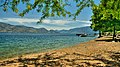
 Antlers Beach Regional Park in Late Winter.JPG 4,608 × 3,456; 2.9 MB
-
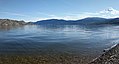 Okanagan Lake Peachland BC.jpg 3,492 × 1,874; 1.43 MB
-
 Okanagan Lake 歐肯納根湖 - panoramio.jpg 1,870 × 1,378; 1,023 KB
-
 Peachland (32354097110).jpg 4,608 × 2,592; 4.91 MB
-
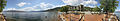 Peachland beach Panorama1.jpg 28,153 × 4,992; 72.31 MB
-
 Peachland from above - 2.jpg 3,456 × 2,298; 2.51 MB
-
 Peachland, British Columbia Location.png 713 × 698; 57 KB
-
 Peachland, British Columbia.jpg 4,288 × 2,412; 1.84 MB
-
 Swimmers in Peachland.jpg 5,184 × 3,456; 8.77 MB
-
 The Connector - panoramio.jpg 3,135 × 2,090; 3.46 MB
-
 Welcome to Peachland Sign.JPG 4,608 × 3,456; 4.29 MB
-
 Western Extent the Rattlenake Island side of Ogopogo Gap.JPG 4,608 × 3,456; 3.37 MB
-
 Z broskyňova... - panoramio.jpg 1,632 × 1,224; 691 KB


.jpg)


