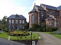
Category:Pastorie St. Odulphuskerk, Assendelft
Jump to navigation
Jump to search
| Object location | | View all coordinates using: OpenStreetMap |
|---|
 | |||||
| Upload media | |||||
| Instance of | |||||
|---|---|---|---|---|---|
| Location | Assendelft, North Holland, Netherlands | ||||
| Street address |
| ||||
| Located on street |
| ||||
| Heritage designation |
| ||||
 | |||||
|
This is a category about rijksmonument number 518067
|
| Address |
|
Media in category "Pastorie St. Odulphuskerk, Assendelft"
The following 12 files are in this category, out of 12 total.
-
 De pastorie naast de rooms-katholieke St. Odulphuskerk.jpg 3,648 × 2,736; 8.36 MB
-
 Monumenten deel 3 001.jpg 2,816 × 2,112; 2.72 MB
-
 Pastorie St. Odulphuskerk 1.jpg 2,666 × 3,555; 8.18 MB
-
 Pastorie St. Odulphuskerk 2.jpg 3,648 × 2,736; 9.13 MB
-
 Pastorie St. Odulphuskerk 3.jpg 3,470 × 2,602; 8.91 MB
-
 Pastorie St. Odulphuskerk 4.jpg 2,736 × 3,648; 10.16 MB
-
 Pastorie St. Odulphuskerk 5.jpg 3,648 × 2,736; 9.8 MB
-
 Pastorie St. Odulphuskerk 6.jpg 3,403 × 2,552; 7.88 MB
-
 Pastorie St. Odulphuskerk 7.jpg 3,648 × 2,736; 9.05 MB
-
 Pastorie St. Odulphuskerk gevel 1.jpg 3,648 × 2,736; 5.44 MB
-
 Pastorie St. Odulphuskerk gevel 2.jpg 2,736 × 3,648; 5.77 MB
-
 Pastorie St. Odulphuskerk sculptuur.jpg 2,736 × 3,648; 7.65 MB


