Category:Papplewick
Jump to navigation
Jump to search
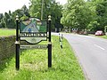
English: The parish of Papplewick is situated towards the west of central Nottinghamshire, to the north of the town of Hucknall. It has an area of 7.15 km². The village of Papplewick is located in the west of the parish. It is 7.5 miles (12 km) north of Nottingham and 6 miles (10 km) south of Mansfield. In 1991, there were 620 people living in the parish, occupying 255 dwellings (1991 census data). In medieval times the village marked the southern gateway to Sherwood Forest.
village in the United Kingdom | |||||
| Upload media | |||||
| Instance of | |||||
|---|---|---|---|---|---|
| Location | Gedling, Nottinghamshire, East Midlands, England | ||||
 | |||||
Subcategories
This category has the following 4 subcategories, out of 4 total.
B
- Burntstump Country Park (8 F)
J
- St James' Church, Papplewick (10 F)
P
- Papplewick Hall (7 F)
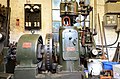
- Papplewick Pumping Station (67 F)
Media in category "Papplewick"
The following 200 files are in this category, out of 288 total.
(previous page) (next page)-
 50p for a train ticket - geograph.org.uk - 2096670.jpg 640 × 480; 111 KB
-
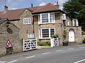
 51-53 Main Street, Papplewick.jpg 1,024 × 768; 149 KB
-
 A busy Easter Sunday at Papplewick - geograph.org.uk - 3941262.jpg 427 × 640; 385 KB
-
 A60 Mansfield Road east of Papplewick - geograph.org.uk - 5540949.jpg 1,024 × 768; 119 KB
-
 An entrance to Sansom Wood - geograph.org.uk - 4894984.jpg 800 × 600; 196 KB
-
 Approaching St. James' church, Papplewick - geograph.org.uk - 6338839.jpg 1,024 × 768; 274 KB
-
 Ash Lane, Arnold, NG5, Notts. - geograph.org.uk - 4320710.jpg 2,510 × 1,500; 690 KB
-
 B6011 meets A60 - geograph.org.uk - 4995185.jpg 3,072 × 1,728; 3.35 MB
-
 B683 towards Papplewick - geograph.org.uk - 1829225.jpg 640 × 480; 112 KB
-
 B683 towards Papplewick - geograph.org.uk - 1829325.jpg 640 × 480; 147 KB
-
 Bank beside disused Railway - geograph.org.uk - 1761672.jpg 640 × 480; 143 KB
-
 Barracks Farm Cottages - geograph.org.uk - 6339115.jpg 1,024 × 768; 150 KB
-

-
 Blacksmith at Papplewick Pumping Station - geograph.org.uk - 5032482.jpg 800 × 1,200; 171 KB
-
 Blidworth Woods - geograph.org.uk - 889821.jpg 640 × 485; 153 KB
-
 Boundary Stone at Newstead Grange.jpg 960 × 1,280; 743 KB
-

-
 Burntstump Hill, Arnold, NG5, Notts. - geograph.org.uk - 4320686.jpg 3,249 × 2,380; 1.36 MB
-
 Butler's Cottages, Papplewick - geograph.org.uk - 3830889.jpg 1,024 × 768; 178 KB
-
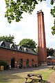 Cafe and chimney Papplewick Pumping Station - geograph.org.uk - 3554238.jpg 3,456 × 5,184; 3.55 MB
-
 Cathedral crypt^ (2) - geograph.org.uk - 2668541.jpg 885 × 1,280; 229 KB
-
 Cathedral crypt^ - geograph.org.uk - 2668540.jpg 1,280 × 844; 251 KB
-
 Church of St James, Papplewick - geograph.org.uk - 4014470.jpg 1,280 × 960; 254 KB
-
 Church of St James, Papplewick - geograph.org.uk - 4014477.jpg 1,280 × 960; 236 KB
-
 Church of St. James, Papplewick - geograph.org.uk - 6338818.jpg 768 × 1,024; 160 KB
-

-
 Cooling lake, Papplewick Pumping Station - geograph.org.uk - 6319189.jpg 1,024 × 768; 185 KB
-
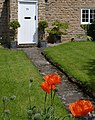 Cottage garden with poppies - geograph.org.uk - 4014489.jpg 1,016 × 1,280; 472 KB
-
 Cottages on Main Street - geograph.org.uk - 4014405.jpg 1,280 × 960; 291 KB
-
 Cottages on Main Street - geograph.org.uk - 4014491.jpg 1,280 × 960; 661 KB
-
 Cottages, Main Street, Papplewick - geograph.org.uk - 6339114.jpg 1,024 × 768; 135 KB
-
 Decorative ironwork, Papplewick Pumping Station - geograph.org.uk - 6319142.jpg 768 × 1,024; 206 KB
-
 Decorative work, Papplewick Pumping Station - geograph.org.uk - 6319151.jpg 1,024 × 768; 188 KB
-
 Disused Railway - geograph.org.uk - 1761658.jpg 640 × 480; 107 KB
-
 Disused Railway - geograph.org.uk - 1761669.jpg 640 × 480; 131 KB
-
 Disused railway line near Papplewick - geograph.org.uk - 4894915.jpg 800 × 600; 224 KB
-
 Dual gauge track at Papplewick - geograph.org.uk - 2113418.jpg 640 × 480; 156 KB
-
 Duke's Cottages - geograph.org.uk - 35005.jpg 640 × 480; 94 KB
-
 Entering the reservoir - geograph.org.uk - 2671893.jpg 1,280 × 853; 239 KB
-
 Entrance gates, Papplewick Pumping Station - geograph.org.uk - 6319194.jpg 1,024 × 768; 189 KB
-
 Entrance to a covered reservoir - geograph.org.uk - 6339112.jpg 1,024 × 768; 193 KB
-
 Entrance to Clover Court, Papplewick - geograph.org.uk - 3506816.jpg 1,024 × 768; 124 KB
-
 Entrance to St James - geograph.org.uk - 1653148.jpg 640 × 480; 120 KB
-
 Faint path into Sansom Wood - geograph.org.uk - 3506753.jpg 1,024 × 768; 201 KB
-
 Farm stacking area - geograph.org.uk - 6267883.jpg 1,280 × 904; 369 KB
-
 Farm track across Papplewick Moor - geograph.org.uk - 5540929.jpg 1,024 × 768; 125 KB
-
 Farmland beside the A60 - geograph.org.uk - 1761662.jpg 640 × 480; 66 KB
-
 Farmland near Papplewick - geograph.org.uk - 1829216.jpg 640 × 480; 44 KB
-
 Farmland on Papplewick Moor - geograph.org.uk - 5540924.jpg 1,024 × 768; 165 KB
-
 Field above Papplewick Pumping Station - geograph.org.uk - 2671835.jpg 1,280 × 853; 374 KB
-
 Field above Papplewick Pumping Station - geograph.org.uk - 2671904.jpg 1,280 × 853; 421 KB
-
 Field off Rigg Lane - geograph.org.uk - 2672386.jpg 1,280 × 853; 351 KB
-
 Fields near Home Farm, Papplewick (1) - geograph.org.uk - 3830895.jpg 1,024 × 768; 153 KB
-
 Fields west of Stanker Hill Farm - geograph.org.uk - 5540933.jpg 1,024 × 768; 131 KB
-
 Flowery pavement along the B683 - geograph.org.uk - 3506797.jpg 1,024 × 768; 172 KB
-
 Footpath above the former railway cutting - geograph.org.uk - 3506763.jpg 1,024 × 768; 214 KB
-
 Footpath near Papplewick Church - geograph.org.uk - 4014484.jpg 1,280 × 960; 526 KB
-
 Footpath to Stanker Hill Farm - geograph.org.uk - 1829213.jpg 640 × 480; 48 KB
-
 Forest Lane - geograph.org.uk - 4894357.jpg 800 × 600; 116 KB
-
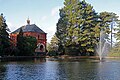
 Fountain in centre of cooling pond - geograph.org.uk - 2557141.jpg 2,817 × 1,879; 2.68 MB
-
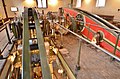
 Galloway Lancashire Boiler Papplewick Pumping Station - geograph.org.uk - 3554248.jpg 5,184 × 3,456; 3.25 MB
-
 Garden sheds - geograph.org.uk - 1428432.jpg 640 × 479; 260 KB
-
 Gardens at Papplewick Pumping Station - geograph.org.uk - 6317718.jpg 1,024 × 768; 360 KB
-

-
 Grass field and houses on Mansfield Road - geograph.org.uk - 6338783.jpg 1,024 × 768; 111 KB
-
 Grass field beside Blidworth Waye - geograph.org.uk - 5835206.jpg 1,280 × 719; 214 KB
-
 Gray's Drive Vicinity, Mansfield Road, Notts. - geograph.org.uk - 4300306.jpg 3,415 × 2,260; 1.31 MB
-
 Greenhouse at Papplewick - geograph.org.uk - 2096663.jpg 640 × 480; 89 KB
-
 Griffins Head - geograph.org.uk - 3457691.jpg 1,600 × 1,200; 356 KB
-
 Griffins Head, Papplewick - geograph.org.uk - 4837990.jpg 4,000 × 3,000; 6.02 MB
-
 Hall Farm Area, NG15 - geograph.org.uk - 3296654.jpg 800 × 510; 154 KB
-

-

-
 In the Papplewick reservoir - geograph.org.uk - 5032474.jpg 868 × 1,000; 249 KB
-
 Inside a covered reservoir, Papplewick - geograph.org.uk - 6339106.jpg 1,024 × 768; 130 KB
-
 Inside a covered reservoir, Papplewick - geograph.org.uk - 6339108.jpg 768 × 1,024; 113 KB
-
 Kettles on the cylinder - geograph.org.uk - 3941251.jpg 640 × 640; 523 KB
-
 King Edward's Plantation - geograph.org.uk - 5835197.jpg 1,280 × 719; 302 KB
-
 Kissing gate near Papplewick - geograph.org.uk - 1651807.jpg 640 × 480; 167 KB
-
 Landscape with wind turbine - geograph.org.uk - 6267884.jpg 1,280 × 960; 253 KB
-
 Lane past the reservoir - geograph.org.uk - 2671865.jpg 1,280 × 853; 398 KB
-
 Left for Linby, right for Arnold - geograph.org.uk - 3506806.jpg 1,024 × 768; 149 KB
-
 Lodge and gates near Papplewick - geograph.org.uk - 4149832.jpg 640 × 451; 145 KB
-
 Looking towards King Edward's Plantation, Papplewick - geograph.org.uk - 3909986.jpg 4,000 × 3,000; 6.22 MB
-
 Looking towards Seven Mile Wood - geograph.org.uk - 4995163.jpg 3,072 × 1,728; 3.44 MB
-
 Looking towards Stanker Hill Farm - geograph.org.uk - 4995167.jpg 3,072 × 1,728; 3.29 MB
-
 Main Street, Papplewick - geograph.org.uk - 1829235.jpg 640 × 480; 88 KB
-
 Main Street, Papplewick - geograph.org.uk - 4837986.jpg 3,960 × 2,172; 4.78 MB
-
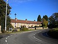
 Mansfield Road, Papplewick, Notts. - geograph.org.uk - 4300284.jpg 3,394 × 2,310; 1.12 MB
-
 Mansfield Road, Papplewick, Notts. - geograph.org.uk - 4300296.jpg 2,742 × 2,028; 1.32 MB
-
 Mill pond near Papplewick - geograph.org.uk - 1651777.jpg 640 × 480; 140 KB
-
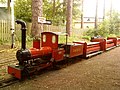
 Miniature Railway track at Papplewick - geograph.org.uk - 2096649.jpg 640 × 480; 145 KB
-
 Miniature Railway, Papplewick Pumping Station - geograph.org.uk - 6338894.jpg 1,024 × 769; 172 KB
-
 Moor Lane, looking towards Papplewick village - geograph.org.uk - 4014194.jpg 1,280 × 960; 431 KB
-
 Moor Pond dam and sluice - geograph.org.uk - 4014213.jpg 1,280 × 960; 551 KB
-
 Morton's Farmhouse - geograph.org.uk - 4014509.jpg 1,280 × 960; 341 KB
-
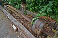
 Mounted pumping equipment - geograph.org.uk - 2113491.jpg 640 × 480; 119 KB
-
 Mystery bench mark - geograph.org.uk - 4014412.jpg 1,280 × 960; 619 KB
-

-

-
 Near A60-B6011 Junction, Burntstump, Notts. - geograph.org.uk - 4320453.jpg 3,187 × 2,407; 1.37 MB
-
 Near A60-B6011 Junction, Burntstump, Notts. - geograph.org.uk - 4320465.jpg 3,929 × 2,850; 2.03 MB
-
 Near A60-B6011 Junction, Burntstump, Notts. - geograph.org.uk - 4320475.jpg 3,326 × 2,898; 1.84 MB
-
 Oak tree and national speed limit sign - geograph.org.uk - 5835194.jpg 1,280 × 1,280; 565 KB
-
 Old Paviors sports ground - geograph.org.uk - 1428384.jpg 640 × 479; 158 KB
-
 Old Paviors sports ground - geograph.org.uk - 1428388.jpg 640 × 479; 128 KB
-
 Old railway cutting - geograph.org.uk - 2672384.jpg 851 × 1,280; 350 KB
-
 Pantiles, Papplewick - geograph.org.uk - 4014497.jpg 1,280 × 1,280; 503 KB
-
 Papplewick - NG15 - geograph.org.uk - 3232207.jpg 3,453 × 2,335; 1.82 MB
-
 Papplewick church from Linby Lane - geograph.org.uk - 4014393.jpg 1,280 × 960; 661 KB
-
 Papplewick church tower - geograph.org.uk - 4014399.jpg 942 × 1,280; 390 KB
-
 Papplewick cottages - geograph.org.uk - 4894993.jpg 800 × 600; 118 KB
-
 Papplewick Grange, NG15 - geograph.org.uk - 3233943.jpg 3,624 × 2,692; 1.7 MB
-
 Papplewick Hall, the entrance front - geograph.org.uk - 4015667.jpg 1,280 × 960; 557 KB
-
 Papplewick House, Papplewick - geograph.org.uk - 3410609.jpg 640 × 422; 180 KB
-
 Papplewick Lodge - geograph.org.uk - 4014424.jpg 1,280 × 960; 362 KB
-
 Papplewick Moor Lane postbox ref NG15 31 - geograph.org.uk - 4014187.jpg 960 × 1,280; 518 KB
-

-
 Papplewick Pumping Station - Beam tops - geograph.org.uk - 3571166.jpg 640 × 424; 262 KB
-
 Papplewick Pumping Station - boiler house - geograph.org.uk - 5842655.jpg 1,280 × 850; 393 KB
-
 Papplewick Pumping Station - boilers - geograph.org.uk - 3570313.jpg 640 × 427; 72 KB
-
 Papplewick Pumping Station - bucket pump - geograph.org.uk - 3574647.jpg 640 × 424; 316 KB
-

-

-

-

-

-
 Papplewick Pumping Station - Cylinders - geograph.org.uk - 3571163.jpg 640 × 424; 252 KB
-
 Papplewick Pumping Station - Cylinders - geograph.org.uk - 3574580.jpg 640 × 424; 263 KB
-
 Papplewick Pumping Station - Cylinders - geograph.org.uk - 3574586.jpg 424 × 640; 267 KB
-
 Papplewick Pumping Station - Cylinders - geograph.org.uk - 3574592.jpg 640 × 424; 259 KB
-

-

-
 Papplewick Pumping Station - engine maker's plate - geograph.org.uk - 5842659.jpg 1,280 × 1,024; 291 KB
-

-

-

-
 Papplewick Pumping Station - foot valves - geograph.org.uk - 6346610.jpg 640 × 427; 121 KB
-

-

-

-

-
 Papplewick Pumping Station - geograph.org.uk - 3567409.jpg 640 × 419; 273 KB
-
 Papplewick Pumping Station - geograph.org.uk - 5842650.jpg 1,280 × 1,280; 826 KB
-
 Papplewick Pumping Station - geograph.org.uk - 6344659.jpg 640 × 427; 117 KB
-
 Papplewick Pumping Station - Governor - geograph.org.uk - 3574616.jpg 640 × 424; 245 KB
-
 Papplewick Pumping Station - Greenhouse - geograph.org.uk - 3567416.jpg 640 × 424; 290 KB
-

-

-

-

-

-

-

-

-

-

-
 Papplewick Pumping Station - live well - geograph.org.uk - 6346374.jpg 640 × 427; 129 KB
-

-

-

-

-

-
 Papplewick Pumping Station - Pump rod - geograph.org.uk - 3574577.jpg 424 × 640; 260 KB
-
 Papplewick Pumping Station - rainbow - geograph.org.uk - 6344778.jpg 427 × 640; 123 KB
-

-

-

-

-
-
 Papplewick Pumping Station - winch - geograph.org.uk - 6346616.jpg 640 × 427; 131 KB
-
 Papplewick Pumping Station - Workshop - geograph.org.uk - 3574881.jpg 640 × 424; 236 KB
-

-
 Papplewick Pumping Station Entrance - geograph.org.uk - 1900203.jpg 640 × 426; 54 KB
-
 Papplewick Pumping Station winding house - geograph.org.uk - 4843139.jpg 1,152 × 864; 358 KB
-
 Papplewick Reservoir No.2 - geograph.org.uk - 2671850.jpg 1,280 × 853; 196 KB
-
 Papplewick reservoirs - geograph.org.uk - 2671822.jpg 1,280 × 853; 233 KB
-
 Papplewick reservoirs - geograph.org.uk - 2671880.jpg 1,280 × 853; 247 KB
-
 Papplewick village sign - geograph.org.uk - 4894998.jpg 800 × 592; 164 KB
-
 Papplewick village sign on Linby Lane - geograph.org.uk - 4014391.jpg 1,280 × 960; 525 KB
-
 Papplewick village sign, Blidworth Waye - geograph.org.uk - 4015673.jpg 1,280 × 960; 522 KB
-
 Papplewick, NG15 - geograph.org.uk - 3232224.jpg 800 × 511; 112 KB
-
 Papplewick, NG15 - geograph.org.uk - 3232228.jpg 3,178 × 2,410; 1.55 MB
-
 Papplewick, NG15 - geograph.org.uk - 3232278.jpg 3,440 × 2,508; 1.52 MB
-
 Papplewick, NG15 - geograph.org.uk - 3233010.jpg 3,780 × 2,938; 1.8 MB
-
 Papplewick, NG15 - geograph.org.uk - 3233086.jpg 4,032 × 3,024; 2.23 MB
-
 Papplewick, NG15 - geograph.org.uk - 3233125.jpg 3,653 × 2,950; 1.99 MB
-
 Papplewick, NG15 - geograph.org.uk - 3233153.jpg 3,494 × 2,945; 1.96 MB
-
 Papplewick, NG15 - geograph.org.uk - 3233290.jpg 4,026 × 2,693; 1.92 MB
-
 Papplewick, NG15 - geograph.org.uk - 3233675.jpg 2,878 × 4,032; 2.27 MB
-
 Papplewick, NG15 - geograph.org.uk - 3233690.jpg 3,630 × 2,800; 1.74 MB
-
 Papplewick, Nottinghamshire - geograph.org.uk - 2838881.jpg 640 × 480; 104 KB
-
 Path in Seven Mile Wood - geograph.org.uk - 5540941.jpg 1,024 × 768; 292 KB
-
 Path through the pylon - geograph.org.uk - 6267889.jpg 1,280 × 960; 493 KB
-

-

-
 Ploughed fields at Stanker Hill Farm - geograph.org.uk - 4894359.jpg 800 × 600; 160 KB
-
 Prepared field and Papplewick Pumping Station - geograph.org.uk - 6317725.jpg 1,024 × 768; 132 KB
-
 Private path - geograph.org.uk - 2113423.jpg 640 × 480; 144 KB
-
 Private road to school and hotel - geograph.org.uk - 1761685.jpg 640 × 480; 81 KB


_-_geograph.org.uk_-_2668541.jpg)


_-_geograph.org.uk_-_3830895.jpg)


