Category:Panoramics in Washington (state)
Jump to navigation
Jump to search
States of the United States: Alabama · Alaska · Arizona · Arkansas · California · Colorado · Connecticut · Delaware · Florida · Georgia · Hawaii · Idaho · Illinois · Indiana · Iowa · Kansas · Louisiana · Maine · Maryland · Massachusetts · Michigan · Minnesota · Mississippi · Missouri · Montana · Nebraska · Nevada · New Hampshire · New Jersey · New Mexico · New York · North Carolina · North Dakota · Ohio · Oklahoma · Oregon · Pennsylvania · Rhode Island · South Carolina · South Dakota · Tennessee · Texas · Utah · Vermont · Virginia · Washington · West Virginia · Wisconsin · Wyoming – Washington, D.C.
Puerto Rico
Puerto Rico
Subcategories
This category has the following 9 subcategories, out of 9 total.
Media in category "Panoramics in Washington (state)"
The following 200 files are in this category, out of 424 total.
(previous page) (next page)-
 1c Panorama (7518585064).jpg 2,400 × 797; 493 KB
-
 2014-07-09 Paine Field Panorama.jpg 28,641 × 2,252; 5.43 MB
-
 Adventuress pano 01.jpg 7,207 × 5,047; 8.09 MB
-
 Aeneas Valley WA from Forest Rd 3120.jpg 6,411 × 1,844; 7.55 MB
-
 Aeneas WA.jpg 5,834 × 1,958; 2.36 MB
-
 Aerial view of Index, Wash., ca. 1900 - DPLA - f3786c8c3a7f8f2596a34db97660998a.jpg 13,350 × 3,929; 4.25 MB
-
 Alki Beach pano 01A.jpg 8,840 × 1,415; 2.58 MB
-
 An oil painting you can hike (9449409683).jpg 1,500 × 506; 423 KB
-
 Anacortes - Railroad Avenue Beach pano 01.jpg 4,276 × 1,622; 3.16 MB
-
 Anacortes ferry pano 01 (19842347254).jpg 7,384 × 1,656; 1.92 MB
-
 Anacortes ferry pano 02 (20276945598).jpg 10,504 × 1,753; 3.85 MB
-
 Anacortes, WA - Harbor, Altair-Americus Memorial Park pano 01.jpg 8,471 × 2,728; 5 MB
-
 Anacortes, WA - Seafarers Memorial Park pano 01.jpg 9,640 × 2,245; 13.48 MB
-
 Anacortes, WA - W.T. Preston pano 01.jpg 5,448 × 2,184; 2.22 MB
-
 Angle Lake 4934s.jpg 16,889 × 2,664; 8.3 MB
-
 Astoria-Megler Bridge 90° pano - Washington side.jpg 13,343 × 2,367; 7.13 MB
-
 Astoria-Megler Bridge02 2008-02-26.jpg 8,033 × 1,843; 2.53 MB
-
 At Johnston Ridge Observatory NW of Mt St Helens - evening light panorama (11362363206).jpg 2,296 × 1,306; 3.52 MB
-
 Barnes Creek pano 01.jpg 5,901 × 2,406; 10.69 MB
-
 Beach at Ocean Shores, WA - the bar, pano 01.jpg 5,904 × 1,632; 2.13 MB
-
 Beach at Westport, WA pano 01.jpg 25,445 × 2,648; 21.75 MB
-
 Bellevue to Seattle pano.jpg 4,019 × 1,880; 2.41 MB
-
 Bellevue, WA - Downtown Park pano 01.jpg 9,458 × 2,354; 3.34 MB
-
 Bellevue, WA - Downtown Park pano 02.jpg 9,509 × 2,310; 3.52 MB
-
 Bellevue, WA - Downtown Park pano 02A.jpg 9,163 × 1,628; 2.86 MB
-
 Bellevue, WA - Downtown Park pano 03.jpg 10,709 × 2,387; 3.46 MB
-
 Bellevue, WA - Downtown Park pano 03A.jpg 5,126 × 1,716; 1.45 MB
-
 Bellevue, WA - Lake Bellevue pano 01.jpg 9,210 × 2,374; 1.9 MB
-
 Bellingham 1909.jpg 2,956 × 420; 442 KB
-
 Bellingham, Wash LCCN2007661614.tif 4,555 × 711; 9.27 MB
-
 Bloedel Reserve pano 01.jpg 5,853 × 2,968; 2.53 MB
-
 BlueHillsWA-BowenVP.jpg 1,218 × 200; 47 KB
-
 Bothell Landing pano 01.jpg 8,299 × 1,755; 3.43 MB
-
-
 Bremerton Naval Yard pano 01.jpg 10,395 × 1,815; 2.42 MB
-
 Bremerton, Washington harbor pano 01 (48572311742).jpg 10,494 × 3,096; 5.2 MB
-
 Bremerton, Washington harbor pano 02 (48572161396).jpg 7,324 × 1,922; 3.08 MB
-
 Bremerton, Washington pano 01.jpg 14,314 × 1,796; 3.27 MB
-
 Buckhorn, Iron Mountains from Marmot Pass.jpg 9,620 × 1,873; 3.94 MB
-
 BuckhornSummitPanorama.jpg 14,959 × 1,390; 4.16 MB
-
 Cama Beach Resort pano 01.jpg 6,700 × 2,592; 4.97 MB
-
 Cama Beach Resort pano 02.jpg 5,702 × 1,800; 3.13 MB
-
 Camano Island - Cranberry Lake pano 01.jpg 6,043 × 2,720; 4.69 MB
-
 Cap Sante, Anacortes, Washington (20034477592).jpg 20,560 × 5,504; 55.38 MB
-
 Cape Alava - Flickr - GregTheBusker.jpg 2,048 × 294; 105 KB
-
 Cape Flattery and vicinity from the Strait of Juan de Fuca pano 01.jpg 39,716 × 2,345; 35.7 MB
-

-

-
 Carbon River pano 01.jpg 14,642 × 11,676; 14.69 MB
-
 Carbon River pano 01A.jpg 6,912 × 10,528; 12.58 MB
-
 Carbonado, WA pano 01.jpg 14,739 × 2,547; 11.99 MB
-
 Carbonado, WA pano 02.jpg 7,624 × 1,392; 3.73 MB
-
 Cascade Pass at North Cascades in WA - Flickr - landscapesinthewest.jpg 4,800 × 1,280; 5.2 MB
-
 Cathlamet, WA - County Line Park pano 01.jpg 9,152 × 2,662; 5.09 MB
-
 Cattle Point Lighthouse pano 01.jpg 14,025 × 2,548; 20.99 MB
-

-
 Christine Falls and Bridge, Mount Rainier National Park, equirectangular HDR pano 01.jpg 5,702 × 6,969; 7.05 MB
-
 Christine Falls overlook , Mount Rainier National Park, pano 02.jpg 12,295 × 5,091; 11.84 MB
-
 Christine Falls, Mount Rainier National Park, cylindrical HDR pano 01 (cropped).jpg 3,113 × 20,142; 11.4 MB
-
 Christine Falls, Mount Rainier National Park, cylindrical HDR pano 01.jpg 7,245 × 21,870; 19.07 MB
-
 Christine Falls, Mount Rainier National Park, equirectangular pano 02.jpg 7,877 × 9,821; 10.28 MB
-
 Cliffs at Roosevelt Beach, WA 01.jpg 8,748 × 2,815; 5.3 MB
-

-
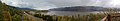
 Columbia Gorge east of Hood River (4332506595).jpg 3,272 × 768; 873 KB
-
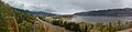
 Columbia River - Mitchell Point Viewpoint pano 01.jpg 6,527 × 2,480; 4.07 MB
-
 Columbia River from Maryhill Museum of Art - pano 01.jpg 18,216 × 2,019; 7.87 MB
-
 Columbia River from Maryhill Museum of Art - pano 02.jpg 20,041 × 1,839; 6.68 MB
-
 Columbia River from Maryhill Museum of Art - pano 03.jpg 8,394 × 1,679; 2.78 MB
-
 Columbia River from Maryhill Museum of Art - pano 04.jpg 9,116 × 1,710; 3.29 MB
-
 Columbia River from Maryhill Museum of Art - pano 05.jpg 9,208 × 1,724; 3.08 MB
-
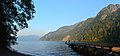
 Columbia River from Rowena Crest pano 01.jpg 10,637 × 2,383; 13.3 MB
-
 Columbia River from Rowena Crest pano 02.jpg 13,863 × 3,033; 23.78 MB
-
 Columbia River from Rowena Crest pano 02A.jpg 13,287 × 2,912; 23.26 MB
-
 Columbia River near Bridal Veil Falls pano 01.jpg 9,504 × 2,421; 14.95 MB
-
 Columbia River near Bridal Veil Falls pano 02.jpg 12,881 × 2,443; 16.49 MB
-
 Columbia River near Bridal Veil Falls pano 03.jpg 13,309 × 2,309; 16.05 MB
-
 Columbia River near Bridal Veil Falls pano 03B.jpg 13,309 × 2,309; 14.94 MB
-
 Columbia River near Bridal Veil Falls pano 04.jpg 9,672 × 2,375; 12.47 MB
-
 ColumbiaRiverGorgePanorama.jpg 13,736 × 3,292; 9.19 MB
-

-
 Conway, WA pano 01.jpg 14,797 × 2,064; 4.38 MB
-
 Coupeville, WA - Old Grain Wharf pano 01.jpg 18,810 × 4,692; 14.09 MB
-
 Coupeville, WA - Old Grain Wharf pano 02.jpg 5,825 × 2,496; 4.47 MB
-
 Crescent Lake (Olympic Peninsula) pano 01.jpg 8,638 × 4,038; 19.08 MB
-
 Crescent Lake Panorama - panoramio.jpg 4,780 × 1,144; 1.05 MB
-
 Cypress Island Panorama Small.jpg 8,796 × 1,200; 3.02 MB
-
 Deception Pass pano 01.jpg 6,218 × 2,752; 3.24 MB
-
 Deception Pass pano 02.jpg 14,574 × 2,493; 7.42 MB
-
 Deception Pass pano 03.jpg 5,992 × 1,576; 1.81 MB
-
 Del Campo Peak Panorama (2865019799).jpg 1,024 × 188; 91 KB
-
 Des Moines, Washington Panoramic.jpg 3,978 × 720; 502 KB
-
 Diablo Dam, Washington.jpg 10,190 × 1,741; 7.3 MB
-
 Diablo Lake pano 01.jpg 5,226 × 2,640; 2.97 MB
-
 Diablo Lake pano 2021-06-20.jpg 13,816 × 3,728; 26.08 MB
-
 Discovery Park Overlook, Seattle, WA - panoramio.jpg 2,960 × 1,050; 1.54 MB
-
 Division Street Bridge.jpg 10,838 × 2,562; 12.93 MB
-
 Dockton, WA pano 01.jpg 6,472 × 2,224; 2.17 MB
-
 Dockton, WA pano 02.jpg 5,371 × 1,672; 1.26 MB
-
 Dosewallips State Park pano 01.jpg 18,065 × 1,840; 11.99 MB
-
 Downtown La Conner, WA pano 01.jpg 5,528 × 2,211; 2.01 MB
-
 Dry Falls State Park-2.jpg (8644101207).jpg 3,309 × 907; 3.08 MB
-
 Dry Falls.jpg 5,050 × 2,188; 3.51 MB
-
 DryFalls WA.jpg 3,872 × 2,592; 1.86 MB
-
 Dumas Bay pano 01.jpg 16,703 × 3,882; 44.56 MB
-
 Duvall, WA - Holy Innocents Church pano.jpg 6,008 × 2,168; 2.29 MB
-
 Duwamish - Chinook Wind Estuary pano 01.jpg 9,227 × 2,436; 11.79 MB
-
 Duwamish - Chinook Wind Estuary pano 02.jpg 8,849 × 2,383; 11.4 MB
-
 East Bay, Olympia, Washington pano 01.jpg 8,104 × 2,144; 2.44 MB
-
 East part of old Olympia Brewery - pano 01.jpg 6,160 × 2,744; 7.59 MB
-
 Echo Bay Sucia Island.jpg 13,813 × 1,863; 4.48 MB
-
 Edmonds, Washington from ferry dock pano 01.jpg 7,123 × 1,579; 3.8 MB
-
 Edmonds, Washington from ferry dock pano 02.jpg 8,016 × 1,752; 3.93 MB
-
 Edmonds, Washington from ferry dock pano 03.jpg 8,024 × 1,576; 3.93 MB
-
 Ellensburg Washington from Manastash Ridge - panoramio.jpg 7,356 × 844; 1.28 MB
-
 Enumclaw, WA — Farmers Park (2020-05-17), pano.jpg 15,488 × 3,898; 21.46 MB
-
 Evans Creek Preserve - lower trailhead panorama 01 (27305763982).jpg 6,104 × 2,904; 7.39 MB
-
 Evans Creek Preserve vertical pano 01 (27306434612).jpg 4,353 × 4,257; 5.51 MB
-
 Evans Creek Preserve vertical pano 01 (rectangular crop) (27332643931).jpg 2,728 × 3,696; 4.25 MB
-
 Evening at Dodwell-Rixon Pass.jpg 9,331 × 1,704; 3.57 MB
-
 Everett - Evergreen Cemetery - pano 01.jpg 6,560 × 3,880; 4.52 MB
-
 Everett - Rucker tomb pano 01.jpg 7,708 × 2,736; 12.54 MB
-
 Everett, WA - Legion Park view pano3.jpg 7,344 × 1,200; 1.11 MB
-
 Fairweather Nature Preserve pano 01.jpg 6,358 × 3,112; 14.83 MB
-
 Falls Creek below Marymere Falls pano 01.jpg 4,052 × 6,928; 16.58 MB
-
 Farm near Chesaw.jpg 7,290 × 1,999; 2.89 MB
-
 Ferndale, WA - Pioneer Park - pano 01.jpg 14,747 × 2,933; 12.15 MB
-
 Ferndale, WA - rail bridge over the Nooksack - pano.jpg 4,736 × 1,976; 1.19 MB
-
 Ferndale, WA Wikivoyage banner.jpg 4,736 × 676; 711 KB
-
 Fir Island, WA - Wiley Slough pano 01.jpg 13,662 × 4,064; 24.12 MB
-
 Fir Island, WA - Wiley Slough pano 02.jpg 12,784 × 2,224; 12.49 MB
-
 Fir-Conway Lutheran Church 01 pano.jpg 9,603 × 2,376; 2.5 MB
-
 FMIB 44716 Carlisle Packing Company's Plant, Village Point, Puget Sound.jpeg 1,877 × 629; 305 KB
-
 FMIB 44717 Carlisle Packing Company's Plant, Village Point, Puget Sound.jpeg 1,877 × 619; 367 KB
-
 FMIB 44737 Salmon Cannery, Lummi Bay Packing Co, Lummi Island, Puget Sound.jpeg 1,340 × 501; 361 KB
-
 FMIB 45211 Robinson Fisheries Co, Anacortes, Washington.jpeg 1,313 × 453; 188 KB
-
 Fort Casey pano 01.jpg 6,656 × 1,568; 2.02 MB
-
 Fort Worden Battery Kinzie pano 01.jpg 5,355 × 2,912; 2.75 MB
-
 Fort Worden Battery Kinzie pano 02.jpg 9,604 × 1,800; 3.63 MB
-
 Fort Worden Panorama.jpg 12,221 × 1,050; 3.34 MB
-
 Franz lake nwr columbia river.jpg 13,185 × 3,227; 4.52 MB
-
 Fresh Snow over Tatie Peak (5037820943).jpg 1,594 × 626; 313 KB
-
 Front St. Leavenworth, WA (panorama).jpg 9,968 × 2,332; 11.18 MB
-
 Front St. Leavenworth, WA at night (panorama).jpg 10,784 × 2,332; 25.57 MB
-
 Goat Peak, Cascades.jpg 19,586 × 4,959; 32.19 MB
-
 Goat Rocks Wilderness, Goat Ridge - Pano - Flickr - Joe Parks.jpg 1,280 × 387; 507 KB
-
 Gonzaga University 360.jpg 10,000 × 1,743; 4.69 MB
-
 Gorge Creek entering Gorge Lake pano 01.jpg 2,041 × 4,250; 8.02 MB
-
 Gorge Creek Falls - pano 01.jpg 3,714 × 6,654; 20.19 MB
-
 Grand Coulee Dam Panorama.jpg 17,038 × 10,153; 54.07 MB
-
 Green River Gorge Conservation Area pano 01.jpg 6,880 × 3,960; 17.89 MB
-
 Green River in Kanaskat-Palmer State Park - pano 01.jpg 17,182 × 2,171; 29.25 MB
-
 Green River in Kanaskat-Palmer State Park - pano 02.jpg 15,407 × 2,528; 24.16 MB
-
 Green River in Kanaskat-Palmer State Park - pano 03.jpg 8,693 × 2,101; 16.27 MB
-
 Green River in Kanaskat-Palmer State Park - vertical pano 01 - rectangular crop.jpg 3,904 × 7,312; 20.3 MB
-
 Green River in Kanaskat-Palmer State Park - vertical pano 01.jpg 5,840 × 7,952; 24.42 MB
-
 Green River in Kanaskat-Palmer State Park, pano 01.jpg 12,303 × 3,126; 41.14 MB
-
 Green River in Kanaskat-Palmer State Park, pano 02.jpg 13,612 × 2,865; 42.61 MB
-
 Green River Natural Resources Area - pano looking southeast from North Observation Tower.jpg 10,721 × 4,004; 14.17 MB
-
 Guemes Island from Anacortes pano 01.jpg 5,560 × 2,497; 6.31 MB
-
 Hills in the Aeneas Valley WA.jpg 4,170 × 1,479; 4.11 MB
-
 Hills near Aeneas WA.jpg 13,251 × 1,496; 10.78 MB
-
 Hoh River Panorama (39016051835).jpg 7,000 × 3,500; 13.63 MB
-
 Hoquiam River - panoramio.jpg 3,264 × 804; 811 KB
-
 Hurricane Hill Panorama.jpg 16,599 × 1,739; 9.5 MB
-
 Hurricane Ridge Panorama III (18003674564).jpg 6,204 × 2,247; 5.32 MB
-
 Hurricane Ridge Panorama.jpg 9,195 × 2,326; 2.45 MB
-
 Hurricane Ridge.jpg 1,019 × 322; 274 KB
-
 I-5 Skagit River Bridge - panorama, 2013-06-03.jpg 2,232 × 696; 1.08 MB
-
 I-90 Columbia River Scenic Overlook pano 01.jpg 12,254 × 2,507; 5.35 MB
-
 I-90 Columbia River Scenic Overlook pano 02.jpg 10,168 × 2,580; 5.13 MB
-
 Inside an Incomplete Satsop Cooling Tower - Mercator Projection.jpg 6,050 × 3,344; 14.19 MB
-
 John G. Young landing on Skagit River - pano 01.jpg 8,856 × 2,534; 7.53 MB
-
 Keechelus Lake looking west.JPG 5,041 × 1,156; 4.89 MB
-
 Kent, Washington - Green River Trail pano 01.jpg 5,011 × 2,212; 2.76 MB
-
 Kent, Washington - Meeker St Bridge pano.jpg 3,883 × 2,140; 925 KB
-
 Kettle Falls Bridges.jpg 13,848 × 4,452; 18.63 MB
-
 Kingston, WA at dusk from docked ferry - pano.jpg 6,668 × 1,757; 3.66 MB
-
 Kirkland, WA - Marina Park pano 01.jpg 14,824 × 2,509; 3.1 MB
-
 Kirkland, WA - Marina Park pano 02.jpg 6,633 × 2,208; 1.35 MB
-
 Kirkland, WA - Marina Park pano 02A.jpg 6,633 × 1,640; 1.21 MB
-
 Kopachuck Panorama.jpg 14,022 × 1,525; 8.12 MB
-
 La Conner, WA - Pleasant Ridge Cemetery pano 01.jpg 14,789 × 1,714; 14.71 MB
-
 La Conner, WA - Pleasant Ridge Cemetery pano 02.jpg 7,541 × 1,664; 7.79 MB
-
 La Conner, WA - Swinomish Channel pano 01.jpg 11,198 × 1,969; 2.59 MB
-
 La Conner, WA - waterfront pano 01.jpg 8,313 × 1,540; 4.91 MB
-
 Lake Cassidy pano 01.jpg 10,152 × 1,694; 2.54 MB
-
 Lake Cushman Pano.jpg 6,645 × 2,915; 4.8 MB
-
 Lake McMurray, WA - pano 01.jpg 4,399 × 1,359; 1.38 MB
-
 Lake Quinault pano 01.jpg 8,035 × 2,372; 5.59 MB
-
 Lake Quinault pano 02.jpg 9,070 × 1,716; 4.78 MB
-
 Lake Quinault, Washington - panoramio.jpg 5,872 × 1,704; 3.53 MB
-
 Lake Samish (1069296081).jpg 1,024 × 218; 132 KB
-
 Lake Sawyer pano 01.jpg 8,593 × 3,297; 17.02 MB
-
 Lake Steilacoom.jpg 6,889 × 1,050; 2.49 MB
-
 Lake Stevens, WA - City Swimming Beach pano 01.jpg 14,770 × 1,792; 13.15 MB
-
 Lake Stevens, WA - North Cove Park pano 01.jpg 8,684 × 1,662; 6.18 MB
-
 Lake Sylvia pano 01.jpg 10,246 × 2,474; 13.43 MB
-
 Lake Sylvia pano 02 - view from dam.jpg 5,106 × 2,612; 6.54 MB
-
 Leavenworth Panorama.jpg 19,614 × 2,986; 17.53 MB
-
 Lewiston, Clarkston, Snake River, Clearwater River pano 01.jpg 19,358 × 2,369; 8.53 MB

.jpg)


.jpg)


.jpg)

_pano_01.jpg)


.jpg)
.jpg)
_(27332643931).jpg)


.jpg)


&filefrom=Liberty+Bay+from+Poulsbo%2C+WA+-+pano+01.jpg#mw-category-media)
.jpg)
.jpg)
.jpg)
.jpg)
.jpg)
.jpg)
.jpg)
.jpeg)
.jpeg)
.jpg)
.jpg)
.jpg)
.jpg)
.jpg)
,_pano.jpg)
.jpg)
.jpg)
.jpg)
.jpg)
.jpg)