Category:Panoramics in South Australia
Jump to navigation
Jump to search
States of Australia: New South Wales · Queensland · South Australia · Tasmania · Western Australia
Internal territories of Australia: Australian Capital Territory · Northern Territory
External territories of Australia:
Internal territories of Australia: Australian Capital Territory · Northern Territory
External territories of Australia:
Media in category "Panoramics in South Australia"
The following 76 files are in this category, out of 76 total.
-
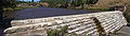
 28 Mile Crossing Camp Ground, Coorong National Park 03.jpg 8,944 × 1,664; 3.19 MB
-
 28 Mile Crossing Camp Ground, Coorong National Park 05.jpg 5,456 × 1,664; 3.03 MB
-
 Adelaide SA 5000, Australia - panoramio (15).jpg 6,786 × 2,412; 4.76 MB
-
 Barossa.jpg 4,000 × 1,000; 726 KB
-
 Browns Beach panorama.JPG 3,358 × 1,014; 1.87 MB
-
 Bundaleer Forest arboretum.jpg 3,871 × 1,039; 1.11 MB
-
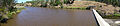
 Clarendon Weir panorama 01.jpg 1,621 × 3,369; 844 KB
-
 Clarendon Weir panorama 02.jpg 4,446 × 1,399; 1.11 MB
-
 Clarendon Weir panorama 03.jpg 3,828 × 1,483; 944 KB
-
 Clarendon Weir panorama 04.jpg 4,980 × 1,422; 1.11 MB
-
 Clarendon Weir panorama 05.jpg 5,852 × 1,277; 1.18 MB
-
 Coober Pedy Panorama.jpg 5,873 × 1,342; 6.41 MB
-
 Coober01.JPG 2,423 × 520; 406 KB
-
 Coorong Banner.jpg 8,933 × 1,283; 2.76 MB
-
 Coorong National Park - panoramio - Wikipedian (1).jpg 4,517 × 859; 1.1 MB
-
 Dutchmans Stern panorama.JPG 4,912 × 1,080; 2.55 MB
-
 Emu Bay.JPG 4,848 × 832; 1.44 MB
-
 Endless Stations 10 - On The Rim.jpg 2,945 × 3,000; 8.87 MB
-
 Endless Stations 171 - Sandy Air.jpg 4,512 × 3,000; 16.09 MB
-
 Endless Stations 173 - The Cliffs Of Insanity.jpg 3,964 × 3,000; 8.14 MB
-
 Endless Stations 174 - The Sudden End Of The Bunda Cliffs.jpg 4,012 × 3,000; 11.55 MB
-
 Endless Stations 175 - Whale Watching In The Off Season.jpg 5,120 × 2,012; 8.82 MB
-
 Endless Stations 176 - A Wheaten Horizon.jpg 5,120 × 2,195; 10.13 MB
-
 Endless Stations 177 - Sun God.jpg 2,497 × 2,497; 3.02 MB
-
 Endless Stations 178 - Rubbish Bin In The Norman Style.jpg 5,120 × 2,316; 11.78 MB
-
 Endless Stations 180 - Horrocks Pass Road.jpg 5,120 × 1,551; 6.11 MB
-
 Endless Stations 182 - Laputa.jpg 5,120 × 1,478; 4.32 MB
-
 Endless Stations 183 - Homeward.jpg 5,120 × 2,966; 13.15 MB
-
 Endless Stations 183 crop.jpg 5,010 × 2,581; 12.34 MB
-
 Endless Stations 6 - Greyscale Trail.jpg 5,120 × 2,259; 6.54 MB
-
 Ethel wreck panaorama.jpg 1,387 × 617; 142 KB
-
 HDR Panorama of Kangaroo Creek Reservoir. 2011. Peter Neaum. - panoramio.jpg 8,419 × 1,779; 7.92 MB
-
 Horseshoe Bay panorama.jpg 4,286 × 1,855; 2.22 MB
-
-
 IMGP7018 - Grindell's Hut pan - Vulkathunha-Gammon Ranges National Park.jpg 10,122 × 1,673; 10.96 MB
-
 Kangaroo Island - Remarkable Rocks - Australia.jpg 6,555 × 2,310; 745 KB
-
 Lobethal Panorama.jpg 5,704 × 1,576; 2.25 MB
-
 McLaren Vale.jpg 580 × 261; 64 KB
-
 Moonarie.jpg 21,500 × 2,851; 9.01 MB
-
 Mount Compass Golf Course, Panorama.jpg 6,434 × 1,824; 2.24 MB
-
 Mount Gambier (AU), Blue Lake -- 2019 -- 0697-704.jpg 13,225 × 4,580; 33.59 MB
-
 Mt Bold Reservoir panorama.jpg 3,680 × 860; 562 KB
-
 Myponga panorama 1.jpg 2,453 × 600; 421 KB
-
 Myponga panorama 2.jpg 2,366 × 941; 446 KB
-
 Myponga panorama 3.jpg 7,865 × 779; 1.08 MB
-
 Myponga panorama 4.jpg 2,464 × 950; 330 KB
-
 Outback SA banner.jpg 10,122 × 1,448; 9.27 MB
-
 Panorama Kangaroo Island.JPG 6,991 × 500; 395 KB
-
 Panorama Mengler Hill.jpg 750 × 201; 43 KB
-
 Panorama showing the Cazneaux Tree, with Wilpena Pound in the background.jpg 6,143 × 2,067; 5.47 MB
-
 Panorama-Myponga Reservoir, South Australia 1.jpg 1,024 × 340; 270 KB
-
 Panoramic view of Cape Spencer and The Gap, Dhilba Guuranda-Innes NP 20230208.jpg 20,309 × 4,179; 21.2 MB
-

-
 Pildappa Rock View 7-1.jpg 2,100 × 300; 512 KB
-
 Port Augusta Banner.jpg 3,539 × 506; 647 KB
-
 Razorback Lookout, Ikara-Flinders Ranges NP 20230212 1.jpg 9,929 × 3,972; 16.62 MB
-
 Regency park.jpg 1,978 × 269; 188 KB
-
 SA Parks banner.jpg 8,944 × 1,276; 2.95 MB
-
 Sellicks Hill View 1.jpg 4,296 × 1,419; 928 KB
-
 Sellicks Hill View 2.jpg 3,819 × 1,506; 848 KB
-
 Sellicks Hill View 3.jpg 6,293 × 1,101; 931 KB
-
 Sellicks Hill View 4.jpg 4,704 × 1,257; 874 KB
-
 Sellicks Hill View 5.jpg 4,324 × 800; 1.03 MB
-
 South Para from hill lookout-merged.jpg 6,645 × 1,357; 2.74 MB
-
 South Parra Reservoir panorama 1.jpg 3,561 × 1,063; 568 KB
-
 South Parra Reservoir panorama 2.jpg 3,121 × 1,073; 467 KB
-
 South Parra Reservoir panorama 3.jpg 5,340 × 1,128; 459 KB
-
 Streaky Bay Pier 7-1.jpg 2,100 × 300; 462 KB
-
 Sturt Gorge.jpg 15,000 × 1,635; 9.01 MB
-

-
 Sunset at Lone Pine - South Australia (Explored).jpg 5,184 × 2,003; 5.46 MB
-
 The Oodnadatta track isolation. Outback South Australia.jpg 4,096 × 1,387; 1.84 MB
-
 View of Rawnsley Bluff and Chace Range from Alison Saddle 20230211 1.jpg 18,060 × 3,440; 19.8 MB
-
 Waves at Lone Pine - South Australia.jpg 5,184 × 2,112; 3.82 MB
-
 Whyalla industy 7-1.jpg 2,100 × 300; 421 KB
-
 Whyalla Pellet Plant from Hummock Hill - panoramio.jpg 3,000 × 634; 1.15 MB


.jpg)
.jpg)
,_Blue_Lake_--_2019_--_0697-704.jpg)
.jpg)