Category:Palouse Prairie Ecoregion (One Earth)
Jump to navigation
Jump to search
One Earth Ecoregion .jpg) | |||||
| Upload media | |||||
| Instance of |
| ||||
|---|---|---|---|---|---|
| |||||
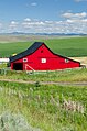
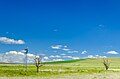
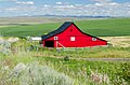
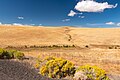
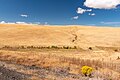
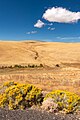
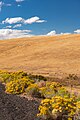
The Palouse Prairie Ecoregion is a designated ecoregion by One Earth. It is classified as a Temperate Grasslands, Savannas, & Shrublands Biome. It is one of two ecoregions in the Columbia Plateau & Blue Mountains Bioregion, with the other member being the Blue Mountains Forests Ecoregion.
Subcategories
This category has the following 14 subcategories, out of 14 total.
Media in category "Palouse Prairie Ecoregion (One Earth)"
The following 27 files are in this category, out of 27 total.
-
 Balm Fork, Willow Creek Reservoir, Heppner - DPLA - a151b3c74c731d04edde179d6d6f2b3c.jpg 1,330 × 2,000; 782 KB
-
 Highway 206, Heppner - DPLA - 23bffd698f05a69369fc6742e8bb6df0.jpg 2,000 × 1,325; 586 KB
-
 Highway 206, Heppner - DPLA - 28c4d82d08b6a3170ec5071a1beedaee.jpg 1,325 × 2,000; 1.03 MB
-
 Highway 206, Heppner - DPLA - 641e61e9fb1f9296a9c01c9eb89a0355.jpg 1,325 × 2,000; 1.03 MB
-
 Highway 206, Heppner - DPLA - 7efb675d35690b81c5393fa2486f1997.jpg 2,000 × 1,325; 562 KB
-
 Highway 206, Heppner - DPLA - 8b22de5f1e3553468f3f081fba441baa.jpg 2,000 × 1,325; 1.2 MB
-
 Highway 206, Heppner - DPLA - 9084a6680ffc7969eab161b9038f0e7a.jpg 1,325 × 2,000; 960 KB
-
 Highway 206, Heppner - DPLA - 934a3596ce50bf2eeba8963ebbda7018.jpg 2,000 × 1,325; 976 KB
-
 Highway 206, Heppner - DPLA - a1cf24660b0bab9412d8ee60feb4a647.jpg 2,000 × 1,325; 552 KB
-
 Highway 206, Heppner - DPLA - adff0935c247def0aa672e9b04f5f8d5.jpg 2,000 × 1,325; 1.03 MB
-
 Highway 206, Heppner - DPLA - dc8bc005b8167bad64fe4a9185f6633e.jpg 2,000 × 1,325; 977 KB
-
 Highway 206, Heppner - DPLA - f55124a9a14018c496c1f6a7ff12be84.jpg 2,000 × 1,325; 659 KB
-
 Highway 207, Heppner - DPLA - 09a4158676d120d361df46d9ccaae9ab.jpg 2,000 × 1,339; 811 KB
-
 Highway 74, Heppner - DPLA - 040db829523c1f4b2e7297a68beb8409.jpg 1,335 × 2,000; 1.25 MB
-
 Highway 74, Heppner - DPLA - 291b8b7ff93183131cea047aeef711c1.jpg 1,335 × 2,000; 1.1 MB
-
 Highway 74, Heppner - DPLA - 758dc01516245568ef149fd8a42b3ca7.jpg 2,000 × 1,335; 997 KB
-
 Highway 74, Heppner - DPLA - 8c1c8f19438e0cb006303888d1c527c6.jpg 2,000 × 1,335; 1.05 MB
-
 Highway 74, Heppner - DPLA - 8e0e58018af1fab13a7b809be2cb5321.jpg 1,335 × 2,000; 1.04 MB
-
 Highway 74, Heppner - DPLA - 9b50f3d413c96981e1aa11a8c04f2ed3.jpg 2,000 × 1,335; 734 KB
-
 Highway 74, Heppner - DPLA - a4c362a2451b9fa182d4011efe5b33b2.jpg 2,000 × 1,335; 994 KB
-
 Highway 74, Heppner - DPLA - a4eaa1f0390f0da29646276dcd8a3ec4.jpg 2,000 × 1,335; 1.08 MB
-
 Highway 74, Heppner - DPLA - b469a6950ac60410317edf772d551875.jpg 2,000 × 1,335; 1.08 MB
-
 Highway 74, Heppner - DPLA - c679625b176946e8edb6c0226b9a0422.jpg 2,000 × 1,335; 1.03 MB
-
 Highway 74, Heppner - DPLA - dce7886454f3ad157eda2cef665ce040.jpg 1,335 × 2,000; 1.11 MB
-
 Highway 74, Heppner - DPLA - fe54767c21ba7140dc7067c7a41d4d43.jpg 1,335 × 2,000; 1,015 KB
-
 Lake, south of Heppner - panoramio.jpg 3,872 × 2,592; 4.06 MB
-
 Umatilla National Forest, Grazing land near Maupin, OR (36380342763).jpg 5,368 × 3,600; 1.76 MB


