Category:Pacific Electric maps
Jump to navigation
Jump to search
This category includes maps of the Bay Area Rapid Transit (BART) system.
Media in category "Pacific Electric maps"
The following 61 files are in this category, out of 61 total.
-
 1925 comprehensive rapid transit plan los angeles.tif 736 × 1,121; 3.15 MB
-
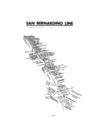
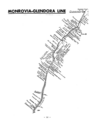
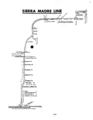
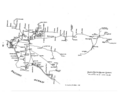 1981 Inventory of Pacific Electric routes maps 01.png 4,276 × 3,336; 118 KB
-
 1981 Inventory of Pacific Electric routes maps 02.jpg 5,100 × 3,295; 1,018 KB
-
 1981 Inventory of Pacific Electric routes maps 03.png 3,294 × 2,549; 85 KB
-
 1981 Inventory of Pacific Electric routes maps 04.png 2,560 × 3,310; 129 KB
-
 1981 Inventory of Pacific Electric routes maps 05.png 2,548 × 3,292; 75 KB
-
 1981 Inventory of Pacific Electric routes maps 06.png 2,543 × 3,286; 93 KB
-
 1981 Inventory of Pacific Electric routes maps 07.png 2,550 × 3,295; 85 KB
-
 1981 Inventory of Pacific Electric routes maps 08.png 2,554 × 3,306; 115 KB
-
 1981 Inventory of Pacific Electric routes maps 09.png 2,555 × 3,307; 53 KB
-
 1981 Inventory of Pacific Electric routes maps 10.png 2,560 × 3,311; 53 KB
-
 1981 Inventory of Pacific Electric routes maps 11.png 2,559 × 3,303; 42 KB
-
 1981 Inventory of Pacific Electric routes maps 12.png 2,565 × 3,311; 195 KB
-
 1981 Inventory of Pacific Electric routes maps 13.png 2,550 × 3,295; 115 KB
-
 1981 Inventory of Pacific Electric routes maps 14.png 2,547 × 3,296; 145 KB
-
 1981 Inventory of Pacific Electric routes maps 15.png 2,590 × 3,315; 129 KB
-
 1981 Inventory of Pacific Electric routes maps 17.png 2,554 × 3,306; 196 KB
-
 1981 Inventory of Pacific Electric routes maps 18.png 2,569 × 3,308; 90 KB
-
 1981 Inventory of Pacific Electric routes maps 19.png 2,550 × 3,295; 89 KB
-
 1981 Inventory of Pacific Electric routes maps 20.png 2,550 × 3,295; 86 KB
-
 1981 Inventory of Pacific Electric routes maps 21.png 2,537 × 3,226; 113 KB
-
 1981 Inventory of Pacific Electric routes maps 22.png 2,550 × 3,294; 147 KB
-
 1981 Inventory of Pacific Electric routes maps 23.png 2,602 × 3,314; 124 KB
-
 1981 Inventory of Pacific Electric routes maps 24.png 2,558 × 3,302; 87 KB
-
 1981 Inventory of Pacific Electric routes maps 25.png 2,590 × 3,312; 86 KB
-
 1981 Inventory of Pacific Electric routes maps 26.png 2,716 × 3,436; 81 KB
-
 1981 Inventory of Pacific Electric routes maps 27.png 2,547 × 3,291; 60 KB
-
 1981 Inventory of Pacific Electric routes maps 28.png 2,603 × 3,304; 115 KB
-
 1981 Inventory of Pacific Electric routes maps 29.png 2,661 × 3,383; 41 KB
-
 1981 Inventory of Pacific Electric routes maps 30.png 2,550 × 3,293; 168 KB
-
 1981 Inventory of Pacific Electric routes maps 31.png 2,567 × 3,317; 73 KB
-
 1981 Inventory of Pacific Electric routes maps 32.png 2,581 × 3,309; 138 KB
-
 1981 Inventory of Pacific Electric routes maps 33.png 2,533 × 3,278; 75 KB
-
 1981 Inventory of Pacific Electric routes maps 34.png 2,563 × 3,308; 51 KB
-
 1981 Inventory of Pacific Electric routes maps 35.png 3,312 × 2,568; 151 KB
-
 1981 Inventory of Pacific Electric routes maps 36.png 2,556 × 3,299; 38 KB
-
 1981 Inventory of Pacific Electric routes maps 37.png 2,611 × 3,328; 76 KB
-
 1981 Inventory of Pacific Electric routes maps 38.png 2,555 × 3,298; 72 KB
-
 1981 Inventory of Pacific Electric routes maps 39.png 2,556 × 3,302; 85 KB
-
 1981 Inventory of Pacific Electric routes maps 40.png 2,540 × 3,282; 33 KB
-
 Architect and engineer (1920) (14596510397).jpg 2,359 × 3,692; 678 KB
-
 Electric railway journal (1909) (14738672486).jpg 2,288 × 3,288; 1.47 MB
-
 Image from page 567 of "The Street railway journal" (1884).jpg 2,494 × 2,750; 707 KB
-
 Lines of the Pacific Electric Railway in Southern California 1912 (uclamss 294 b120 1).png 7,584 × 5,688; 40.94 MB
-
 Location of Motordrome stop (California geographic place name).jpg 1,035 × 675; 703 KB
-
 Los Angeles Pacific Electric Railways (Red Cars).svg 1,000 × 590; 962 KB
-
 Los Angeles Pacific Railroad Map 1909.png 564 × 680; 319 KB
-
 LosAngeles-1941.png 3,000 × 2,217; 784 KB
-

-
 Map of the Los Angeles-Pacific R.R (uclamss 294 b96 1).jpg 7,728 × 6,303; 14.65 MB
-
 Map of the Venice-Inglewood.jpg 4,587 × 2,243; 3.84 MB
-
 PacElec.jpg 1,232 × 942; 256 KB
-
 Phenomenal Growth of Los Angeles Toward the Ocean 1912 map.jpg 4,799 × 2,602; 3.43 MB
-
 Redondo Beach via Playa Del Rey circa 1906.jpg 750 × 1,464; 320 KB
-
 Relief map Pacific Electric Railway.jpg 6,432 × 3,216; 9.25 MB
-

-
-
 Route of Venice–Playa del Rey Line 1912.jpg 532 × 572; 126 KB
-
 The Commercial and financial chronicle (1908) (14755318786).jpg 2,586 × 4,272; 2.13 MB
-
 The Street railway journal (1904) (14759705382).jpg 3,665 × 2,949; 764 KB
-
 The street railway review (1891) (14572087070).jpg 1,366 × 1,414; 160 KB


_(14596510397).jpg)
_(14738672486).jpg)
.jpg)
.png)
.jpg)
.svg)


.jpg)


_(14574170470).jpg)
_(14758676224).jpg)

_(14755318786).jpg)
_(14759705382).jpg)
_(14572087070).jpg)