Category:PEF map of Western Palestine (details of sheet 16)
Jump to navigation
Jump to search
Media in category "PEF map of Western Palestine (details of sheet 16)"
The following 48 files are in this category, out of 48 total.
-
-
 Abu Shusheh and caves in Survey of Western Palestine 1880.16 (cropped).jpg 1,126 × 1,081; 645 KB
-
 Ashkelon1870s.jpg 1,877 × 1,176; 500 KB
-
 Historical map series for the area of 'Ajjur (1870s).jpg 737 × 741; 259 KB
-
 Historical map series for the area of Abu Shusha (1870s).jpg 739 × 742; 245 KB
-
 Historical map series for the area of al-Barriyya (1870s).jpg 739 × 742; 224 KB
-
 Historical map series for the area of al-Batani al-Gharbi (1870s).jpg 738 × 741; 156 KB
-
 Historical map series for the area of al-Batani al-Sharqi (1870s).jpg 738 × 741; 136 KB
-
 Historical map series for the area of al-Burayj (1870s).jpg 738 × 741; 244 KB
-
 Historical map series for the area of al-Jaladiyya (1870s).jpg 737 × 741; 158 KB
-
 Historical map series for the area of al-Maghar (1870s).jpg 738 × 742; 162 KB
-
 Historical map series for the area of al-Mansura, Ramle (1870s).jpg 738 × 742; 166 KB
-
 Historical map series for the area of al-Masmiyya al-Kabira (1870s).jpg 738 × 741; 123 KB
-
 Historical map series for the area of al-Masmiyya al-Saghira (1870s).jpg 738 × 741; 135 KB
-
 Historical map series for the area of al-Mukhayzin (1870s).jpg 738 × 742; 148 KB
-
 Historical map series for the area of al-Na'ani (1870s).jpg 739 × 742; 199 KB
-
 Historical map series for the area of al-Qubayba, Ramle (1870s).jpg 739 × 743; 178 KB
-
-

-

-
 Historical map series for the area of al-Tina (1870s).jpg 738 × 741; 150 KB
-
 Historical map series for the area of Aqir (1870s).jpg 739 × 742; 158 KB
-
 Historical map series for the area of Barqa, Gaza (1870s).jpg 738 × 742; 144 KB
-
 Historical map series for the area of Barqusya (1870s).jpg 737 × 741; 201 KB
-
 Historical map series for the area of Bashshit (1870s).jpg 738 × 742; 191 KB
-
 Historical map series for the area of Bayt Daras (1870s).jpg 738 × 741; 163 KB
-
 Historical map series for the area of Bil'in, Gaza (1870s).jpg 737 × 741; 210 KB
-
 Historical map series for the area of Deir al-Dubban (1870s).jpg 737 × 741; 250 KB
-
 Historical map series for the area of Hamama (1870s).jpg 737 × 741; 184 KB
-
 Historical map series for the area of Ibdis (1870s).jpg 737 × 741; 116 KB
-
 Historical map series for the area of Idnibba (1870s).jpg 738 × 741; 218 KB
-
 Historical map series for the area of Jilya (1870s).jpg 738 × 742; 191 KB
-
 Historical map series for the area of Julis, Gaza (1870s).jpg 737 × 741; 158 KB
-
 Historical map series for the area of Khirbat Bayt Far (1870s).jpg 738 × 742; 214 KB
-
 Historical map series for the area of Khulda (1870s).jpg 738 × 742; 223 KB
-
 Historical map series for the area of Mughallis (1870s).jpg 738 × 741; 247 KB
-
 Historical map series for the area of Qastina (1870s).jpg 738 × 741; 125 KB
-
 Historical map series for the area of Qatra (1870s).jpg 738 × 742; 167 KB
-
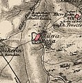 Historical map series for the area of Ra'na (1870s).jpg 737 × 741; 233 KB
-
 Historical map series for the area of Sajad (1870s).jpg 738 × 742; 218 KB
-
 Historical map series for the area of Saydun (1870s).jpg 738 × 742; 234 KB
-
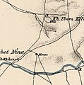
 Historical map series for the area of Tall al-Turmus (1870s).jpg 738 × 741; 157 KB
-
 Historical map series for the area of Tell es-Safi (1870s).jpg 737 × 741; 227 KB
-
 Historical map series for the area of Umm Kalkha (1870s).jpg 738 × 742; 157 KB
-
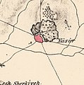 Historical map series for the area of Yasur, Gaza (1870s).jpg 738 × 742; 138 KB
-
 Historical map series for the area of Yibna (1870s).jpg 739 × 742; 174 KB
-
 PEF map - ESDUD, Isdud-Ashdod and Wadi Sukereir-Lakhish 1880.jpg 1,873 × 1,977; 558 KB
-
 PEF map -BEIT DURAS.jpg 1,014 × 593; 138 KB
.jpg)
.jpg)

.jpg)
.jpg)
.jpg)
.jpg)
.jpg)
.jpg)
.jpg)
.jpg)
.jpg)
.jpg)
.jpg)
.jpg)
.jpg)
.jpg)
.jpg)
.jpg)
.jpg)
.jpg)
.jpg)
.jpg)
.jpg)
.jpg)
.jpg)
.jpg)
.jpg)
.jpg)
.jpg)
.jpg)
.jpg)
.jpg)
.jpg)
.jpg)
.jpg)
.jpg)
.jpg)
.jpg)
.jpg)
.jpg)
.jpg)
.jpg)
.jpg)
.jpg)
.jpg)

